


![]()
Вы здесь
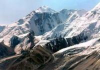
Bayankol glacier.
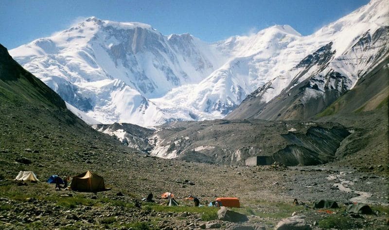
Glaciers in Bayankol gorge.
“...no climbers with hooked sticks and ropes, no hunters ... The Pilatus and Riga Mountains are more accessible for tourists than the unexplored Alatau glaciers...
people roam. Russian crawlers on rocks, but not yet sung by writers."
Peter Krasnov.
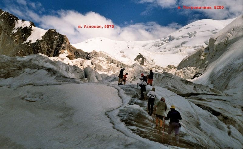
Walk on glaciers in Bayankol gorge.
The Bayankol glacier is located in the upper reaches of the Sarykoinou River (one of the sources of the Bayankol River), located on the northern slope of the Sarydzhaz ridge in the Narynkol district of the Almaty region.
The Bayankol glacier is divided into glaciers: Central, Western and Eastern. The glaciers have independent terminal moraines, with three independent streams that merge into the Sarykoinou River. The width of the circus of the Bayankol glacier from east to west, from Uzlovaya peak in the Meridional ridge and to the border of the Western Bayankol glacier with the Semenov glacier in the Sarydzhaz ridge is 16.5 kilometers.
Length of the Bayankol Central glacier, which descends from the northern slope of the Eleven peak at a height of 5437 meters above sea level, is 4.8 kilometers, an area of 5.4 square kilometers. The upper boundaries of the Central Bayankol glacier are located in the main ridge of the Sarydzhaz ridge at an altitude of 5437 meters above sea level.
The tongue of the glacier is located at the source of the Sarykoinou River at an altitude of 3389 meters above sea level. The length of the upper boundary of the glacier along the ridge from the western part of the Eleven pass to the western summit of the Eleven peak is 2.3 kilometers.
Geographic coordinates of the Bayankol Central Glacier: N42 ° 18'19.60 "E80 ° 11'18.47"
Bayankol Vostochny glacier is located on the northern slope of the Sarydzhaz ridge and on the northwestern slope of the Meridional ridge. The upper boundary of the glacier along the ridge of the Sarydzhaz ridge stretches from west to north-east.
From Bayankol peak 5790 meters above sea level through Kazakhstan peak 5769 meters above sea level, 5450 meters above sea level, Karlytau peak 5550 meters above sea level and after 13 kilometers connects with the Meridional ridge.
Along the Sarydzhaz ridge, the glacier border stretches from the Bayankol peak with a height of 5790 to the junction with the Meridional ridge of 5.6 kilometers. After Karlytau peak, the upper boundaries of the Western Bayankol glacier are the main ridge of the Meridional ridge.
The length of the upper border of the glacier along the ridge of the Meridoinal ridge is 7.5 kilometers to the Chinese pass. The area of the Bayankkol Vostochny glacier is 22.5 square kilometers. The western branches of the glacier stretch to the Chinese Pass 3900 meters above sea level.
In this section, the sources of the glacier begin from the Uzlovaya peak, 5100 meters above sea level, and the Pogranichnik peak, 4910 meters above sea level. The length of the glacier from the peak Kazakhstan to the headwaters of the Sarykoinou River is 7 kilometers.
The tongue of the East Bayankol glacier is located at an altitude of 3305 meters above sea level.
Geographic coordinates of Bayankol Eastern glacier: N42 ° 18'46.33 "E80 ° 14'51.52"
Length of the upper boundary of the Bayankol Western glacier is 15 kilometers. The border begins to the west of the Western peak of Eleven, 5428 meters above sea level, in the main ridge of the Saryjaz ridge. It passes further through the 5163 meter mark above sea level, then through the 5437 meter mark above sea level.
From mark 5437, the border moves to the north-west along the main ridge of the Katta-Ashutor ridge through the summit at an altitude of 4651 meters above sea level and ends in the south-west of the Alaskuz peak at an altitude of 4520 meters above sea level.
The length of the northernmost part in the Eastern Glaciers group is 5.2 kilometers. This glacier is the most even and gentle among the Bayankol glaciers. The tongue of the Western Bayankol glacier is located at an altitude of 3551 meters above sea level.
Geographic coordinates of the Western Bayankol Glacier: N42 ° 18'31.25 "E80 ° 08'27.13"
Their stories of visiting the Bayankol glaciers in the upper reaches of the Sarykoinou River.
In 1902 - 1903, one of the first in the upper reaches of the Bayankol gorge was the German climber and geographer G. Merzbacher, who set the goal of his expedition: to find a way to Khan-Tengri.
An attempt was made to visit the headwaters of the Bayankol River by the Hungarian geologist Prince in 1906.
An expeditionary group of military topographers in 1912 under the leadership of Professor V.V. Sapozhnikova was also in the area.
In 1932 - 1937, the upper reaches of the Bayankol gorge were studied by scientists: S.S. Schultz, D.I. Yakovlev and others, who have seriously supplemented the information on the geology and glaciology of the region.
Authority:
Alexander Petrov.
Photos by
Sergei Mikhalkov, Almaty city