


![]()
Вы здесь
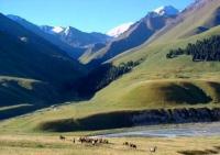
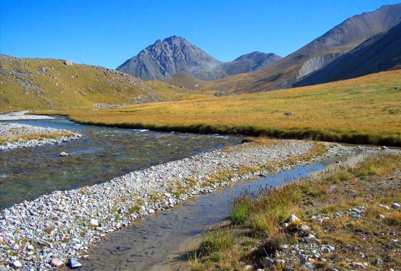
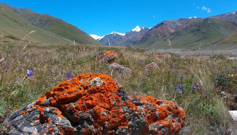
Valley of Chong-Kemin River.
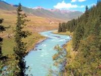
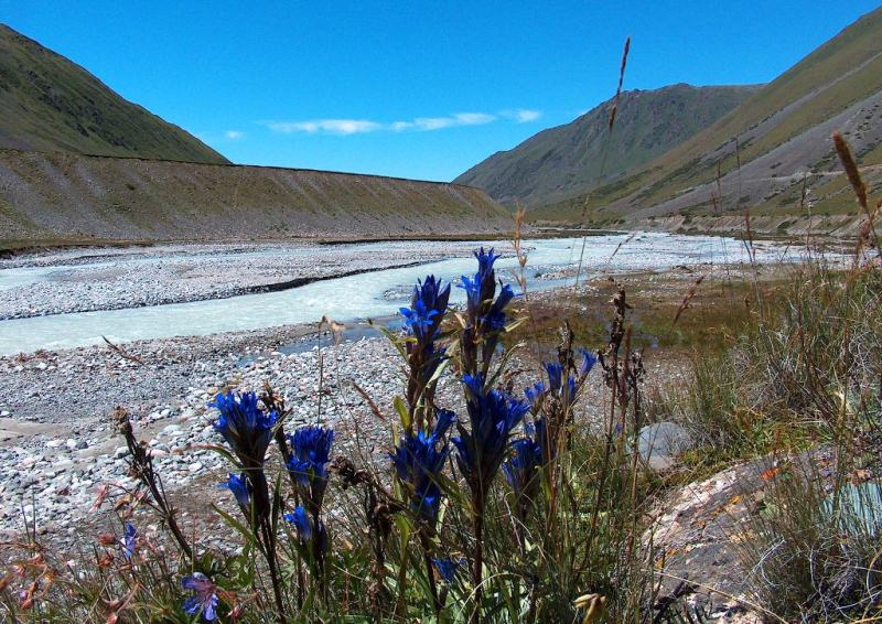
Gorges in Kungey Ala-Too mountains.
"In an immoral society, all inventions that increase man's power over nature are not only not good things, but an undoubted and obvious evil."
Lev Tolstoy.
Trip to Chong Kemin valley.
The valley of the Chong-Kemin River is located at altitudes from 1333 to 3118 meters above sea level, is located in the western part of the Northern Tien Shan mountains and is a watershed between the Zailiyskiy Alatau ridges in the north and Kungey Ala-Too in the south, on the territory of Chui and Issyk-Kul regions (along the Chong-Kemin River from Lake Zhasyl-Kol to the mouth of the Shu River there is an administrative border of two regions).
The Chon-Kemin valley is 110 kilometers long and is the second largest in the mountains of the Northern Tien-Shan. The valley starts from the high-mountainous lake Zhasyl-Kol, which is located on the western side of the Chiliko-Kemin mountain range and ends with the Boom gorge.
In the upper part, the Chon-Kemin gorge expands and acquires the character of a valley, in the middle part, due to the narrowing of the channel, canyons are formed. The valley is located 150 kilometers east of the city of Bishkek on the road leading to the village of Shabdan.
The Chon-Kemin and Kichi-Kemin rivers flow along the gorge. The valley of the Chon-Kemin River stretching from west to east is extremely beautiful. The river begins at the glaciers of the Chiliko-Kemin cofferdam at an altitude of 3118 meters above sea level, where the Zailisky Alatau and Kungei Ala-Too ridges join in the Chiliko-Kemin mountain knot.
Further, Chong-Kemin, it flows into the Shu River at the very beginning of the Boom Gorge. The lower channel of the Chon-Kemin River is located in the gorge of the Kapchigai canyon, which has steep rocky slopes and banks. The rocks are covered with spruce, barberry and mountain ash. Streams run down the slopes.
Behind the narrows, the bottom of the gorge becomes flatter, and a small hollow is formed, covered with greenery. It is 6 kilometers wide and 15 kilometers long. Low-grass meadows are located in the upper part of the valley. A dark spruce forest covers the high slopes of the Chong-Kemin gorge.
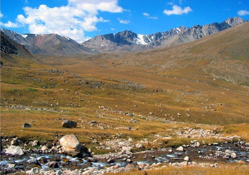
The spruce forest in combination with glaciers gives the valley an amazing view. Further, the valley narrows. The ridges approaching, stretch in parallel to the east to the very Chiliko-Kemin mountain node. The powerful Kungey Ala-Too glaciers lie in this area.
The northern slopes of Kungey Ala-Too are covered with spruce forests. Ate grows here in picturesque groups. The forest grows densely here, and therefore it is impossible to distinguish between trees separately at a great distance. Below the village of Shabdan is the Kemin natural park. Its area is 500 hectares.
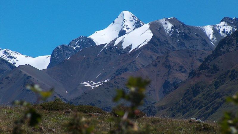
The park is protected by the animal world - tolai hares and pheasants. Ephedra is protected in the Kapchigai State Botanical Sanctuary, located in the Kapchigai tract. Chong-Kemin valley is limited by high mountain ranges - Kungey Ala-Too (up to 4760 m. a. s. l. - Choktal peak) and Zailiysky Alatau (up to 4978.9 m. a. s. l. - Talgar peak).
Their arcs at the headwaters of Chon-Kemin converge and form a powerful Kemino-Chilik mountain cluster with numerous glaciers. In the middle part, these arcs go around a small hollow and again converge with their spurs in the lower reaches of the Chon-Kemin, where the river, before its confluence with the Shu River, flows for 10 kilometers in a narrow and deep gorge Kapchygai.
The road from the Boom gorge leads to the Chong-Kemin valley bypassing the bridge on the Shu river. Here is crossed a bridge, named Semenovsky in honor of P.P. Semenov-Tyan-Shansky, who crossed the river during his journey in this place.
The route of the road along Kapchygay is cut in the rocks, hanging in places over the bed of a violent river. Near one of them, the village of Novorossiyki, the ruins of a large settlement have been preserved. These are the remains of the settlement Suyab, the former center of the Western Türkic Kaganate (VII - VIII centuries) and the state of Karluks (VII - X centuries).
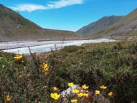
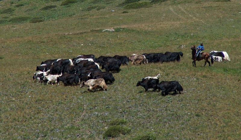
In the valley there is a village specializing in growing potatoes and raising sheep. Upstream, the valley takes on the character of a gorge, the slopes of which are covered with spruce forests. In the upper reaches of the valley, where the bottom expands somewhat, and the lower parts of the slopes become flatter, the famous summer pasture Kok-Oyrok is spread.
Geographical coordinates of Chong Kemin valley: N42°50'57 "E76°36'30
Authority:
http://www.kyrgyzstantravel.info Courtesy of Anatoly Khalepov. Alexander Petrov.
Photos by
Alexander Petrov and Sergei Mikhalkov.