


![]()
Вы здесь
Underground mosque Masat ata.
Sightseeing trip on Mangystau.
"Seven nations came - seven nations left."
Flashpacker Mangistau.
Underground mosque Masat Ata is located at an altitude of 243.8 meters above sea level, is located in south-eastern part of necropolis of same name, in southern part of cliff, in northern part of Mangyshlak plateau, 8 kilometers northwest of eastern edge of Sauskan sands, 19.6 kilometers southeast of village of Ushtagan, 17.3 kilometers southwest of village of Sazdy in Mangistau district of region of same name.
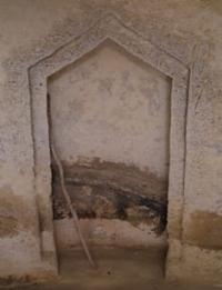
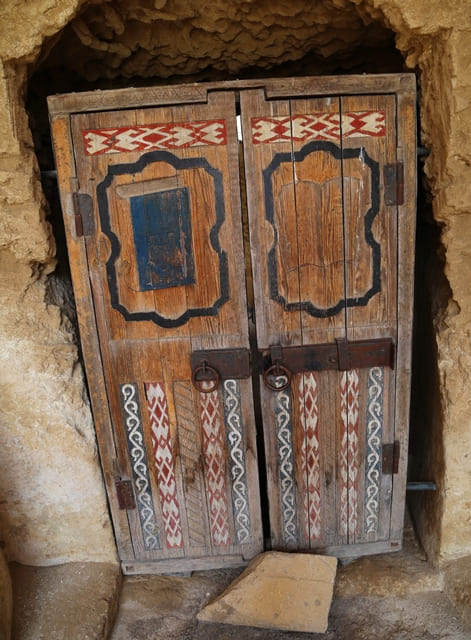
This famous place is mentioned in historical sources about Mangistau. The underground mosque is located near a steep slope of a hill, it belongs to the most ancient period of the necropolis development. The mosque, in comparison with other similar monuments, has been preserved to this day very well, traces of natural weathering are almost not noticeable.
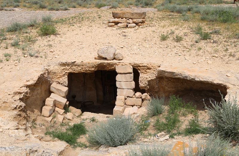
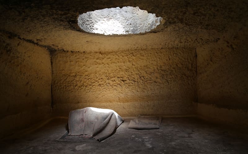
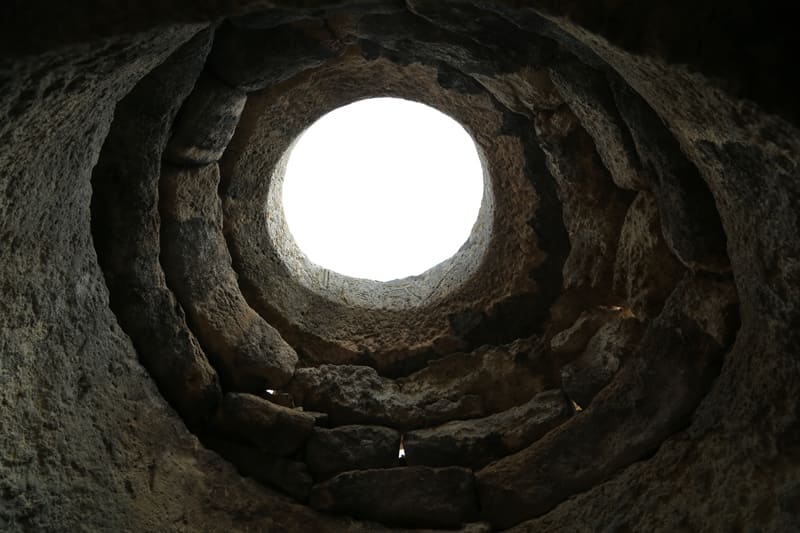
The mosque is carved into dense sandstone rock. The interior of the mosque has the form of a yurt vault. At the top, almost in the center, there is a light opening, round in plan. The opening is raised on the outside with the help of stonework. The idea of the dome and its initial implementation, as A. Bernshtam believed, belonged to the horse nomads of the Asian steppe.
In Mangistau, it received an almost literal embodiment, right down to the imitation of a round opening in the center of the yurt vault (shanyrak) by including a round opening of a sunbeam in the center of the ceiling. In many of the described monuments, we encounter such a design solution.
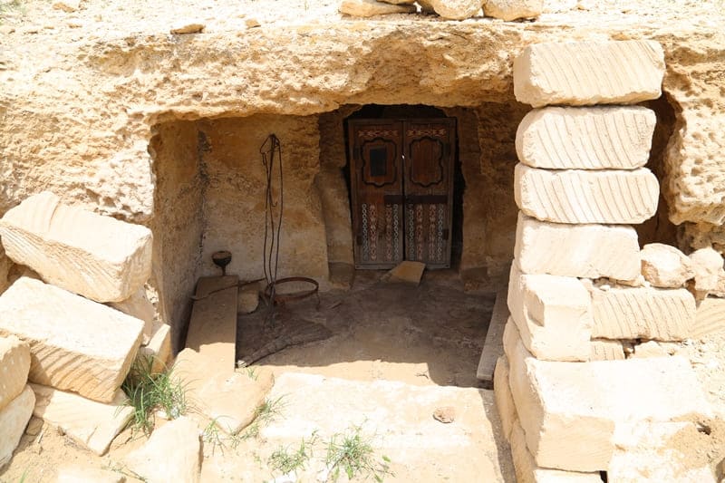
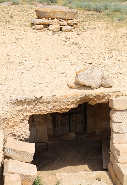
The mosque is located next to two wells, which are currently abandoned. In the southern part there is an entrance, a little to the left of the entrance a mihrab is carved. The mihrab faces Mecca. 3 - 4 meters to the west of the mosque there is an artificial opening with a diameter of about 2.5 meters, perhaps an unfinished room.
In the courtyard part there are drainpipes, in the form of lines, carved on the terrace. They are several meters long. The edge of the lines leads to a water collection well, the water was probably used for household needs. The monument in 1982 by the decision of the Council of Ministers of the Kazakh SSR was accepted for state registration and protection of republican significance.
Geographic coordinates of underground mosque Masat ata: N43 ° 41'35 E52 ° 52'55


Authority:
Otynshy Koshbayuly, Murat Kalmenov. "Underground mosques of Mangystau". Lketanymdyқ basely. Almaty, Orkhon Publishing House. 2009.160 s.
Photos by:
Alexander Petrov..