



Вы здесь
Kazakh Gulf.
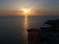
Rest on Caspian Sea in Kazakhstan.
"In the time of your great sovereigns’ ancestors, ambassadors and merchants used to travel by water to the port of Kabakly; however, that route became blocked due to the Kalmyks. Nowadays, travel is directed to the maritime port of Mangishlak, where merchants from both sides arrive to trade. This route is currently clear, and there are no grievances or harm caused by anyone. It is proposed that your sovereign might deign to establish a town at the port of Mangishlak, on this side of the sea. Once such a town is built, our merchants - along with your merchants - will gather there with their goods to conduct trade, which will be to the mutual benefit of both sides."
Charter from the Khan of Khiva, Anusha. April 1675.
Motorboat trip on Caspian Sea Kazakhstan.
Kazakh Bay – A Large Expanse of Caspian Sea off Coast of Mangystau.
The Kazakh Bay (Kazakh: *Қазақ шығанағы*) is one of the major bays along the eastern coast of the Caspian Sea. It is situated off the southern shore of the Mangyshlak Peninsula, within the Karakiya District of the Mangystau Region in Kazakhstan.
The bay lies between Cape Rakushechny to the north and Cape Sengirli to the south, cutting deep into the arid landscape of Mangystau. This location is particularly striking because it serves as a vivid meeting point for two entirely distinct natural worlds: on one side, the vast inland sea; on the other, the waterless expanses of the Mangystau desert, characterized by plateaus, sheer cliffs, rocky plains, and sparse vegetation.
The Kazakh Bay does not resemble an ordinary, small sea cove. Its expanse of water is so vast that, when standing on the shore, it is difficult to immediately grasp its true dimensions. The coastlines gradually dissolve into the haze, and the sea merges with the horizon.
Geographical location and configuration of Kazakh Bay.
The Kazakh Bay is situated in the eastern part of the Caspian Sea, in one of the most distinctive areas along its coastline. According to reference data, the bay is arc-shaped and indents the landmass to a depth of approximately 46 kilometers.
The width at its entrance is about 83 kilometers; the average depth is roughly 13-15 meters, with a maximum depth of approximately 32 meters. The shores are predominantly elevated. Your field notes mention larger linear dimensions - 91.5 kilometers from Cape Rakushechny to Cape Sengirli, and 73.2 kilometers across the central part of the bay along a diagonal axis.
These figures likely represent distances between specific extreme points of the coastline rather than the length of the bay in the standard hydrographic sense. Therefore, it would be more appropriate to present them in the article as supplementary indicators of the bay’s spatial scale, rather than as figures that contradict its officially cited length.
The eastern section of the Kazakh Bay is particularly noteworthy, as it contains the shallow Kenderli Bay. This area is separated from the open Caspian Sea by a unique natural barrier: the Kenderli (or Ada) Spit. This sandy landform stretches from the southeast to the northwest, curving northward at its northern end.
It is here that the landscape of the Kazakh Bay takes on a gentler, more inviting character - ideal for recreation - where the open desert meets a sandy shoreline, and the shallow waters warm up quickly.
Shores of Kazakh Bay.
The coastline of the bay is not uniform. In certain areas, elevated sections of the Mangyshlak Plateau - formed by resistant sedimentary rocks - reach all the way to the water. The eastern coast of the Caspian Sea is characterized by a diverse landscape featuring marine terraces, limestone cliffs, plateau-like surfaces, sandy spits, and desert plains.
The region around the Kazakh Bay, in particular, possesses a rather complex coastline. The desert nature of the surrounding territory is especially striking when viewed from the sea. Beyond a strip of coastal sands and shingle, the arid, almost treeless land of Mangystau begins abruptly.
There is none of the dense vegetation typical of many other seacoasts here. The plant cover is dominated by drought-resistant species capable of enduring high summer temperatures temperatures, a lack of precipitation, and strong winds. Yet, following rare rains, the desert can transform with surprising speed: ephemeral plants emerge, greenery appears in low-lying areas, and the vegetation cover briefly bursts into vibrant life.
It is precisely this contrast - the blue expanse of the Caspian Sea set against the seemingly lifeless desert of Mangyshlak - that stands out as a defining feature of the landscape.
Kazakh Bay on Early Maps of Caspian.
The history of the geographical exploration of the Kazakh Bay dates back to the early XVIIIth century. In 1715, an expedition led by Alexander Bekovich-Cherkassky - commissioned by Peter the Great - explored the eastern shore of the Caspian Sea.
The expedition was tasked with both military and geographical objectives: to survey the little-known eastern coastline and to investigate reports regarding the presumed former course of the Amu Darya River. During the voyage, Bekovich-Cherkassky covered a significant portion of the eastern coast and produced a map that marked an important milestone in the cartography of the Caspian.
Historical records on cartography indicate that, beyond Cape Rakushechny, Bekovich-Cherkassky documented the Kazakh Bay, labeling it "Kyzyl" - meaning "red" - on his map. In later XVIIIth-century cartographic materials, the name shifted. In 1724, the bay was referred to as "Peterbay," while a 1731 map by I. V. Tokmachev identified it as "Kenzirminskaya Bay."
These archaic names are of particular interest, as they illustrate how the geographical understanding of this remote stretch of the Caspian coast evolved within European cartography. Thus, the contemporary name - Kazakh Bay - is merely the latest link in a long historical and cartographic chain of designations.
Bekovich-Cherkassky and the Eastern Caspian.
The work of the Bekovich-Cherkassky expedition was of immense significance for its time. In 1715, a substantial portion of the eastern Caspian coast was surveyed in detail for the first time; the explorers mapped numerous bays, capes, and other coastal features.
Consequently, the eastern part of the sea was, for the first time, depicted with greater accuracy on European maps. It is particularly noteworthy that one of the primary motivations for the expedition was to determine the fate of the Amu Darya River.
At the time, there were theories suggesting that this river might have once flowed into the Caspian Sea. For this reason, every major bay, river mouth, dry riverbed, or unusual coastal formation held not only geographical but also strategic importance for the explorers.
Today, as one gazes upon the tranquil waters of the Kazakh Bay, it is difficult to imagine that, more than three centuries ago, these shores were part of a vast expanse that was virtually unknown to European cartography.
Waters, Depths, and Climate of Kazakh Bay.
The Kazakh Bay is a relatively shallow area in the eastern part of the Caspian Sea. The average depth here is estimated at approximately 13-15 meters, with a maximum depth of about 32 meters. In the shallow waters of the Kenderli area, the depths are significantly less. A key characteristic of the bay is its temperature regime.
In summer, the water surface can warm up to 26–27°C. Due to the hot, arid climate of the Mangystau region and the shallow water, this eastern section - especially the Kenderli area - is noticeably warmer than many other parts of the Caspian coast.
In winter, the situation changes completely. During cold spells, the water temperature in the bay can drop significantly, and the shallow areas may become covered with a thin layer of ice. Reference sources indicate the possibility of ice cover lasting for about two to three months.
The salinity of the water is approximately 13-14‰. It is important to correct a common error found in some secondary accounts: the unit is per mille (parts per thousand), not percent.
Caspian Sea and desert.
The natural environment of the Kazakh Bay is shaped not only by the sea but also by its proximity to the deserts of Mangystau. The eastern coast of the Caspian is one of the most arid coastal landscapes in Eurasia. Precipitation is scarce, evaporation rates are high, and solar radiation in the summer is extremely intense.
Consequently, the sea lies literally side by side with the desert. The coast is especially impressive after a long period of dry weather. The sky seems huge, the horizon unusually distant, and there is almost no transition zone between the sea and the plateau.
The wind here is one of the most important factors in the formation of the modern landscape. It transports sand and dust, affects coastal forms, creates ripples on sandy surfaces and at the same time promotes the rapid evaporation of moisture.
Therefore, the Kazakh Bay cannot be considered only as a body of water. This is a single natural system of sea, desert, coastal terraces, sand spits and the Mangistau plateau.
Kenderli is softest part of Kazakh Gulf.
In the east of the Kazakh Gulf there is Kenderli Bay, separated from the main water area by the spit of the same name. This particular area is especially famous for its sandy beaches and shallow waters. Kenderli occupies a unique transitional position between the desert landscape of Mangistau and the maritime space of the Caspian Sea.
The modern resort complex Kenderli is located approximately 210 kilometers south of Aktau. The area is connected by road with Zhanaozen; from Zhanaozen to the Kenderli coast - about 77 kilometers along the route you indicated. For a traveler, this is one of those rare sections of Mangistau where the harshness of the desert is unexpectedly replaced by a fairly comfortable sea landscape.
Geographic coordinates of Kenderli resort: N42°47'02 E52°37'48
Legend of red water in Kazakh Gulf.
The Kazakh Gulf, as far as is known, does not have one widely known historical legend directly related to the origin of its name. Therefore, it is better to perceive the following story precisely as a literary legend, created based on the nature and history of Mangistau, and not as a written folk legend.
They say that once upon a time, a young wanderer walked along the deserted shore of Mangyshlak. The road continued for a long time: dry stone plateaus rose on the right, a huge sea lay on the left, and there was neither a tree nor a stream around.
At sunset, the wanderer climbed to the high bank and saw how the last rays of the sun painted the surface of the water crimson-red.
It seemed to him as if the sea was on fire.
The wanderer asked an old shepherd who met him at the parking lot:
- Why is the sea red here?
The old man replied:
- Because it remembers the earth. Every evening the sun returns to him the color of this desert.
The next day, the wanderer continued his journey and told about the unusual bay to the people he met further along the road. So, as if, the old name remained in memory - Kyzyl, “red”.
Historical cartography does connect the Kazakh Gulf with the name Kyzyl, but the above story is an artistic legend, and not a documented explanation of this name. The old name itself is known from cartographic materials of the 18th century.
Kazakh Gulf today.
Today, the Kazakh Gulf is of interest to several travel destinations. For nature lovers, this is an opportunity to see one of the most expressive landscapes of the eastern Caspian Sea, where the sea directly touches the deserts of Mangistau. For history buffs, this is an opportunity to mentally walk the route of the first explorers of the Caspian Sea and remember the expedition of Bekovich-Cherkassky, who worked here more than three hundred years ago.
For travelers who prefer a sea holiday, the most attractive area is Kenderli with its sandy coast and shallow bay. For a photographer, the Kazakh Bay is particularly compelling due to its extraordinary interplay of color and space: blue waters, pale sands, the gray-yellow and reddish rock formations of Mangystau, an expansive sky, and an almost total absence of tall vegetation.
It is here that the unique character of Mangystau - a region that may appear harsh and lifeless at first glance, yet reveals a wealth of nuances upon closer inspection - is most palpable.
How to reach Kazakh Bay.
One of the primary driving routes to the Kenderli coast begins in Aktau, leading through Zhanaozen and continuing southward. The distance from Aktau to the Kenderli area is approximately 210 kilometers, while the stretch from Zhanaozen to the coast covers about 77 kilometers.
When traveling, it is important to keep in mind that outside of populated areas, Mangystau is an extremely arid and sparsely inhabited region. Consequently, a trip to the more remote parts of the Kazakh Bay requires the kind of preparation standard for desert travel: careful route planning, and ensuring an adequate supply of water, fuel, and reliable means of communication.
The warm season is the best time to visit the coastline. In the height of summer, however, one must account for high temperatures and the near-total lack of natural shade.
Kazakh Bay: a sea at edge of desert.
The Kazakh Bay is notable not so much for any individual records, but for its distinct geographical nature. Here, the Caspian Sea reaches deep into the mainland, forming a vast, arc-shaped expanse, while beyond its shores lies one of the most arid regions in Kazakhstan.
This area preserves the legacy of XVIIIth-century cartographers who explored the then-little-known eastern coast of the Caspian; it is home to the sand spits and shallow waters of Kenderli - a place where the dry, scorching climate of Mangystau meets a vast body of water.
And so, the Kazakh Bay is not merely one of the bays of the Caspian Sea. It is a meeting point between sea and desert - a place where geography quite visibly transforms into history.
Geographic coordinates of Kazakh Bay: N42°36'55 E52°21'20


Authority and photos by:
Alexander Petrov.