


![]()
Вы здесь
Boroldai Saka burial mounds.
Popular walking from Almaty.
“Those who have stayed here before generations
Dozed in dreams of self-delusion.
Sit down and drink! All the speeches of the sages
Desert dust and wind blowing"
Omar Khayyam.
Saki burial mounds in Kazakhstan.
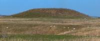
Archaeological Park-Reserve "Boraldai Saki Mounds" - a unique monument dating from the V - VIII centuries BC is located in the northwestern part of Almaty, 2.7 kilometers to the south and slightly east of the Boroldai village, 2.4 kilometers to the north -west from the village of Ozhet in the Alatau district of the city of Almaty.
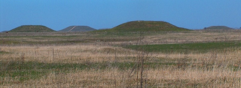
The park-reserve “is a huge necropolis that has been preserved within the boundaries of the modern city. On the territory of 430 hectares there are 47 large and more than 200 small mounds of the Saka elite and leaders of the Uisun tribes.
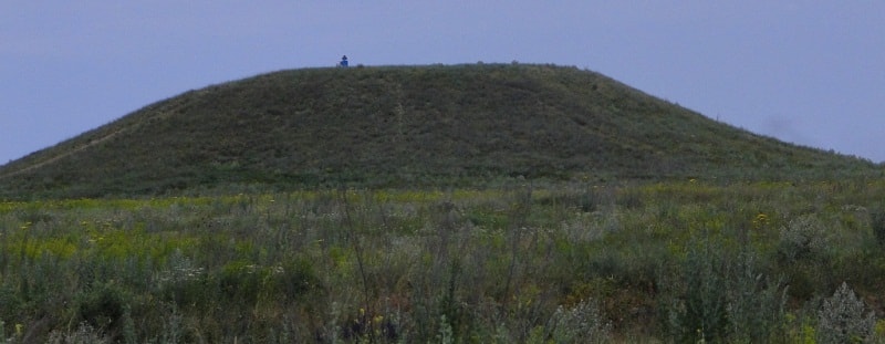
The tallest is 14 meters high and 130 meters in diameter. It offers views of the city and mountains. The monument has preserved its cultural and natural landscape up to the present time, avoiding buildings and destruction.
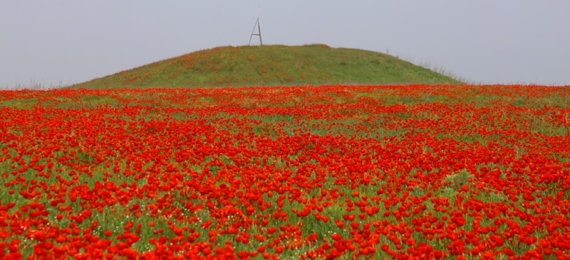
The most amazing thing is that the kurgans are still almost unexplored and potentially contain a huge number of mysteries, and perhaps even sensational discoveries. Zhetysu burial mounds ... Huge structures up to 20 meters high, which are compared with the Egyptian pyramids, and small hills up to one and a half meters high.
Large The kurgans are called "royal", and this is true, since representatives of the ruling dynasties and the military elite of the ancient tribes are buried under them. One of these "royal" necropolises is the Boroldai burial ground, which occupies a part of a high loess plateau, located in the northwestern part of the city of Almaty.
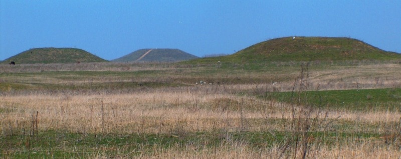
Most of it is well preserved - deep ravines and a steep bank of the Bolshaya River Almatinka, surrounding the plateau, protected the monument from modern development and destruction. The burial ground is 3 kilometers long and 800 meters wide.
Scientists have established that the Boroldai burial mounds, as well as the Issyk, Talgar, and Kegen burial mounds, were erected by the Saka tribes who inhabited the VIII-III centuries. BC e. Zhetysu, and Usuns who inhabited this region in the 3rd century. BC e. - III century. n. e.
Both those and others are the distant ancestors of the Kazakhs. According to To ancient sources, in particular "Avesta", nomadic "tours with fast horses" lived in the steppe expanses of Kazakhstan north of the Bactrians, Sogdians and Khorezmians.
Tours in Persian written sources are called Sakas, which means "mighty men", and in the works of Greek authors they appear under the name "Scythians". By the Scythians and Saks, the Greeks and Persians meant numerous alliances of related tribes.
Chinese sources Saks were called "se". Achaemenid ancient Iranian sources name three large groups of Sakas: Saki-haomavarga (Saki brewing the drink haomu), Saki-tigrahauda (Saki wearing pointed hats and Saki-paradaraya (Saki overseas).
It is very difficult to indicate certain territories of these tribes, since the ancient authors do not provide precise geographic references. Analyzing written sources and archaeological material, the famous archaeologist K. A. Akishev proceeded from the fact that the Saka-Tigrahauda of Iranian sources correspond to the Scythian-Ortho-Caribantia of the Greek authors, since both words mean "sharp-capped".
The scientist placed both those and others on the territory of Zhetysu, where numerous monuments of Saka culture were discovered and studied, including the Issyk mound with the burial of the "king" in a pointed headdress decorated with golden arrows.
At the end of the Ist millennium BC. e. On the territory of Kazakhstan, new tribal alliances arose, which replaced the Sakas. The lands of the Saks-Tigrahauda in Zhetysu and the Almaty region were occupied by the Usun tribes, who came here from the depths of Central Asia in the II century BC e.
Usun was one of the largest state associations in Central Asia. The center of his possessions was the Ili Valley, although their headquarters Chigu ("City of the Red Valley") was located between Issyk-Kul and the southern bank of the Ili.
The exact location of Chigu has not yet been determined. It is localized on the coast of Issyk-Kul, but it could also be located in the valleys of the Kegen and Charyn rivers. The etymology of the term "usun" itself has not yet been clarified.
It is known only in Chinese hieroglyphic writing, the modern sound of which is identical to one of the Kazakh ethnonyms - "Uisyn". Monuments of the Usun culture are widespread in Zhetysu, Fergana (partially) and the northern part of East Turkestan.
Having in the II century. BC e. population up to 630,000 people, Usuns could send a large army of cavalry and foot archers. The squad of the king of the Usuns and his two heirs consisted of 30 thousand cavalry - each with 10,000 soldiers.
Usuns established diplomatic relations with the states of Davan (Fergana), Kanguy (South Kazakhstan), Yantsai (Aral Sea region). The Usuns connected trade relations with possessions located from Lake Lopnor to the Tarim depression, from Turfan to Yarkand.
They maintained close ties with the Xiongnu, the most powerful state north of the Great Wall of China. Boroldai burial ground belongs to the Sakas and Usuns. Representatives of the ruling dynasties of the Saka and Usun states and the elite of society were buried here.
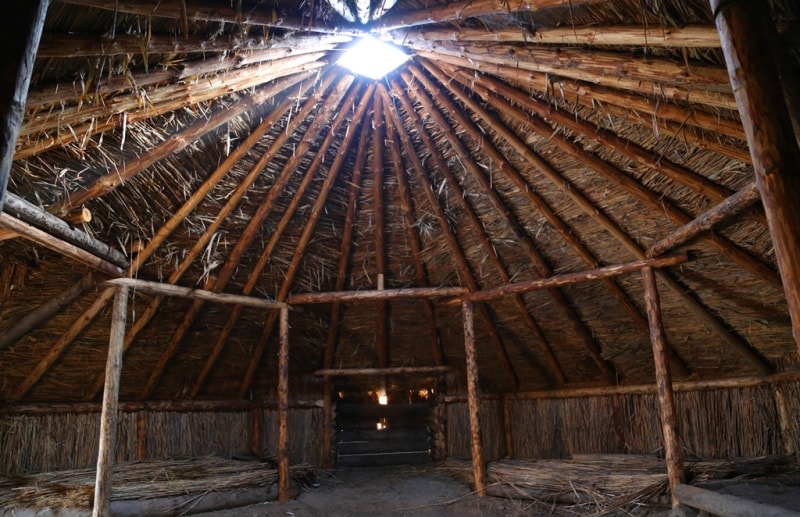
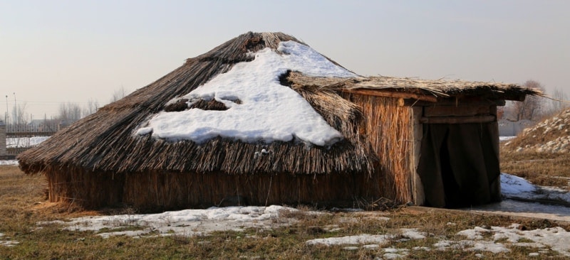
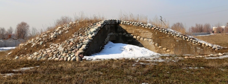
Each large burial mound is an architectural structure, each mound is an architectural ensemble. Parts of these ensembles are the mounds themselves with their complex arrangement of embankments and graves, ring-shaped displays of vertical stones-menhirs, stone rings around the mounds, places of cult feasts, altars.
The entire necropolis is an ancient "picture" of ideas about the universe, a person's place in it, a place for rituals and ceremonies associated with the cult of ancestors, calendar cycles, spring, autumn, summer and winter festivals.
It is also an open-air museum. In 2006, a decision was made to organize the Boroldai Saki Mounds Museum-Reserve on its territory.
Geographic coordinates of the archaeological park-reserve "Boroldai Saki kurgans": N43 ° 19'58.59 "E76 ° 52'06.28"
Authority:
"From Altai to the Caspian Sea". Atlas of monuments and sights of nature, history and culture of Kazakhstan. 2012.
http://lib.yessenovfoundation.org/atlas-tom-2/files/assets/basic-html/page330.html
Photo by
Alexander Petrov.