


![]()
You are here
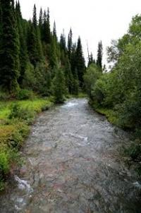
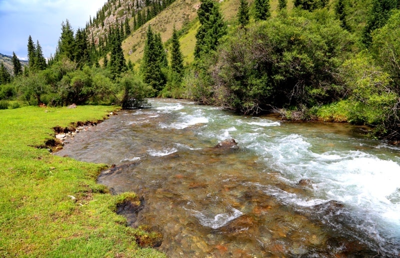
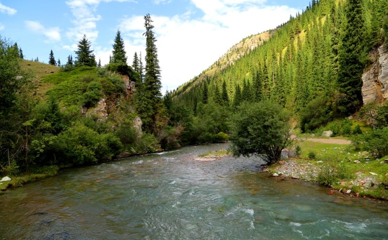
Ulken-Kokpak river.
Birding Tours Almaty region.
"Camels and sheep lambing - noise in the paddocks,
From the wings of the birds in the ravines there is a buzz and a rumble.
When trees and flowers admire the water,
The river, like pava, bends, murmurs"
Abaya Kunanbaev. “On the Eve of Summer”.
Bird Watching Tours Almaty region.
The Ulken-Kokpak River belongs to the Tekes River basin, located on the northern slope of the Terskey Alatau ridge between the Kopyl mountains in the west and the northern spurs of the Meridional ridge in the Narynkol district of the Almaty region.
The river starts from the Kokpak pass, 3482 meters above sea level on the northern slope of the Terskey Alatau ridge. At an altitude of 1835.8 meters above sea level, the river between the villages of Tegistyk and Kakpak is dismantled for irrigation of agricultural land in the summer months.
Only in the spring months and the flood season does the river reach the Tekes River. The length of the Ulken-Kokpak River is 50 kilometers. About 10 kilometers below the right tributary of the Buzunbai River, the Ulken-Kokpak has a second name - Koklen.
The river, for the most part, has a meridional direction, and only in the upper part, in the vicinity of the Tuyukasha gorge adjacent to the east, the river turns to the west. At an altitude of 2628 meters above sea level, the Ulken-Kokpak receives the right tributary of the Tuyukash, which has a length of 8.5 kilometers.
600 meters below the river receives the left tributary Tokmak with a length of 5 kilometers and originating at an altitude of 3901 meters above sea level. At an altitude of 2465 meters above sea level, the river receives a 6.5 km long right tributary of the Kuantemes and originates to the west of the Kuantemes peak at a height of 3884.6 meters above sea level.
After 2.5 kilometers, the Igliksa River, 7 kilometers long, flows into the river from the right side, which originates under the northern slope of an unnamed peak 3602 meters above sea level. A path has been laid along the Igliksa gorge, which after 8 kilometers bypassing the Karakol pass, 3452 meters above sea level, reaches the Karakol lake located at an altitude of 3102 meters above sea level.
Slightly lower, Ulken-Kokpak receives the left tributary of the Suzisay, which is 6 kilometers long. At an altitude of 2270 meters above sea level, another large tributary, Buzunbay, flows into Ulken-Kokpak, which originates from the moraine lake Akkol-Dekkol surrounded from the south by glaciers at an altitude of 3395 meters above sea level, located on the northern slope of the Terskey Alatau ridge.
The Buzunbai River passes the Karakol Lake at an altitude of 3102 meters above sea level, which is 1.7 kilometers long and 444 meters wide in the northern part of the lake. Buzunbay is 22 kilometers long; it is the second longest tributary of the Ulken-Kokpak River.
After 4.5 kilometers on the left, the Tuyukkakpak tributary, 26 kilometers long, rushes to Uzun-Kokpak, which originates from under the eastern part of the Kokpai peak 3808 meters above sea level. Another part of the headwaters of the Tuyukkakpak River is located on the northern side of the Kubergenti Pass, 3570 meters above sea level.
In turn, in the middle reaches of the Tuyukkakpak at an altitude of 2650 meters above sea level, the right tributary of the Kokchukur with a length of 6.5 kilometers is received. After 3 kilometers on the left, a small unnamed stream 4 kilometers long flows into Ulken-Kokpak.
After 2 kilometers below, the right, unnamed tributary, which has a length of 6 kilometers, flows into Ulken-Kokpak. Thus, Ulken-Kokpak has 9 large and small inflows. The Ulken-Kokpak River is located between the Bayankol gorges in the east and Orta-Kokpak in the west.
A motor road with several bridges is laid along the gorge along the river. The upper part of the river is very picturesque, along the way there are cozy meadows, the river flows in the frame of the Tien Shan firs, herbs, mixed forest.
On the right side of the Uzun-Kokpak River, at the mouth of the Buzunbai River, there are several cottages of the camp site.
Geographic coordinates of the Ulken-Kokpak River: N42 ° 36'06.68 "E79 ° 50'42.41"
Authority and photos by
Alexander Petrov.