


![]()
You are here
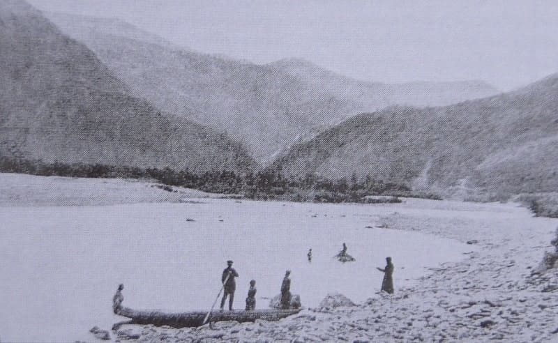
Ulba river on Kazakh Altai.

Rafting on Ulba River.
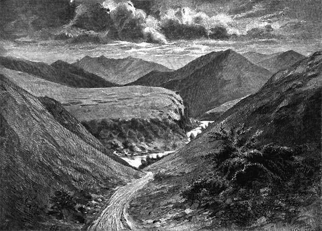
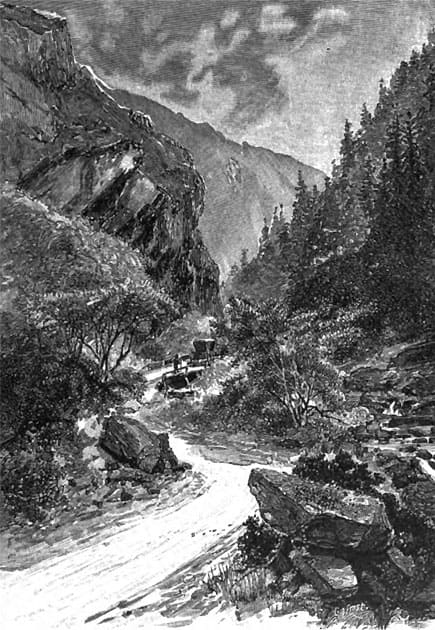
"Not far from the village, we forded the swift Ulba River, which had swept away the bridge and scattered enormous stones with a generous hand across its valley. However, despite the devastation wrought by the capricious river, its valley between the Dolgaya and Shipitsynskaya mountains resembled a blooming park. Its woody vegetation consisted of slender Siberian poplars (Populus laurifolia), birches, willows, aspens, bird cherries, and so on. Clusters of trees interspersed with clearings and thickets of Siberian shrubs. Among the tall grasses, I noticed many peonies (Paeonia hybrida), unfortunately already faded, but still revealing the dark purple interiors of their fruit. With each turn in the road, new landscapes unfolded before us in all their beauty. We continually forded the branches of the Ulba or the mountain streams that flowed into it, or climbed low porphyry cliffs covered in lush vegetation. The views from some of these elevations, overlooking the river's bends and the cliffs that sometimes overhung it, were particularly picturesque. To our right, a mountain was visible, rising hundreds of meters above the river. Its high, sharply angular ridge unmistakably indicated that it was composed of granite; the locals gave it the rather poetic, yet characteristic, name of Ugloukha.
P. P. Semenov-Tyan-Shansky. "Journey to Tien Shan." 1856-1857.
"Near the village of Sogra, the Mokhovka River flows [as Pallas calls it, but the villagers call it Sogra], flowing into the Ulba immediately beyond the village. The village has many streets; it is neat and welcoming; its residents are prosperous, and they welcomed me with great hospitality. After traveling seven miles from Sogra, I continued on across the Ulba steppe. We crossed the Ulba on a ferry built by the factory administration to facilitate the delivery of ore from the Zyryanovsky mine. The opposite (left) bank of the Ulba consisted of steep shale cliffs, often overhanging the water. From here it's only two miles to Ust-Kamenogorsk. The rocky shore of the Ulba gradually merges into the steppe that forms the banks of the Irtysh. Late on Saturday evening, as the sun was setting behind the hills to the west, we were already racing along the gentle, beautiful gorge leading to the Ulba Valley, and before dusk we had settled comfortably into a cozy room at the Ulba post station, feasting on bread and raspberries with cream.
Ledebour K. F., Bunge A. A., Meyer K. A. "Journey through Altai Mountains and Dzungarian Kirghiz Steppe." 1826.
Traveling along rivers of East Kazakhstan.
Ulba River lies at an altitude of 279 to 669 m. a. s. l. River is formed by confluence of Tikhaya River, which flows from north and originates on southern slopes of Ulba Range, and Gromotukha River, which flows from east and originates from Lake Palevskoye at an altitude of 2,109 m. a. s. l. It is a right tributary of Bukhtarma River and flows through city of Ust-Kamenogorsk and municipal administration of Ridder, in Glubokovsky District ofEast Kazakhstan Region.
The river is 100 kilometers long, and the basin area is 4,990 square kilometers. It is fed by mixed waters, with snowmelt predominating. The river freezes over in November and December, and breaks up in April. The average water discharge is 100 m³/sec.
The Ridder Cascade Hydroelectric Power Station is located on the river. The urban-type settlement of Ulba is located on the Ulba River. The settlement is under the jurisdiction of the municipal administration of Ridder. The village's unofficial name is the 4th District.
It has a comprehensive school (11 grades), a kindergarten, a fire station, and a mine rescue unit. There are also several stores selling industrial, grocery, and general merchandise, several hair salons, a post office, and a branch of the People's Bank of the Republic of Kazakhstan.
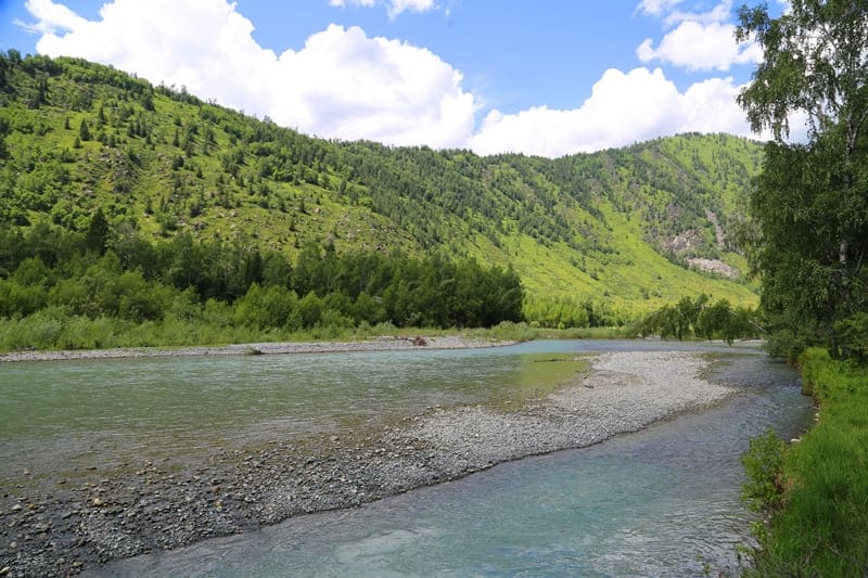
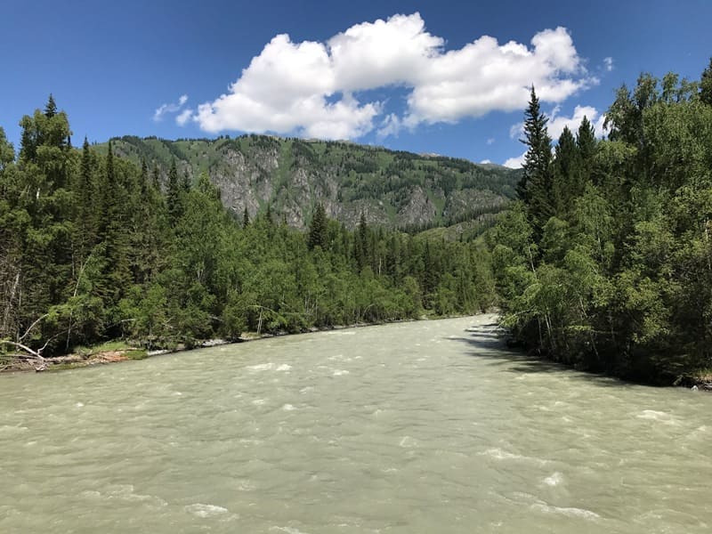
The Ulba River valley is located in a picturesque mountain gorge with rocky outcrops. The river is swift-flowing and has many rapids. The floodplain landscape varies with altitude. In the upper reaches, gray rocks and scree predominate, while further down, vibrant alpine meadows are found.
Grasses give way to cedar, fir, spruce, larch, pine, willow, and birch. Vast clearings are overgrown with shrubs everywhere. Where the river valley widens, meadows blossom. On the right tributary of the Ulba, the Tikhaya River, is the city of Ridder (formerly Leninogorsk), a major center of the mining industry and non-ferrous metallurgy in the East Kazakhstan region.
A hydroelectric power station has been built in the upper reaches of the Ulba River at the foot of the Ivanovsky Ridge. Nearby is the urban-type settlement of Ulba, a railway station, the mines of the Ridder Mining and Processing Complex (formerly the Leninogorsk Polymetallic Plant), and a woodworking plant.
The Ulba offers boat trips ranging from 90 to 100 kilometers long, classified as a second-category difficulty. Trips last from one to five days. Seasonality runs from May to August. The starting point of the route is Tishinka Station, which tourists can reach by train from Ust-Kamenogorsk.
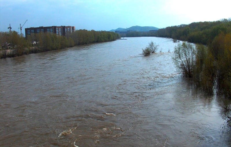
During floods and summer rains, the Ulba's water level rises significantly. A kilometer from the station, the river divides into several branches, all of which are quite turbulent.
Geographic coordinates of Ulba River are: N50°11'47 E82°57'48
Geographic coordinates of mouth of Ulba River are: N49°57'02 E82°34'55
Geographic coordinates of beginning of Ulba River are: N50°17'02 E83°22'56
Authority:
Planet Adventure, The encyclopedia of Kazakhstan, 1996.
Photographs and drawings:
George Kennan. "Siberia and Exile." "Southwestern Siberia. The Altai Mountains." Volume 1. 1906.
Photographs taken by George Kennan, drawings by George Frost in 1885, taken from the archive of George Kennan.
https://rus-turk.livejournal.com/354668.html
Photos by:
Alexander Petrov.