


![]()
You are here
Tuarkyr mountains.
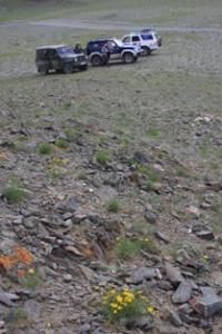
Mountains in northwest of Turkmenistan.
“Erase random features. And you will see: the world is beautiful!
Alexander Blok.
Mountain heights of Turkmenistan.
Tuarkyr Mountains are located 54 kilometers east of the eastern shore of the Sovetsky Gulf, east of the Ersary Baba Mountains in the Turkenbashi etrap of the Balkan velayat in northwestern Turkmenistan. The length of the mountains from southeast to northwest is 34 kilometers, their width is insignificant, in the central part it reaches 4 kilometers.
The western slopes of the mountains are cut by ravines-sai, the length of the ravines reaches 6 kilometers. The highest nameless mark in the central part of the Tuarkyr Mountains reaches a height of 320 meters above sea level.
The next highest mark at 314.8 meters above sea level is 4.7 kilometers southeast of the previous peak. The wide folded structures of Tuarkyr are parts of the Meso-Cenozoic cover of the Epi-Hercynian platform, the formation of which is associated with local uplifts of the folded base of the Turan Plate.
The rocks of this base come to the surface in the center, where these rocks make up the Kyzylkiya (Kyzyldakayalar) uplands in the Tuarkyr system. The Tuarkyr system is similar in structure to the Mangyshlak highland.
In a rough scheme, this is also an anticline fold with Middle Paleozoic, Permian, Triassic, and Jurassic rocks in the core and Cretaceous in the wings. The difference of the Tuarkyr system is that the northeastern limb of the fold is covered with Paleogene and mainly Neogene layers (Neogene layers directly continue the Neogene cover of Ustyurt).
The protrusion of the Hercynian base to the south of Chagyl forms ridges lower than the Karatau mountains on Mangyshlak, and the monoclinal ridges of chalk rocks on the wings of the fold that frame the inner part of the system form ridges of greater height (up to 483 meters above sea level).
This frame includes the heights of Begendzaalikyr First, Kyyamatdag, Ersary Baba, etc. The eastern part of the Tuarkyr system is the Kaplankyr monoclinal ridge, which merges with the Ustyurt (up to 329 meters above sea level).
In the cliff and at the foot of Kaplankyr, Cretaceous and Paleogene rocks come to the surface, and the plateau inclined to the east is formed by the same Neogene cover as on Ustyurt. In the region of Tuarkyr and Kaplankyr, in contrast to Mangyshlak, desert landscapes completely dominate, and in its main part (with the exception of the northwestern edge), this region already belongs to the southern desert zone. On the framing ridges of the Tuarkyr system and on Kaplankyr, a clayey wormwood-saltwort desert dominates with carbonate gray-brown soils (according to E.V. Lobova), turning into a solonchak desert with gray-brown solonchakous soils.
Southern wormwood prevails here, there are also boylych (Salsola arbuscula) and other species of Salsola, biyurgun, rheomyria, nanophyton. On ridges, plateaus, and especially on steep slopes with rocky cliffs at the top, the clay and saline desert often turns into rocky.
The inner part of the Tuarkyr system is occupied by clayey ephemeral-sagebrush and sagebrush desert in combination with saline desert. Southern wormwood and saltwort dominate here (tetyr - Salsola gemmascens, boyalych).
etween Tuarkyr and Kaplankyr stretches a strip of the Uchtagankum sandy desert, which in the northern part is called Kumsebshen with white saxaul and other psammophytes, which is one of the northwestern "bays" of the Karakum beyond Uzba.
To the east, at the foot of the Kaplankyra scarp, there is an extensive depression, the Goklenkui saline land, a typical saline halophyte desert, confined to the axis of the anticline with an outcrop of Cretaceous rocks.
Geographical coordinates of Tuarkyr: N40°39'10.18" E55°17'57.27"
Authority:
A.G. Isachenko, A.A. Shlyarnikov. The nature of the world. "Landscapes", Moscow, "Thought", 1989. (Andrusov, 1915; Borneman and Spiridonov, 1929; Dolenko, 1930; Rusanov, 1930; Fedorovich, 1947; Rybin, 1952; Shlesinger and Pleshcheev. 1959; Kazakhstan, 1969; Faizov, 1970; Geology of the USSR, 1970; Soils of the Mangyshlak Peninsula, 1974; Borovsky and Dzhamalbekov, 1983; Safronova, 1986).
Alexander Petrov.
Photos by
Alexander Petrov.