


![]()
You are here
Tour to Kapamsay canyon and Sarytash bay.


Drive to Kapamsay Canyon.
"All strong personalities love traveling"
Carthage proverb.
A brief description of the route of a sightseeing trip from Aktau to Kapamsay Canyon:
Aktau - Akshukyr settlement – Kashkar ata necropolis - Kasym necropolis - Kapamsay canyon - Shakpak ata necropolis and underground mosque - Sarytash pier - Aktau.
Distance of route: 275 km.
The length of the active part: 2 - 3 km.
Season: April - October.
Duration: 1 day.
The best time for the tour: April, May, June, September.
Detailed travel program for the southern coast of Sarytash Bay:
A trip to the Gulf of Sarytash.
Transfer: Aktau - Akshukyr village (20 km). Our way from Aktau lies north in the direction of the city of Fort Shevchenko, in the village of Akshukyr visit the necropolis of Kashkar ata. On the Kashkar-Ata necropolis, a characteristic type of monuments are various types of tombs of the Koytas type, tombstones of small sizes without decorative processing. At the ends and sides, carved tamgas and epitaphs in Arabic. Walk to the necropolis.
Transfer: Kashkar ata necropolis - Kasym necropolis - Kapamsay canyon (99 km).
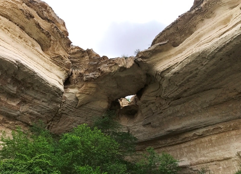
At 92 km after Aktau we turn to the north-east. We pass a small necropolis of Kasym consisting of four old burials. Arrival at Kapamsay Canyon. A walk along the western part of the ravine to its southern tip is the beginning of the canyon.
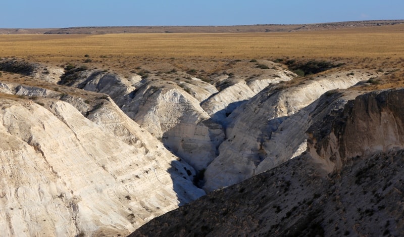
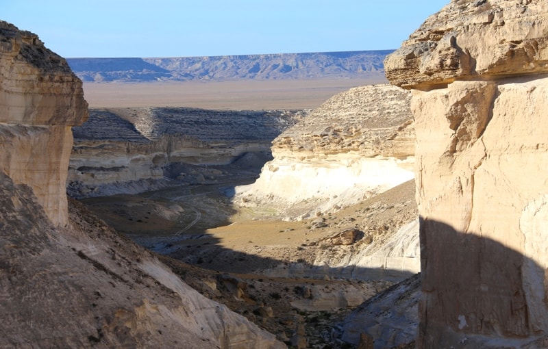
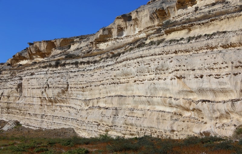
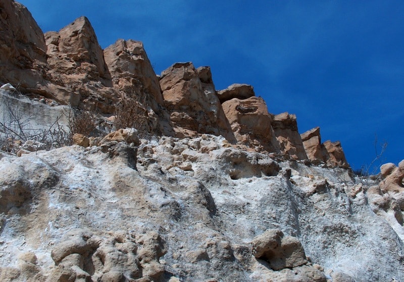
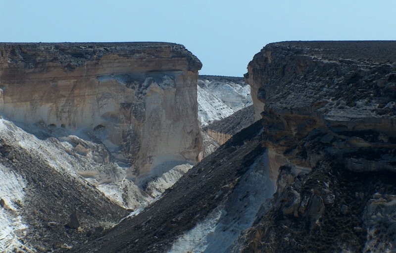
To the north, the canyon expands, makes intricate bends, exposes the overhanging white chalk cliffs, which fall into the bottom of the canyon by sheer discharges.
Further transfer: the western part of Kapamsay canyon - the eastern lateral canyon Roshcha (3.5 km).
We go down the rocky road, which is laid along the western part to the northern beginning of the canyon.
Kapamsay Canyon stretches from south to east for 4 kilometers. In the vicinity of the lateral canyon Grove, the largest width of the canyon is 277 meters. The rocks of Kapamsay canyon are composed of sedimentary deposits of the Jurassic and Cretaceous periods.
In the canyon, a huge number of randomly scattered boulders and bizarre silicon stones, picturesque chalk cliffs are sometimes decorated with bizarre chemical and physical weatherings. These weatherings are similar to bee honeycombs of different sizes and configurations. Visit to the side Grove Canyon, walk around the canyon.
Transfer: Kapamsay canyon - necropolis and underground mosque Shakpak ata (7.5 km).
We pass the shepherd’s house and our road turns east, on the way there is a source of hot water, a mosque and soon we will stop at the metal fence in front of the Shakpak ata complex. Visit to the necropolis and the underground mosque of Shakpak ata.
The mosque is located in the thickness of calcareous rocks on the western slope of a small terrace overlooking the Zhanbyrt valley, not far from Mount Ongazy (Onega), in the area of Shilykudyk. The mosque is a building of four rooms located in the shape of a cross, which are elongated along the line of the central room with a dome vault, with a light opening in the upper part.
The entrance aperture at the western part of the mosque is arranged as a small corridor, at the end of which there is a small platform, and the outer side of the aperture is designed as a portal. In the middle of the corridor on the north side, there is another opening leading to the office building.
In the center of the south wall of this chamber is a small arched niche meaning mihrab. On the walls of the mosque there are many inscriptions in Arabic script.
Transfer: Shakpak ata mosque - Sarytash pier (9 km).
After visiting the necropolis and the underground mosque of Shakpak ata, we will visit the pier Sarytash. The berth is currently not working. In the 30s of the last century, a narrow-gauge railway with a length of 26 kilometers was laid to the pier, along the "narrow-gauge railway" coal was transported from mines in the vicinity of the Taushyk village.
Only 11 kilometers of this road were laid along the plain and the shore of the southern part of Sarytash Bay, the remaining 16 kilometers were laid along the Kumakapa River. It should be noted that the narrow gauge road was laid to the Donspan building in the Taushyk tract, which is located 5 kilometers northwest of the Taushyk village.
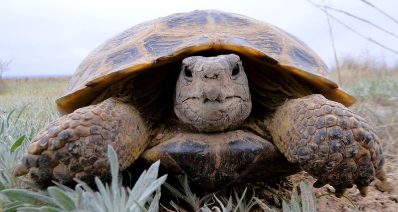
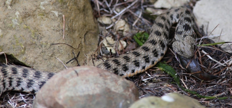
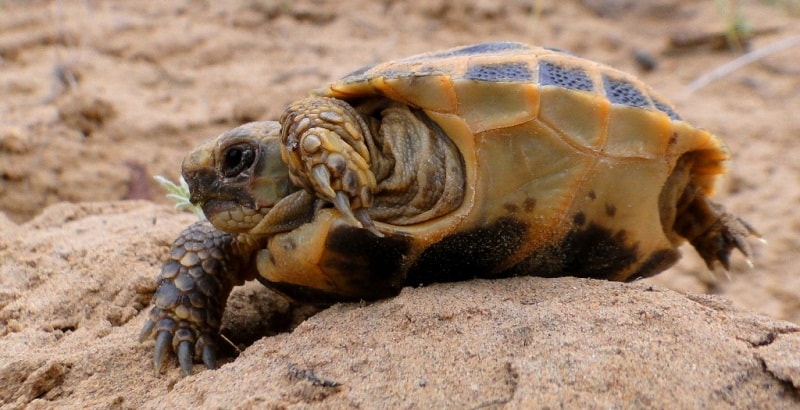
Coal mines were located 2 kilometers west of the village of Taushyk. From coal mines to the Donspan building, coal was transported by truck. At this time, an embankment of large stones has been laid to the pier, on both sides of the embankment, among the stones this place was chosen by a large number of bull-calves, this is already water (Natrix tessellata).
Watery spends time in water much more than ordinary watery one. It feeds mainly on fish (60%), less often amphibians. Spends the night on land, in the morning it warms up in the sun and goes hunting for water. Having caught the prey, it crawls back to the shore, where it swallows it and either goes for new fish, or arranges to digest the prey.
Often hunts gobies, for which he received the nickname "bull-calves". It also winters on land, in spring appears in March - April, the mating season in April - May. He leaves for the winter in October-November. The main enemies of snakes are birds of prey and mammals.
Watermark is not aggressive, at the sight of a person he usually tries to hide in water or in shelter. Bites are extremely rare. For humans, they practically do not pose any danger. Photographing colonies of water snake.
Return to Aktau (136 km).
Note:
Author program of Alexander Petrov. Copying and introduction - from the sanction of the author petrovsra@mail.ru
Photos by
Alexander Petrov