


![]()
You are here
Tien-Shan mountains.
Travel to mountains of Kyrgyzstan.
“Nature is wise. You can learn everywhere and from everything”
Leonardo da Vinci.
Tien-Shan mountains Hiking on Kyrgyzstan.
Tien-Shan is a majestic highland spreading from the Syr-Darya River to the Gobi Desert, from Takla-Makan Desert to Balkhash-Alakol hollow. Huge snow-covered Tien-Shan mountain ranges stretched for 2500 kilometers from the West to the East and for 750 kilometers from southwest to northeast.
Dzhungarsky Alatau (Zhetusy Alatau) is also a part of these mountains. In the extreme West the mountains are limited by Karatau range, in the east by Karkyktag hills, in the south by Maidantag range, in the north by Kungei and Tastau spurs of Dzhungarsky Alatau.
Tien Shan can be subdivided into Western, Northern, Internal, Central, Eastern and Dzungarian Alatau. The name “Tien-Shan" has came from Chinese and in turn is a calque of Turkic toponym "Tengri-Tag" - the Heaven’s Mountains. Ancient hunnu (sunnu) called them "chenly" (heavenly).
Tien-Shan as well as Pamir are characterized by sub-latitudinal ranges. In Western Tien-Shan attention is paid to ranges of diagonal extension: from the southwest to the northeast (Ugamsky, Karzhantau, Pskemsky, Chatkalsky and others) and from the northwest to the southeast (Fergana and Karatau).
Meridional range is the largest unique range in Tien-Shan stretching from the north to the south and draws the boundary of Kazakhstan with China and Kyrgyzstan. And the longest Kakshaal-Too range having the length of 580 kilometers is located in the south of Internal Tien-Shan.
In western part of Tien-Shan the highest tops are in Fergana range (nearly 4900 m. a. s. l.), in Chatkalski (4503 m. a. s. l.), in Talasski range it is Manas Peak (4448 m. a. s. l.), and in Ugamski it is Sairam Peak (4238 m. a. s. l.). Western Tien-Shan is characterized by widely spread calcareous and slate rocks which easily give in to water washouts, and deep cuts, jagged mountain tops and impassable gorges are usual view here.
Frequently they alternate with flattened mountain ridges, for example Karzhantau range has flat surface, and therefore is easily climbable. Rather low (up to 1768 m. a. s. l.) and isolated Kazykurt range with leveled crest is very popular among local population.
There is a superstition that in Bible days Noah's Ark has moored to this very range. That is why Kazykurt is something like local Ararat. Spacious Ahangaranski plateau adjoins to southwest edge of Chatkalski range. Western Tien Shan due to its lowness and southern position is rather poor in glaciers.
Glaciation total area is only 500 square kilometers with the number of glaciers not more than 1000. Small glaciers with length of less than 1 kilometer prevail here. The largest Palgov glacier is in the southern part of Fergana range on its northeast slope. Its length is 5,4 km and total area of 7,4 sq.km.
To Pamir measures it is an ordinary middle or even a small glacier. There is permafrost in Western Tien-Shan, and this permafrost it usually has is-land or spotted nature. It can be met on the slopes of northern exposition at the height of over 3000 meters above sea level.
Glaciers descend to 3300 - 3500 m level in the north and to 3700-3900 m. a. s. l. in the south of the region. Subtropical climate is typical for the foothills of Western Tien-Shan. onsiderable is the level of air temperature fluctuation at different heights: air temperature drops (at absolute altitude of 3000-2800 m. a. s. l. mean annual temperatures drop below zero) and the quantity of atmospheric precipitation increases.
Southwest slopes of high mountains of At-Oinoksky and Fergana range where the annual sum of precipitations is over 1000 mm are the most humidified. About 600 - 700 mm of precipitations and in some areas a little bit more drops in the group of ranges adjoining to Chatkalsky range.
The Most snowy are the slopes of Fergana range and the highest parts of Chatkalsky, Chandalashsky (Sandalashsky) and Pskemsky ranges in the northeast. Snow cover thickness can reach and sometimes exceed 2 meters, so, these places are extremely avalanche-hazard.
Western Tien Shan is characterized by the variety of Sylva. Tien-Shan firs prevail here, sometimes Semenov's fir can be met, walnut groves, wild apples and plum, wild pistachio and almonds have still remained here, and also there are maples and many small-leaved wood species and bushes.
Sarychelekski biospheric nature reserve and Arslanbob Tract are the most remarkable in this respect. The first is located in southern spurs of Chatkalsky range and the second מן southwest slopes of Fergana range. Biospheric nature reserve is named after Sarychelek Mountain Lake which is located in the mid-mountains at the height of about 1900 m. a. s. l.
It has the length of 7,5 km and area of about 5 sq.km. Its maximal depth reaches 234 m. This picturesque running Lake with transparent dark blue water and reflection of blue sky and neighboring wood in its waters like in a mirror has a tectonic origin and is formed as a result of landslip.
Round the Lake there is so called original vegetative paradise. It is possible to find surprising combination of wood species: Tien-Shan fir neighbors with walnut. Perhaps, it is the only place in Central Asia Mountains where such neighborhood really exists. There is tree-like juniper, Siver's wild apple, cherry plum, maple and other trees and bushes.
Lower at the foothills of Chatkalsky range wild pistachio and almond grow, and as soon as the road goes up from the Naryn River towards the Lake one can pass through their thinned groves. Arslanbob (Lion’s gate) is located in Kara-Unkur River basin (Black cave) on southeast slope of Babash-Ata - the spur of Fergana range. Here in mid-mountains there is a relict walnut grove, the most known in Central Asia.
Air is saturated with sweet-scented aromas of fructifying trees and bushes, such as nut wood, wild apple (its fruits are edible), wild plum (alycha) and many others. Northern Tien-Shan includes Kyrgyz Ala-Too, Zailiysky, Kungei Alatau and Ketmen.
Very often eastern part of Talassky range and northern slopes of Terskei-Ala-Too (the Kyrgyz for "Terskei Ala-Too") is referred to this region. Note should be taken to the adjective "ala". As a rule, in available literature this word is translated as "motley".
However leading toponymists of Kazakhstan and Kirghizia not without reason suppose that it should be better to interpret the toponym "ala" as "high". From geographical point of view this explanation seems to be more logical. Northern Tien Shan is the most ancient highland part in geological point of view.
The highest top (excluded Terskei Alatau) is Talgarsky Peak (4978 m). The name Talgar has Mongolian origin: it came from the word "Delger" that means Massive Mountain. It rises in Zailiysky Alatau south-east to Almaty. The longest ridge in Northern Tien-Shan is Kyrgyz Ala-Too which stretches for 454 kilometers, its highest top - Semenov's-Tien-Shansky Peak - is nearly as high as Talgar and reaches 4875 m. a. s. l.
In Northern Tien-Shan all ranges are of sub-latitudinal strike. The lowest of them is Ketmen with Sarytau and Karatau spurs, the latter has the Peak which reaches 3722 m. a. s. l. The crests of Ketmen and Karatau are flattened, and in isolated places small airplane can land there.
These mountains have no modern glaciers, but the fir forest belt is well distinguished there. In Zhalanashsky hollow located towards the northwest from western end of Ketmen at the height of about 1000 meters there is Charyn River canyon (Sharyn) -left tributary of the Ili River.
Chain of canyons of different shape stretches for a distance of 80 kilometers: some of them are cut in rocky massif to the depth of 300 meters, the others in neogene-quaternary detritus to the depth of 200 meters. Al of them are picturesque in their own way.
The most known canyon is located along Almaty-Narynkol highway near the bridge over the Charyn River and at resurgence of the River from Toraygyrsky Mountains. Nature has created fanciful land forms reminding towers or fortress baileys and sometimes figures of people or animals. It is about 200 kilometers from Almaty to these beautiful places.
Northern Tien-Shan Mountains, except for Kirghiz range, are rather wooded: in mid-mountains Tien-Shan firs grow at the height of 1500 - 2700 m. a. s. l. In the Kyrgyz range the firs give place to tree-like juniper. Dwarf juniper is widespread at all ranges of the region.
Rocky low mountain massifs are scattered all over Ili hollow: they are Makaisary, Sogety, Boguty, Sholak, Ulken-Kalkan and many others. Their height is 1000 - 1800 m. a. s. l. These places are represented by deserted landscapes.
In the mountains of Northern Tien-Shan at the height of more than 2700 - 2800 m. a. s. l. there is the zone of permafrost. Sometimes it can be seen in the form of small areas in forest belt at the height of 2000 meters above sea level. The most humidified is the central part of northern macroslope of Zailiysky Alatau where about 1300 - 1400 mm of atmospheric precipitation falls in high mountains.
It is the most snow-covered part of mountains of high avalanche and mud stream risk. So, mud stream in 1921 has destroyed many constructions in Verny (today's Almaty), and in 1963 mud stream has practically destroyed picturesque mountain Lake Issyk which by present time has only partially restored.
Mud flows are generally formed due to heavy rains, rapid thawing of glaciers or during catastrophic earthquakes. In the valley of Bolshaya Almatinka River in the mountains of Zailiysky Alatau near Almaty city at the height of 2500 meters there is high-altitude Big Almaty Lake (ZhosalykoI) surrounded by beautiful firs.
It was formed by enormous landslip happened during severe earthquake about 2500 years ago. The cleanest Lake water comes into water supply system of Almaty. In upper reaches of the Bolshaya Almatinka River one may not only admire the scenery but see rock glaciers.
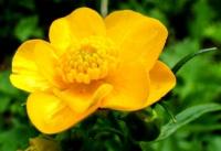
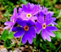
Mountains of Northem Tien-Shan are famous for richest Alpine meadows which are widespread at the height of 2800 - 3500 m. a. s. l. Fine summer pastures "zhailau" are located there. Greenery of these meadows is adorned by edelweiss stars, blue urceoles of gentians, fragrant primula (primrose), poppies, chamomiles and other flowers.
Also attention is attracted by cushion plants such as tilyakospermum and driadante. The first explorers of Northem Tien-Shansky are Ch.Ch. Valikhanov, ׀.׀. Semenov- Tien-Shan, N.A. Severtsov, I.V. Mushketov and A.N. Krasnov. In second half of XIX century they have laid down the foundations of doctrine of vegetation, fauna, geological feature and relief of the region.
For the first time N.A. Severtsov has described the traces of ancient glaciations of Central Asia mountains. Internal Tien Shan is the most peculiar part. It is stretched from Teskey Alatau to Kakshaal Too, from Fergana range to the Saryzhaz River valley.
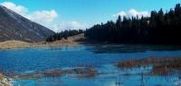
This region combines high-altitude plains (uplands) with mountain ranges and massifs. Uplands here are called syrts. There are a lot of Lakes basically small in sizes, but some of them are rather large, such as Songkel (270 square kilometers) and Chatyr-Kel (153 square kilometers).
The Rivers in syrts with rather quiet stream only in some places turn to rough streams. Rather low ranges in comparison with the level of syrts which are located basically at the altitude of 3000-3800 meters commands the plain, but actually their summits reach the altitude of 4500 - 5000 meters and sometimes more.
The most spacious plains are located in the basins of Ak-sai Vostochnaya, Arabel, Kum-Tor Rivers, in depressions of Chatyr-Kel and Songkel Lakes, in valley of Taragai and Karasai Rivers. Syrts differs by rather arid climate: annual amount of precipitation does not exceed 200-300 millimeters.
So, besides Alpine meadows there are mountain steppes and so-called cold deserts and sometimes even mountain tundra. The most part of mountain ranges of Internal Tien-Shan has modem glaciations. Especially Ak-Shiyrak - a small range in length at the watershed of Syr-Darya and Tarim basins can be distinguished in this respect.
The total area of range glaciers is 400 square kilometers, and the largest of them Petrov's glacier reaches 14 kilometers in length. In comparison, the area of Ak-Shiyrak glaciations is approximately equal to the area of Zailiysky Alatau glaciation, while the length of the first is 60 kilometers and of the second is 280 kilometers.
However, Ak-Shiyrak range is little higher than Zailiysky Alatau but it is far southward. In Internal Tien-Shan there are about ten glaciers which are more than 10 kilometers in length, but none of them reaches 15 kilometers. Distinguishing characteristic of glaciation of this region is presence of glaciers of flat tops.
Mostly they are related to very flat southern slopes of Terskey Alatau. It is a special kind of glaciers reminding glacial covers of Greenland or Antarctica in miniature: ice loaf or cap which zone of feeding is the centre of the cover and ablation zone (thawing) is the edges.
Permafrost in Internal Tien-Shan is widespread everywhere. On northern slopes of Ak-Shiyrak at the heights of 4000-4200 meters its thickness reaches 370 meters. Diverse cryogenic forms of relief are directly or indirectly connected with permafrost; they are icing, thermokarst depression, rock glaciers, frost mound (tufurs), structural soils, soliflual terraces on slopes and "ploughing" blocks.
In the recent geological past (about 15 thousand years ago) all Internal Tien Shan was under glacial cover. Landscapes of these places always were fertile places for wild rams, mountain ibex, Tien-Shan bear and numerous populations of marmots.
Of course, today the fauna has rather depleted and the main reason of it is immoderate hunting of animals. But about 50 years ago many places of Internal Tien Shan were the land of unscarred marmots and other inhabitants. Here, at the foot of Ak-Shiyrak range at the altitude of 3600 meters the most high-altitude meteorological station "Tien-Shan" was established which operated from the end of 1920.
Massive building of meteorological station is the first permanent structure constructed in Central Asia in permafrost. The pearl of Central Asia is Issyk Kul blue mountain sea. This wonderful Lake is located between Northern and Internal Tien-Shan at the height of 1606 m. a. s. l.
And this is the biggest mountain Lake of Central Asia. The length of Issyk Kul is 178 kilometers, maximal width is 60 kilometers, area 6236 square kilometers, depth reaches 668 meters, and water volume is about 1738 cubic kilometers. Last researches show that waters in Lake is 17 times more than in Balkhash Lake. Issyk Kul is the greatest depository of water in Central Asia Mountains. Water in the Lake is saltish - 5,8 g of salt per liter.
The climate on the coasts of Issyk Kul is rather temperate: winter is mild, and summer is not as hot as in the foothills of Zailiysky Alatau. The Lake does not freeze in winter and water is unusually blue and clean. The modern name of Issyk Kul Lake is interpreted different ways.
One variant assumes that name in translation from Turkic languages means "warm" or even "hot Lake", another goes back to ancient Turkic "yduk" or "ydyk" that is "sacred". For a long time local population regarded this Lake as sacred and it was forbidden to wash clothes or litter it.
Issyk-Kul was formed several millions years ago and is running fresh-water Lake. Water level was changed many times over time: 14 thousand years ago it was below modern status of 100 meters, and 4 thousand years ago it was higher than today by 40 meters.
Once the water level increased there was water runoff into the Chu River, and when the level decreased the runoff stopped. Last runoff was observed somewhere in the middle of XVIII century. Borders of Central Tien-Shan are still universally unrecognized.
We set the bounds in the west and north with Saryzhaz River valley, in the east with Muzart Rivel" basin , in the south with Kakshaal-Too and Khalyktau foothills, in the northeast its slopes go down in Tekesa valley. Axis of Central Tien-Shan is Meridian range from which latitudinal sections of Saryzllaza, Tengri-Tag, Kakshaal-Too and Khalyktau ranges step aside.
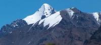
Central Tien Shan is the most elevated part of highland: here is the highest top - Pobeda Peak (7439 m) which is called Temir or Tomyr in China. This mountain junction includes Khan Tengri Peak (6995 m) and at least 20 six-thousand meter mountains and dozens of mountains measuring at least five thousand meters in height.
Central Tien-Shan also has "glaciation pole" of this mountain range. Glacial covers occupy the territory of at least 4000 square kilometers including the largest glacier - outhern Inylchek (Engilchek) spread for 60 kilometers and even more than five glaciers reaches 2S kilometers in length.
Central Tien-Shan is characterized by alternation of thick glacial covers and the highest ranges with deep valleys, where Tien-Shan fir, juniper, birch, poplar, mountain ash, willow and other vegetation grow. Here it is possible to meet both mountain steppes and Alpine meadows.
It is interesting that firs on the slopes of Southern Inylchek glacier rise considerably higher than its border (glacier ends at the height of 2800 meters and isolated trees can be met even at the height of 3100 meters). Amazing natural phenomenon of the region is the Mertsbaher Lake. It is located between the end of Northern Inylchek glacier and right edge of Southern glacier.
Once these two glaciers combined together, and only then the surface of one has decreased and formed a hollow which was periodically filled with thawed snow and has generated Mertsbaher Lake at the height of 3300 meters above sea level. It length is 4 kilometers, width is 1 kilometer and depth sometimes reaches 100 meters.
Water volume in the Lake reaches 200 - 300 million cubic meters. Almost every year there is ice dam failure, and the huge water stream directs to the Valley of Inylchek River. In summertime huge blocks of ice - icebergs float in the Lake.
The Lake was discovered by German climber G. Mertsbaher in 1903 and later it was named after him.
In Central Tien-Shan the permafrost is also widespread. On the slopes of its highest tops deprived of solid ice-cover, its thickness can reach 1 kilometer. Under very large glaciers at small heights it is probably absent. However, till now it is much unclear concerning of sub-glacial permafrost. It is the most unstudied type of high altitude permafrost.
The largest part of highland within China is usually regarded to Eastern Tien-Shan. And it is logical to exclude only the hills of small area of Central Tien-Shan and western part of Boro-Horo range from the concept of "Eastern Tien Shan".
The basic mountain ranges and massifs of Eastern Tien-Shan are Khalyktau, Kharat, Iren-Habyrga (High wall), Uken, eastern part of Boro-Horo, Bogdo-Ula (Bogdo-Shan), Barkeltag and Karlyktag (Kalytag).
Three latter ones form more or less isolated massifs. Karlyktag is the most eastern among them and reaches about 5000 meters in height. And Bogdo-Ula with the main top of the same name rises to the height of 5445 meters. The highest top of Eastern Tien-Shan reaches 5500 meters and is located in Iren-Habyrga range.
There are no large glaciers here, but in Urumchi Riverhead there is a glacier No. 1 which is known for that fact that observations there have been conducted since 1959. Though the glacier is rather small and reaches 2,3 kilometers in length it is one of the most accessible: it can be reached by car.
About 150 meters lower there is meteorological station where average annual air temperatures is -5,3°C. The most frozen range of Eastern Tien-Shan is Iren-Habyrga. The total area of this glacier is 1400 square kilometers. Permafrost is widespread in Eastern Tien-Shan, its small islets can be met even at the top part of forest belt.
This mountain region is rather arid in comparison with Northern Tien-Shan. But Tien-Shan fir woods are widely spread there. Dzungarsky Alatau consists of two basic sub-latitudinal ranges. The main is called differently; more often it is called as Central Northern. It is spread for 350 kilometers in length.
To the south there is Toksanbai (Bedzhintau) range which in the east, in China, proceed to Boro-Horo. The highest mountain top is 4622 meters. On topographic maps it is usually specified without name. On informal schemes and in some publications it is called as Semenov-Tien-Shanski's Peak.
On Chinese maps it is called as Besbakan. The name "Dzungarsky Alatau" was offered in 1856 by P.P. Semenov-Tien-Shanski, later it was used by Ch.Ch. Valihanov in his scientific publications. Earlier these mountains were called as Alatau.
This name was convenient for local population. Simultaneously there was another name of these mountains - Zhetusy that means seven Rivers. But the figure "seven" in this case had no special meaning and was used as "many Rivers". Plenty of Rivers in this mountain region were assumed as a basis of toponym.
Later, in second half of XIX century the name was used for the most part of Tien-Shan and foothills. Nowadays such name is used as a synonym of Almaty region. Dzungarsky Alatau through Boro-Horo range joins with Eastern Tien-Shan. Natural border between them is marked range descending in Ashaly Riverhead (70 kilometers to the east of Sayram-Nur Lake).
In the south Dzungarsky Alatau is limited by Iliysky hollow, and in the north by Balkhash-Alakol hollow. In the east its territory adjoins to Ebi-Nur Lake hollow. Dzungarsky Alatau is separated from Barlyk and Maily low hills in the northeast by deep graben - Dzungarian Gates.
These places are famous for stormy wind "Ebe" especially raging in winter and spring, which speed from time to time reaches 70 meters per second. It is able to knock the person down. Railway from Kazakhstan to Xinjiang goes through Dzungarian Gates.
In cross-section Dzungarsky Alatau has asymmetric structure: southern macroslope is steep and short, northern is long and cascade. Higher the cascades become narrow and crests of ranges become more jagged. Dzungarsky Alatau is characterized by sizeable modern glaciation: the total area of a glaciers is 1000 square kilometers, and total number of glaciers is not less than 1500.
The largest of them reaches 8-9 kilometers in length. Permafrost here is extended for more than 2500 meters. Among cryogenic forms of relief attention is attracted by huge soliflual covers at the mountain slopes. Perhaps, nowhere in Central Asia Mountains they reach such impressive sizes.
Various hillocks and frost mounds (tufurs) are widely spread. Icing and rock glaciers are common here. Long-term observations which gave the opportunity to reveal surging character of rock glacier movement were carried out on one of such glaciers - Nizkomoreny glacier.
The main part of Dzungarsky Alatau is wooded. The belt of coniferous forests is located at the heights of 1300-2500 meters. Except Tien-Shan fir, Siberian silver fir sometimes can be met there: you can have a sensation of approaching to open spaces of Southern Siberia.
In other respects, vegetation of mountains greatly reminds the flora of Zailiysky Alatau. Alpine meadows win the heart with their colorful magnificence. Animal kingdom of these places is similar to fauna of Northern Tien-Shan in many respects.
Rarely, it is possible to see maral, and mountain streams with ice water is a habitat of endemic - triton (Mongolian frog teeth). It animal can be met. Mountains of Tien-Shan are rich in minerals. Natural deposits in its western part of iron, copper, manganese, mercury and other ores are especially various and numerous.
The mineral wollastonite which is widely used in ceramic industry is typical for these mountains and is used in manufacture of high-quality electrical insulating devices. There are many coalfields, mineral and thermal springs. In Internal Tien-Shan at the northwest foot of Ak-Shiyrak, at the altitude of about 4000 m. a. s. l., there is Kumtorsky gold deposit, the largest deposit in Central Asia Mountains with total reserves of these precious metals estimated in 500 tons!
At the foot of the ranges of western edge of Dzungarsky Alatau the unique deposit of ornamental stone kalyptas (kalyptash in literal translation from Kazakh is stone for stamps manufacturing) is located.
The stone can be single-color or motley and this raw material can be easily processed by knife. So, it is used for numerous hand-made articles: bowls, pipes, caskets. Ink device made of kalyptas was exhibited at World Fair in Paris in 1889.
Anciently, this stone was used to make stamps for nobility - khans, sultans and beys.
Jasper deposit, the largest in Central Asia, is in Bogdo-Shan (Bogdo-Ula) mountains in the east of Tien-Shan (China) at the height of about 3500 meters. Karatau range, located in the northwest edge of Tien-Shan, where 62 caves were discovered is the most interesting for cave explorers.
One of these caves reaches 380 meters in length. Not all Karatau caves have been discovered and they are still waiting for their "Columbus". Many mountain Rivers of Tien-Shan are used for rafting by sportsmen. The most popular are Sharyn (Charyn), Tauchilik, Talgar, Naryn, Koksu, Tentek and Saryzhaz.
Authority:
“Central Asia Mountains”. 2009, Almaty,Publishing house “Mektep”. Authos Aldar Gorbunov, Anna Ivachenko, Sharipa Bisarieva.
Photos by:
Alexander Petrov.