


![]()
You are here
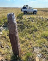
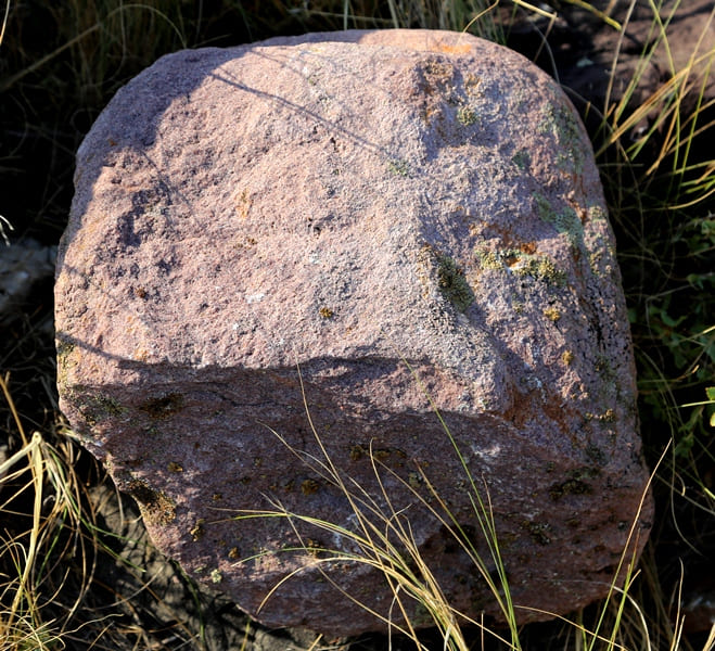
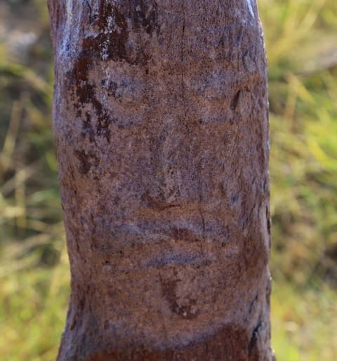
Stone statues Zhylysay.
Tours in Ulytau mountains.
“Comans pour a large hill over the dead and erect a statue to him, facing east and holding a cup in his hand in front of the navel. They build pyramid-shaped houses for the rich. And in some places I saw large towers made of bricks, in some places stone houses, although there are no stones there.
Wilhelm Rubruck. "On Turkic sculptures" XIII century.
Archeologic sights of Central Kazakhstan.
Stone sculptures of Zhylysay are located at an altitude of 489 meters above sea level, located in the southwestern outskirts of the Ulytau mountains, 10.1 kilometers southeast of Mount Edighye, 1063 meters above sea level, 3.4 kilometers to the south and slightly east of the Korgasyn winter road, 10.7 kilometers southeast of Mount Akshoky, 798 meters above sea level, 32.1 kilometers west and slightly south of the village of Aiyrtau and 25.2 kilometers southwest of the village of Ulytau in the Ulytau district of the region of the same name.
For the first time, a group of stone sculptures was explored in 1946 - 1960 by the Central Kazakhstan archaeological expedition. Stone sculptures of Zhylysaya are a significant group of monuments - stone sculptures discovered on the territory of the Ulytau region.
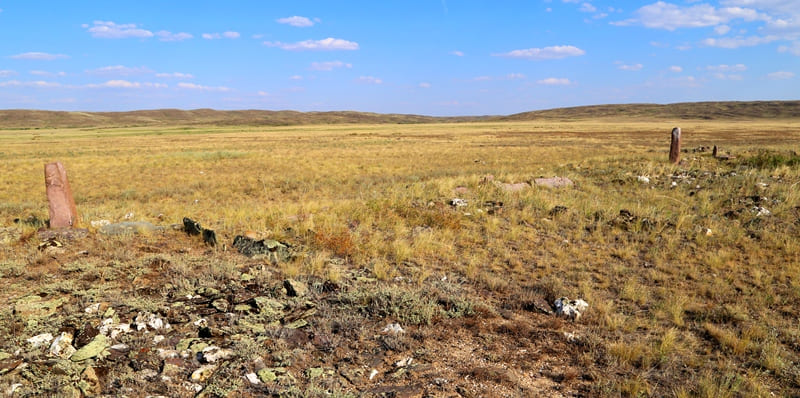
They belong to the era of the Turkic Khaganate (VI - VII centuries) and the Kipchaks (VIII - XIII centuries). Statues from the Kaganate era are installed in the eastern part of the stone fences. The total number of stone fences of Zhylysay is eight, stone sculptures are installed in the eastern part of each of them.
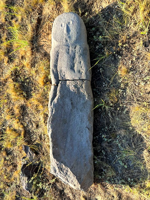
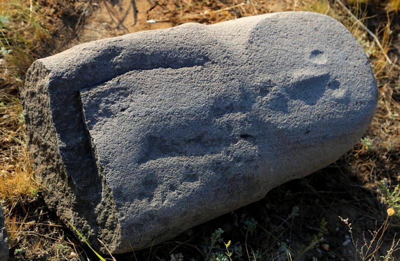
Three of them are destroyed. Of the five sculptures that have survived to this day, two depict an elderly man, two depict young men, and one depicts a middle-aged woman. Perhaps the last statue is a reflection of the goddess Umai, who protects children.
The monuments depict drawings of a saber, dagger and other types of weapons, dishes (bowls for drinks). The nature of the construction of the complex is practically identical to Argykanatinsky, although it was badly destroyed.
Tomb structures consist of rectangular enclosures built from flat stone slabs measuring 1.8 x 2 meters and larger ones measuring 5.9 x 6 meters. Just like in Argykanat, the balbals are located in the eastern part of the fences and the images face east.
The continuation of the structure is a chain of smaller tombstones. Ulytau monuments provide valuable information reflecting the history of the spiritual culture of the tribes inhabiting the territory of Kazakhstan.
Geographical coordinates of Zhylysay stone sculptures: N48°29'36.94" E66°45'43.24"
Note:
If you are using geographic coordinates for Google Earth or Google Maps navigation systems, you must remove the last two digits from geographic coordinates and " (hundredths of a second) and enter the result in the input line. Example: N51°44'09.67" E72°39'40.81" = N51°44'09 E72°39'40

Authority:
"Archaeological map of Kazakhstan." Alma-Ata, 1960. No. 937, table III, 16.21. Akishev K.A. "Antiquities of Northern Kazakhstan." “Proceedings of the Institute of History, Archeology and Ethnography” T.7. Archeology. Alma-Ata, 1959. p. 9, fig. 4-5, tab. I. Margulan A.Kh. "The remains of settled settlements in Central Kazakhstan." "Medieval hillforts and settlements." Zhezkazgan, 1996.111 s. www. tengrifund.ru
Photos by
Alexander Petrov.