


![]()
You are here
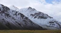
Rushansky ridge.
Adventure traveller in Pamir mountains Tajikistan.
“There are no gloomy times, there are only gloomy people who forget to travel”
Carthage proverb.
Outdoor enthusiast in Tajikistan.
The Rushan Range is located in Western Pamra in the territories of two regions of the Gorno-Badkhshan Autonomous Region - Ishkashim and Roshtkalinsky. The Rushansky ridge stretches between the Bartang and Gunt rivers, in the west in the vicinity of the Lyangar-Kutal pass, adjoins the North Alichur ridge, forming a single mountain formation.
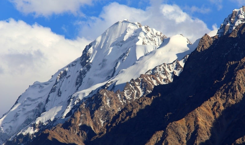
To the south of the Yazgulemsky range is one of the largest ranges of the Pamirs - Rushansky. Its highest point - Pathor peak - has a mark of 6080 meters above sea level. The ridge is sharply dissected and abruptly breaks off to the Panj River valley.
Most of the peaks in the Rushansky ridge have a height of more than 4000 meters above sea level, about 220 peaks - a height of more than 5000 meters above sea level. The bottom of the Bartang River Valley lies at an altitude of 1950 - 3250 meters above sea level, the bottom of the Gunt River Valley is at an altitude of 2200 - 3850 meters above sea level.
The northern slope is more gentle and dissected than the southern one, it has several large spurs, including from the peak of 5458 m (24 km), from the peak of 5391 m (36 km), from the peak of 5317 m (28 km), from Udarif peak (25 km), including the spur of Pathor peak (43 kilometers long), the mountain spur between the Bardara and Devloh rivers (33 kilometers long), the spur between the Langar and Bardara rivers (46 kilometers long) and the Irkhtsky mountains (43 kilometers long).
Mountain spurs also extend to the south, between the Shteklazar and Safet-Obdara rivers (32 km long), Ouar mountains (27 km long) and Anderavaj mountains (30 km long). The length of the Rushansky ridge is 120 kilometers, has an average height of 5100 meters above sea level, the highest point is the peak of Pathor 6080 meters above sea level.
he northern slope of the ridge is wide, dissected by deep valleys of tributaries of the Bartang River. The southern slope is short, abruptly breaks off to the Gunt river valley. In the watershed part, the relief is gentle, divided by wide valleys, the upper reaches of which are still occupied by glaciers.
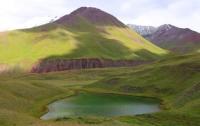
In the lower slopes of the Rushan Range, wormwood semi-deserts and deserts spreading into alpine meadows and rocky landscapes are widespread. Thickets of sea buckthorn, birch, poplar and hawthorn grow in river valleys. Above 4,000 meters above sea level are nival landscapes.
The company line on the slope of the northern exposure lies at an altitude of 4,500-5,000 meters above sea level, on the slope of the southern exposure - at an altitude of 4,600-5,300 meters above sea level. The icing of the Rushan Range is represented by numerous glaciers, the total area of which is over 500 square kilometers.
There are 4 passes in the Rushansky ridge from 3,000 to 3,950 meters above sea level, over 30 passes from 4,000 to 4,950 meters above sea level and 15 passes from 5,000 to 5,300 meters above sea level.

Authority:
"Glaciers." L.D. Dolgushin, G.B. Osipova. Series "Nature of the world." Moscow, the publishing house "Thought". 1989.
Photos by
Alexander Petrov.