


![]()
You are here
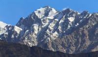
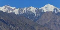
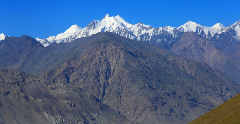
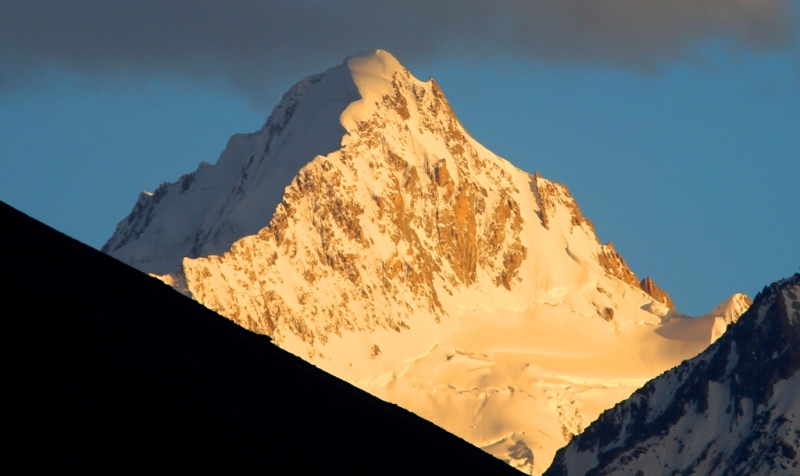
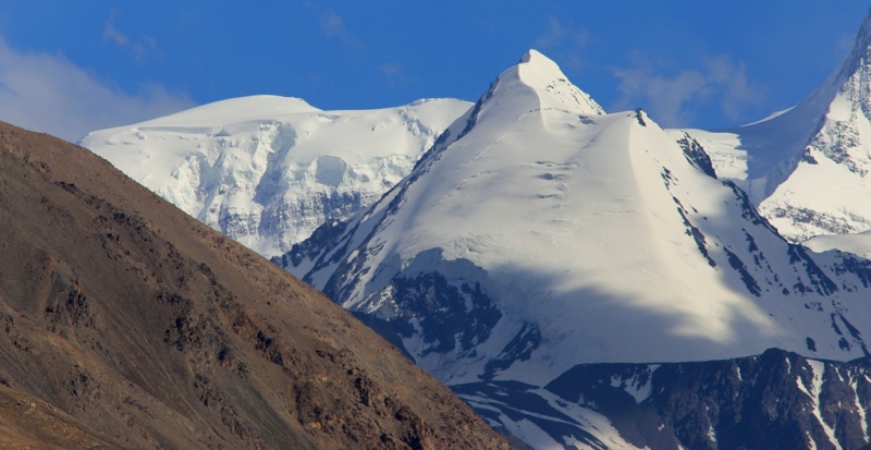
Ridge of North Tanymas.
Expedition tours in Pamirs.
“In the world, how can you live in peace when the world by its nature knows no peace?”
Sanayi.
Individual tours in Pamir mountains.
The North Tanymas Ridge is located in the Murghab region of the Gorno-Badakhshan Autonomous Region in eastern Tajikistan. The Northern Tanymas ridge stretches in the latitudinal direction for 62 kilometers from the middle course of the Fedchenko Glacier to the Takhta-Korum pass 4555 meters above sea level, separating it from the Zulumart ridge.
The highest point of the ridge is the Krutoy Rog peak, 6018 meters above sea level, located in the higher western part of the ridge. The northern slope of the ridge is complicated by several spurs - watersheds between the left tributaries of the Balyandkiik river.
The largest of them are the Kyzkurgan ridge and the Balyandkiik ridge. To the south of the North Tanymas ridge, the Aral ridge stretches parallel to it. The relief of the western part of the ridge is characterized by deep dissection, to the east, to the headwaters of the Balyandkiik river, there is a gradual transition to the relief of the Eastern Pamirs with a small relative height and less significant dissection.
The height of the firn line increases from 4700 - 4800 meters above sea level in the western part of the ridge to 500 - 5200 meters above sea level in the eastern part. Due to its high altitudes, a sufficiently large amount of precipitation of 800 - 1000 mm in the western part and the strong rugged terrain on the ridge North Tanymas significant glaciation is found, confined mainly to the higher western part of the ridge.
In total, there are 318 glaciers with a total area of 473.9 square kilometers on the North Tanymas ridge with its spurs and on the Aral ridge.
In the headwaters of numerous valleys that divide the slopes of these ridges, there are large valley and caravan and valley glaciers, which make up more than 50% of the total number and 93% of the total area of glaciation glaciation.
Cirque glacier and hanging glaciers are confined to the lower parts of the ridge and its spurs. About 140 peaks exceeding a height of more than 5,000 metro above sea level, two peaks more than 6,000 meters above sea level are concentrated in the North Tanyma ridge.
Two large spurs extend to the north of the ridge - the Kyzkurgan ridge, about 40 kilometers long and the Balandkiik ridge, about 40 kilometers long. To the south is a parallel, slightly dissected Aral ridge, about 25 kilometers long, separated from the North Tanymas by the Nalivkin glacier.
The lower part of the slopes and valleys are occupied by alpine deserts, steppes and alpine meadows, higher are nival landscapes. At the foot of the southern slope, at the confluence of the Tanymas and Kokjar rivers, there is a birch grove - Toptal valley.
The bottoms of adjacent valleys in the north and west of the North Tanymas ridge are located at an altitude of 2900 - 4500 meters above sea level, in the south - at an altitude of 3000 - 4500 meters above sea level.
The division of the ridge relief ranges from 700 to 1,500 meters. In the ridge, about 25 passes with a height of 5000 - 5400 meters above sea level and 4 passes with a height of 4500 - 5000 meters above sea level are known.

Authority:
"Glaciers." L.D. Dolgushin, G.B. Osipova. Series "Nature of the world." Moscow, the publishing house "Thought". 1989.
Photos by
Alexander Petrov.