


![]()
You are here
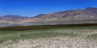
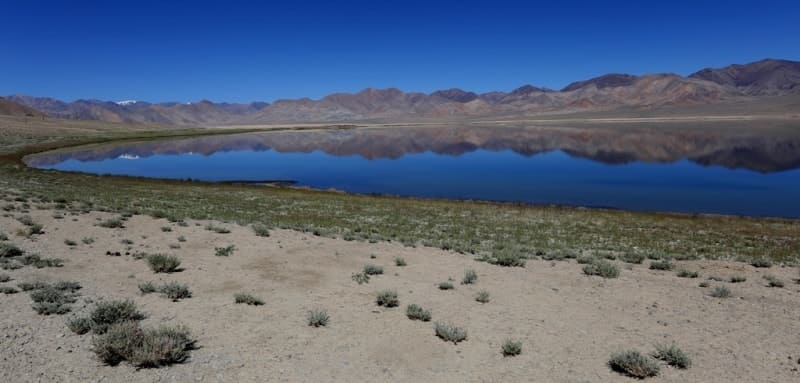
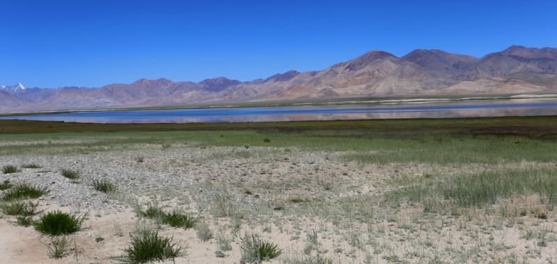
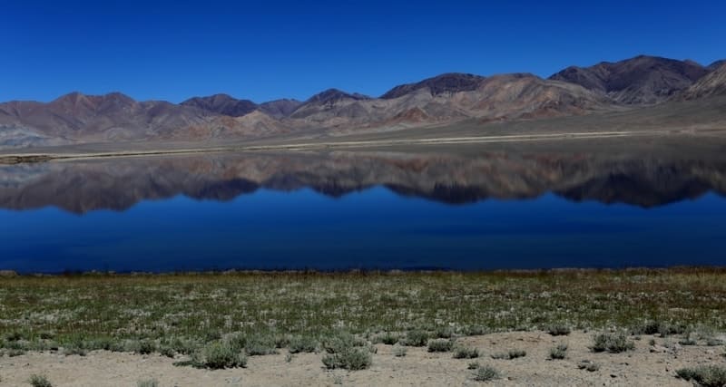
Rangkul lake.
Tours on lakes of Pamir in Tajikistan.
“Nature is an infinite sphere whose center is everywhere”
Ralph Waldo Emerson.
Private Tour in Tajikistan.
Lake Rangkul is located in the Gorno-Badakhshan Autonomous Region, in the southern spurs of the Sarykol Range, at an altitude of 3,784 meters above sea level in the easternmost remote part of Tajikistan, in a vast drainless basin.
Lake Rangkul is connected to Shorkul Lake by a narrow channel. The length of the lake is 4 kilometers 455 meters, the width is 2 kilometers 50 meters. The area of Lake Rangkul is 7.9 square kilometers, the perimeter of the lake reaches 14.32 kilometers, the greatest depth is 2.5 meters.
The Rangkul lakes are located in a flat wide valley, overgrown with saltwort and sedge - in Kyrgyz "rang" (sedge lake). Salt layers are visible along the flat shores of the bays, although the water in the lakes is almost fresh, the depth is small - only 2.5 meters.
On the left side of the valley rise the sheer cliffs of Matatas, composed of gray marble-like limestones, covered with rust of “desert tan” from the surface. The eastern and northeastern parts of the lake are swampy.
The lake is located 50 kilometers from the city of Murgab and 11 kilometers from the village of Rangkul, which is located to the east of the lake. In the southern part of the lake is the island of Aralbashi. The water in the lakes is fresh, the surface of the lake is distinguished by an extraordinary play of colors that change during the day from turquoise-blue to blue-violet.
Food is provided by melted snow and glacial waters. The runoff occurs along the Uzyukdarya channel to Lake Shorkul. The water warms up slowly. The lake is home to fish from the genus Osmans. Colonies of wild geese settled on the islands.
Near the lake is the village of Rangkul and the road to the city of Murghab. There are Saka mounds in the lake basin. “In the mountains south of the lake, there is the Putnikov Cave or the Matatas Cave, in which, according to legend, the treasures of Alexander the Great or Venetian merchants who traveled to China along the Silk Road are hidden.
On the left side of the valley rise the sheer cliffs of Matatas, composed of gray marble-like limestones, covered with rust of “desert tan” from the surface. In these rocks, at an inaccessible height, dark holes of large caves gaped in tiers.
As usual, legends were made up about these caves, passed down from generation to generation. In the distant past, legends say, a large and rich army came to the lands of the Kirghiz from the east. It was at the end of a warm summer.
The camp was set up in the Rangkul valley, famous for its good pastures. But the nature of the Pamirs is insidious. A few days later, a strong wind blew, prickly snow fell in a thick veil. The blizzard lasted a week and was replaced by the most severe frost.
Camels and horses fell from exhaustion and cold, as the pastures were covered with a hard crust of wind-blown and frozen snow. There seemed to be no way out of this white desert: snow-covered mountains guarded the valley, which just a few days ago had been so friendly, green and warm.
People died from cold and disease. The military leaders decided to hide the huge treasures obtained in military campaigns in the caves of Matatasha. But how to get to them? Warm carcasses of freshly fallen animals were applied to the cold rocks.
One carcass of a sheep, on it a second, a third ... a staircase appeared, tightly bound by severe frost into one whole with a sheer wall. Packs with gold, colored stones, expensive weapons, wool from Kashmir, brocade from India, silk from China were dragged along it.
The winter has passed. The sun warmed the rocks of Matatas, and like icicles from the roofs, one after another, weathered and dried mutton carcasses fell. Untouched riches were waiting for a daredevil who would dare to make his way to the treasured caves.
True, there were such brave men, but they all died falling off the enchanted rocks. But about 20 years ago, bold climbers were found, they climbed to the lower, most accessible cave and, having found nothing, left a note about their visit.
These were the climbers of the Tajik-Pamir expedition. The climbers of V. I. Ratsek climbed to the top of Matatas with me, bypassing the rocks from the back side, and from the upper edge on the ropes descended parallel to the wall.
Two climbers entered one of the caves, but, apart from a large layer of wild goat droppings, they saw nothing. However, the climbers failed to get into the highest caves hidden in deep niches. One of them, like a weight on a string, hung at the level of the cave, it was rocked by the wind, and it could not cling to the rocks: the wall was far away, but the entrance to the cave was clearly visible in it.
So the mystery of Matatas remained unsolved until the end. As long as it is known, wild goats and mountain eagles nesting on the rocks of Rangkul will not tell anyone. Later, these caves were stormed by climbers led by the famous physicist Academician I. E. Tamm.
And in 1958, Leningrad student climbers, led by master of sports A. G. Gromov, climbed a sheer stone wall. They certainly didn't find any treasure either. A small cave kept an eagle's egg and some shabby rags brought for the nest by the same eagles. This is how beautiful legends collapse in our realistic age…”
Geographical coordinates of Rangkul Lake: N38°28'35.00" E74°15'04.27"
Authorship:
The Nature It is Mountain-Badakshan province Tajikistan. 2010.
“Years of searching in Asia. Pamir notes. 1951". EM. Murzaev. 1973
Photos by
Alexander Petrov.