


![]()
You are here
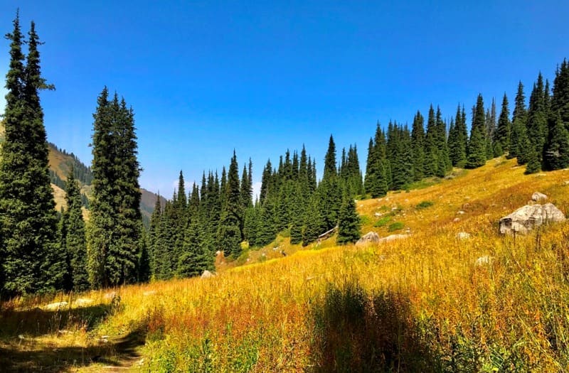
Prokhodnoye gorge in Ile-Alatau park.
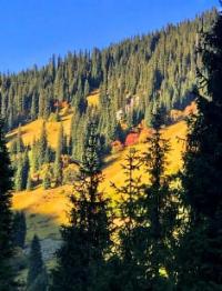
Sights of Prokhodnoye gorge in mountains of Northern Tien-Shan.
"Nature is like a woman who, showing from under her clothes one part of her body, then another, gives persistent admirers some hope to know her all one day."
Diderot D.
Walking in Prokhodnoye gorge in Zailiyskiy Alatau Mountains.
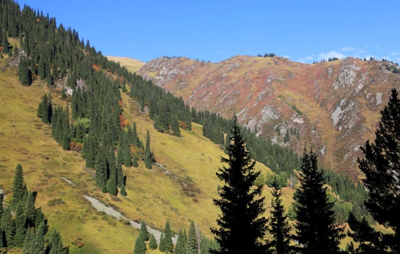
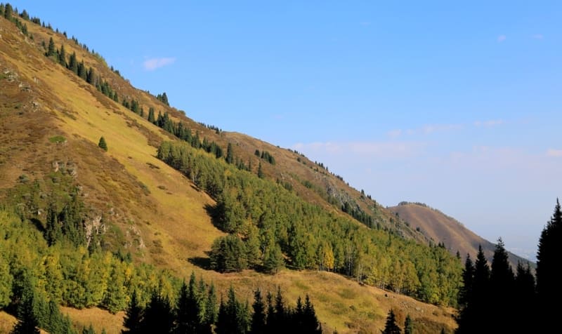
Prokhodnoye gorge is located between the Big Almaty gorge in the east and Kargalinka gorge in the west, it is located on the northern slope of the Zailiyskiy Alatau ridge in Bostandyk district of Almaty region.
The length of the Prokhodnoye gorge is 18 kilometers. The gorge stretches from the south-west to the north, from the Almaty pass with a height of 3599.1 meters above sea level and ends with the gorge connecting with the Big Almaty gorge at an altitude of 1422 m. a. s. l.
In ancient times, the Almaty pass was used as a caravan route to Kyrgyzstan and further to China. The river of the same name flows along the gorge, being the left tributary of the Bolshaya Almatinka River. Along the gorge, on the left side, there is a 3.8 km long motor road that connects with the Almaty - Cosmostation motor road.
1 kilometer from the Big Almaty River, higher along the Prokhodnoye gorge, on the right side of the river there is a walnut grove. There are numerous restaurants and cafes, guest houses in the gorge. 3.8 kilometers from the branch of the road to the Big Almaty gorge in the Prokhodnoye gorge, at an altitude of 1835 m. a. s. l., on the left side of the river there was a sanatorium "Almaarasan" (translated from Kazakh "Teply Klyuch").
Rest home "Almarasan" had its own history since 1931.
More than 16 healing springs with thermal-radon sulfur springs have been recorded on the western slopes of the Prokhodnaya River gorge. In terms of its healing qualities, the water is close to the famous French waters of the Pyrenean type.
The sanatorium worked until 1990.
Then the resort was closed for renovations, and it no longer worked. During the Great Patriotic War (1941 - 1945), wounded soldiers were improving their health in the sanatorium.
Geographic coordinates of thermal springs and baths on left bank of Prokhodnaya river: N43°05'00 E76°54'20
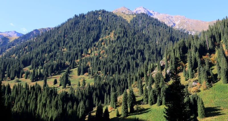
According to legend, Tamerlane's warriors bathed in the waters of the springs during their numerous campaigns of conquest. On the left side of the gorge there is a walking trail that stretches along the entire gorge. During the Soviet Union, tourist routes of various categories of complexity were laid along the gorge through the passes: Almaty-Alagir, Dikiy, Almaty with access to the valley of the Chon-Kemin river and further to Lake Issyk-Kul (Kyrgyzstan).
Through the Zhosalykozen pass from the Prokhodnoye gorge, and now there is a tourist route to the Big Almaty gorge.
The so-called Polyana Terra is located 330 meters south of the mouth of the Morenaia River at an altitude of 2640 m. a. s. l. A picturesque meadow with rare trees with a turum tree and scattered large stones in the eastern part disposes to rest and the desire to spend more time in this place.
From the "Terra" glade to Prokhodnoye gorge, it is convenient to carry out further radial walks:
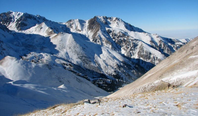
- on Mount Vechernyaya, 3410 m. a. s. l.,
- Mount Pyla 3790 m. a. s. l.,
- to the upper reaches of the Prokhodnoye gorge to Lake Dikoe, located in the gorge of the same name to the east of the Prokhodnoye gorge at an altitude of 3449 m. a. s. l.,
- to the Zhosalykozen pass with a height of 3336.8 m. a. s. l., on which there is a high-mountain station for the study of cosmic rays of the Institute of High Energy Physics of the Academy of Sciences of Kazakhstan,
- to the Bolshoi Almaty peak, 3681.9 m. a. s. l.,
- Mount Tourist with a height of 3954, 2 m. a. s. l.,
- to make the transition to Lake Bolshoy Almaty 2511.2 m. a. s. l. and further to the Big Almaty gorge.
At the mouth of the Zhosalykozen stream, which flows from the western watershed slope, between the Prokhodnaya and Big Almaty rivers, there is the "Aleshkin bridge", consisting of three logs across the Prokhodnaya river at an altitude of 2,724 m. a. s. l.
Geographic coordinates of "Aleshkin Most": N43°02'33 E76°55'07
At an altitude of 3449 m. a. s. l. in the gorge of the Dikaya river, Lake Dikoe is located east of the Prokhodnoye gorge. The lake is located in the southwestern part of the Almatynyn Alagir mountains, on the right bank of the headwaters of the Dikaya river.
The length of the lake from the southwest to the northeast is 1155 meters, the greatest width in the northern part is 33 meters, in the southern part - 30 meters. The perimeter of the lake is 256 meters, the area is 2 912 square meters. In the middle of the lake, on the west side the Dikaya river flows into the river and starts from the nearby glacier located in the southern part of the gorge.
Geographic coordinates of Lake Dikoe east of Prokhodnoye gorge: N42°59'11 E76°55'18
Geographic coordinates of Prohodnoye gorge: N43°04'26 E76°54'21

Authority and photos by:
Alexander Petrov.