


![]()
You are here
Physico-geographical position of Kazakh small hills.

Travel through five countries of Central Asia.
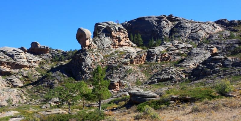
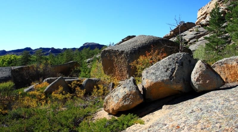
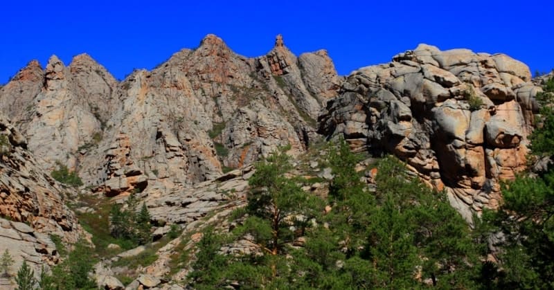
“Kazakh small hills, Saryarka, Central Kazakhstan small hills, a flat-elevation territory with separate low-mountain massifs and ridges, located in the central and eastern parts of Kazakhstan. The length from west to east is almost 1200 kilometers. The width in the western part is about 900 kilometers, in the eastern part - 400 kilometers. In the western part, which has average absolute heights from 300 to 500 meters above sea level and is characterized by greater evenness of the relief, there are two low-mountain massifs: Ulutau, 1133 meters above sea level, and the Kokchetav Upland, Mount Sinyukha, 947 meters above sea level in the north. The eastern part is distinguished by higher absolute altitudes (on average from 500 to 1000 meters above sea level) and more dissected relief; in its center rise the Karkaraly Mountains with the Aksoran massif 1565 meters above sea level - the highest in the Kazakh hills. In the east is the Chingiztau ridge, 1077 meters above sea level. Low-mountain massifs, the relative height of which usually does not exceed 500 - 600 meters above sea level, are surrounded by small hills, i.e., spaces of elevated undulating plain on which numerous hills and ridges of bedrock are located in rows or randomly, with a relative height of 10 50 to 100 meters above sea level.”
N. A. Gvozdetsky.
Natural, tourist attractions of Kazakhstan.
The Kazakh small hills are located between the large plains - West Siberian and Turan, and in the east it adjoins the mountain structures of Altai and Tarbagatai. The border with the Altai-Sayan country runs along the Zaisan depression and the western foot of the Kalbinsky ridge.
The border of the Kazakh small hills with the West Siberian Plain, emphasized by a chain of brackish and saline drainless lakes, is quite clearly visible. The western boundary with the strata plains of the Turgai trough, corresponding to the deep fault zone, is well expressed morphologically. In the north it coincides with the meridional segment of the Ishim valley, and in the south – with the foot of Ulytau.
In the southwest, the small hills gradually transform into the elevated plain of Betpak-Dala, and in the southeast it is limited by the Balkhash-Alakol depression, which arose in the Neogene-Quaternary, natural features that bring it closer to the Turan Plain.
The western and northern foothills of Tarbagatai separate the Kazakh small hills from the mountains of Central Asia. From west to east, the country's territory stretches for almost 1,500 kilometers (61 - 850 east), from north to south in the western part for 950 kilometers, and in the eastern part for 350 - 400 kilometers.
The area of the Kazakh small hills is about 700,000 square kilometers. The physical-geographical country under consideration is called in different zoning schemes the Kazakh folded country or the Kazakh small hills; sometimes it, together with the Turgai Plateau, is combined into a single country, called Central Kazakhstan.
Kazakh small hills is the name of a large orographic unit to which this country territorially corresponds. The shallow hilly relief within its boundaries is not dominant. Denudation plains on a folded base are widespread here, and low-mountain and even mid-mountain massifs are found.
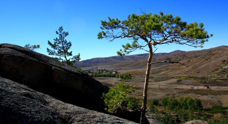
Therefore, the name “Kazakh folded country” more fully reflects the originality of the lithogenic basis of the territory. The inland location in the southern half of the temperate zone (55 - 450 N) determines a sharply continental arid climate and the dominance of steppe and semi-desert PTCs, in the space of which pasture cattle breeding has long developed.
Expeditionary research conducted by the Russian Geographical Society, the Department of Land Improvements, the Resettlement Administration and the Geological Committee made a great contribution to the study of the Kazakh hillocks in the pre-revolutionary period.
Distinctive features of the research of the Soviet period were their practical orientation and detail, the participation of national personnel, republican scientific and industrial organizations. Geological exploration of the territory led to the discovery of numerous deposits of various minerals.
In connection with the development of virgin and fallow lands, detailed soil mapping was carried out. The agroclimatic, pasture and water resources of the territory were studied.
Authority:
N. A. Gvozdetsky, N. I. Mikhailov “Physical Geography of the USSR”, Asian part, Third edition, corrected and expanded, Moscow “Thought” 1978.
Photos by:
Alexander Petrov.