


![]()
You are here
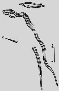
Petroglyphs of Western Kazakhstan.
Hiking Tour One Day Atyrau.
“For everything in this journey of life we are on, there is a right wing and a left wing: for the wing of love there is anger; for the wing of destiny there is fear; for the wing of pain there is healing; for the wing of hurt there is forgiveness; for the wing of pride there is humility; for the wing of giving there is taking; for the wing of tears there is joy; for the wing of rejection there is acceptance; for the wing of judgment there is grace; for the wing of honor there is shame; for the wing of letting go there is the wing of keeping. We can only fly with two wings and two wings can only stay in the air if there is a balance. Two beautiful wings is perfection. There is a generation of people who idealize perfection as the existence of only one of these wings every time. But I see that a bird with one wing is imperfect. An angel with one wing is imperfect. A butterfly with one wing is dead. So this generation of people strive to always cut off the other wing in the hopes of embodying their ideal of perfection, and in doing so, have created a crippled race”
C. JoyBell C.
Guide to trip Hiking in Uralsk town.
Sites of Western Kazakhstan Western Kazakhstan includes four administrative Regions – Western Kazakhstan, Atyrau, Aktyube and Mangistau. This vast territory is an aggregation of high and low plains bounded only in the north and south-west by relatively small mountain formations.
Rock art sites are known in the Mangyshlak Peninsula (Mangistau), Ustyurt Plateau and Mugodzhari Mountains that are southern spurs of the Ural Range. The total length of Mugodzhary from the north towards the south is 200km, their median altitude is 450 - 500m.
The mountains mainly consist of magmatic, metamorphic, and occasionally pressed sedimentary rocks. Mugodzhary is classified as low-hill terrain and, in its southern part, consists of low mountains and rolling hills that resemble the Saryarka terrain.
Several rivers –the Emba, Irgiz, Or, Tobol, Taldy – originate there, but most dry out. The Ustyurt Plateau is a vast high plain (up to 370m above sea level) with uniform leveled surfaces bounded by steep precipices up to 150m high.
The plateau is structured by horizontally embedded marine deposits, limestone, and dolomites, where karst developed. Ustyurt is classified as an argillaceous desert with a sharply continental, extremely dry climate with an annual precipitation of 100 – 150mm.
The uniqueness of the Mangistau and Ustyurt natural environment influenced the development of rock art, particularly the almost non-existence of durable rocks as a substrate. Ancient images on soft limestone may only be preserved on closed-in natural surfaces or in a fossilized archeological condition (Koskuduk).
The majority of rock drawings date to the late medieval period and modernity (XVIth – early XXth centuries). At the same time, the properties of the local rocks enabled the creation of excellent drawings filled with ethnographic details.
Finally, the widespread use of rock surfaces in funerary and cultic structures for thematically.
Authority:
“Rock Art Sites in Kazakhstan”. Alexey E. Rogozhinskiy.