


![]()
You are here
Passes in Fany Mountains.
Travel in Fany Mountains.
“Traveler, be careful,
Remember: you are here - like a tear on an eyelash"
Pamir proverb.
Climbing in Fany Mountains.
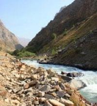
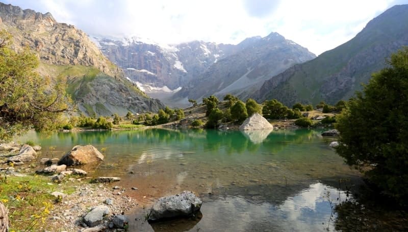
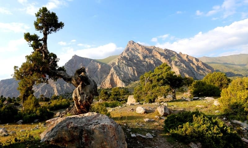
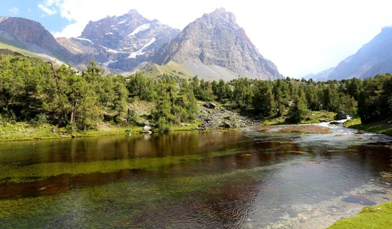
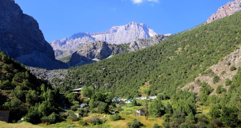
Fann Mountains, the highest part of the Zeravshan Range, bounded from the east by the Fandarya River, from the west by the system of Marguzor Lakes and the Shing River, in the Sughd Region of northwestern Tajikistan.
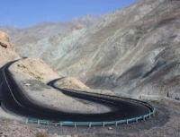
There is only one automobile pass in the Fan Mountains - Anzob, 3373 meters above sea level, which crosses the Gissar ridge. The asphalted section has been brought from Dushanbe to the pass and further. There is a weather station on the crest of the pass.
Previously, the pass was closed for vehicles for most of the year due to snow drifts, now a tunnel has been built here through the pass and traffic is open all year round. The pass offers views of the Sangalsky snow ridge, and in the north - the Anzob river gorge going down to Yagnob.
The sharp top of the Gissar ridge Zami-Karo and the neighboring, higher pyramid of another peak are clearly visible. Several pack passes have been laid across the Gissar ridge. The Mura pass leads from Iskander-kul and Sarytoga lakes to the gorge of the Karatag river with a subsequent exit to the village of Shakhrinau and Dushanbe.
The planned route of the Varzob turbase passes through this pass. The Khazor-Mech pass connects Lake Iskanderkul with the gorge of the Maykhura River, the right tributary of the Varzob River. The Rufigar pass connects the headwaters of the Yagnob with the gorge of the Sardai-Mion river.
On this path you can go to the village of Ramit, and from there to Ordzhonikidzeabad and Dushanbe. There are also several passes through the Zeravshan Range. The Dukdon Pass serves as the easiest route through the mountains from Iskanderkul Lake to Penjikent and Samarkand.
No more difficult is the Pushnovat pass, which connected Lake Iskanderkul with Samarkand, during the time of the Soviet Union. The Laudan pass allows, at a low altitude, to lay the easiest mountain path from Fandarya to Samarkand along the gorges of Pasruda and Artuchi. Through the Rast Pass Yagnob communicates with Matcha.
All of these passes have a significant height and are cleared of snow only by the middle of summer. There are also pack passes across the Western and Eastern Fan Ranges. From the Voru River gorge, you can go to the upper reaches of the Artuch River through the easy pass Guintan, and through the Eastern Fan Range leads a rather difficult path from Norvat to Sangi-Safed on Pasruda through the Lower Zinakh pass.
There are a lot of pedestrian passes with a marked path that do not require special equipment or are well oriented. The Alaudin pass leads through the Zeravshan ridge, which is used when crossing from the Alaudin lakes to the Kulikalon depression.
The Zurmech pass, leading to the Chukurak gorge, is laid through the Western Fan ridge. Through the northern spur of Chapdara with the pass of the same name, you can reduce the transition from the Alaudin lakes to the Pasruda valley, but in this case you have to overcome a significant rise.
Through the southern spur of the East Fan ridge, the passes Biob, Anzak, Omsk lead. Through them you can go down to the gorge of the Serima river and go to the Iskan-derkul lake, but on the way from the Biob and Anzak passes you need to overcome the Serima canyon, which is difficult to do without special equipment.
In the Serima gorge, you can go down from the east through the Norvat meadow pass. Going out to the Iskanderkul lake, one also has to overcome the Serima canyon. The Lower Shodan pass allows you to go to the upper reaches of the Dzhidzhik River. The way to the pass passes through meadows and light talus.
The Suvtor Pass connects the upper reaches of the Suvtor and Biob rivers. On the southern side, the slopes represent a high mobile talus, and on the northern side - a moraine of the former glacier with a pile of stones and large blocks.
Through the Chukurak pass it is easy to get from Lake Kulikalon to the gorge of the Chukurak River. The Agmat pass allows you to go around the peak of Moscow from the west and go down into the gorge of the Agmat river.
The next group is made up of passes that require the use of special equipment (ice ax, sleeping bag, mittens, rope, dark glasses, boots with tricones or vibrams and carbines). There should be people in the group who know how to use the rope, and all participants should be able to insure themselves with an ice pick.
The passes over the Zeravshan Range have their own characteristics. In the west, from the gorge of the Karakul River to the gorge of the Sarymat River, the Akhbasher Pass (translated as "the pass through which tigers walk") leads. From the east, a long, but not steep ascent through snowy fields leads to it.
Akhbasher is followed by traversing of a snowy or gravelly (depending on the season) slope with access to the Sarymat pass through a lateral spur. Descent from the Sarymat pass to the gorge of the Sarymat river.
To the next pass - Pushnovat Saddle, they ascend from the Pushnovat gorge along a snowy couloir with a gradual increase in steepness. You can descend from the ridge of the pass either in the Akhbasoy gorge or in the South Chapdara gorge.
On the eastern side of the pass there is a snow cornice, which must be broken through. In the Akhbasoya gorge, descend along the talus to the left, and in order to pass into the Southern Chapdara gorge, you need to go to the Zveriny pass and from there descend to the Southern Chapdara and Arga.
The Double pass leads from the gorge of the Left Zindon River. It is named Double, as it is possible to descend either to the upper reaches of the Kaznok, or to the Akhbasoy gorge. The ascent from the Left Zindon goes along a steep snow slope, and the descent to the east along very light talus and snow fields.
From the gorge of the Right Zindon River through the Chimtarga pass, the path goes to the Mutny Lakes. The pass is high, but not difficult. Ascent from the west - through glaciers and moraines, and when descending, you can choose a convenient path along the talus.
To the north of the Adamtash peak is the Shogun-Aga pass, which serves as a variant of the passage of the Zeravshan ridge from Alaudin to Kulikalon. Ascent from the east - along meadow slopes, and then sloping smooth slabs sprinkled with rubble emerge.
Caution is required. Descent to the Dyushakh lakes along talus and snowfields, and below - along meadow slopes. The Angisht and Kuk-Teppa passes are known across the Gissar ridge. The way to Angisht goes from Iskander-Kul Lake along the gorge of the Saryduvol and Angisht rivers.
Kuk-Teppa is on the way from Yagnob to Karategin. From the Kansi village - movement along the left tributary of the Yagnob to the gorge of the Sardai-Miona river. The Kaznok and Upper Zinakh passes are laid through the Eastern Fan ridge. The treasury enjoys the predominant attention of tourists.
There are, in fact, two passes: the Upper and the Lower, separated by the summit of the Serpent. From the southern side they walk along the talus to the very ridge of the Lower Kaznok. Descent from it along the steep snow slope requires great care, as there are rocks below.
Descent from the higher Upper Kaznok located to the east is also through the snow, below the slope flattens out and turns into a snowy field. By the end of summer, the snow melts and the ice base of the slope is exposed.
Then you have to go down the rocks, very fragile and unstable. Having gone down to the end of the snow field, they turn to the left and, traversing another snow slope, they come to the moraine ridge, along which it is easy to go down to the pebble flat fields of the Mutny Lakes circus.
There is another pass through the East Fan ridge - the Upper Zinakh between the peaks of Fan-Ulla and Sarof. You can climb it along the couloir between the peaks Fan-Ulla and Stupenka from Imat or from the Turzul gorge, first passing through a spur extending from the Sarof peak to the north.
Descent along snowfields and talus in the gorge of the Dzhidzhik river. The Ozerny pass in the Pushnovatsky short spur is very interesting. From the gorge of the Pushnovat river, you need to go to the left bank and climb the rocks and snow fields to the site where two Pushnovat lakes are located.
Then move with a gradual ascent along pebble and snow fields to the ridge of the pass. Descent along rocks and talus to the path to Archa-Maidan. The upper reaches of the Akhbasoy and South Chapdara rivers are connected by the Zveriny pass, so named because a path trodden by mountain goats runs along its crest.
On the western side of the pass hangs the last remnant of the former glacier. The descent to the other side goes along rocks and long snowfields. From the gorge of the Left Zindon you can go to the gorge of the Amshut river through the pass of the same name.
There are two crossing points: North and South Amshut. The latter is more low, but here rocks and pieces of ice, breaking down from the steep peak of Amshut, can threaten. Ascent from the Left Zindon along coarse scree and snowflakes.
The descent first along a small moving talus, and then along large blocks and rocks is very long and tiring. The path to the Turzul pass through the northern spur of the Sarof peak is very beautiful. Before the traveler, ascending from the Turzul gorge, birch forests, stone taluses, moraines of the Turzul glacier, a snow field that goes to the ridge of the pass gradually change.
Very close to one side, the walls of the summit of Sarof go up, on the other - rocky ledges and a sharp spire of the top of the Step, and in front of the snow-ice peak of Fan-Ulla. From the Turzul pass it is easy to cross, traversing the talus, to the Upper Zinakh pass, from where the Upper Shodan pass is very close between the Sarof and Paltsy peaks.
Being on the Kulikalon lake, you can make a one-day excursion, going from the southern end of the lake to the Temir-Tau pass and going down to the Duushah lakes. On the descent, there are smooth slabs sprinkled with rubble.
An unexpected sharp drop in the spur dividing the gorges of the Surkhob and Zheltaya rivers created the Zard pass, which presents an opportunity to go from the Zheltoy glacier to the Malaya Hansa glaciers. Exploring the northern spur of the Sarof peak, an expedition with the participation of Bulgarian tourists discovered the pass, which was named the Bulgarian pass.
Ascent from the Turzul gorge along the couloir, pressed against the wall of the Tower top, filled with snow below, and above - with ice. The icy slope can be walked over the rocks. From the pass, an easy ascent to the top of Patrush. Descent towards the Imat gorge along talus and meadow slopes.
The next group includes more difficult passes, where tourists are required to be able to use mountaineering techniques. It is advisable that the group consists of at least 6 people. In the Zeravshan ridge, at the junction of it with the Gissar ridge, there is the Aksu pass.
The ascent starts from the mouth of the Aksu River, one of the sources of the Karakul River. Several glaciers descend into the upper gorge of Aksu. The way to the pass goes along the left side glacier (orographically). Descent from the pass to the Sarymat gorge also along the glacier, overcoming rocky areas and snow couloirs.
One can pass through the Zeravshan ridge by the Zindon pass from the Left Zindon gorge to the Kaznoka gorge. The pass is located on the northern side of the Skalnaya Stena peak. Ascent along the steep snow-ice couloir.
Descent towards Kaznok is more convenient with access to the Kaznok glacier, and then along the talus to the bottom of the gorge. The Mazalat pass, located between the peaks Fizkultura and Sport and Tratulet, leads through the East Fan ridge.
It stands right in front of your eyes when you rise from the north to the Kaznok Pass, and often misleads tourists who take it for Treasury. The ascent to the pass along the snowy slope is not complicated, but you have to look through the cracks. When descending to the south, there are sections of rock of moderate difficulty where you have to use a rope.
The VAA pass (All-Union Academy of Architecture), named so by A. Mukhin and V. Gusev in 1939, connects Muddy Lakes with the Kaznoka gorge. The ascent along the snowy fields is not difficult, you can descend or narrow narrow gorge with a stream down, or through an additional pass with access to the Hansa glacier. In the first case, you have to overcome a canyon with several waterfalls, in the second you need to go down with a safety net along steep rocks.
The Karaganda pass is located between the peaks of Malaya Hansa and Black Peak. Ascent along the Hansa glacier to its upper reaches. Descent along the couloir and snowfields to the Surkhob gorge. The Saddle of the Hansa pass is located between the Small and Big Hansa.
Ascent from the Suvtor gorge along steep rock ledges and walls. Descent along the icefall of the Yellow glacier. On the right side of the icefall, avalanches descend from the slopes of the Big Hansa, on the left, rocky slopes threaten with rockfall.
There are open and closed cracks on the icefall. From the foot of the icefall, a calm path begins along the Yellow glacier to the Imat gorge.
Authority:
"Fan Mountains and Yagnob". N.V. Paganuzzi. 1968. Moscow. Physical Culture and Sports Publishing House.
Photos by
Alexander Petrov.