


![]()
You are here
Pamir-Alai mountain system.
Nature of Pamir-Alai.
"You're walking along the edge of a glacier,
Without taking your eyes off the top.
The mountains are sleeping, breathing in the clouds,
Exhaling snow avalanches"
Vladimir Vysotsky. "To Mikhail Khergiani"
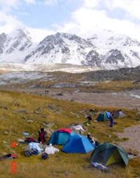
Traveling through Pamir-Alai.
A mountain system that includes the highest Pamir Plateau, located between the Fergana Valley in the north and the upper reaches of the Amu Darya (Pyanj-Vakhandarya) in the south. Most of it is located within Tajikistan, the northeastern part belongs to Kyrgyzstan, and the western part belongs to Uzbekistan.
The eastern and partially southern edge of the Pamir Highlands extends into foreign territory (China and Afghanistan). Relief and geological structure of the Pamir-Alai mountainous country. he northern ranges of the Pamir-Alai system are Alai and Turkestan, bordering the Fergana Valley from the south. Both ridges are noticeably asymmetrical: their southern slopes are steep, their northern slopes are accompanied by advanced chains (Kichik-Alai, i.e. Small Alai, etc.).
From the line of the Alai and Turkestan ridges in the area of the Matcha mountain cluster (altitude more than 5600 meters above sea level), the Zeravshan ridge departs, which stretches to the west south of Zeravshan. The Alai, Turkestan and Zeravshan ranges bear numerous glaciers.
These ridges are characterized by jagged ridges, sharp peaks, and mountain-glacial landforms. The exception is the western sections of the Turkestan and Zeravshan ranges, which are medium-altitude and mostly flat-topped: here, due to lower elevation, ancient leveling surfaces have been preserved.
In the westernmost spurs of the system of the northern Pamir-Alai chains (Nuratau ridge, etc.), ancient planation surfaces can also be traced, shield-like elevated due to neotectonic movements and dissected by younger gorges.
The powerful Gissar ridge extends from the high glaciated ridge of the Zeravshan ridge on the southern side. This entire system of northern Pamir-Alai ridges belongs to the Hercynian fold zone. Their geological history is similar to the geological history of the southern Tien-Shan ranges.
These ridges of the so-called Gissar-Alai system are composed of sedimentary and metamorphic rocks of the Paleozoic with the inclusion of large intrusions (granites, diorites). The modern relief of the ridges is the result of recent uplifts that occurred in the Neogene and Quaternary periods. Research by N. A. Gvozdetsky in the northern advanced ranges of the Alai ridge, the western part of the Turkestan ridge and in the extreme western spurs of the entire system showed that the concept of S. S. Shultz is applicable to the northern ridges of the Pamir-Alai, as well as to the Tien-Shan.
That the tectonic formation of relief is associated with the formation of folds of large radius. In the Paleozoic limestones of the northern Pamir-Alai ranges, karst phenomena are developed, mainly caves (the Kan-i-Gut cave with huge halls in the northern advanced ridge of the Turkestan Range, caves in the advanced ranges of the Alai Range and in the Osh Mountains of southeastern Fergana).
In the western part of the Zeravshan Range, southwest of Urgut, there is a typically pronounced karst landscape with sinkholes, similar to the landscape of the Crimean yayls. Here, on the Kyrktau plateau, the deepest karst abyss in Uzbekistan (950 meters) and one of the deepest in the world, the Kiev karst abyss, was recently discovered.
The Pamir-Alai regions, located south of the described Gissar-Alai system, are tectonically heterogeneous. To the south of the Gissar ridge is the West Tajik depression (also called the South Tajik depression). In the west it is bordered by the spurs of the Gissar ridge.
Most of this territory, according to modern concepts, belongs to the Epi-Hercynian platform and has folding of the Meso-Cenozoic cover associated with movements along the fault lines of the Hercynian basement.
These faults and folds of the Meso-Cenozoic cover, running from the northeast to the southwest, do not coincide with the sublatitudinal strike of the Hercynian basement structures, but correspond to the strike of the structures of the western part of the adjacent Pamir region of the Alpine geosynclinal region (Cenozoic Tethys geosyncline), with the development of which their formation is associated.
Only a relatively narrow strip in the east of the depression (and not the entire depression, as before) is now attributed to the zone of the Pre-Pamir marginal trough of the Alpine geosynclinal region. In the Western Tajik depression there are many relatively low folded ridges, stretching from northeast to southwest and south-southwest, slightly curved and convexly facing northwest.
The ridges are composed of Mesozoic (mainly Cretaceous), Paleogene and partly Neogene sedimentary strata with a large role of carbonate and sandy-clayey variegated rocks. The structural forms of the relief are typically expressed, especially cuesta-like and cuesta ledges on the wings of the folds.
Valleys, slopes, and often ridge crests are terraced. Karst phenomena are developed in limestones, gypsum-bearing and salt-bearing rocks. The Karlyuk caves in the Kugitangtau ridge are distinguished by their significant size (up to 3 kilometers in total length) and drip-drip formations made of gypsum and marble onyx.
The folded structures of the Pamir region of the Alpine geosynclinal region are separated from the Hercynian structures of the northern tectonic zone of the Pamir-Alai by a system of deep faults and thrusts, which are associated with earthquakes in the Surkhob Valley.
Rubble - deposits of a deadly rocky mudflow, disruptions and landslides of weathering crust - buried the ancient Tajik city of Khait and the villages of the Yasman Valley during the 1949 earthquake. In the Pamir region of the Alpine geosynclinal region, several tectonic zones are distinguished, which extend almost latitudinally, but in the west (in the area of Peter the Great and Darvaz ridges) they deviate to the south, generally forming an arc convex to the northwest.
The outer zone of the Pamirs is formed by lagoonal-continental, less commonly, marine sediments of the Mesozoic-Cenozoic up to 8 - 10 kilometers thick. In the Lower Mesozoic, effusive rocks are developed. Sedimentary strata are involved in intense folding, and there are numerous thrusts.
Northern Pamir are composed of sedimentary-metamorphic and terrigenous-volcanogenic rocks of the Paleozoic with Hercynian granitoid intrusions. This is a large anticlinorium with anticlinal and synclinal structures of the second order.
Central Pamir are characterized by the presence of almost all Paleozoic and Mesozoic systems, with the Mesozoic being represented by marine (including carbonate) and lagoonal-continental facies. There are volcanic-sedimentary deposits of the Paleogene.
Intensive development of fault dislocations and complex folding affect not only Mesozoic, but also Paleogene deposits. The granitoid massifs are mainly of late Mesozoic age.
Southwestern Pamir are formed by deeply metamorphosed Precambrian rocks - gneisses, crystalline schists, marbles, intruded by granitoid intrusive bodies.
This zone is a large anticlinorium.
South-Eastern Pamir is an area of development of the Upper Paleozoic and marine Mesozoic with a significant participation of limestones. Sedimentary strata form relatively simple folded structures, elongated to the east-southeast and complicated by longitudinal faults and reverse faults (M.V. Muratov and I.V. Arkhipov, 1961).
B. A. Petrushevsky (1961) includes the South-Eastern Pamir in the Central zone, which he calls the Middle Pamir megasynclinorium, while the zones of the South-Western and Northern Pamirs are called the South Pamir and North Pamir meganticlinorium.
Thus, the ancient rocks of the Pamirs (gneisses with crystalline schists and Paleozoic sedimentary-metamorphic strata) are confined to uplift zones, that is, they are exposed in the highly elevated cores of the anticlinoriums of the Alpine geosynclinal region.
Cenozoic folding movements of the Alpine geosyncline (Cenozoic Tethys geosyncline) were accompanied by powerful uplifts and denudation of folded ridges, which created the modern relief.
Peter the Great and Darvaz ridges are directly attached to the Pamir Plateau, which includes their eastern segments, and belong to the two northern zones of the Pamir region of the alpine geosynclinal region.
The Peter the Great ridge is composed (with the exception of the eastern segment) of Meso-Cenozoic deposits. Its northern slope has clear steps of planation surfaces, on which karst phenomena are clearly expressed in many areas (in Mesozoic limestones and gypsum).
Pamir Highlands, or the Pamirs themselves, are located in the east of the Pamir-Alai mountain system, south of the Alai Valley, separating the Alai and Trans-Alai ranges. On the map, the Pamirs have a characteristic quadrangle shape.
The greatest heights are located along its edges. It is most natural to draw the northern border of the Pamirs along the right foot of the Trans-Alay Range, the southern border along the Pyanj and Vakhandarya rivers (attributing the entire Vakhan Range to the Pamirs), then along the left source of Tashkurgan.
In the east, the Pamirs include the Sarykol ridge and the Kashgar Mountains with the highest altitudes in the entire Pamirs (Kongur peak 7579 meters above sea level, Muztagata peak 7555 meters above sea level).
The west, the border should be drawn along the Panj valley and then north of the main bend of the river (a little east of 71° E) so that the highest, eastern, sections of the Peter the Great and Darvaz ridges belong to the Pamirs.
The Trans-Alai ridges in the north, the Kashgar and Sarykol ridges in the east, the Wakhan ridge and its western continuation - the Shakhdara ridge in the south, the high ridges of the Western Pamirs, abutting the Academy of Sciences ridge, form the elevated edges of the Pamir Highlands.
In the future we will talk only about that part of the Pamirs, excluding, therefore, the eastern and southeastern outskirts of the highlands. Some researchers (K.V. Stanyukovich, E.M. Murzaev) proposed calling only the eastern half of the Pamirs, based on the uniqueness of its landscapes and referring to one of the first researchers of the Pamirs, geologist D.L. Ivanov.
However, D.L. Ivanov does not have priority in the study of the Pamirs, but his article “What should we call the Pamirs?” (1885) dates back to a time when the mountains of Central Asia were still very little studied and when there was not only natural, but also inevitable discrepancy in the use of proper geographical names.
However, after the territory was covered with topographic surveys and more or less correctly depicted on geographical maps, the signature “Pamir” lay precisely in the quadrangle, the boundaries of which we have just outlined, and, of course, it was not by chance.
Of the southern ridges of the Western Pamirs, the highest are Rushansky (Pakhor Peak 6080 meters above sea level) and Shakhdara (Karl Marx Peak 6726 meters above sea level). Erosion, gravitational and other denudation processes reach exceptional intensity in the Western Pamirs.
The Eastern Pamirs are characterized by completely different orographic features. Here, essentially in the central part of the highlands, the ancient relief is well preserved (K.K. Markov, M.V. Muratov), while on the western and eastern outskirts of the Pamirs - in the Western Pamirs and the Kashgar Mountains - it was mostly destroyed by deep incision from the edges of mountain gorges and glacial-nival processes.
The relief of the Eastern Pamirs is characterized by flat bottoms of vast valleys and basins, raised to enormous heights - 3500 - 4500 meters above sea level. Above them rise ridges and mountain ranges, sometimes reaching heights of more than 6000 meters above sea level (the peak of Soviet Officers on the Muzkol ridge, 6233 meters above sea level.
In the northeastern part of the Pamirs there are large flat drainage basins with lakes. The basins and wide flat valleys of the Eastern Pamirs are filled with products of mountain destruction - fine earth, crushed stone, pebbles, sand, and piles of ancient moraines.
Permafrost occurs in soils. The mountain slopes are covered with crushed stone and eluvial boulder loam (K.K. Markov, 1935). The ridges separating wide valleys, with enormous absolute heights, often have relatively small relative heights and outwardly resemble mid-mountain ridges.
The highest ridges have sharp mountain-glacial forms (this is a young sculpture against the general background of the ancient relief). In the Eastern Pamirs, the basin of Karakul Lake belongs to the tectonic zone of the Northern Pamirs, the Muzkol ridge and the area of Lake Rangkul - to the Central zone, and the Oksu River basin - to the zone of the South-Eastern Pamirs.
In different areas of the Eastern Pamirs (the basin with lakes Shorkul and Rangkul, the Nayzatash pass), among the mesoforms of the ancient relief, limestone remains are noteworthy, which N.A. Gvozdetsky is inclined to consider as relict forms of tropical karst, which formed in the Oligocene and, perhaps, in Miocene in the climate and landscape of savannas.
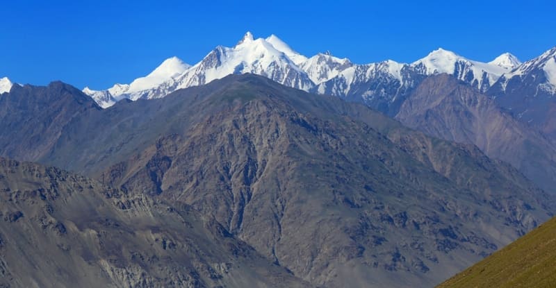
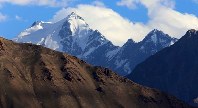
So, the Pamir-Alai mountain system is heterogeneous in surface structure. Northern chains (Gissar-Alai system), most closely resembling the Greater Caucasus in terms of relief and glaciation; Western Tajik depression with relatively low ridges and structured relief forms; the powerful Trans-Alai Range and the highly dissected and high Western Pamirs; the high, less dissected highlands of the Eastern Pamirs are all different geomorphological regions.
The main orographic units are the Gissar-Alai system, the Western Tajik depression and the Pamirs. Climate. Climatically, the Pamir-Alai is also heterogeneous, although all of it is located in the subtropical zone. The enormous range of altitudes, causing altitudinal climatic zoning, and sharp differences in the distribution of moisture associated with the directions of moisture-bearing air currents and orographic barriers determine climatic contrasts.
In the western part of the Pamir-Alai, on the Gissar ridge, up to 1500 mm or more of precipitation falls per year, and walnut and maple forests grow there, while in the Eastern Pamirs only about 100 mm/year of precipitation falls and is characterized by the most desolate highland landscapes that you can imagine.
Climate of Pamir-Alai is formed under the influence of: continental tropical air formed in the summer over Central and Central Asia and the neighboring Iranian Plateau; continental air of temperate latitudes, formed in winter over Siberia and Central Asia; cyclones of the Iranian branch of the front of temperate latitudes (in the low-mountain and mid-mountain tiers); constant westerly moist air currents in higher layers of the atmosphere (from an altitude of approximately 3000 meters above sea level).
Due to the peculiarities of atmospheric circulation, precipitation falls in the greatest quantities in the western part of the mountain system and mainly on the western and southwestern slopes, while the eastern slopes and the underlying valleys and plateaus are in the rain shadow.
The contrasts in the distribution of precipitation over relatively short distances are striking. Thus, even in the depths of the mountain system, on the Fedchenko glacier, thanks to the barrier influence of the Academy of Sciences ridge and adjacent ridges that give impetus to precipitation, the annual precipitation reaches 2236 mm, and just a few tens of kilometers to the east, in the regions of the Eastern Pamirs , their number, as we have seen, is negligible.
In the highlands, especially a lot of precipitation falls where latitudinal and sublatitudinal ridges come together to the east, forming a kind of trap for westerly air flows. In such places large glaciers originate (Zerafshansky, glaciers in the upper reaches of the Obihingou-Garmo river.
Despite the sharp differences in the relief of the Western and Eastern Pamirs (they will be discussed below), the Pamirs clearly act as an integral orographic unit, the commonality of which is manifested in the eccentric location of the highest altitudes (K.K. Markov, 1935), i.e. elevation of mountains along the outskirts of the Pamirs.
And if later research revealed that in its natural features the Eastern Pamirs differ sharply from neighboring mountainous regions, in particular the Western Pamirs, then, it would seem, there should have been only one conclusion from this - to single out the Eastern Pamirs as a special physical-geographical region, without causing any confusion in the use of geographical names.
We must also keep in mind the dismemberment of the eastern edge of the Pamirs - the Kashgar Mountains and note that the name “Eastern Pamir” is used rather conventionally, only in relation to our territory of the Pamirs; if we take the Pamir Plateau as a whole with its foreign eastern part (with the Kashgar Mountains), then a certain symmetry will be restored and the Eastern Pamir will become rather Central, as some Soviet researchers call it (K.K. Markov, O.E. Agakhanyants).
The heavily glaciated ridge of the Trans-Alay Range (Lenin Peak, 7,134 meters above sea level) rising in the north of the Pamirs significantly exceeds the Alai Range and other ridges of the Gissar-Alai system stretching to the north.
N.L. Korzhenevsky calculated that in terms of the average height of the ridge, the Trans-Alai ridge exceeds even the ridge of the Academy of Sciences and is thus the highest ridge of the Pamir part of the USSR. In the eastern part of the Trans-Alai Range, through the notch of the Kyzylart Pass, a road was laid leading into the Eastern Pamirs and further to the west, to Khorog (Osh - Khorog highway).
The Trans-Alai Range, which belongs to the outer tectonic zone of the Pamirs, is composed of Meso-Cenozoic strata. On its northern slope and at the foot, gypsum karst is quite widespread. The internal territory of the Pamirs, lying south of the Trans-Alai Range, is sharply divided into two parts according to orographic features: the Western Pamirs and the Eastern Pamirs, which we call so conventionally, according to tradition.
The Western Pamirs are characterized by a system of high ridges of southwestern and almost latitudinal extent, separated by deep valleys and gorges. These are the Peter the Great and Darvaz ridges (meaning their eastern segments), as well as the Vanj ridge, connecting in the east with the meridional ridge of the Academy of Sciences; to the south are the Yazgulemsky, Rushansky, Shugnansky and Shakhdara ridges.
The northern of these ridges and the Academy of Sciences ridge belong to the tectonic zone of the Northern Pamirs, the Vanch and Yazgulem ridges belong to the Central Pamirs, and the last three ridges belong to the Southwestern Pamirs.
In the Western Pamirs there is the highest peak of the USSR - Communism Peak, 495 meters above sea level, rising in the Academy of Sciences ridge at the junction of the Peter the Great ridge. This peak rises next to the Fedchenko glacier, the largest in the USSR and one of the largest mountain-valley glacier in the world.
At the junction of the ridges of Peter the Great and the Academy of Sciences, the Pamir firn plateau is located - the remnant of an ancient alignment surface, raised to a height of more than 6000 meters above sea level. Gando and others).
In the middle mountains, under the influence of cyclones of the Iranian branch of the front of temperate latitudes, more precipitation falls on the southern and southwestern sides of the mountains, however, due to the southern exposure, there is more insolation here, so you often see denser forests on the northern slopes.
Mid-mountain and especially low-mountain regions have much in common with neighboring desert areas in terms of the nature of climatic processes. In winter, however, since intrusions of cold air do not extend above 500 - 600 meters, it is warmer in the mountains than on the plains, i.e., a temperature inversion occurs, and with the passage of cyclones and intense precipitation on the southern and southwestern slopes of the mountains, on the northern slopes, foehn phenomena develop.
In the spring, as in the southern deserts, due to increased cyclonic activity, rain often falls, which continues into early summer. The maximum precipitation here is in spring, winter-spring, spring-summer. Drought in the mountains begins only in the second half of summer, since the rains stop here much later than on the plain.
Before the onset of drought, ephemeral vegetation develops in the foothills and low mountains.
The duration of drought in the mountains is much shorter than on the desert plains; only August and September are sharply dry. During these months, the vegetation burns out and goes under the snow cover of the winter season, much more dried out than in the Tien-Shan, where the maximum precipitation occurs in the summer and the growing season does not stop until the autumn snowfalls.
Only in the Eastern Pamirs, in contrast to the rest of the Pamir-Alai territory, is there a summer maximum precipitation, which is explained by the influence of circulation processes developing over Tibet (B.P. Alisov, 1956), or by the action of the South Asian monsoon (O.E. Agakhanyants , 1965).
As on the Tien Shan syrts, summer precipitation often falls in the form of cereals and snow. In the foothills of the Pamir-Alai and in the low mountains, winter is relatively short and mild, summer is long, with high temperatures; the amount of precipitation is greater than in neighboring deserts (350 - 700 mm/year).
At altitudes of 1500 - 3500 meters above sea level, the climate already has the characteristic features of a mountain climate, it is cooler and in the predominant part of the territory it is more humid: in these altitude limits there is a zone of greatest moisture and in some places precipitation falls in excess of 1000 and even 1600 mm/year.
In the Eastern Pamirs, the climate is very dry, sharply continental and harsh (at an altitude of about 4000 m, the average January temperature is −20°, July 8°). In the valleys of the Western Pamirs, temperatures are higher (at an altitude of about 2100 meters above sea level, the average temperature in January is −7.4°, in July 22.5°) and, although not as much as in the Eastern Pamirs, it is still very dry (annual precipitation - less than 260 mm); in the highlands of the Western Pamirs there is much more precipitation, especially in the north.
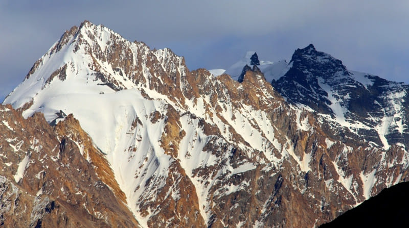
Claciation of the Pamir-Alai. The snow line in the Pamir-Alai mountains rises in the direction from west-northwest to east-southeast. On the Turkestan ridge it is located at an altitude of about 3500 meters above sea level, in the area of the Fedchenko glacier - 4400 meters above sea level, in the central and eastern regions of the Pamirs it rises to 5200 - 5240 meters above sea level.
The snow line height of more than 5000 m is typical only for the tropics and is due to the exceptional dryness of the climate here. In the northern ranges of the Pamir-Alai, the greatest glaciation is observed in the Matcha mountain cluster.
The Zeravshan glacier (in the upper reaches of Zeravshan) has a length of about 25 kilometers. The glaciation of the Pamirs is enormous, especially in the northern and northwestern parts. About 7,000 glaciers are known in the Pamirs, of which over 700 are more than 2 kilometers long, and seven glaciers exceed 20 kilometers.
The length of the Fedchenko glacier is 77 kilometers, the Grumm-Grzhimailo glacier (east of the Fedchenko glacier) is about 37 kilometers, the Garmo (between the Peter the Great and Darvaz ridges) is 27.5 kilometers, the Bolshoy Saukdara glacier (in the Trans-Alai ridge) is about 25 kilometers.
In terms of the number of largest glaciers and the area of glaciation, the Pamirs rank first among other mountain-glacial regions. The glaciated area of the Pamirs reaches almost 7,500 square kilometers, which is more than 10% of the entire surface of the Pamirs.
The amount of water contained in the Pamir glaciers, according to rough estimates, is equal to the amount of water in the Aral Sea (B.P. Alisov). The glaciated area of the entire Pamir-Alai is more than 9600 sq. km.
See the work “Fedchenko Glacier”, volume 1, Tashkent, 1962. The same monograph states that seismic sounding determined the maximum ice thickness in the middle part of the glacier to be 1000 meters above sea level.
The glaciers of the Pamir-Alai, like the Tien-Shan, are in most cases in a state retreat. During the glacial epochs of the Middle and Upper Quaternary, glaciation developed most strongly in the same areas that are now most covered by glaciers, that is, in the Northwestern Pamirs and on the Trans-Alai Range.
The ancient Muksuisky glacier (a continuation of the current Fedchenko glacier) reached 164 kilometers. In the central and eastern parts of the Pamirs there were foot glaciers. They were also common in the Alai Valley along the foot of the Trans-Alai Range, where long moraine ridges now lie.
The Pamir-Alai rivers belong mainly to the Amu Darya basin. Of these, besides the Amu Darya itself, which in its upper reaches is called Pyanja, the largest is Kyzylsu - Surkhob - Vakhsh. The rivers of the eastern outskirts of the Pamirs belong to the basins of Yarkand and Kashgar.
From the rivers of the Kashgar basin, the upper reaches of the eastern Kyzylsu and Markansu enter our territory. The basin of the mountainous Zeravshan lies in the Gissar-Alai system; From the northern slopes of the Alai and Turkestan ridges, rivers flow towards the Syrdarya.
Large rivers starting in the highlands are fed by glaciers and snow, and compared to the rivers of the Tien Shan, they have a larger share of glacial feed. This especially applies to rivers starting from the glaciers of the northwestern Pamirs, flowing from the Trans-Alay Range, and to the upper Zeravshan (Matcha River).
The rivers flowing from the Pamir-Alai mountains are no less important for irrigation than the Tien Shan rivers. Particularly important in this regard are the Amu Darya with oases in its lower reaches and the Karakum Canal named after V.I. Lenin, tributaries of the Amu Darya with oases within the mountainous region itself (Gissar Valley, Vakhsh oasis and other oases of the Western Tajik depression), Zeravshan (Samarkand, Bukhara , Karakul oases), rivers of southern Fergana.
Lakes of Pamir-Alai. The largest lake in the Pamir-Alai - Karakul, in the Eastern Pamirs - lies at an altitude of 3914 meters above sea level. The basin of the lake is based on tectonic origin, greatly changed as a result of the influence of ancient glaciation.
Depth - up to 236 meters. The water is brackish and undrinkable. In winter the lake freezes. Rising mountains on the sides, the blades of bays, islands, the blue color of the water reflecting the clear cloudless sky - all this creates a picturesque landscape, especially pleasing to the eye after the lifeless gray deserts surrounding the lake.
To the southeast of Lake Karakul, in one of the basins of the Eastern Pamirs, there are relatively small lakes Shorkul (now almost split into two independent reservoirs - western and eastern) and Rangkul, connected by a channel.
Lake Shorkul is brackish, Lake Rangkul is almost fresh. Among the flowing lakes of the Pamirs, Sarez, Yashilkul and Zorkul stand out for their size. All of them lie in modern river valleys and were formed by damming their valleys with mountain falls or moraines.
Zorkul lies above all the large lakes of the Pamirs - at an altitude of 4126 meters above sea level. The largest of the flowing lakes of the Pamirs, which have a dammed origin, Sarez, was formed in 1911 as a result of a mountain collapse that dammed the Murgab-Bartang River.
The height of the rubble blocking the valley is about 750 meters. It is called Usoisky, since the village of Usoi is buried under it, and the lake is named after the village of Sarez, which was flooded by overflowing waters. It stands out not only for its size (its length is more than 60 kilometers), but also for its depth (over 500 meters); it is the next deepest lake in Central Asia after Issyk-Kul.
Among the lakes of the Gissar-Alai system, one can name Iskanderkul on the northern slope of the Gissar ridge, which belongs to the Zeravshan basin. This is a drainage dam lake dammed by the terminal moraine of an ancient glacier. It is famous for its exceptional picturesqueness.
Vegetation and soils of Pamir-Alai.
High-altitude landscape areas. The general background of altitudinal zonation of the vegetation cover is superimposed on the sharp influence of slope exposure and a general significant increase in the continental climate from west to east.
The influence of the exposure is clearly visible in the example of the Turkestan Range. On its northern slope (as well as on the northern slope of the Alai Range) juniper forests of Juniperus semiglobosa (at low altitudes - J. seravschanica) grow, while the southern slope is extremely poor in vegetation, bare rocks and scree are covered with a dark desert tan.
In the western part of the system, the structure of altitudinal zonation is almost the same as in the south of the Western Tien-Shan, only there are no spruce forests here. The lower zone is formed by semi-deserts, or desert steppes, of the subtropical type with the predominance of ephemeral grasses (“short-grass semi-savannas”) on ordinary (typical) and dark gray soils.
The next zone is of large-grass ephemeral subtropical steppes (“semi-savannahs”) on dark gray dry steppe soils (leached sierozems). In the middle mountains, where is it better moistening, forest-meadow-steppe zone is developed.
Its lower belt is characterized by meadow steppes, bush thickets, broad-leaved forests of walnut, maple, etc. Under the thickets of bushes and forests, mountain-forest brown and brown soils are developed. In the upper zone, juniper trees are common on mountain brown-brown soils.
Broad-leaved forests are most abundant on the Gissar ridge. The ridges of high ridges belong to the mountain-meadow zone, with subalpine, alpine and subnival belts, often with sparse and fragmentary vegetation cover, and to the glacial-nival zone.
Towards the east, due to the increasing continentality of the climate, landscapes and the structure of altitudinal zonation change. This change can already be seen in the Garm region, which occupies a middle position within the mountain system.
In the valleys of the Garm region, located at an altitude of 1000 - 1500 meters above sea level, wormwood-ephemeral semi-desert is widespread on dark gray soils and dark gray dry steppe soils. Xerophytic tree and shrub vegetation is developed on the rocky slopes.
Higher on the slopes of the ridges are wheatgrass steppes with patches of shrub thickets of exochorda albertii in the west of the region and yellow-flowered rose hips (Rosa ecae) in the east. At the beginning of summer, a mass of red poppies bloom in the steppes.
Dark gray dry steppe soils are replaced under shrub thickets by mountain brown soils, which move into the next altitudinal zone - mixed-grass mountain steppes and tree-shrub vegetation, similar to the forest-meadow-steppe zone of the Tien-Shan, especially the South-Western.
This zone occupies the slopes of ridges ranging from 1800 - 2000 to 2600 - 2800 meters above sea level. Thickets of almonds (in the lower zone), exochords and rosaries (from Rosa ecae) are common here. Of the tree species, the most important are walnut, which grows only in the west of the region, and maple (various species), penetrating somewhat further to the east.
Higher up, on the rocky slopes, juniper dominates, which in the west is also mixed with maple and exochord. In the east of the region, tree thickets are represented mainly by juniper trees; Along the banks of rivers and streams there are willow and poplar groves.
At altitudes of 2800 - 3000 meters above sea level, a very peculiar subalpine tall grass is developed, dominated by large umbrella species - prangos pabularia, in Tajik - yugan, and ferula (Ferula jaeschkeana), or camel, distinguished by the size of the inflorescences and the thickness of the stem ( 6 - 8 cm); Ixiolirion, or sevchok in Tajik, is also very common, with beautiful blue flowers collected in inflorescences that look like giant candles.
The burying of herbs here is much taller than human height. The rider's head barely rises above them, and the horse, making its way through these thickets, completely drowns in them. On the ridge of Peter the Great, in clearings among tall grass, there are peonies with abundant large flowers of a beautiful bright red color.
Crimson peonies, soft blue inflorescences of Ixiolirion, high mountain ranges in the distance with their green meadows and snow sparkling in the sun - all this creates a landscape of unique beauty. In other places, other herbaceous plants are mixed with prangos - hedgehog grass, bluegrass, etc.
Moreover, the turf remains quite loose. Under such meadow-steppe subalpine vegetation, mountain-meadow-steppe soils are formed. Higher up the slopes (from an altitude of 3000 meters above sea level) there are grass-forb and forb-cousinium subalpine meadows on mountain-meadow and mountain-meadow-steppe soils.
Drier areas are characterized by cousinium-fescue, wormwood-fescue (in the east) and feather-grass-fescue alpine meadow-steppes and steppes with mountain-meadow-dry-steppe and chernozem-like subalpine soils.
In the alpine belt, onion-short-grass meadows on gravelly slopes and carpet-like short-grass meadows on fine-earth soils are common. The soils of the alpine belt are mountain-meadow peaty and semi-peaty, as well as mountain-meadow-steppe semi-peaty.
The mountain-meadow zone ends with a subnival belt with sparse and fragmented soil and vegetation cover. Above 3600 - 4000 meters above sea level there is a glacial-nival zone. The increase in continental climate to the east is especially pronounced in the nature of the soil and vegetation cover of the Pamirs.
In the Western Pamirs, tree vegetation is very sparse and poor in species. On rocky slopes and ancient moraines there are rare thickets of juniper, which (like willow) rises into the mountains higher than other trees. Poplar, birch, and willow grow along the banks of rivers and streams, forming groves here.
Altitudinal zonation is obscured due to the lack of woody vegetation on the slopes. The desert vegetation of the valleys turns on the slopes into sparse semi-desert, mountainous xerophytic and mountain-steppe. In the highlands in the north, mountain meadows and meadow-steppes are developed with the dominance of cobresia, but more often - sparse vegetation of rocks and screes; to the south, in drier conditions, cryophilic (cold-resistant) short-grass and semi-shrub, usually sparse vegetation with areas of alpine short grass is formed.
The Eastern Pamirs are characterized by a high-mountain desert with rare and almost invisible plants against the background of bare stones and rubble, which form cushions that are dense and similar in appearance to stones.
Only after visiting the Eastern Pamirs can one imagine how truly deserted this territory is. It is even more lifeless and desolate than the cold desert of the high-mountain Tien-Shan syrts. V.I. Grubov believes that the nature of the Eastern Pamirs is very close to Tibetan, and classifies the Eastern Pamirs as the Tibetan botanical-geographical province.
The most characteristic plant of the Eastern Pamirs is the squat subshrub teresken (Eurotia ceratoides), the only type of vegetable fuel in this area. Desert tereskenniks are common at altitudes from 3500 to 4100 - 4200 meters above sea level.
At the same altitudes, with better moisture, wormwood deserts and sparsely grassed high-mountain steppes (on fine soil) of fescue, eastern feather grass, etc. develop. Cushion-shaped upland xerophytes are found on rocky areas. At higher elevations, other desert and sparsely grassed steppe formations are common.
Cryophilic cushion plants predominate - from squat cushion-shaped plants (Oxytropis immersa, O. poncinsii, Acantholimon hedini, A. diapensioides, etc., less commonly Sibbaldia) adapted to exist in low temperatures.
Along the rivers and streams of the flowing Pamirs there are cobresia and sedge meadows, often saline and hummocky. The soils of the cold high-mountain deserts of the Eastern Pamirs have some common features with the soils of the desert plains of Central Asia but are not similar to either the gray-brown soils.
Here, special pale-yellow soils of high mountain deserts are given, containing 0.3 - 1% humus and usually solonetzic. Characteristic of them are desert takyr-like formations, extremely low in humus (up to 0.3 - 0.6%), which are saline and saline.
Plump salt marshes are found in patches. Poorly developed (skeletal) soils on rocky and sandy substrates are also typical. In places with better moisture, under grass-wormwood vegetation, more humus (1 - 2%) soils, such as high-mountain desert-steppe soils, develop.
Noting the similarities with the soil formations of hot deserts, it should be noted that along with this in the Eastern Pamirs there is permafrost, in places fossil ice, as well as stone polygons characteristic of the rocky tundras of northern latitudes.
Fauna of Pamir-Alai, especially the high-mountain deserts of its eastern part, is not rich, but unique and has much in common with Tibet and the Tien Shan syrts. The Pamirs are inhabited by the argali mountain sheep, the long-tailed marmot (Marmota caudata), the red pika, and the Pamir hare (Lepus tolai tibetanus).
The domestic animal is the yak (kutas). Birds include the Tibetan snowcock (Tetraogallus tibetanus), Tibetan sajja (Tchangtangia tibetana), sicklebill, Tibetan raven, Tibetan lark, brown-headed gull, snowy vulture (Gyps himalayensis), mountain or Indian goose (Anser indicus), and stonechat.
The rest of the Pamir-Alai mountains and partly in the Western Pamirs, mountain and marking goats (Capra sibirica, C. falconeri), mountain Central Asian fox, bear, Tibetan wolf (Canis lupus laniger), jackal, porcupine, mountain voles, and wood mouse are common.
The most common birds in the high mountain zone are vultures, and in mountain gorges - chukar (Alectoris kakelik) and pigeons. Reptiles include viper and lizards.
Mineral resources of Pamir-Alai are rich in various mineral resources, which have not yet been sufficiently explored and developed everywhere. Important and better developed areas of the mining industry are the advanced chains of the Turkestan and Alai ranges with the adjacent areas of southern Fergana and the Western Tajik depression with its western framing.
In the first of these areas, polymetals, mercury, sulfur, hard and brown coal, and oil are mined. In the second region there are fewer ore deposits (there are lead deposits), but in addition to oil, coal and sulfur, potassium and table salt are mined.
Oil and gas deposits were discovered in the Vakhsh valley (Kichik-Bel, Kzyl-Tumshuk), gas - in the area of the Kugitangtau ridge. There is coal in the Zeravshan basin, in the Pamirs (Kurtekinskoye deposit). There are gold deposits in Darvaza, the Eastern Pamirs and other areas.
Deposits of metal ores are confined mainly to the contact zones of intrusions, coal – to Jurassic sedimentary rocks, oil - to Paleogene and Neogene rocks. Rock salt is found in variegated Meso-Cenozoic sediments.
Limestones and loess-like loams of the foothills, widespread in the mountains, serve as raw materials for the cement industry. There are many other building materials. In different regions of the Pamir-Alai there are mineral springs: thermal hydrogen sulfide, radioactive (Khoja-Obigarm), carbon dioxide springs of the Narzan type.
Some springs are already used in resorts in Tajikistan as medicinal sources. The energy potential of the Pamir-Alai rivers is still underutilized. Dushanbe is supplied with energy from hydroelectric power plants built on the Varzob River (Varzob and Nizhnevarzob hydroelectric power stations).
The hydroelectric power station on the Gunt River in the Western Pamirs supplies the city of Khorog with electricity, and in total there are already seven hydroelectric power stations operating in the Pamirs. The development of hydropower from the largest rivers has begun, primarily the Vakhsha (Nurek hydroelectric power station), and research is underway on the hydropower use of the Pyanj River. The grazing resources of the mountain meadows and steppes of the Pamir-Alai are great.
The valleys of the Western Tajik depression are the most important areas for the cultivation of fine-fiber cotton. Up to 80% of all fine-fiber cotton cultivated in Tajikistan is concentrated on lands irrigated by the Vakhsh system (approximately 60 thousand hectares).
Areas on the slopes and hills of the foothills in the Vakhsh Valley are used for planting lemons. With the creation of the Bainazin hydroelectric complex, the Yavan Valley was irrigated with Vakhsh water. An underground irrigation canal, the 13-kilometer Dangara tunnel, is being laid through the Vakhsh ridge to irrigate the Dangara steppe with Vakhsh water from the Nurek reservoir, where cotton-growing and horticultural and wine-growing state farms will be created on the still empty virgin lands.
A large irrigation construction project has unfolded in the Beshkent valley of the Shaartuz region in the south of Tajikistan, where a hydroelectric complex on the Kafirnigan River, the Beshkent main canal, an extensive irrigation network of closed sprinklers and reinforced concrete trays are being built, and land leveling is underway.
Here there will be cotton fields, vineyards and plantations of subtropical crops. On the territory of Uzbekistan, cotton tracts are concentrated in the Surkhandarya valley. For their petition, powerful reservoirs have been created - Yuzhno-Surkhanskoye, Chimkurganskoye and Sherabadskoye ("Surkhan Sea").
On the unirrigated land masses of the foothills and low mountains of the Pamir-Alai, orchards and vineyards bear fruit abundantly. New areas are being developed for fruit nurseries and vineyards, for example, in the foothills of the Gissar ridge.
Thanks to the southern position and continental climate, agriculture rises higher in the Pamir-Alai mountains than anywhere else in the USSR. Grapes in the Western Pamirs are cultivated to an altitude of about 2000 meters above sea level (i.e., approximately to the height of the upper edge of the forest in the Caucasus Mountains).
Apricot in Tajikistan rises to 2700 meters above sea level (i.e. almost to the height of the snow line in the Western Caucasus). Barley and peas in the Western Pamirs (Shugnan) ripen at altitudes of up to 3500 meters above sea level.
Geographic coordinates of Pamir-Alai mountain system: N39°19'45.98" E70°17'12.23"
Note:
If you are using geographic coordinates for Google Earth or Google Maps navigation systems, you must remove the last two digits from geographic coordinates and " (hundredths of a second) and enter the result in the input line. Example: N51°44'09.67" E72°39'40.81" = N51°44'09 E72°39'40
Authority:
N.A Gvozdetsky, Yu.N. Golubchikov. Series “Nature of the World”, Moscow, “Thought”, 1987.
Photos by:
Alexander Petrov.