


![]()
You are here
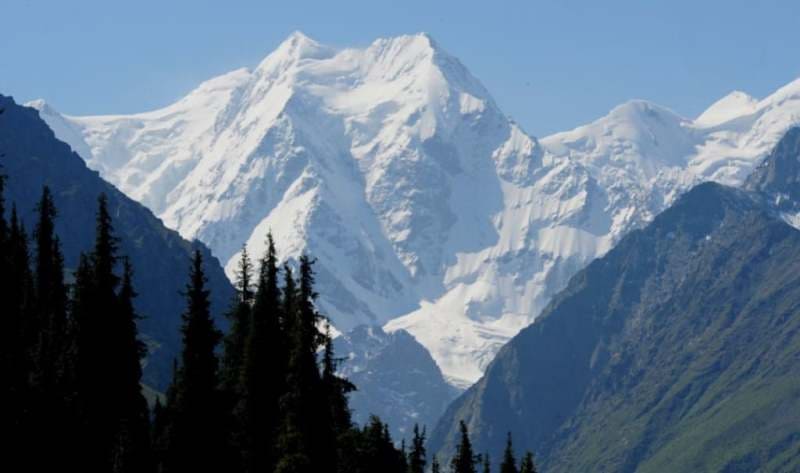
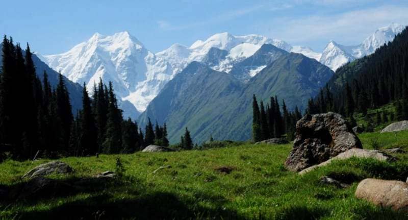
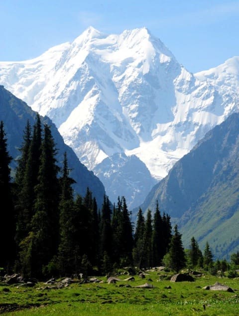
Oguz-Bashi mountain range. Jety-Oguz gorge.
Climbing in Karakol gorge.
…By 3 o'clock in the afternoon we reached the Dzhety-Oguz River, where we stopped for the night. The view from our overnight stay to the south through the Dzhety-Oguz gorge to the Tien Shan was amazing. The snow-white two-horned Oguz-bash closed the valley in the south and resembled the Jungfrau mountain of the Bernese Alps, but was even more original and splendid both in its form and in its whiteness”.
P.P. Semyonov Tien Shansky. “Travel to Tien Shan”. June 10, 1857.
Climbing Oguz-Bishi peak in Terskey Ala-Too.
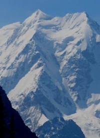
Oguz-Bashi mountain range, 5168 meters above sea level, is third highest peak in Terskey Ala-Too ridge, located in upper reaches of Alanysh River in Dzhety-Oguz region in east of Issyk-Kul region.
In the southern part of the Jety-Oguz gorge, in the upper reaches of the Ailanysh river, the Oguz-Bashi mountain range dominates. It is headed by the main peak of Oguz-Bashi with a height of 5168 meters above sea level.
To the west of the main peak is the first Western peak of Oguz-Bashi with a height of 5110 meters above sea level.
Even further west of the main peak is the Oguz-Bashi second Western peak, 5000 meters above sea level. To the east of the main peak is the second Eastern peak Oguz-Bashi with a height of 4780 meters above sea level. Still east of the main peak is Mount Oguz-Bashi, the third Eastern, with a height of 4950 meters above sea level.
The highest peak of the Terskey Ala-Too Karakol ridge with a height of 5280 meters above sea level is located 3.1 kilometers northeast of the Oguz-Bashi peak. Dzhigit peak, 5020 meters above sea level, is located 8.9 kilometers to the north-east.
Ailanash glacier with a length of 5.4 kilometers descends from the northern slopes of the Oguz-Bashi massif. Through 2.2 kilometers after the beginning, the glacier is covered with cracks, ice falls are formed. For 3.5 kilometers, the glacier is open, then until its end at an altitude of 2948 meters above sea level, the glacier is under a thick layer of moraine.
To the south, from the Oguz-Bashi massif, the Bordu Zapadny glacier, 4.5 kilometers long, flows down, which belongs to the basin of the Sarydzhaz river. To the east and further to the south from the Oguz-Bashi massif flows the Bordu Vostochny glacier with a length of 7.3 kilometers, which also belongs to the basins of the Uchkel and further Sarydzhaz rivers.
In 2002, Oguz-Bashi Peak was renamed into Boris Yeltsin Peak.
History of first ascents to Oguz-Bashi peak:
1962 - ascent to the top of Oguz-Bashi, the first Western and the first Eastern on the 5B category of difficulty, traverse led by V. Ryazanov.
1973 ascent of the main peak Oguz-Bashi, 5B category of difficulty, along the North Face with E. Myslovsky, V. Ivanov. I. Grebenshchikov.
1977 - climbing the Oguz-Bashi massif of 5B category of complexity along the northern ridge, under the guidance of V. Boshman.
1980 - ascent to the main peak of Oguz-Bashi along the northern wall, 6A category of difficulty under the guidance of O. Sharov.
1980 - the first ascent to the Oguz-Bashi peak along the northern wall - 6th place in the USSR championship in the technical class under the leadership of Ivan Dusharin.
1984 - climbing the northeastern wall, 6A category of complexity by A. Ershov's group. 1984 - climbing Oguz-Bashi, the first Western peak (5110 meters above sea level, 5A category of difficulty along the north-western ridge from the Dzhety-Oguz gorge by V. Ryazanov's group).
1984 - climbing to the top of Oguz-Bashi the second Western, 5000 meters above sea level, 5B category of difficulty, along the left northern couloir by the group of L. Volkov.
1984 - climbing Oguz-Bashi the second Vostochnaya with a height of 4780 meters above sea level of the 5B category of difficulty along the northern face by a group of V. Leontiev, 1984
1984 - climbing the 5B category to the third East Oguz-Bashi peak, 4950 meters above sea level, along the center of the northern wall, by V. Tenev's group.
1988 - climbing Oguz-Bashi along the northern face through an icefall, 5th category of difficulty by Alexey Shustov's group.
Climbing to Mt. Oguz-Bashi. North face.
In the Kyrgyz language, Dzheti-Oguz means "seven bulls," a name related to the legend concerning the rocky red pillars that stand out at the beginning of the valley, The massif, which is not far from the Karacol region, rises up on the northern buttresses of the Terksey Alatau range.
The area consists of two valleys, the Dzhety-Oguz and the Baytor, that intersect in a wooded zone where the road ends (the road can be negotiated by off-road vehicles). Here you can set up your base camp, which will be the starting point for the climbs up Oguz-Bashi, Armstrong (4,909 m), and Baytor (4,700 m), where there are lovely snow and ice routes.
The highest peak in the region is Oguz-Bashi (Bull's Ficad, 3,168 m), with three 5-6 rated routes on its faces. You can get here from the city of Przheval'sk by way of the road parallel to the one that leads to the Karakol region.
Geographic coordinates of Oguz-Bashi massif: N42 ° 09'34 E78 ° 26'01
Authority:
Alexander Petrov.
http://mountains.tos.ru
Photos by
Sergei Pyshnenko, Bishkek city.
http://karakol.kg