


![]()
You are here
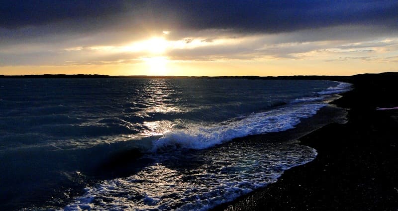
Northern and southern shores of Aral Sea in Kazakhstan.
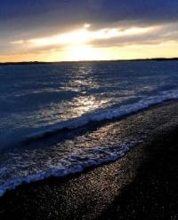
Journey along northern coast of Small Aral.
“Travel is a book. Only those who can read between the lines of observed life can read it. The one who is looking for the original, the exotic, is set "poetically", inevitably falls into error, because in normal conditions of life he is looking for the abnormal.
E.M. Murzaev.
Brief description of tour route along the southern coast of Small Aral:
Aralsk - Zhalanash village - Tastubek village - Akespe village - Saksaulskaya station - Arals - Kamyslybas lake - Bogen village - Kok-Aral dam - Aralsk.
Distance: 670 km.
Season: from May 1 to September 15.
Best time to travel: May - June.
Tour duration: 2 days, 1 night.
Detailed program day by day along northern coast of Small Aral:
Drive from Aralsk to Kyzylorda.
Day 1. Aralsk - Northern Aral - Aralsk (234 km).
Transfer: Aralsk - settlement Zhalanash (63 km).
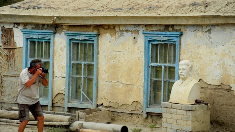
Departure from Aralsk, our path lies to the north-west, after about 5 kilometers from the city the asphalt ends, the further path to the village of Zhalanash passes along the grader. For 27 kilometers in front of the village of Zhalanash, to the left of the road, there are picturesque cliffs of the Saryshoky tract of the Eastern chink of Ustyurt, a stop for photography. Arrival in the village of Zhalanash, a short walk in the vicinity of the village, photographing rural houses with flat roofs.
Transfer: settlement Zhalanash - settlement Tastubek (25 km).
The village of Tastubek is located on the Koktyrnak peninsula. In the south-west of the village, 29 kilometers away is the bay of Zhalanash, in the southern part of the peninsula there are low hills of Bultuk and Ushshoky.
Transfer: parking lot of fishermen near Small Aral - Shoshkaly valley - cliffs Kaltybai (30 km).
We are moving north, to our left is the Butakov Bay, this is the northernmost part of the Aral Sea. Approximately 2 kilometers from the sea, the cliffs of the Eastern tip of the Ustyurt chink begin, and here are the Kaltybai mountains. Walk around.
Transfer: mountains Kaltybay - First ship on coast of Aral (11 km).
We drive west along the Eastern cliff of Ustyurt and along the northern shore of the Butakov Bay. On the right, we observe an elevation - Mount Karasandyk, 200 meters above sea level. After 10 kilometers, Mount Akshoky rises on the Ustyurt cliffs, 215 meters high above sea level.
Arrival to the first ship, walk around. This ship is on the shore, mostly dismantled, the wooden parts are in a heap apart from the ship to the side, everything is rusted through. About 400 meters southwest of the First Ship is the Second Ship.
This ship is a shapeless pile of rusty iron, it is in the water, about 70 meters from the shore. The bottom is very heavily silted, it is impossible to approach the ship. From here, to the east, 3 kilometers in the coastal zone of the Aral Sea, there is the deepest place in the Butakov Bay - 45 meters. Walk around.
About 120 meters west of the Second Ship is the Third Ship. The ship is also partly in the water and partly on land. Most likely it was a tug, judging by the preserved cabin of the boat. Walk around.
Transfer: Third ship - fourth ship on Aral coast (9 km).
Our path lies to the north-west along the Eastern cliff of Ustyurt. We pass the Kenderli mountains, 227 meters above sea level, which are the most dominant elevation on the coastal chink. The fourth ship is the best-preserved barge of all the previous ones. Most of the barge is in the water, there is sand around, a lot of garbage. Walk around.
Transfer: Fourth ship is Akespe thermal well (10 km).
Lunch on the way. We continue our movement along the Eastern cliffs of Ustyurt. Gradually we move away from the coast of the Aral Sea, on the way we pass the mountain Kumbulak, 210 meters high above sea level, which is located in the northwestern part of the cliffs.
Arrival at the source of Akespe. In 1986, geologists from the town of Shymkent drilled a well and hot water gushed out. The water temperature is 62 degrees, the water comes from a depth of 1200 meters. On the north side of the source is a local necropolis.
Transfer: Akespe well - Saksaulskaya station (63 km).
Our path lies to the northeast past the Sarykol cliffs, which is located 6 kilometers southeast of our route. In 2016, a railway was built from here to the town of Zhezkazgan with a length of 517 kilometers.
Transfer: station Saksaulskaya - town of Aralsk (53 km). Arrival in Aralsk, transfer to the hotel, accommodation.
Day 2. Aralsk - Kok-Aral dam - Aralsk (436 km).
Transfer: Aralsk - settlement Aralkum - lake Kamyslybas (86 km).
Lake Kamyslybas (Kambash, Kamyshlybash) is located at an altitude of 56 meters above sea level, located 68 kilometers southwest of Aralsk, 2.7 kilometers from the highway M 32 Samara - Almaty, 2.3 kilometers west of the village of Kamystybas .
The lake stretches from the southwest to the northeast for 28.5 kilometers, the largest width in the eastern part reaches 7.7 kilometers. The greatest depth is 16 - 18, the average depth is 2 - 2.5 meters. Walk along the western shore of the lake.
Transfer: Lake Kamyslybas - settlement Amanotkel - settlement Bogen (62 km).
Our path lies to the west, along the right bank of the Syrdarya River. At the entrance to the village of Bogen there is a new mosque, in the central part of the village there is a school, built in 1954, partially covered with sand. Short walk around the village.
Transfer: Bogen village - Aklak hydroelectric complex (21 km).
A new hydraulic structure with a capacity of more than 300 cubic meters of water per second (Aklak hydroelectric complex) was built on the Syrdarya channel - Karaozek, which made it possible to water lake systems that contain more than one and a half billion cubic meters of water.
Transfer: Aklak hydroelectric complex - Kok-Aral dam (49 km).
Through the isthmus of Berg Bay, in 2005, an embankment dam was built that blocked the Small and Big Aral and was called the Kok-Aral dam. Walk along the Kok-Aral dam, inspection of the dam locks.
Further transfer: Kok-Aral dam - Aralsk (218 km). Arrival in Aralsk, end of the tour.
Note:
Author's program of Alexander Petrov. Copying and use of material with the permission of the author.
Authority and photos by
Alexander Petrov.