


![]()
You are here
Mountains Syrdarya Karatau.
Wildlife Tours in Karatau mountains.
“What a buzz on the steppe floats?
From Karatau from mountain heights,
From the valleys of the Syr Darya and
Chu It flows like a stream»
Aktaban.
Journey to Karatau mountains.
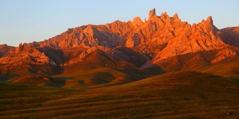
Mountains Syrdarya Karatau is a northwestern spur of the Western Tien Shan in the south of Kazakhstan, stretching from the southeast to the northwest. It extends from the Talas Alatau and gradually descending, passes into the Syrasu-Chuy plain.
Located in the territories: Zhambyl, Turkestan and Kyzylorda regions. A small southeastern part of the Syrdarya Karatau is called Karachat-Too Mountain with a dominant peak of the same name 1239.1 m. a. s. l., located on the territory of the Kyrgyz Republic.
In the northwest, the mountains border on the Daryalyktakyr plain and the Ashchykol depression. In the west, the mountains border on the Kyzylkum desert, in the east and northeast, on the sands of Moiynkum. In the southeast, the mountains border on the Kyrgyz Alatau in the east and the Talas Alatau mountains in the south.
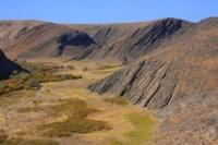
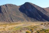
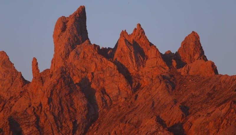
The length of the Syrdarya Karatau ridge is 434 kilometers, the maximum width of the mountains reaches 54 kilometers. Syrdarya Karatau is divided into East or Small Karatau and South-Western Karatau. The highest point of the Karatau ridge is Mount Bessaz, 2176 m. a. s. l., located in the eastern part between the Karakuz and Orta-Ayryk mountains.
The second highest peak is Mount Ozen, 1896 meters above sea level, located 3.2 kilometers south of Mount Bessaz. Eastern Karatau has a slightly undulating top surface composed of shales and sandstones of the Proterozoic.
Southwestern Karatau is cut by numerous valleys and is divided into a number of massifs composed of limestones, sandstones, Carboniferous conglomerates and Devonian volcanic rocks.
To the north-west it goes down and already at the confluence of the dry channels of the Sarysu and Chu rivers, the mountain passes to the plateau. In terms of geological structure and relief, Karatau is similar to the Chu-Ili mountains. It settles, collapses and levels out.
The northeastern and southwestern mountain ranges of the Karatau ridge are separated by intermountain valleys. If its southwestern ridge was formed from metamorphic rocks of the Proterozoic, then the northeastern ridge was formed from sandstones and shales of the Paleozoic.
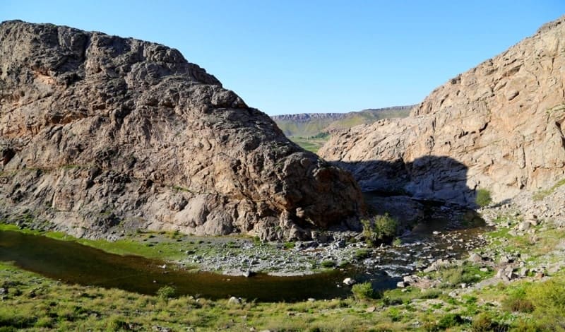
The valleys located between the two ridges are composed of red clays. Mesozoic and Cenozoic deposits of limestone, sandstone and clay are also widespread. The local relief was formed in a dry climate. There is no permanent surface runoff.
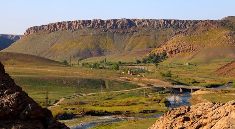
The slopes are dissected by large and small gorges and dry riverbeds. Tops are flat, aligned. To the south-west, from the Karatau ridge, the valley of the Syr-Darya river departs, to the north-east - the valley of the Talas river. The Karatau mountains have a great influence on the weather and climatic conditions of the territories of the nearby regions.
The average January temperature is 10 degrees C. The difference between the average January temperatures on the northeastern and southwestern slopes of Karatau is 4-6 degrees C, which is explained by the influence of warm air masses from the southwestern slopes.
The average annual amount of atmospheric precipitation at the foot of the slopes is 200-400 mm, above 400-600 mm. The amount of precipitation on the southwestern slopes is 150-300 mm more than on the northeastern slopes.
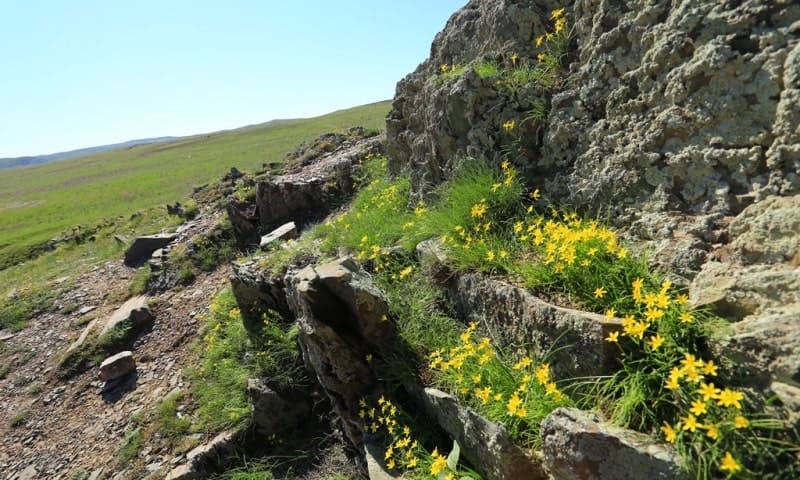
The soils are mountain chestnut, mountain brown.
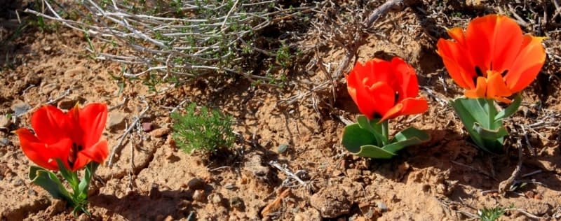
The vegetation is mountain-steppe, feather-grass-fescue, fescue and shrubs.
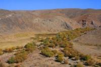
There are tugai strips along riverbeds. Rubber (tausagyz) contains 35-40; rubber and nowhere, except for Karatau, does not grow in the republic. The number of endemic species and plants reaches 9%, this is one of the richest areas in the world with endemic species.
Despite the general dryness of the region, almost every gorge has a small river or stream. Thanks to this, an original microclimate, a peculiar flora and fauna are formed in them. The Karatau mountains are surrounded by numerous salt and fresh lakes.
The fauna of the region is not rich. Jerboa, ground squirrel, ermine, steppe polecat, badger, fox, corsac, mountain goat live. A large supply of minerals was found on the territory of Karatau. They are used for the production of lead, zinc at the Shymkent lead-zinc plant and for providing chemical plants in Taraz with phosphorus raw materials.
Ores are mined in an open way. Karatau is a source of building materials - gypsum, cement, etc., which gives the state a large profit. The folded base of the southwestern and southern parts of the range was formed in the Paleozoic era. The main shape of the relief of the Western Tien-Shan was formed during mountain building in the Neogene and Anthropogenic periods of the Cenozoic era.
The proof of this is the earthquakes occurring in the Tien-Shan. The general view of the relief of the mountains is not the same. In the mountains, high peaks, ridges with intermountain valleys, hilly plains, etc. alternate. The altitudinal belt of mountains is formed in direct dependence on the geographical location and the scheme of mountain ranges.
The Arys, Boraldai, and Bogen rivers flow from the southwestern slopes of Karatau. From the northwestern slopes there are some rivers that are fed by melted snow waters in spring and dry up in summer.
Geographical coordinates of Syrdarya Karatau: N43°44'52 E68°31'57
Enlightener:
A.C.Beisenova, T.G. Smagulov. “The brief encyclopedia Kazakh SSR”. Volume 2, Section the Nature.
Alexander Petrov
photos.