


![]()
You are here
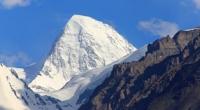
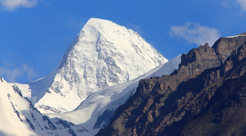
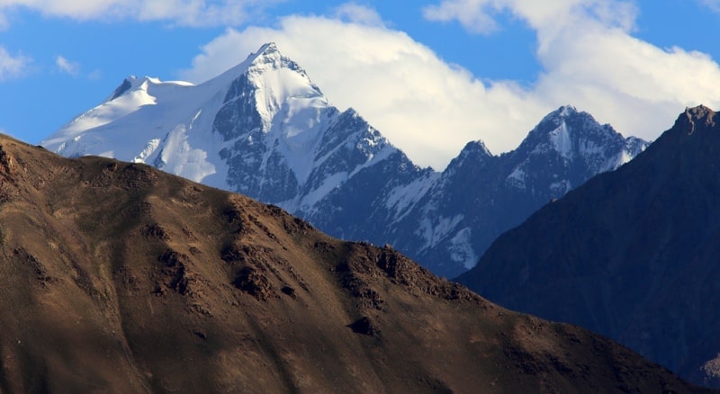
Mountains of North-West Pamir.
Tours in mountains of North-West Pamir.
"The Pamir ridges are connected with the powerful systems of the Tien Shan, Kuen-Lun, Himalayas, Hindu Kush, which creates from it a huge knot in which the highest elevations of Central Asia are intertwined."
N. Korzhenevsky.
Climbing in mountains of North-West Pamir.
On an area of nine hundred square kilometers, in a system of broken crests, a whole bunch of peaks rises with huge absolute heights. This area after the expeditions of 1928-1933. they began to call the North-Western Pamirs, which can be considered as part of the high-mountain Pamirs, occupying about ten thousand square kilometers.
In the North-Western Pamirs there are 18 peaks with a height of more than 6,000 meters, this is the peak of Communism - 7495 m, Korzhenevskaya - 7105 m, Moscow - 6785 m, Leningrad - 6507 m, Izvestia - 6840 m, Voroshilova - 6665 m, 50th anniversary Komsomol - 6701 m, Klara Zetkin - 6600 m, Karpinsky - 6623 m, Pionerskaya Pravda - 6550 m, 40 years of the Uzbek SSR and the Communist Party of Uzbekistan - 6700 m, Soviet Russia - 6852 m, Garmo - 6595 m, 26 Baku Komissarov - 6834 m, Revolution - 6974 m, Bezymyannaya - 6596 m, Fikkira - 6718 m.
The main orographic unit of the North-Western Pamirs is the ridge of the Academy of Sciences, open N.L. Korzhenevsky. In its northern part, the ridge forms the highest mountain region of the CIS. Here, at the junction of the ridges of the Academy of Sciences and Peter the Great, is the high-altitude pole of our country - the peak of Communism with a height of 7g. 495 meters above sea level.
Fortambek glacier flows north from the peak of Communism, Bivachny glacier to the east, and Garmo to the west. In the High Pamir Mountains, in the system of the ridge of the Academy of Sciences and the adjacent ridges of Peter the Great, Darvaz, Vanch and Yazgulemsky, 40% of the glaciations of the Soviet Pamir are concentrated on it, the largest glaciers - Fedchenko (71.2 km), Grumm-Grzhimailo (36 km), Garmo (27 km), Sugran (24 km), the Geographical Society (21 km), Fortambek (19.9 km), Yazgulemsky (19.5 km), Yazgulemdara (13.5 km).
12 kilometers from the peak of Communism to the north, in the mighty spur of the ridge of the Academy of Sciences, another "seven-thousandth" rises - the fourth highest peak in the USSR - the peak of Evgenia Korzhenevskaya (7105 m).
One of the features of the relief of alpine Pamir is the presence of aligned surfaces similar to the firn plateau of the peak of Communism. They, as P.A. points out Shumsky (1945), is almost everywhere observed in the basin of the Grumm-Grzhimailo glacier.
Most of the ridges that form the sides of this glacier rise above 4700 m, have rounded peaks and gentle convex slopes. The remains of gently sloping surfaces are observed at altitudes of 5 to 6 km, even among the high alpine relief in the western and southern parts of the region.
According to the same author, the flat peaks of the peaks of Communism and Garmo are the remains of the East Pamirian relief. Aligned ancient surfaces continue on the eastern slope of the peak of Communism.
The inclined surface of the base of the summit ridge of the peak of Communism is located in the east, approximately at the level of 6800 m, and in the west - 7100 m. And here the ancient horizontal surfaces occupy a section equal in length to 3.5 km, in width - 2 km thus, the top from three sides is surrounded by aligned areas inherited from the ancient relief of Prapamir.
Climatic features of the North-Western Pamirs. The most abundant precipitation is the windward slopes facing the winds that carry moisture. For Central Asia, these are mostly open western slopes, although the outer slopes of mountains of any exposure capture some of the moisture.
The lee slopes are poor in precipitation, especially in the cold season, when water vapor is not transported to heights by local circulation. This regularity has one feature that is very important for the practice of mountain climbing: the leeward slopes of the mountains, close to the passes, are significantly moistened for ten kilometers or more.
This happens for a number of reasons. Firstly, the sediment flow lines repeat the contours of the ridges in a smoothed form and behind the ridges their lowering does not occur immediately. Secondly, ascending flows can spread to the upper part of the leeward slope and pick up cloud particles, droplets, and especially snowflakes, and raise them a little.
Thus, part of the precipitation is transferred to the windward slope. Finally, blizzards carry snow from the windward slopes to the windward and to the valleys. In August and September, the recurrence of clear weather is more than 50% and even reaches 70%, and the recurrence of cloudy weather is significantly reduced.
Cold intrusions in the area of Fedchenko Glacier are accompanied by a sharp decrease in air temperature, significant cloud cover and heavy rainfall in the form of rain near the tongue of the glacier, and in the form of snow in the middle and upper parts of its flow.
Naturally, on the slopes of the surrounding peaks, and especially on the slopes of the peak of Communism, precipitation occurs only in solid form. Long cold spells are replaced for a short time (2 - 3 days) with low cloudy weather with a small increase in air temperature.
In the first half of September, the nature of the weather does not change. For example, in 1957 in late August - early September at an altitude of about 4900 m (Fedchenko Glacier), where the expedition of the Leningrad State University named after A.A. Zhdanova, she was clear with a high intensity of solar radiation.
However, in the firn region, such weather conditions with large albedo and large radiation from the firn surface called a significant decrease in air temperature, which dropped to - 20 ° or even lower at night. Consequently, at an altitude of 6900 m, the temperature reached - 48 °.
The expedition mentioned above also worked on Fedchenko Glacier in 1958, when climbers of the Turkestan Military District and Uzbekistan climbed the eastern ridge in the classical way on the peak of Communism (this route was first traversed in 1958 after 1937).
The weather conditions during the expedition from July 20 to September 3, 1958 were extremely favorable: the sun never hid behind clouds during August and early September. The expedition of the A. A. Zhdanov Leningrad State University gives the following characterization of the weather of this period in the area of the Fedchenko Glacier:
“In the first half of July 1958, warm, cloudy weather without precipitation with air temperatures exceeding the norm by 4 - 5 ° was observed. . And only on July 15 – 16 did a cooling occur due to the rapid western, and then the north-western invasion.
The intensive cooling process, during this period, was caused by the formation of a high ridge over Kazakhstan, to the rear of which there was a continuous influx of Arctic air, the air temperature from July 14 to 16 (in two days) dropped from +18.3 to +5 at the end of the tongue of the Fedchenko glacier , 1 ° (on average per day), and in the middle of the glacier - from +7.8 to + 2.9 °.
When comparing the repeatability of processes with perennial, it turned out that the number of northern incursions into the territory of Central Asia was less than the norm. More often the territory was influenced by the southwestern periphery of the anticyclone and thermal depression.
The air temperature, despite a sharp cooling in the middle of the month, was close to normal due to high temperatures (up to 30 °) in the first half of July. Precipitation fell much more compared to the average long-term value."
In August of the same year, alternations of cold intrusions with warm, slightly cloudy weather were observed. Cold intrusions were observed on August 5 – 7, 11 – 16, 23 – 26 and caused an unstable weather pattern.
Clouds increased, rains fell, and snow fell in the area of Lake Karakul and on the Fedchenko Glacier. In general, over the month, compared with long-term data, there were fewer cold intrusions, cloudy weather prevailed.
Thermal depression was observed on average 10 days compared with 6 days over a long period. Unfortunately, the Belyaev Glacier (the origins of the Garmo Glacier) and Fortambek Glacier do not have such detailed and long-term meteorological observations that would characterize the western (from the side of the Garmo Glacier) and northern slopes of the peak of Communism (from the side of the Fortambek Glacier).
The most complete weather data on high-altitude nodes were collected on the Fedchenko Glacier due to the work of the station of the same name, which began observations in the autumn of 1933, Altynmazar station with the same series of observations, as well as weather stations of the International Geophysical Year, which worked here in 1957 - 1959. (Vitkovsky Glacier and Fedchenko Glacier) and, in addition, the work of the LGU expedition (1957 - 1959).
Some researchers (in particular V.A. Giorgio, 1962) are inclined to believe that when frontal cloud systems are approaching the Pamirs, overcast sediments are intensified on the windward slopes, on the crests and even in the leewards, but not far from the crest.
In the practice of climbing, this may indicate that the western slopes of the ridge of the Academy of Sciences have more favorable weather than the windward (eastern) ones facing the basin of the Fedchenko Glacier.


Authority:
Vladimir Iosifovich Racek, “The Five Highest Peaks of the USSR”, Uzbekistan Publishing House, Tashkent, 1975.
Photos
Alexander Petrov.