


![]()
You are here
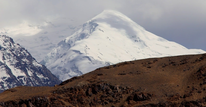
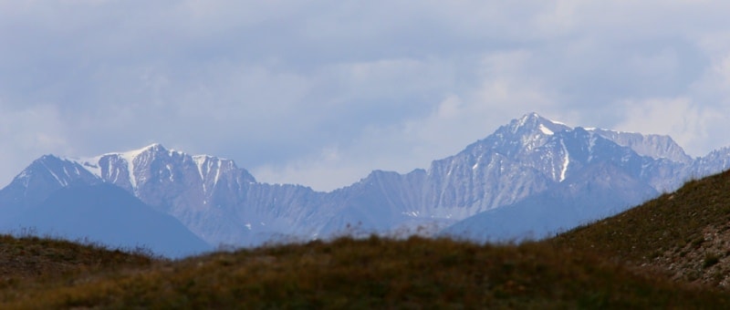
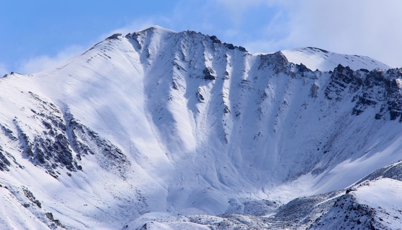
Mountains of Eastern Pamir.
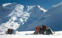


Hiking trails in Pamir mountains.
"The stone swung forward a little
And rushed down to the river
Twenty One Bad Years
Hanged on his right hand"
Yuri Vizbor. December 1954.
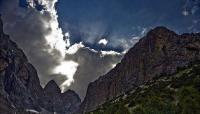
Sights of nature of Pamir mountains.
The Eastern Pamir is an upland, most of which is located in the Murgab district of the Gorno-Badakhshan region of Tajikistan, surrounded by ridges about 5500 - 7500 meters above sea level. The central part of the Eastern Pamirs is confined to Lake Karakul, which is surrounded by the Zaalaysky ranges in the west, Sarykolsky in the east, Muzkol in the south and Zulumart in the west.
Alpine desert prevails, there are many small glaciers on the northern slopes, and large valley glaciers with elevations of up to 2000 meters are also found. A total of about 2100 glaciers with a total area of 1375 square kilometers.
Ranges with gentle slopes rising 1 – 2 km above the valleys and vast drainage hollows are characteristic of the Eastern Pamirs, however there are ridges with significant relative heights. The ridges of the mountains are flat, the valleys are wide, and slow rivers flow in them, and salt lakes lie in the basins.
The Eastern Pamir is an alpine desert surrounded by even higher mountain ranges rising to 5500 - 6800 meters above sea level. The center of the Eastern Pamir is considered Lake Karakul, lying at an altitude of about 4000 meters.
To the west and east of the lake, the mountains rise to 5200 - 5500 meters above sea level, the valleys are flat, slightly incised, and small glaciers lie on the northern slopes. About the same type relief of the southern part of the Eastern Pamirs.
The Zaalaysky and Zulumart ridges are much higher (6000 - 6800 meters above sea level), their slopes are very dissected, and they have large valley glaciers with a vertical glaciation range of up to 2000 meters.
Some part of the Eastern Pamirs - the highlands of the central part of the Pamirs from the east, already on Chinese territory, are bordered by the high mountains of the Sarykol Range and the Kashgar Mountains. In the Kashgar mountains, there are the highest peaks of the entire Pamirs, these are peaks: Kungur 1 at a height of 7681 meters above sea level, Kungur 2 at a height of 7664 meters above sea level and the famous Mustag-ata peak at a height of 7433 meters above sea level - the "father of snowy mountains".
The average glaciation range of the entire East Pamir is small, about 600 meters. The climate of the Eastern Pamirs is continental, dry. The large absolute altitude and great transparency of the atmosphere cause intense solar radiation and low air temperatures, and the closedness from the west by a barrier of high ridges leads to high air dryness and low rainfall.
The average annual air temperature in the region of Lake Karakul - 3, - 7 °. In winter, frosts reach -40 °. Summer is cool, average July temperature + 8.7 °, but frosts are possible in any of the summer months. Precipitation is about 60 mm per year.
On the slopes of the ranges, in the region of the food boundary and higher, there is more precipitation, which ensures the existence of modern glaciers. The bulk of precipitation falls in the spring and early summer in solid form.
In different parts of the Eastern Pamirs and on the slopes of various exposures, snow accumulation above the nutrition boundary ranges from 40-60 to 80-100 grams of square centimeters per year. The food border runs at an altitude of 5030 - 5200 meters above sea level, an average of 5140 meters above sea level.
The main types of ice formation are firn and ice. Despite the high intensity of solar radiation, ablation on the glaciers of the Eastern Pamirs is small, since a significant part of the radiation is spent not on melting, but on the evaporation of snow and ice.
This is associated with the formation of the so-called penitent forms of selective melting of snow and ice under conditions of direct solar radiation, a small amount of turbulent heat transfer, and a large heat transfer to evaporation and efficient radiation.
These forms are also characteristic of other glacial regions with dry and cold climate (volcanoes of South America, the highlands of the Himalayas, Antarctic “oases”). The speeds of glaciers in the Eastern Pamirs are small.
With the exception of large valley and dendritic glaciers, on which large masses of surface moraine are concentrated, glaciers of the Eastern Pamirs are distinguished by small moraines. They produce much smaller transport and glacier leveling work compared to the glaciers of the Western and Central Pamirs.
The vibrations of their ends are also small. The division of the Pamirs according to the nature of the relief and climate into Western, Central and Eastern is widely used in geomorphology. However, the border between them is conditional, since in some areas the relief sections characteristic of the Eastern Pamirs alternate with the strongly dissected relief of the Western Pamir type, and vice versa.
In addition, the border between these areas is drawn along the crests of ridges or cuts ridges into parts.
Therefore, adhering to the general description of the Pamir of this zoning, when characterizing glaciation, we grouped all the Pamir ridges into 4 regions:
1) Northern Pamir, which includes the entire Zaalaysky ridge,
2) The Central and Western Pamirs, including the ridge of the Academy Nauk with the ridges of Peter the Great, Darvaz, Vanch, Yazgulemsky and the North Tanymas ridge adjacent to it from the
est,
3) Southwestern Pamir nountains - latitudinal ranges south of the Yazgulemsky range,
4) Eastern Pamir - the Zulumart, Sarykolsky, Muzkol and others ranges in the southeastern part of the Pamir mountains.
Authority:
"Glaciers." L.D. Dolgushin, G.B. Osipova. Series "Nature of the world." Moscow, the publishing house "Thought". 1989.
Photos
Alexander Petrov.