


![]()
You are here
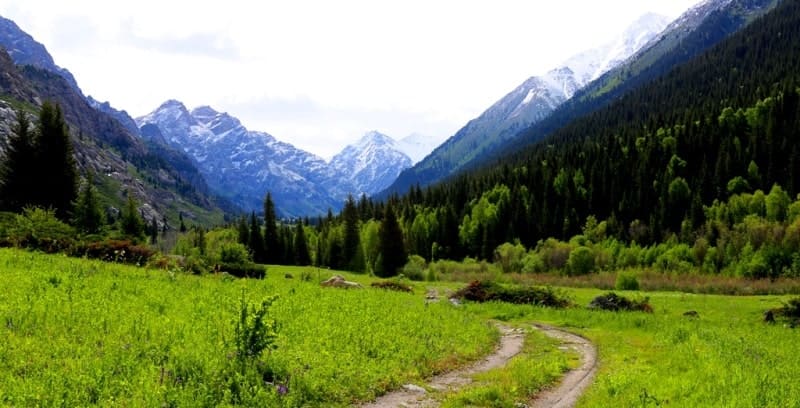
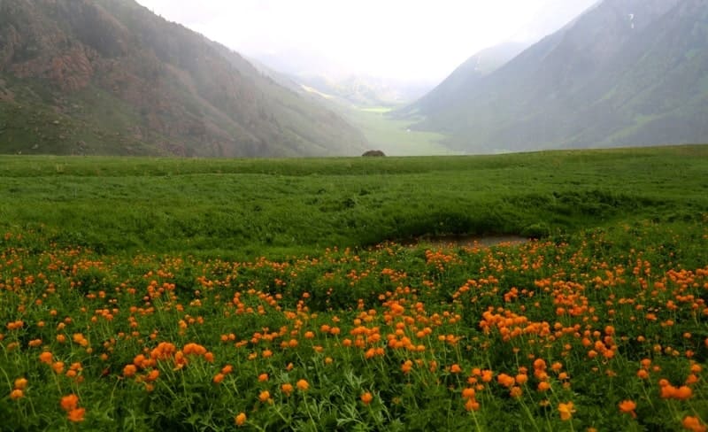
Mountains of Dzungarsky Alatau.
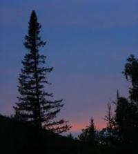
Trip to mountains of Dzungarsky Alatau.
“Traveling and studying constantly, I come to perfection”
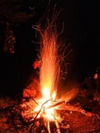
Trip from Almaty to Lepsinsk.
Video film: View from Kapal plateau to Dzungarian Alatau mountains. Alma-Ata's region. July 8, 2017.
The Dzungarian Alatau Mountains stretch from southwest to northeast along the state border of the Republic of Kazakhstan and the Republic of China, between the Ili River and Alakol Lake, and are located on the territory of Almaty and East Kazakhstan regions.
In the east, it is limited by the Dzungarsky gates from the Barlyk and Miley ridges located in China, in the south it is separated from the Tien-Shan by the valley of the Ili River. Like the Saur and Tarbagatai ranges, the Dzungarsky Alatau, by nature, occupies an intermediate position between the Tien-Shan, a typical Central Asian mountain system, and the mountains of southern Siberia.
Siberian fir penetrates the mountains of the Dzungarsky Alatau, for example, while the Tien-Shan is characterized by a different species - Semenov fir. Along with this, in the Dzhungarsky Alatau, juniper, as well as the Tien-Shan spruce (Schrenka spruce), typical for Central Asian mountain systems, are common.
S.P.Suslov (1954) noted the quantitative predominance of Altai-Siberian plant species in the vegetation cover of the Dzungarsky Alatau. The Jungar Alatau system consists of several parallel high chains; the main one, the longest, extends in the north, accompanied by still low and short front ridges on the north side.
To the south of the main chain are the Toksanbai, Bejintau and Tyshkantau ranges, which are connected with the spurs of the Chinese ridge of Boro-Khoro. The ridges of Toksanbay and Bejintau are connected with the main northern mountain a dam, which serves as a water section between the upper reaches of the Koksu and Borolday rivers.
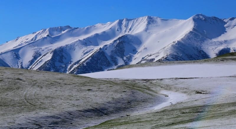
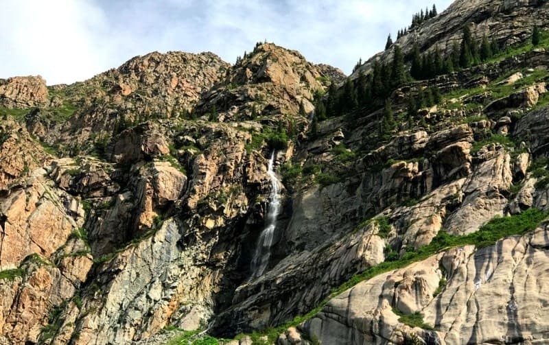
The main ranges of the Dzungarsky Alatau rise above 4000 meters above sea level, the northern, the main chain - up to 4442 meters above sea level - the peak of Besbaskan. Significantly exceeding the level of the snow line, the ridges have snow peaks and glaciers up to 8 kilometers long.
Many spurs extend to the west, southwest and northwest from high snow chains. The formation of folds in the Dzungarsky Alatau occurred in the Paleozoic. The main folding was Hercynian. In Hercynian time, denudation processes developed, in the Mesozoic and Paleogene the territory was in a platform mode with a small amplitude of oscillatory movements, and in the Neogene and Lower Quaternary, uplifts occurred, accompanied by fractures of the earth's crust.
The basis of the mountain system is the Dzungarian anticlinorium, containing in its core the Lower Paleozoic, Riphean and Middle Proterozoic rocks, crushed into a system of complex folds, sometimes creating fan-shaped structures.
Many peaks are granite exits. The metamorphic schists of the Middle and Lower Paleozoic play an important role in the structure of the main ranges and leading ridges. Paleozoic sandstones and limestones are less common.
The foothills are composed of thicknesses of Paleogene, Neogene and Quaternary sediments. Dzhungarsky Alatau is a rise complicated by the gaps that accompanied the Neogene-Quaternary rise of the mountains.
Movement along the discontinuities led to the formation of a series of ledges, clearly expressed in the relief. In general, high plateau-like spaces located at different hypsometric levels are characteristic of the relief.
They give steppedness to the outer slopes of the mountain system. In the high mountains there are plateaus located above the line of eternal snows (Kolesnik, 1933, Yudichev, 1940). Ancient leveling surfaces, raised to a height of 3000 to 4000 meters above sea level or more, indicate the young age of the mountains.
The snow line in the Dzhungarsky Alatau is located at altitudes from 3200 to 3800 meters above sea level (on the northern slope below, on the southern - above). The area of glaciation is about 1000 square kilometers.
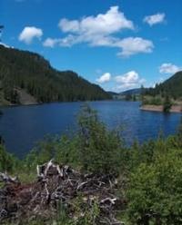
The number of glaciers is 1369. Traces of two ancient, Pleistocene, glaciations are observed. Permafrost is widespread from a height of about 2600 to 2800 meters above sea level. Glaciers and snows, and mainly rainfall and groundwater, feed many rivers flowing from the northern slope to the Balkhash, Sasykkol and Alakol lakes, and from the southern to the Ili River.
Some rivers are lost in the sands and swamps or used for irrigation of fields. Differentiation of landscapes of the Dzungarsky Alatau is primarily determined by the altitudinal zonality and, to a large extent, the exposition of the slopes, which is why the spectra of the altitudinal zonality of the northern and southern slopes of the mountain system are different (Tikhonova T. S. Landscape mapping, 1972. S. 191 - 207, Tikhonova, 1967a, b).
The lower parts of the mountain slopes are covered with desert (on the southern slope), semi-desert and steppe vegetation, respectively, on gray-earth, brown desert-steppe, mountain chestnut soils and mountain soils.
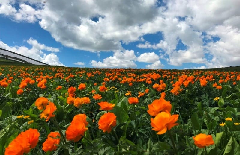
The mountain steppes, mainly feather-grass and fescue on the southern slope, pass into mixed herbs. In the high-altitude zone from 1500 to 2400 meters above sea level, meadow and forest vegetation is widespread on the northern slope.
Rare forest from the Tien-Shan spruce is developed here; there are also sections of thick spruce forests. Siberian fir is mixed with the Tien-Shan spruce. Under the meadows mountain meadow soils are developed, under the forests there are peculiar dark-colored forest soils similar to the soils of the Tien-Shan spruce forests.
Below the spruce forests, in some places there are forests of apple trees and aspen, bushes overgrown by bushes. On the southern slope of the Dzhungarsky Alatau, spruce plots occur in the form of intersperses among mountain steppe vegetation (Rubtsov, 1948).
Probably, the forest and meadow steppe zone of the midlands should be distinguished here, from 1800 to 2600 meters above sea level, replacing the meadow forest of the northern slope. In the upper parts of the slopes, mountain meadow vegetation is developed on mountain meadow typical and weakly tuberous (in the alpine zone) soils.
In the subalpine zone, among motley grass and meadow meadows with a state of geranium and foxtail and juniper, there are intersperses of fescue and sheep steppes. On the highest sections of the ridges of the main ranges, the landscapes of the nival-glacial zone are developed.
In the spruce-fir forests of the Dzhungarsky Alatau, deer-deer live. In the coniferous forests from the north, here and further into the Tien-Shan, some species common to the Siberian taiga penetrate, from birds, for example, Siberian pine.
Basically, the animal kingdom of the Dzungarsky Alatau already bears the character typical of the Tien Shan. Within the Dzhungarsky Alatau, two physicogeographic provinces are distinguished: the Dzhungarsky Alatau, which includes the main part of the mountain system, and the West Dzhungarsky, occupying its western and southern foothills and spurs (Gvozdetsky, Nikolaev, 1971; Physical and geographic zoning of the USSR, 1968).
In Dzhungarsky Alatau there are polymetallic (Tekeli deposits), copper and iron ores, as well as ores of other non-ferrous and rare metals. There are stone-coal deposits of local importance, thermal mineral springs (Kopal-Arasan, etc.).
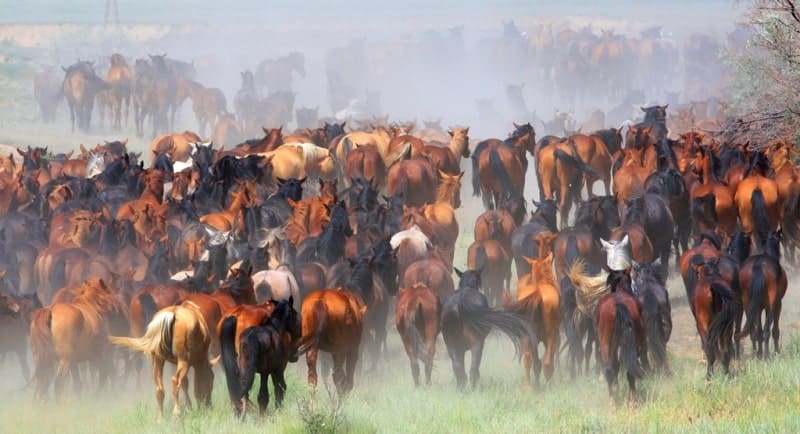
In the foothills, field cultivation and gardening are widespread. On the basis of mountain pastures developed sheep breeding, meat, dairy and beef cattle breeding, herd horse breeding. The possibility of using forest resources is limited by the soil-protective and water-protective role of forests.
Geographic coordinates of Dzungarian Alatau mountains: N45°04'06.16" E80°16'31.92"
Authority:
Series Nature is the world. "The mountains". ON THE. Gvozdetsky, Yu.N. Golubchikov. Moscow "Thought". 1987.
Photos by
Alexander Petrov.