


![]()
You are here
Mountain country of Pamir.
Nature of Pamir.
“The journey of a thousand miles begins with a single step”
Lao Tzu.
Ridges of Pamir.
The Pamir, or the Pamir Highlands, the highest in Central Asia, is located in the southeast of the Pamir-Alai mountain region, on the border with Afghanistan and China, within which its southern and eastern margins go. On the geographical map, the Pamir has the shape of a quadrangle, slightly sloping to the west. Especially high elevated edges of the highlands are characteristic. In the north, this is the Zaalaysky ridge with Lenin peak, 7134 m. a. s. l. in the north-west is the ridge of the Academy of Sciences with the ridges of the Western Pamir extending to it to the west.
On the ridge of the Academy Nauk, the highest peak of Central Asia rises - the peak of Communism, with an altitude of 7495 meters above sea level, discovered in 1928 by the Pamir High Mountain (Soviet-German) expedition. In the Kashgar mountains rise the highest peaks of the Pamir Highlands - Kongur peak, 7719 m. a. s. l. and Muztagat, 7546 m. a. s. l.
The main part of the Pamir territory belonging to Central Asia is located within Tajikistan, forming, in addition to the northwestern outskirts of the Gorno-Badakhshan Autonomous Region. The northern slope of the Zaalai Range is located on the territory of Kyrgyzstan.
Some scholars have proposed calling the Pamir only the eastern part of its Central Asian territory (Eastern Pamir), based on the originality of its landscapes and referring to the article by geologist D. L. Ivanov “What should I call the Pamir?” (1885).
However, D. L. Ivanov does not have a priority in the study of the Pamir, and his article refers to the time when the mountains of Central Asia were poorly studied and the discrepancy in the interpretation of the boundaries of individual geographic objects was inevitable.
But after the territory was more accurately plotted on the map, the signature “Pamir” was applied on the geographical maps in the quadrangle outlined above. This is an integral orographic unit characterized by an eccentric arrangement of the highest heights (Markov, 1935).
We must bear in mind not only the differences in the relief of the Western and Eastern Pamir, as described below, but also the dissection of the eastern outskirts of the Pamir - the Kashgar Mountains. The name East Pamir is used conditionally, only in relation to the Central Asian territory of the Pamir.
If we take the Pamir Highlands as a whole with its foreign eastern part, then the well-known symmetry in the nature of its dismemberment will be restored, and the Eastern Pamir will soon become the Central one, as some Soviet geographers called it (Markov, 1935; Agakhanyants, 1965).
Geology of the Pamir.
In the Pamir region of the Alpine-Himalayan geosynclinal belt (here the Alpine, i.e., Kainozoic, folding), several tectonic zones are distinguished, which extend almost latitudinally, but in the west (in the area of the Peter the Great and Darvaz ranges) go to the south, forming an arc, as it were, convex to the northwest.
The Southeastern Pamir is composed of rocks of the Upper Paleozoic and Mesozoic marine, with significant participation of limestone. The sedimentary strata here form relatively simple folded structures elongated to the east-southeast and complicated by longitudinal faults and reverse faults (Muratov and Arkhipov, 1961).
From the point of view of the global plate tectonics, the Pamir arose together with the Himalayas “during the rapprochement of the Hindustan and North Asian lithospheric plates” (Florensov, 1983. P. 83). The strongly icy ridge of the Zaalai ridge rising in the north of Paramir significantly exceeds the ridges of the Gissar-Alai system.
N.L. Korzhenevsky calculated that the average height of the ridge of the Zaalai ridge exceeds even the ridge of the Academy of Sciences, thus being the highest ridge entering the Central Asian part of the Pamir Highlands. The ridge belongs to the external tectonic zone of the Pamirs, composed of Mesozoic and Cenozoic thickness.
Gypsum karst forms are quite widespread on its northern slope and at the foot of the plinth (Gvoz dedecki, 1968.1981).
Relief of the Pamir.
The territory of the Pamir, lying south of the Zaalai ridge, according to the features of the relief is clearly divided into two parts: the Western Pamir and the Eastern Pamir, so called by us conventionally, according to tradition. The Western Pamir are characterized by a system of high ridges in the whole of the southwestern and almost latitudinal strike, separated by deep valleys and gorges. In the north, it is the ridge of Peter the Great, curved in terms of Darvaz and Vanch connected at the eastern ends to the meridional ridge of the Academy Nauk.
The ridge of Peter the Great and Darvaz belong to two northern tectonic zones - the outer and North Pamir. The ridge of Peter the Great is composed (with the exception of the eastern section) of the Mesozoic and Cenozoic sediments. Its northern slope has clear degrees of leveling surfaces, on which karst phenomena in Mesozoic limestone and gypsum are clearly expressed in many areas (Gvozdetsky, 1981).
At the junction of the Peter the Great ridge and the Academy Nauk, the Pamir firn plateau is located - the remainder of the ancient leveling surface, raised to a height of more than 6000 m. a. s. l. The Vanchsky Range, as well as stretching south of Yazgulemsky, belong to the tectonic zone of the Central Pamir.
To the south one after another follows the Rushansky Ranges, Pathor Peak, 6083 m. a. s. l., Shugnansky and Shakhdarinsky, belonging to the Southwestern Pamir zone. The slopes of the ranges of the Western Pamir, going down to the sides of the valleys dividing it, are very steep.
Erosion and gravity processes here are characterized by exceptional intensity, almost everywhere the lower parts of the slopes are covered with talus. The Eastern Pamir has very different land features. Here, essentially in the central part of the highlands, the ancient relief was preserved (K.K. Markov, M.V. Muratov, I.A. Rezanov), while on the western and eastern outskirts of the highlands - in the Western Pamir and Kasgar mountains - it is destroyed by deep gorges and glacial and nival processes.
The relief of the Eastern Pamir is characterized by flat bottoms of vast valleys and hollows, raised to a huge height - 3500-4500 m. a. s. l. Ranges and mountain ranges rise above them, sometimes reaching heights of more than 6,000 m. a. s. l.- the peak of Soviet Officers on the Muzkol Range, 6,233 m. a. s. l.
In the north-eastern part of the Pamir there are large flat drainage basins with lakes. The basins and flat valleys of the Eastern Pamir are filled with products of mountain destruction - fine earth, gravel, pebbles, sand, piles of ancient moraines.
Permafrost is found in soils.
The slopes of the mountains are covered with rubble and boulders. Ranges dividing wide valleys, with huge absolute heights, often have relatively small relative heights and resemble the mid-mountain ones. The highest ridges have sharp mountain glacial shapes, distinguished by a young sculpture against the general background of an ancient relief.
In the Eastern Pamir, the Karakul Lake basin belongs to the tectonic zone of the Northern Pamir, the Muzkol Ridge and the Rangkul Lake region belong to the Central zone, the Oksu River basin belongs to the Southeast Pamir zone. In different regions of the Eastern Pamir (the basin with the Shorkul and Rangkul lakes, the Nizatash pass), limestone remnants, which N. A. Gvozdetsky is inclined to consider as relict forms of the tropical karst formed in the Oligocene, attract attention among forms of the ancient relief and maybe in the Miocene, in the climate and savannah landscape.
Climate of Pamir.
Although the whole Pamir is in the subtropical zone, the enormous heights causing altitudinal zonality determine the severity of the climate in most of its territory (except for the valleys of the Western Pamirs), and the orographic barriers to the path of the western and southwestern air flows are determined Contrast the distribution of precipitation.
In the northwestern part of the Pamir, on the Fedchenko Glacier, thanks to the barrier effect of the Academy of Sciences ridge and adjacent ridges, giving an impetus to precipitation, their annual amount reaches 2236 mm, in the upper part of Vancha (and in the western western highlands ) - up to 2500 mm, and only a few tens of kilometers to the east, in the Eastern Pamir, only about 100 mm/year is precipitated.
Cold alpine deserts with such lifeless landscapes that are hard to imagine without having been there are widespread. However, in the glacial (nival-glacial) zone, even in conditions of sharply continental climate of the Eastern Pamir, 800 - 1000 mm of precipitation falls annually (Kotlyakov, 1977).
In the Eastern Pamir, in contrast to the entire territory of the Pamir-Alai mountain region, where the maximum rainfall is spring and spring-summer, the highest rainfall occurs in summer, which is explained by the “atmospheric circulation conditions connecting the Eastern Pamir with the Tibetan Plateau” (Alisov, 1969. P. 84) or by the action of the South Asian muson (Agahanyants, 1965).
Summer precipitation often falls in the form of snow. In the Eastern Pamir, the climate is very dry, sharply continental and harsh (at an altitude of about 400 meters, the average January temperature is -20 °, July + 8 °). In the valleys of the Western Pamirs, temperatures are higher (at an altitude of about 2100 meters, the average January temperature is -7.4, July + 22.5 °) and, although not the same as in the Eastern Pamirs, it is still very dry (annual rainfall is less than 260 mm).
In the highlands of the Western Pamir, there is much more rainfall everywhere, especially in the north. The snow line on the northwestern edge of the Pamirs is located at an altitude of 3600-3800 m. a. s. l., in the area of Fedchenko glacier - 4200 - 4400 meters above sea level, in the central and eastern parts of the Pamir it rises to 5200-5240 m. a. s. l.
The height of the snow line of more than 5000 m. a. s. l. is characteristic only of the tropics, here this height is due to the extreme dry climate, above the snow line and there is a lot of precipitation in the form of snow that feeds the glaciers. The icing of the Pamirs is grandiose, especially in the northern and northwestern parts.
About 7100 glaciers are known in the Pamir (6730, if we take into account the complex valley glaciers as a whole, together with tributaries).
Glaciation area of Pamir.
Reaches approximately 7,500 square kilometers, which is more than 10% of the entire Pamir surface. By the number of glaciers and the area of glaciation, the Pamir ranks first among the mountain-glacial regions of Central Asia. More than half of the area of glaciation includes the northwestern part of the Pamirs with the orographic axis in the form of the ridge of the Academy Nauk and the Zaalaysky ridge.
Here are all the largest glaciers of the Pamir, including the Fedchenko Glacier, the first largest in Central Asia and one of the largest in the mountains of the world - 77 kilometers long, 651.7 square kilometers in area, with a maximum thickness of ice in the middle part 1000 meters (Fedchenko Glacier, 1962).
Located east, the Grumm-Grzhimailo glacier has a length of about 37 kilometers and an area of about 143 square kilometers, the Garmo glacier, lying between the ridges of Peter the Great and Darvaz, is 30.4 kilometers, the area is more than 114 square kilometers.
Ten glaciers of the Pamir are longer than 20 kilometers, more than 700 more than 2 kilometers long. The icing of the Pamir, as well as the entire Pamir-Alai mountain region, is in a stationary state - about half of the glaciers occur and half are retreat.
In the era of the ancient, Pleistocene glaciation, glaciers developed most strongly in the same areas that are now most affected by glaciation, that is, in the northwestern part of the Pamir and on the Zaalaysky ridge. The ancient Muksuisky glacier (continuation of the current Fedchenko glacier) reached 164 kilometers.
In the central and eastern parts of the Pamir there were glaciers of the foot. They were also distributed in the Alai Valley along the foot of the Zaalai Range, where long moraine ridges now lie.
Rivers of Pamirs.
Belong mainly to the Amu Darya basin. Of these, in addition to the Amu Darya itself, which in the upper reaches is called Panj, the largest is Kyzyl-Suu, Surkhob-Vakhsh. The rivers of the eastern outskirts of the Pamir belong to the basins of Yarkend and Kashgar.
From the rivers of the Kashgar Bassein, the upper reaches of Kyzyl southeast and Markansu enter. Large rivers starting in the highlands have glacial-snow feeding, and in comparison with the Tien-Shan rivers, the proportion of glacial feeding is greater.
This is especially true for rivers starting from the glaciers of the northwestern part of the Pamir and flowing down from the Zaalaysky ridge.
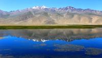
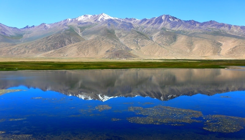
Lakes of the Pamir.
The largest lake in the Pamirs - Karakul in the Eastern Pamir - lies at an altitude of 3914 m. a. s. l. The basin of a lake of tectonic origin, greatly altered as a result of the influence of ancient glaciation. Depth - up to 236 meters. Water is brackish and unsuitable for drinking. In winter, the lake freezes.
Rising on the sides of the mountain, the blades of the bays, islands, the blue color of the water, reflecting the clear cloudless sky, - all this creates a picturesque landscape, especially pleasing to the eye after the lifeless gray deserts surrounding the lake.
But with wind and waves Karakul darkens very much and lives up to its name - “black lake”. In one of the basins of the Eastern Pamir, there are relatively small lakes Shorkul (now almost divided into two independent reservoirs - western and eastern) and Rangkul, connected by a channel.
Shorkul lake is brackish, Rangkul is almost fresh. Of the flowing lakes of the Pamirs, Sarezskoye, Yashilkul and Zorkul stand out. They lie in river valleys and formed by springing the valleys with mountain landslides or moraines. Zorkul lies above all the large lakes of the Pamir - at an altitude of 4125 m. a. s. l.
The largest of the flowing lakes of the Pamir, which are of obstructed origin, Sarez, was formed in 1911 as a result of a mountain collapse damming the Murgab-Bartang River. The height of the obstruction blocking the valley is about 750 meters.
It is called Usoi, as the village of Usoi is buried beneath it, the lake is named for the village of Sarez, which was flooded by the spilled waters. It stands out not only for its size in plan (length over 60 kilometers), but also its depth (over 500 meters), it is the next deepest lake in Central Asia after Issyk-Kul.
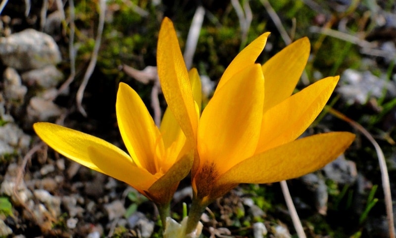
Vegetation of the Pamir.
Altitudinal zonality in the Pamir mountains is expressed differently in the western and eastern parts. In the Western Pamir, the spectrum of altitudinal zoning is wide, but not very visible due to the lack of forest, meadow, and steppe altitudinal zones typical of the mountains of Central Asia.
The woody vegetation here is very sparse and poor in species. On stony slopes and ancient moraines there are rare thickets of juniper, which (like willow) rises in the mountains above other trees. Along the banks of rivers and streams grow poplar, birch, willow, which form groves here.
Desert, mostly wilderness, vegetation of the valleys passes on the slopes into semi-desert, mountain xerophytic and mountain steppe, in the lower parts of the slopes into subtropical high grass. The bottoms of valleys and hollows here are occupied by a high-mountain desert with rare, almost invisible plants against the background of bare stones and rubble, which form pillows of grass and moss, dense and similar in appearance to stones.
V.I. Grubov (1959) believes that the nature of the East Pamir is close to Tibetan, and relates the East Pamir to the Tibetan botanical-geographical province. Desert teresken are common at altitudes from 3500 to 4100 4200 meters above sea level. At the same altitudes, with better wetting, wormwood deserts and rare grasses of high mountain steppes (on fine earth) from fescue, eastern feather grass, etc. develop.
Other desert and rare grasses and steppe formations are more common.
The fauna of the Pamir.
Especially the high-mountain deserts of its eastern part, is not rich, but it is peculiar and has much in common with Tibet and the sytens of the Tien-Shan. In the Pamir, the mountain sheep argali, the long-tailed Marmot, the red pika, the Pamir hare live. At home, bred yaks – Kutas.
This is a very valuable animal, giving a lot to a person who constantly lives in the mountains of the Pamirs. Kutas milk is twice as fat as cow's, and butter, cottage cheese, and cheese are made from it. Felt for yurts from wool, weave rough cloth, etc.
In addition, it is well adapted to high altitude pack animals. Of the birds in the Pamir, there are Tibetan Ular, Tibetan Saja, sickleak, Tibetan raven and lark, snow Himalayan vulture, mountain, or Indian goose.
Mineral wealth of the Pamir.
Is gold (Darvaz, East Pamir), ores of molybdenum, tungsten, of non-metallic ones - asbestos, mica, lapis lazuli, rock crystal, coal, healing mineral springs, including thermal ones (Garm-Chashma, etc.). The hydroelectric power station on the Gunt River supplies electricity to the city of Khorog, and in total 7 hydroelectric power stations are already operating in the Pamir.
Surveys are underway for hydropower use of the Panj River, which is supposed to create a cascade of hydroelectric power stations. The rivers flowing from the Pamir mountains are of great importance for irrigation. First of all, it should be borne in mind the Amu Darya itself with the oases in its lower reaches and the Kayrakkum canal named after Lenin.
Significant pasture resources of the Pamir. The seasonal use of pastures is different, summer prevails in the Western Pamirs, winter pastures are also common in the Eastern Pamir. The pastures of both the Western and Eastern Pamir require measures to improve them (Agahanyants, 1966; Gvozdetsky, 1968).
Thanks to its southern position and continental climate in the Pamir mountains, agriculture rises higher than anywhere else. The vine in the Western Pamirs is cultivated to an altitude of about 2000 m. a. s. l. (i.e., approximately to the height of the upper border of the forest in the mountains of the Caucasus).
Apricot in Tajikistan rises to an altitude of 2700 m. a. s. l. (i.e., almost to the height of the snow line in the Western Caucasus). Barley and peas in the Western Pamirs (Shugnan) ripen at heights of up to 3,500 m. a. s. l. Most of the population is concentrated in mountain valleys.
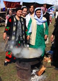
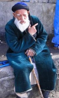
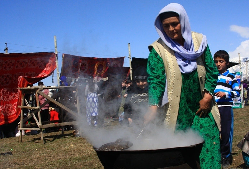
In the western part of the Pamirs mountain Tajiks mainly live: Vakhans, Ishkashim, Shugnans, Rushans, Yazgulemts, Vanchians. The eastern part of the Pamir is less frequently populated, mainly by the Kyrgyz. The main occupation of the inhabitants is mining and cattle breeding.
In the capital of the Gorno-Badakhshan Autonomous Region, the city of Khorog, there is the Pamir Botanical Garden of the Academy of Sciences of Tajikistan, conducting research general scientific and applied nature. It is located at an altitude of 2320 m. a. s. l. and is the highest mountain botanical garden in Central Asia.
In the Eastern Pamir, not far from Murghab, there is a high-mountain Pamir biological station of the same academy, conducting work on the study of Pamir vegetation, plant physiology and ecology in high mountains (the station is located at an altitude of 3860 m. a. s. l.), conducting experiments on the creation of fodder and agricultural bases of the Eastern Pamir.
The Pamir is the clearest example of a high continental highland. Thanks to the laying of automobile roads to the center of the Gorno-Badakhshan Autonomous Region, the city of Khorog and the development of air communications, the Pamir lost its former inaccessibility.
Its peculiar nature is more and more fully explored and mastered by man for economic needs.


Authority:
Series Nature is the world. "The mountains". N A. Gvozdetsky, Yu.N. Golubchikov. Moscow "Thought". 1987.
Photos by:
Alexander Petrov.