


![]()
You are here
Medieval Kesh.


History of Kesh
"The garden is blooming, a friend and a bowl of wine -
Here is my paradise. I do not want to find myself in a different way.
Yes, no one saw the heavenly paradise!
So for now we will be comforted in the earthly"
Omar Khayyam.
City guide to Shakhrisabz.
The medieval Kesh was located in the eastern foothill part of the valley, in the upper course of the Kashkadarya and its tributaries. Currently, in the territory of medieval Kesh and its regions there are Guzar, Dehkanabad, Kamashinsky, Kitabsky, Chirakchi, Shakhrisabz and Yakkabag districts of the Kashkadarya region of Uzbekistan.
Archaeological research in this area was carried out by the staff of the Kesh archeological and topographic expedition of the Tashkent State University under the leadership of M. E. Masson. There is a special work by S. B. Lunin on the historical geography of Southern Sogd VIII-XII century.
Studies in the eastern part of the Kashkadarya valley were also carried out by S. K. Kabanov, V. D. Zhukov, G. Ya. Dresvyanskaya, 3. I. Usmanova, A. S. Sagdullaev, N. I. Krasheninnikova, N. P. Stolyarova, P. Niyazov, E. Bakhshitsyan, O. N. Lushpenko and others.
At one time, V. Tomashek located in the eastern part of the Kashkadarya valley the “Sogdian land” of ancient sources, and his opinion was supported by a number of researchers and others. M. Ye. Masson identified the settlement of Yerkurgan, located in the lower reaches of the Kashkadarya River, with the capital of the Nautaka region.
In Chinese sources, Kesh is mentioned under various names. Thus, in the “History of the Elder House of Han” (206 BC-25 AD), the city of Kesh is referred to as the city of Sousse or Suche, which was the capital of the ownership of the Small Kangyu king.
In the Chinese chronicle "Beishi" (386-618) this possession is called - Shy or Shi. Its ruler by the name of Di-jae was the most influential and powerful in Sogd and was the first to establish diplomatic ties with China during the reign of Emperor Da-ie (605-616).
During the reign of Di-jae, the city of Ki-shek was built, i.e. Kesh. In his possession included 500 cities, each of which was surrounded by stone walls. According to another Chinese chronicle - "Tanshu" (618-907), after the administrative reform carried out by the Chinese authorities in 658-659, the possession of Shy was transformed into Kyu-sha or Kyo-shuan-an district, which also included the neighboring possession of Na-She-bo, i.e. Nahshab. In the VII century.
In Kesh there was a temple, the deity of which soldiers came to worship before each military campaign, and each time they sacrificed a thousand ram. From these data it follows that at the beginning of the VIIth century, and perhaps even earlier, Kesh was a fairly strong possession, the power of the ruler of this possession extended to the entire valley of Kashkadarya and in its power surpassed even the rulers of Samarkand.
The rise of Samarkand began only after the administrative reform carried out by the Chinese in 658-659. In the IX century. in the literary tradition there was information that Kesh in the past was the capital of all Sogd. The elevation of Kesh supposedly began in the era of the Chinese Jin dynasty (265-419), after the capital Canton was moved here from the Seven Rivers.
VV Barthold believed that the name Sousse, mentioned in Chinese sources, can convey the ancient name Sogd-Sugit. The local population living in the Shakhrisabz region is familiar with the word “sugudi”, meaning “resident of Sugud”, but this is not the name of the nationality - Sogdians.
The same term is found in modern toponymy of Tajikistan with the meaning “cultivated area abound with running water”. According to O. I. Smirnova, the name “Sugud” basically means “Country of fertile valleys”. The name “Sugud” is also associated with the ancient Iranian word “suhta” (purified by fire), which means “Holy Land”.
There is an opinion that the city received the name “Kesh” at the beginning of the VIIth century. during the period of the rise of the ruler by the name of T-chjo, who, according to Chinese sources, built the city of K-shi, ie, Kesh. However, the city of Kesh in the form of "Kas" is mentioned much earlier, in the III.
AD During the reign of the Sasanian king Shapur I (243-273.) In 262 AD A list of countries and peoples was compiled in three languages - Parthian, Middle Persian and Greek. The list refers to the city of Kas in the country of Sogdiken, which is identified with Kesh.
In the V century. Kesh was ruled by Ephtalits, and in VI - VII centuries. here dominated the Turks. According to Arabic-speaking sources, in pre-Islamic times, the kings of Kesh wore the title "nidun". However, this title is not fixed on pre-Islamic Kesh coins.
In V-VI centuries. In Kesh, there were coins with the image of a standing archer and the head of a ruler with a Sogdian inscription, which reads “Turk” or “Turak”. Among the so-called Turkic-Sogdian coins VII-VIII The centuries in circulation in Sughd are distinguished by one group of coins depicting a ruler with Turkic features and an inscription “Turak Ruler” or “Turan Ruler”.
The first Sogdian coins with the title of the supreme king - “ihshida” Sogd, belonged to a ruler named Shishpyr, who lived in the first half of the VIIth century. This ruler, whose name is known only by coin, is identified with the king of Kesh by the name of Shashebi or Shasebi, which is mentioned in Chinese sources.
In 642 he sent an embassy with gifts to the Chinese emperor. After the administrative reform carried out by the Chinese authorities in 658-659, the right to issue coins in Sogd with a high royal title passes into the hands of the rulers of Samarkand.
On the coins of Kesh, which were in circulation in the second half of VII. or at the beginning of the eighth century. given the name of another king Kesh - Ahurpata. This ruler is identified with the king of Kesh by the name of Ahubido, who sent an embassy to China in 727, or with another king of Kesh by the name of Shi Ahe (Shir Ahur), who ascended the throne in 658-659.
It should be noted that the three-pointed sign “tamga” on the Kesh coins has a close resemblance to the signs on the coins of Khorezm and Northern Tokharistan and Usrushany of the same time. Thus, all these data allow us to suggest that in the VIth – VIIIth centuries, and perhaps even earlier, in Kesh, Sogdian dynasty was of Turkic origin.
In Muslim time sources, Kesh is mentioned in the form of Kiss or Kiss. According to Yakuta, in the XI century. among the locals was in use pronunciation Kiss. However, al-Sam'ani, who in the first half of the XII century. spent twelve days in Kesh, notes that the Kashsh pronunciation was common here.
According to Yakut, Kiss is the Arabized form of the name of the city, Beruni calls Kash - the local form of pronunciation, and Kas Persian. Only one local form, Kish, is given in the “Hudud al-alam”. V. V. Barthold, based on the Chinese transcriptions of the name of the city, believed that the local pronunciation was Kesh.
This is also confirmed by the Sogdian documents (from Mount Mug) found in Tajikistan, one of which mentions the word “Keshi”, i.e. "Residents of Kesh". On the first coins of the ruler Kesh - Ikhrid, issued on the model of Arabic coins in the middle of the VIII century, the name of the city Kesh is given in the form of Kish.
The word “porridge” or “kush” is a geographical term that is widespread in Central Asia, and is contained in the name of many, not only ancient and medieval, but also modern toponyms. This term is used in the meaning of “elevation into which the river rests and, bending around it, is divided into two channels”.
The same term seems to underlie the name of the river Kashkrud, which in Sogdian means “river Kesha”. The modern name - Kashkadarya is the Turkic form of the same name. The ancient and early medieval Kesh was located on the site of the town of Kitab and occupied an area of about 40 hectares.
The citadel of the ancient city (Sousse, according to Chinese sources) corresponds to the site of ancient settlement Calandartepa, which covers an area of one hectare. According to local legend, the city of Kitab was founded by the first Achaemenid king of ancient Iran named Kayumars, the reign of which dates back to the last centuries of the 1st millennium BC.
The oldest layers in the territory of Calandartep belong to the IIIrd-IInd centuries. BC. Therefore, this city did not exist in the era of Alexander the Great (IV c. BC O.) and could not be the administrative center of the region in the eastern part of the valley of Kashkadarya, which is mentioned in ancient sources called Nautaka.
Not far from the Kitab in the foothills of the Zarafshan Range are the ruins of the huge fortress Uzunkir occupying an area of 70 hectares and built in the VIII-VII centuries. BC e. (It is assumed that the ancient administrative center of the Nautaka region, mentioned in ancient sources, was located here.
Subsequently, this capital center moved to the south, to the place of Kitab, where from III-II century BC it developed The ancient city of Sousse and the early medieval Kesh. Uzunkir, which could accommodate the entire army of the retreating Sogdians.
From the Shurob ferry on the Amu Darya to the Uzunkir fortress - 240 km, which was eight days for the medieval caravans. stops for four days. Bess himself probably took refuge in a small fortress Sangirtepa (2 hectares), located 650 meters south of Uzunkir, where the residence of the local ruler was located.
In the early Middle Ages, the center of urban life moved to the west of Kalandartepa, where at that time the fortress of the ruler Kesh was erected, the remains of which are known as “Kurgan”. In Muslim time sources, the first mention of Kesh is contained according to ancient sources, in one of the fortresses of the Nautak region, the warriors of Alexander the Great captured the leader of the Sogdians, Bess.
The fortress was located at a distance of ten days from the Amu Darya, but a detachment of Macedonian warriors walked this distance in four days. It is assumed that this fortress was located on the site of Kitab or in the area of Shahrisabz. In our opinion, it is more likely that the capture of Bess occurred precisely in the al-Tabari fortress, when describing an uprising led by Mukanna.
In the IX century. al-Ya'kubi calls Kesh "the main city of Sogd", and Ibn al-Faqih - "a city in the Samarkand region". At the end of X century. Al-Mukaddasi classifies Kesh to the region of Bukhara. Arab geographers of the Xth century provide some information on the historical topography of Kesh of the time.
The most detailed description of the city is contained in the work of Ibn Hawqal, whose information has been repeatedly attracted by researchers and others. According to him, the city of Kish in the X century. consisted of “kukhandiz” “hisna” and “rabad”, i.e. citadel, fortress and suburb. In addition, there was another city (madina), which came into contact with Rabad.
The inner city with a kitchenette lay in ruins, and the outer city was inhabited. “Dar al-Imara”, i.e. The government house was located outside the city, and the rabad was located in the al-Musallah area. The prison and the mosque were located in a ruined inner city, and the bazaars were in rabad.
The size of the city was one third of the Farsach. All the buildings of the city were built of clay and wood. In the wall of the inner city there were four gates, which were called: Bab al-Hadid - the Iron Gate, Bab 'Ubaidallah - that is, Ubaidallah Gate, Bab al-Kassarin - Gatekeeper of the Sweepers, Bab al-Madina ad-Dahil - Gateway of the Inner City.
Within the walls of the outer city there were two gates: Bab al-Madina ad-Dahil - that is, the Gate of the Inner City, Bab Barknan - the Gate of Barknan. The last gate was called so by the name of the village, located near Kesh.
Not far from the city gates Kesh flowed two rivers, one of which was called Nahr al-Kassarin - the River of Sweepers.
She took the beginning of the mountains Siyam and flowed near the southern gate Kesha. The second river was called Nahr Asrud -, which flowed from the Kashkrud rustaka - and flowed near the northern city gate Kesh. In the city and in its rabad running water was abundant and beautiful gardens were bred.
In Kesh, there was a very hot climate, thanks to which here earlier than in other areas of Maveirainahra, fruit ripened and delivered to the markets of Bukhara. According to al-Mukaddasi, the city of Kesh consisted of “kukhandiz”, “madina”, “internal slave” and in contact with him “external slave”, that is, from the citadel, the city itself and the internal and external suburbs.
Kukhandiz was in the inner city and lay in ruins. The mosque Kesh was located in the inner city and was considered the most beautiful in Sogd after Samarkand. Thus, from information sources it is clear that in the X century. The city of Kesh consisted of four parts, which were located nearby and directly adjoined to each other.
The ruined inner city and the kuhandiz are localized quite precisely on the site of Calandartep and the antique city in the territory of Kitab. As for the other two parts of the medieval Kesh, the rabad and the outer city, the opinions of scholars differ in determining their location.
So, V. V. Barthold believed that the “outer city” was a two-gate rabad. S.K. Kabanov believed that the outer city of Kesh was located on the site of the modern Shahrisabz. This opinion is shared by some other researchers. However, M. Ye. Masson believed that a settlement on the site of Shakhrisabz did not arise earlier than the XIIIth century.
There is also an opinion that the early medieval Kesh was located on the site of Shakhrisabz, and the second suburb or the outer city was called Kitab-Musall. Of the four gates of the inner city, V. Bartold localized only the Bab al-Kassarin gate in the southern side, where the river Nahr al-Kassarin flowed, i.e. Aksudarya.
When listing the city gate Kesh in the sources behind the gate Bab al-Kassarin, follow the gate Bab al-Madin ad-Dahil, i.e. Gate of the inner city. According to the same sources, one of the two gates in the wall of the outer city of Kesh was also called the Gate of the Inner City or the Gate of the Outer City. V. V. Barthold considered al-Mukaddasi's information more accurate.
In our opinion, the “outer city” or “outer rabad” Kesh was directly in contact with the “inner city” and “inner rabad”, as indicated in the sources. Approximately it could be located in the region of the early medieval Kesh, which arose to the west and south-west of the ancient inner city, i.e. in the area where the ruins of the Kurgan fortress are located.
Consequently, the gates located in the wall of the inner city of Kesh were western or southwestern. In this case, it turns out that the gates of the inner city of Kesh are listed in the sources in a clockwise sequence. Thus, the Iron Gate should be localized on the north side, and the Ubaidaldah Gate on the east side.
The government house, apparently, was located in the outer city, somewhere near the Kurgan fortress, outside the inner city of Kesh. The second gate of the outer city - Barknansky, apparently, was in the southwestern side and went on the caravan route leading to Termez.
The al-Musallah area, in which Rabad Kesh was located, was located south of this gate on the road to Shahrisabz, where even in ancient times was located the quarter of potters-artisans. Here, outside the inner and outer city in the IXth - Xth centuries, there apparently was a suburban mosque for festive prayers - ad-musallah or namozgoh. In the X century.
The center of city life with bazaars has also moved here. In the XI - XII century. the city moves further south-west along the caravan route to the place of Shahri-sabz, where, in the early Middle Ages, the trade and craft city of Kesh began to take shape.
Some researchers took it for the outer city of Kesh, which is referred to by sources in the 10th century. It is believed that the city existed on the Kitab site until the end of the 8th century, and then was abandoned. However, this contradicts the data of some sources.
In the X century. a prison and a mosque were still functioning on the territory of the inner city, which was considered one of the most beautiful in Sogd. Life here continued in the first half of the tenth century, since al-Istahri points to the parallel existence of the internal and external city of Kesh.
In Khudood al-'alam, which was compiled in the last quarter of the 10th century. It also speaks of the “kukhaniz” and “shakhristan”, that is, the citadel and the inner city, as functioning parts of the city. Only Ibn Hawqal and al-Mukaddasi report that the “kuhaniz” and the “inner city” were destroyed.
According to archaeological data, the northern part of Calandartepa was settled in the second half of the VIII-IX centuries. On the territory of the citadel there are also traces of life in the XII - beginning of the XIII centuries. - XI century, what S. Kabanov pointed out in his time. I
n any case, no doubt, that in the X century. this territory was still an integral part of the city of Kesh and here was one of the most important parts of the Muslim city - the cathedral mosque. There is an opinion that the “outer city” of Kesh in the X century.
It was located on the site of Shakhrisabz, and the administrative center of Kesh with the residence of the ruler and the namozgoh mosque is located in the al-Musallah area, which is located in one of the ancient settlements located to the west or south-west of Shahrisabz.
However, this contradicts the data sources, according to which the outer city of Kesh in the X century. had two gates. According to archaeological data, the city that existed on the site of Shakhrisabz, in the 9th-10th centuries. still did not have a fortress wall. It was built here only in the XIV century. Temur.
Consequently, this city could not have in the X century. urban spores mentioned by sources. True, there is an indication of Hafiz-i Abru, who notes that when Temur began construction of the fortress wall, there are still remnants of the “old fortress wall” Kesh.
This "old wall" could be built in the XI-XII centuries. under the Karakhanids, when many monumental buildings were erected on the territory of Shahrisabz. Thus, in the X century. the city that existed on the site of Shakhrisabz did not yet have a fortress wall, and consequently, two gates, which are mentioned by sources.
In addition, if the administrative center of Kesh was located in the Shakhrisabz district, then it would be seven to eight km from the mosque, which is unlikely. In the Middle Ages, the cathedral mosque occupied a central place in the life of a Muslim city and, as a rule, was located not far from the administrative center.
In our opinion, all four components of medieval Kesh were located side by side and touched each other, as indicated in the sources. If the inner city of Kesh in the X century. was located on the Kitab site, the outer city could not be located on the site of Shakhrisabz, which is contradicted by the sources.
The sources indicate that the size of the city of Kesh in the X century. amounted to about a third of the Farsach (57, p. 324), which is about 2.5 km. M. Ye. Masson proposed to read instead of the “third of the Farsakh” - “the three Farsakhs” and refer these dimensions to the territory inside the late medieval wall of Chim, which surrounded all the cultural lands around Shahrisabz and Kitab (497, p. 29).
However, such a reading cannot be accepted, since the word "farces" in the text is given in the singular, and the figure - in the masculine gender. Therefore, according to the rules of Arabic grammar, only reading “one third of the Farsah” is possible here.
Based on these data, the area of the city was estimated at 400 hectares and was considered greatly exaggerated. But the size of the city will not be so great, if we take this figure, that is, “a third of the Farsach”, only to the length of the city.
There is no direct indication in the sources that the value refers to each of the sides of the city, as was accepted by researchers when calculating the area of the city.
Consequently, the city could be stretched to the south-west from Kitab for a distance of about 2.5 km along the caravan route, which led to Shahrisabz and further to Termez. At the same time, he had a small width. The city that existed on the site of Shakhrisabz in the IXth-XIIth centuries was also stretched along the same road, which was also its main street.
The distance between Shahrisabz and Kitab is five to six km. If the city of Kesh in the X century. was stretched for 2.5 km, then the southern outskirts of his rabad was already three to four km from Shahrisabz. Therefore, it is likely that in the following centuries, the trade and craft rabad Kesh could merge with another trade and craft town satellite Kesh, which was located on the site of Shahrisabz.
In the XI - XII century. here the center of the city life Kesh gradually moves and a new cathedral mosque is being built. In the XII century. Al-Sam'ani calls Kesh “a small town”, and in another part of his work - “a village near Samarkand”.
Perhaps in the first case he was referring to the city of Kesh, which in the XII century was located on the site of Shakhrisabz.
It is here, apparently, that the “Kesh madrasah”, which is mentioned by al-Sam'ani, was located. As for the “village of Kesh”, he, here, obviously, Al-Sam'ani meant the settlement that existed at the site of Kalandartep in Kitab in the XII century.
According to Ibn Hawkal, the Barknan Gate of the outer city of Kesh was so named after the village Barknan.
From this it follows that Barknan was a rather significant point located on the caravan route, to which in the Middle Ages, as a rule, the main city gates went out. V.V. Barthold believed that the village of Barknan was directly adjacent to the city.
The Barknan gates of the “outer city” Kesh went south-west to the trade route leading to Nasaf and Termez. The nearest significant settlement on this road in the IXth-Xth centuries. there was a city that existed on the site of Shahrisabz.
Here, near Shakhrisabz, the caravan drink was divided in two directions: one went south towards Termez, and the second - south-west - towards Nasaf. was a satellite town of Kesh.
At the beginning of the XX century. The northern gates of Shakhrisabz were called the “Gate of the Kitab” or “The Gate of the Arch,” that is, the citadel. In the X century. here, of course, there was no gate, so Ibn Haukal calls it a “village”. The first settlement on the site of Shakhrisabz-Barknan was formed in the 5th-6th centuries, the core of which was Balandtepa Hill or Zindontep Hill, located 300 meters north of Shahrisabz.
At this time there was a fortified castle of the local ruler, in which there was a Zoroastrian temple. In the XIX century. here they worshiped cults of the Zoroastrian religion and on the day of “Nauruz” - the sacred holiday of Zoroastrians, here mass celebrations were held annually.
Around the castle was located unfortified settlement, which in the VII-VIII century. grows, and in the IX-X century. transformed into a significant trade and craft center. In the XI-XII century. here the center of urban life is gradually moving from Rabad Kesh. In the XII century.
The city, apparently, became known as Keshem, and the name Barknan fell out of use or was attached to one of its quarters. During the Mongol invasion, the city was not damaged, since its inhabitants did not resist the conquerors. In the thirteenth century It developed as a Mongolian city and continued to be called Kesh.
This is evidenced by the numerous remains of buildings of that time. In the XIV century. The city was surrounded by walls and turned into a major metropolitan center. Many of the monumental buildings of Shakhrisabz in the time of Temur were erected on the site of more ancient buildings of the IXth-XIIth centuries.
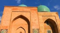
Thus, at the base of the Kok Gumbaz mosque, the foundations of an earlier mosque that functioned in the XIth - XIIth centuries were revealed. It is assumed that Kok Gumbaz accurately repeats the layout of the former mosque building. Apparently, the new cathedral mosque Kesh was built in the XI century. under the Karakhanids it was here, after which the center of city life Kesh moved to Shahrisabz.


Authority:
"Historical geography of the Southern Sogd and Tokharistan by Arabic-speaking sources of the 9th - early 13th centuries." Sh.S. Kamaliddinov.
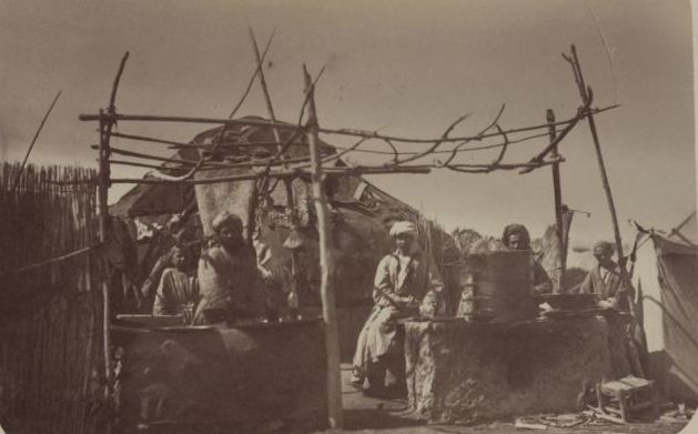
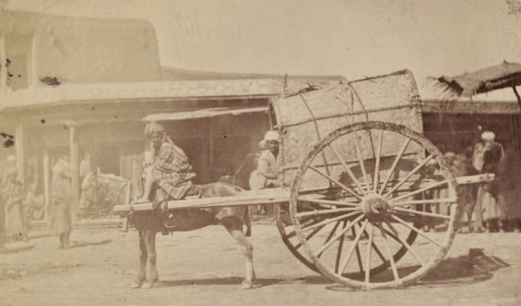
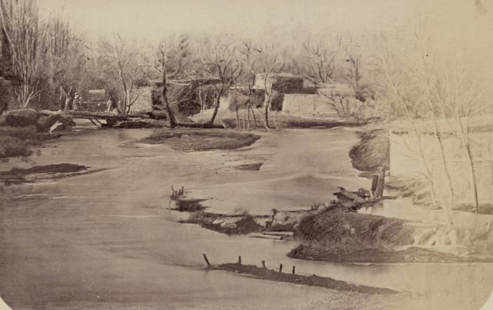
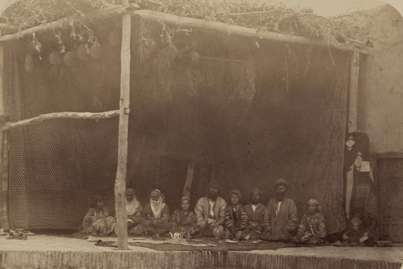
Photos by:
from Turkestan album. Published in 1872 in St. Petersburg, by order of the first Tashkent Governor-General Konstantin Petrovich von Kaufman. The album included four parts: the archaeological (two volumes), the ethnographic (two volumes), the crafts of the peoples of Central Asia (the trade) and the historical part. The number of photos is more than 1200. Compiled by A. L. Kuhn (1871 - 1872). The collection of materials for a multi-volume publication for more than two years was carried out in the military topographic department of Tashkent, where lithographic parts of each plate were printed. A complete set of all volumes and parts of this book is stored today only in three collections: in the National Library of Uzbekistan in Tashkent, in the V. Lenin State Library in Moscow and in the Library of the US Congress in Washington. Each of the six volumes of the Turkestan Album is a huge folio, upholstered in green leather, 45 by 60 centimeters in size. Each page of the publication contains from one to eight photos, made with the technology of albumen printing (based on egg white). In 2007, the National Library of Congress completed the full digitization of all pages of the Turkestan Album.