





You are here
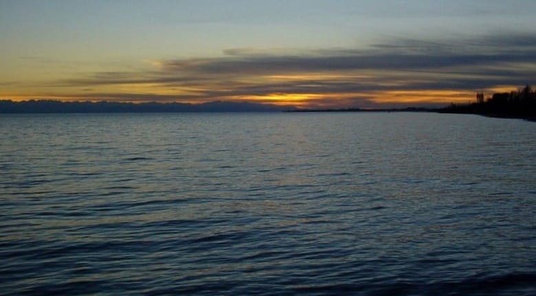
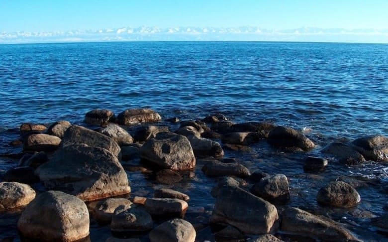
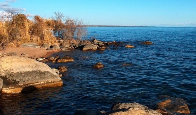
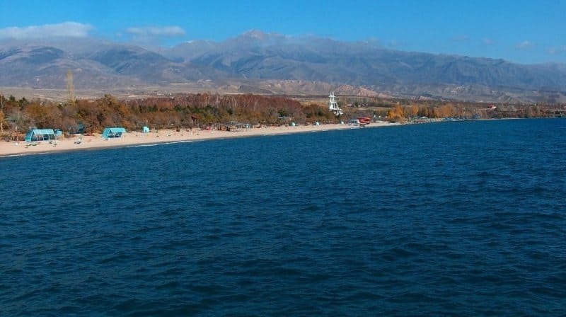
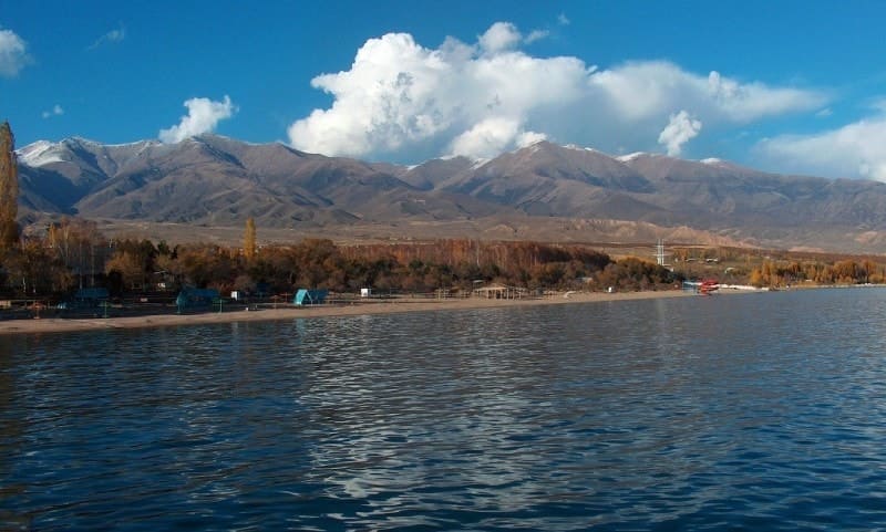
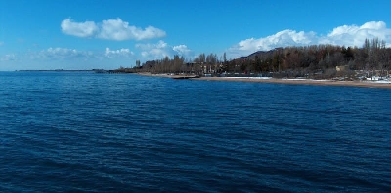
Lake Issyk-Kul.

Trip on lake Issyk-Kul.
"From east to west it is very long, from south to north it is short. It is surrounded by mountains on all four sides, and many streams gather in it. Its water is greenish-black, and its taste is at once salty and bitter. Sometimes it is calm, sometimes it is turbulent. Dragons and fish live in it together…"
Syan Zang's major historical and geographical work, "Records of the Western Countries (During the Great Tang Dynasty)." Work on this book was completed in 646 (some sources mention the final edition in 648), shortly after the monk's return from his 17-year pilgrimage to India. The journey through the Lake Issyk-Kul region itself took place much earlier, around 630.
Visiting Lake Issyk-Kul.
"Issyk-Kul" means "warm lake" in Kyrgyz. The lake has also had other names, such as "Tuz-Kul" meaning "salt lake"; the water contains salts of sodium, potassium, calcium, magnesium, silicon, chlorine, iron, and radon, giving it healing properties.
The origin of the word "Issyk-Kul" is related to the Mongol presence in the area around the lake. Another name for the lake is Timur-tu-Nor, meaning "containing iron." Deposits of magnetic iron sand were found on the lake's shores, and the layer of these deposits often reached up to a meter.
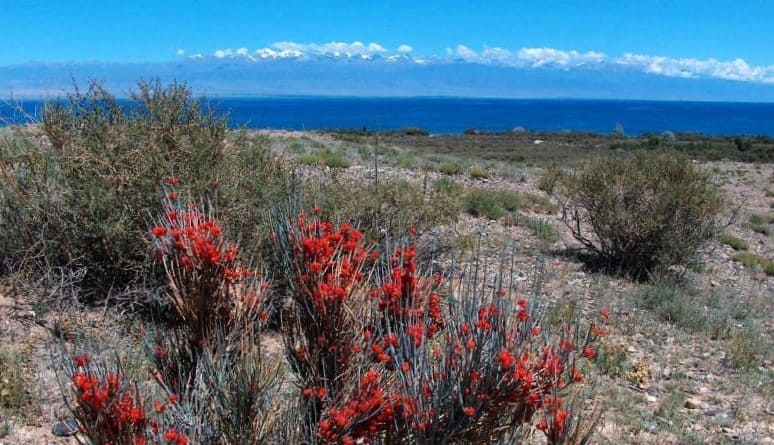
Another poetic name for the lake is Jit-Kul, meaning "fragrant lake." This old Kyrgyz name derives from the fact that the Issyk-Kul basin was once a blooming garden. About 80 rivers flow into Issyk-Kul, but not a single stream flows out. But its water level is steadily declining because the lake is located in a zone of insufficient moisture and exceptionally high solar activity-the number of clear days here is much higher than on the Black Sea coast.
Evaporation removes nearly 2,000 cubic meters of water from the lake's surface annually. Over the past hundred years, the water level of Issyk-Kul has dropped by at least seven meters, the shore is retreating, and new bays, coves, peninsulas, and shallows are emerging.
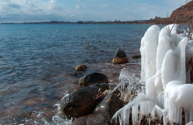
Lake Issyk-Kul occupies a tectonic depression; its maximum depth is 702 meters, located near the village of Kadji-Sai on the southern shore of Issyk-Kul. The average depth is 278 meters. Due to its colossal volume of water (1.7 times greater than that of the Aral Sea) and its greater depth, Issyk-Kul does not freeze in winter; only in shallow waters in some places along the western shore of the lake does a thin ice cover appear in midwinter. Issyk-Kul's water is brackish. The lake is navigable, with boats sailing from Balykchy (Rybachye), the railway terminus, to the Karakol pier.
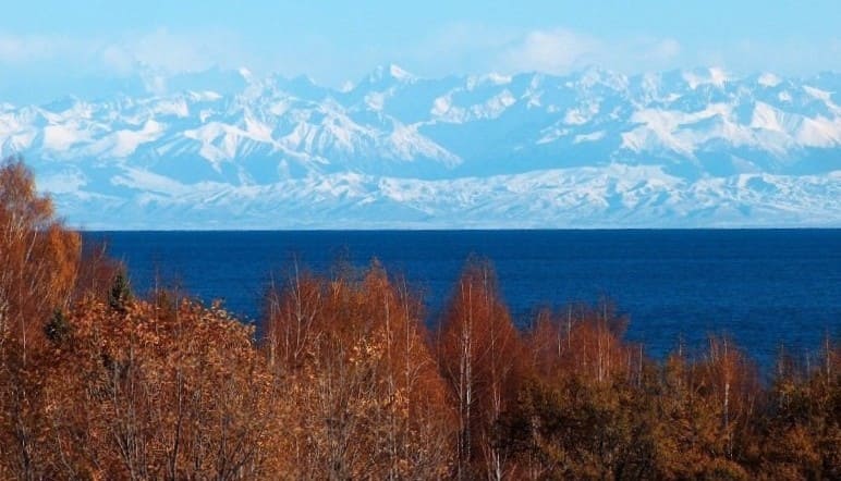
The lake's water level is falling, dropping by 7 cm per year (7 meters over the past 100 years). This falling water level leads to increased salinity, lower groundwater levels, and desertification of the basin. Surrounded by snow-capped ridges, the lake never freezes over, and even in the coldest winter months, it remains free of ice.
In summer, strong winds stir the lake's water, warming it to great depths. In winter, its waters, also cooling evenly, do not release the heat required for ice formation. More than 50 large and small rivers flow into Issyk-Kul, but not a single one flows out of the lake.
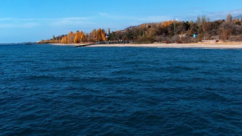
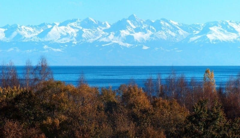
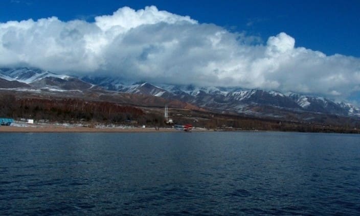
Due to its lack of an outlet, the lake's water, although very clear, is brackish and undrinkable. The lake is bordered to the south by Terskey Ala-Too ("Facing Away from the Sun"), and to the north by Kungey Ala-Too ("Facing Towards the Sun").
The lake is located at an altitude of 1,609 meters above sea level. In terms of depth, Issyk-Kul is second only to Lake Baikal and the Caspian Sea in Eurasia. It contains twice as much water as the Aral Sea, although its surface area is 10 times smaller.
Lake Issyk-Kul and its basin are a favorable location for the construction of resorts, sanatoriums, rest homes, pioneer and tourist camps, etc. The Terskey Ala-Too Mountains are home to numerous hot mineral springs, located in the gorges of Dzhuuk, Chon Kyzyl-Su, Jety-Oguz, Altyn-Arashan, Ak-Su, Boz-Uchuk, and others.
Interestingly, these numerous hot springs, scattered in the mountain crevices, have been used by people for a long time. In mid-June 1857, P. P. Semenov-Tyan-Shansky's detachment made a stop at the site where the "Blue Issyk-Kul" sanatorium now stands.
A note about this was preserved in the traveler's diary:
"Huge carp glittered in the sun with their beautiful scales and splashed in the large pool." "We had large quantities of fish on the very surface of the water, getting tangled in the dense thickets of aquatic plants. We had no fishing gear with us, but the Cossacks, entering the water, grabbed their sabers and, drawing them, began to chop down the fish entangled in the algae and splashing on the surface.
This improvised fishing method yielded us up to 11 poods of fish in two hours..."
P.P. Semenov-Tyan-Shansky was the first scientist to be interested in the origin and fluctuations of Lake Issyk-Kul in historical and prehistoric perspectives. It has been established that the endorheic Lake Issyk-Kul-a reservoir of tectonic origin-is located in the Northern Tien-Shan mountain system at the bottom of a vast intermontane basin, bounded to the north by the Kungei Ala-Too range and to the south by the Terskey Ala-Too range.
The Lake Issyk-Kul basin covers an area of 22,080 square kilometers, of which the lake itself accounts for 6,236 square kilometers. The maximum length of the lake is 179 kilometers; width 60 kilometers; shoreline length 662 kilometers; maximum depth 702 meters; average depth 280 meters.
The lake is replenished with water by precipitation, underground inflow, and runoff from rivers and streams, with a total annual volume of approximately 3,720 million cubic tons. The largest rivers are the Jergalan, with a total surface runoff of 28.4 meters cubic per second, and the Tyup, with 12.1 meters cubic per second.
The rivers, in turn, are replenished by water from glaciers. The Issyk-Kul Basin contains 834 glaciers, covering an area of 650.4 square kilometers, accumulating up to 48 cubic kilometers. Freshwater, most of which is located in the Terskey Ala-Too Ridge (510.1 square kilometers).
Overall, the lake's water balance is derived from precipitation, surface inflow, and groundwater, while its water balance is derived from evaporation and irreversible losses due to irrigation. A characteristic feature of the bottom topography of Lake Issyk-Kul is its stepped structure: a deep-water plain and three terraces.
The plain is located at depths of 650-668 meters and occupies the central part of the lake, which is slightly shifted to the south. Its flat bottom transitions into a stepped slope, with the older terraces occupying the deeper areas. The youngest upper terrace complex includes the surface of the coastal shoal with depths of 30-50 m and the upper ring ledge, the base of which is located at depths of about 110 m.
Throughout the Pleistocene (700 thousand years ago), the lake level rose, reaching a maximum in the Upper Pleistocene, to an altitude of 1640 m above sea level, where its position was limited by the runoff through the Boom Gorge to the west.
During the Holocene, Issyk-Kul regressed to depths of 110 m, with some researchers suggesting level stabilization at depths of 100, 150, and 300 m, although underwater terraces have also been observed at depths of 6-8, 12-14, 18, 28, 38, 63, 83, and 110 m.
This drop to 100 m was likely the only major regression in Issyk-Kul's history during the Holocene (approximately 7,000 years ago); in more recent times, the amplitude of fluctuations was approximately 20 m. Over the past 3,000 years, the amplitude of the lake's level has been 340 m, assuming the Holocene age of the 100-meter regression is taken into account.
When the lake level dropped to 100-110 m, its area did not exceed 3,800-3,900 square kilometers. The average rate of change in the lake level was 8 cm/year. For comparison, in the 20th century, when regular level measurements became possible, the rate of decline from 1926 to 1975 averaged 4.7 cm/year.
Some researchers suggest that there have been at least two major drops in the lake's level in its history: the first to a depth of 110 m, the second to 70 m. Relatively smaller fluctuations in level were also observed in more recent times. Based on archaeological finds on the lakebed, it is generally accepted that in the VIIth-Ist centuries BC, the lake level was 8-10 m lower than it is today; in the XIIIth century AD, by 6 m; in the XVth century, by 4-2 m; and in the mid-XVIth century. – by 1.5 m.
In recent years, radiocarbon dating of lake sediments has yielded more accurate dates, helping to establish the chronology of lake level fluctuations. For example, the surface of silt sediments at a depth of up to 1 m has been dated to ages ranging from 9,950 ± 200 to 13,540 ± 400 years; at depths of 2 and 5 m, to 16,500 ± 700 and 18,600 ± 400 years.
Taking into account the dating of approximately 26,000 years for sediments at an altitude of 1,640 m, it can be concluded that the water level of Issyk-Kul was higher than its current level (1,640-610 m) 26,000 ± 10,000 years ago. A series of 1-radiocarbon dates (primarily from woody organic matter collected on the Halocene terrace and in the lake at depths of 5-6 m) indicate a time interval ranging from 700 ± 50 to 170 ± 60 years.
This suggests that 500-700 years ago, the water level of Lake Issyk-Kul was 2-5 m lower than today, and in the early to mid-XXth century, it was close to an absolute elevation of 1,620 m. Traces of the last short-term water level transgression of 1-1.5 m (1900-1910) are most clearly visible on the shores of the eastern part of the lake in the form of coastal ridges.
Thus, 1,000-1,500 years ago, the water level of Lake Issyk-Kul was lower than today. The depth of its Holocene regression, however, drops by 100 m. Many scientists associate long-term fluctuations in the Issyk-Kul lake level with climate change.
A.V. Shnitnikov sees a connection between the water levels of lakes in Central Asia and Kazakhstan and the moisture content of their basins. According to V.M. Bukin, climate aridization in the first half of the Early Pleistocene caused a profound regression of the lake, resulting in its shoreline being 260-270 m lower than today.
Towards the end of the Early Pleistocene, the climate became cooler, during which glaciers grew, and lake transgression developed. O.A. Pomortsev also links lake level fluctuations to climate in the modern era. Thus, from 1956 to 1977, a linear glacier retreat from 150 to 810 m was recorded, and on the Kara-Batkak glacier, the retreat ranged from 2.1 to 6.8 m/year.
An 80 mm increase in precipitation (30% of normal) at near-normal temperatures led to a significant enrichment of the lake with moisture at the beginning of the century (1896-1910), causing its water level to rise by 1 meter. The lake's water balance could have been positive in the XXth century only if the annual precipitation entering its basin had been 40 mm greater than the actual level.
V.V. Romanovsky considers several factors that may influence the water level of Lake Issyk-Kul. Despite increased precipitation from 1956 to 1982, the lake's level continued to decline, which may be due to two factors: increased evaporation and decreased river runoff into the lake due to irrigation water withdrawals.
The increase in evaporation may be caused by global warming. Analysis of air temperature measurements in Karakol showed that, beginning in the late 1930s, air temperatures have been trending upward, indicating that the climate in the basin is warming.
Against this backdrop, a trend toward increasing moisture deficit is also observed, with the exception of the eastern regions. Climate warming naturally causes increased evaporation from the lake's surface. From 1940 to 1959, the average annual evaporation was 814 mm, while from 1960 to 1979, it increased to 860 mm.
The current trend toward climate warming will increase river runoff due to glacier melt, but significant river water losses for agricultural and domestic purposes occur in the lake valley. Some of the withdrawn water reaches the lake in the eastern basin or is irretrievably carried beyond its boundaries.
Over the past 11 years (1984-1994), the lake level, having fluctuated by 24 cm, has practically stabilized. Regarding the significant and long-term fluctuations in the Issyk-Kul level in the distant past, V.V. Romanovsky agrees with Yu.V. Gerasimova and L.M. Smirnova on their hydrocratic nature.
History of connection between Chu River and Lake Issyk-Kul.
1. In the Upper Pleistocene (approximately 26,000 years ago), the absolute water level of Issyk-Kul was approximately 1,640 m. The Chu River flowed into the lake near the Ak-Olen tract.
2. At the Pleistocene-Holocene boundary, the central block of the lake basin subsided. The river became disconnected from the lake. The water level of Issyk-Kul was 110 m lower than today. Most of the Chu River's waters drained through the Boom Gorge, but one of its branches, the Kutmaldy Channel, whose course can still be traced today, connected with the lake.
3. Approximately 1,200 years ago, the water level of Lake Issyk-Kul reached an absolute height of 1,622-1,623 m, i.e., The height of the discharge threshold through the Boom Gorge.
4. As a result of tectonic movement or deep erosion of this threshold, the water level of Lake Issyk-Kul dropped, and a separate reservoir formed near the modern village of Kok-Moinok. The waters of the Chu River, which fed this reservoir, partially flowed into the Boom Gorge and partially fed the lake through a system of channels.
5. As a result of the further lowering of the threshold, the Kok-Moinok reservoir disappeared, and the Chu River flowed directly into the Boom Gorge.
6. The loss of a significant portion of the Chu River's flow caused a drop in the lake level.
7. The humid climate from the XIIth to the XIXth centuries AD caused a new rise in the lake level. During this period, the lake transgressed to an absolute height of 1818.5 m. At this height, a barrier formed, blocking the Kutmaldinskaya channel. 8. In the 19th century, the Kutmaldinskaya channel followed the southward-retreating riverbed, rejoining the old channel 3 km from the coastal embankment.
The new channel has a weak incision, suggesting only periodic flooding of the Chu River into Issyk-Kul. According to the author, only about 1,200 years ago did the Chu River completely drain Issyk-Kul. Subsequently, its connection to the lake was more of a formality.
Three main factors influence water level of Lake Issyk-Kul:
1) rising temperatures and decreased humidity in the basin;
2) severing the hydrographic connection between the Chu River and the lake;
3) water withdrawal for irrigation from the rivers feeding the lake.
With a further water level drop of 3 meters, the shallows of Tyup Bay near Cape Sukhoi Khrebet will shrink significantly. The bay itself will be bounded by the Tyup River Canyon. It is in these shallows that the most abundant fish species-chebak and whitefish-spawn.
To the west, in Rybachinsky Bay, due to the gentle slope of the coastal bottom, drainage will occur over a considerable distance. On the northern coast, where sands lie at depths of up to 20-30 meters, the drop in water level will be accompanied by accumulation of sand near the shore.
A lower water level will intensify the impact of anthropogenic pressures on the lake. Indirect signs of deteriorating water quality are already present. Hydrobiologists at the Issyk-Kul Biological Station have noted an increase in phytoplankton and microorganism abundance.
The drop in lake level is associated with a decrease in the amount of nutrients coming from littoral silts, thereby increasing the lake's biological productivity. As the level drops, the salinity of the lake's water increases slightly. In 1932, the salinity of Issyk-Kul's water was 5.82 g/L.
By 1984, it had increased to 5.9 g/L. During this period, the water level dropped by 2.5 meters, and the volume of water mass by 16 square kilometers. Thus, a further drop in the Issyk-Kul level will affect not only the climate in the basin but also the ecosystem of the lake itself.
However, in the 21st century, a trend toward a slow rise in the lake's water level has been observed. The scientific problem of the causes of transgression and regression has not yet been fully elucidated and awaits resolution.
Geographic coordinates of Lake Issyk-Kul are: N42°26'17 E77°09'30







Authority:
"Issyk-Kul. Naryn" Encyclopedia, Frunze, 1991. "Kirgizia," Mysl Publishing House, Moscow, 1977.
D. M. Mamatkanov. http://www.pokolenie.kg
Photos by:
Alexander Petrov.