


![]()
You are here
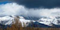
Kungei Ala-Too Range.

In Kungei Ala-Too Mountains Tours.
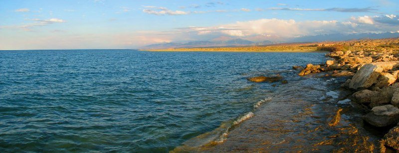
“It is difficult to imagine anything grander than the landscape that opens up for a traveler from Kungei-Alatau through a lake to the ridge of the Heavenly Mountains. The dark blue surface of Issyk-Kul can safely compete with the same blue surface of Lake Geneva, but the vastness of the reservoir, which "five times the area of Geneva, it seemed to me almost limitless. The incomparable grandeur of the background of the landscape gives it such grandeur that Lake Geneva does not have."
P.P. Semenov-Tian-Shansky.
Issyk-Kul lake private tour.
Kungei Ala-Too (“motley snowy mountains facing the sun”) begins in the Boom Gorge area in the west and stretches in the latitudinal direction, forming an arc facing the convex part to the north, ending in the east near the valley of the Karkara River.
The length of the ridge at the indicated boundaries in a straight line is 275 kilometers, the average height is 3700 meters above sea level. Kungei Ala-Too is a relatively narrow alpine chain. The width of the ridge in its highest part is 30 - 35 kilometers.
The maximum heights are in the Chotkal massif, Chotkal peak 4771 meters above sea level and in the middle part of the ridge, in the area adjacent to the powerful rise, extending to the northwest of the nodal peak Keminsky peak, 4643 meters above sea level towards the Zailiysky ridge Alatau and known as the Chiliko-Kemin jumper.
There are many beautiful peaks 4,500 - 4,600 meters above sea level and here the Zailiysky Alatau and Kungei Ala-Too ridges come together so that between their ridge lines the distance in a straight line is reduced to 8 kilometers.
The Chiliko-Kemin mountain dam is a watershed between the two largest rivers of the Northern Tien Shan - Chilik and Chong-Kemin.
The total area of glaciation of the Kungei-Ala-Too ridge exceeds 400 square kilometers, the number of glaciers is 427.
The icing of the northern slope (64%) significantly exceeds the glaciation of the southern, since more humid air masses are intercepted mainly by the Zailiysky Alatau. The rest falls in the form of precipitation on the northern slopes of Kungei-Ala-Too and only a small part on its southern slopes.
True, on the southern slopes of Kungei Ala-Too in the summer there are torrential rains that come with thunderclouds from the side of Issyk-Kul Lake, but they do not have a significant effect on the size of glaciers.
The largest glaciation nodes are Central, Aksuysky, Syutbulaksky, Chong-Aksuysky and Choktalsky. More than half of the glaciers are small forms of glaciation; various types of valley glaciers are also widespread.
The largest of them are Zhangyryk, with a length of 8.9 kilometers, South Zhangyryk, with a length of 8.0 kilometers, Atajayloo (Chon-Ak-Suu), 7.6 kilometers long, Novy, 6.4 kilometers long. Glaciers fall respectively to heights of 3550 - 3600 and 3650 - 3700 meters above sea level.
The height of the firn line varies greatly depending on the exposure, the average height for the northern slope is 3800 - 3850 meters above sea level, the southern - about 4000 meters above sea level. Traces of ancient glaciations are well preserved on Kungei Ala-Too: moraines, ancient valleys, terraces, especially in the valleys of the rivers Jindysu, Taldy, Chotkal.
The Kungei Ala-Too rivers (almost 100 of them) are mainly of glacial nutrition. On the northern slope of the ridge, in its highest part, the most significant rivers are the Dure, Kashka-Suu, Jindysu, Koysu, Orto-Koisu, Chong-Kemin, Tortunchu-Koysu, Cholpon-Ata, Dolonates, Ak-Suu, flowing into stormy Chon-Kemin, the most powerful tributary of the Chu River.
To the east of the lintel, the rivers Novaya, Kensai, Zharbulak, Zheldysai, Kugantor, Kairakty, Korumdyk, Syutbulak and others flow down from the northern slope. All of them are right tributaries of the rapid Chilik, carrying its waters into the Ili River.
The rivers of the southern slope often have the same name as the rivers flowing down on the opposite side of the ridge and belong to the basin of Lake Issyk-Kul. These are Dure, Kobyrga, Chotkal, Koisu, Ortho-Koisu, Chong-Koisu, Cholpon-Ata, Bakty-Dolonaty, Ortho-Dolonaty, Rosary-Dolonaty, Chon-Ak-Suu, Ak-Suu, etc.
All these rivers are relatively small in size (from 15 to 35 kilometers) and only Chong-Aksu reaches a length of 50 kilometers. All rivers are characterized by narrow, often canyon gorges in the lower reaches and wide valleys in the upper reaches.
The river level changes sharply during the year and day, reaching a maximum in July and by 16-18 hours. The Kungei Ala-Too rivers, like all mountain rivers, are full-flowing and treacherous. This is especially true for rivers of northern exposure.
As a rule, there are no bridges on these rivers, so you have to choose the most convenient places and the right time for crossings. Crossings through the main rivers of the Chilik and Chong-Kemin regions are possible only in the upper reaches.
Below, due to the greater development of these gorges (cattle breeding), bridges and cables are occasionally found, however, they can be temporary and unstable at the location.
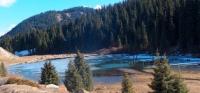
Kungei Ala-Too lakes are famous for their picturesque lakes. Many lakes are moraine, which arose at the bottom of mountain valleys, partitioned by terminal moraines. Typically, these lakes are located at high altitudes at the ends of glaciers.
Another group of lakes is of dam origin, i.e. lakes resulting from the dam of the valley with mountain landslides. As a rule, such lakes have a shape elongated along the valley of the gorge, rocky and steep banks and great depth.
Among the most beautiful mountain lakes are lakes: Jasyl-Kol, Chon-Kel-Ter (Kol-Kogur), lakes in the Taldy valleys.
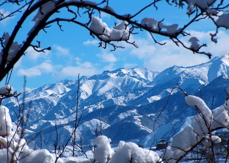
The climate of Kungei-Ala-Too is continental and, in addition to general laws, has many of its own inherent features, due to the relief, high-altitude zonality, and on the southern slope of Kungei Ala-Too, and the presence of a deep ice-free lake.
Climatic conditions in this mountainous area change rapidly as they rise. The dry steppe at the foot of the ranges is replaced by a strip of gardens and groves, forests and meadows rise above them on a steep ledge, and glaciers and snowfields sparkle above them on the ridges of the ranges.
Such a striking contrast between the foothills and the high mountains depends mainly on the amount of moisture that the western and northwestern currents of the high atmospheric layers bring to the mountains. Moisture falls at the foot of the ridges by heavy rains, and high in the mountains - in the form of snow.
From the west of the region to the east, at the same heights, the temperature decreases and the amount of precipitation increases. Against the background of general seasonal phenomena during the year, a series of sharp cooling is observed, associated in the summer with the passage of cyclones, and in winter - of anticyclones.
They significantly change the usual pattern of the weather. According to meteorological observations, in the Chong-Kemin river basin at an altitude of 3600 meters above sea level, the average monthly temperature in January is -13.9 ° C, the average monthly temperature of the warmest month in July is + 2.5 ° C, the average annual temperature is -5.6 ° C.
The maximum temperature is + 18 ° C, the minimum is lower - 30 ° C. Precipitation - 633 mm, in the lower part of the same valley - 433 mm. Summer precipitation is 54% of the annual norm. In the north and south of the region, temperature contrasts are less than precipitation on the northern slopes of the Zailiysky Alatau more on the southern slopes of Kungei Ala-Too - less.
In the first half of summer, the weather is usually unstable, in the second half it is better, and at the end of August and September, sunny days with little rainfall are usual. In winter, the most stable weather conditions are in January-February. In summer, mountain-valley winds are well pronounced in the alpine zone.
Glacial winds are also noted in the glacial zone. Wind speed is usually small, but gusty winds of considerable strength happen in the spring and summer when passing atmospheric fronts. During the day, the maximum wind speed was noted at night and in the morning.
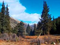
The nature of Kungei Ala-Too is diverse in its species and forms. The lifeless valleys are replaced by amazingly beautiful gorges covered with slender fir trees. The dark coniferous forest belt is located at an altitude of 1600 - 1800 meters above sea level to 2800 - 3100 meters above sea level.
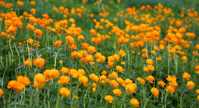
The forest grows mainly along the northern, northeastern and northwestern slopes of the gorges. Juniper thickets are found. High, next to the glaciers, edelweisses grow, often covering whole meadows with solid silver carpets here.
In total, more than a thousand species of rich and diverse vegetation are found in the region, more than half of which grows at an altitude of 1300 to 1700 meters above sea level - thickets of wild apple trees, apricot, aspen, birch, rosehip, barberry, honeysuckle, raspberry.
Such a richness of nature and a variety of terrain, as well as the accessibility of the area make Kungei Ala-Too the most popular and most visited in the Tien-Shan. The most interesting tourist attraction is the central part of this mountainous region, including the Chiliko-Kemin bridge.
Here the main glaciers are concentrated, here are the most beautiful and technically difficult passes.
The most significant sections of the Kungoy-Ala-Too ridge.
Western Kungei Ala-Too, with a length of 140 kilometers, is located at an altitude of 3100 to 4771 meters above sea level.
Eastern Kungei Ala-Too, with a length of 140 kilometers, is located at an altitude of 3200 to 4690 meters above sea level.
The Chiliko-Keminskaya mountain dam, 8 km long, is located at an altitude of 3960 to 4332 meters above sea level.
Authority:
A.G. Isachenko, A.A. Shlyarnikov. The nature of the world. “Landscapes”, Moscow, “Thought”, 1989.
Photos by
Alexander Petrov.