


![]()
You are here
Kostanay region.
Car tours to northern regions of Kazakhstan.
"Learning is light and ignorance is darkness. The work of the master is afraid, and if the peasant does not know how to own a plow, bread will not be born."
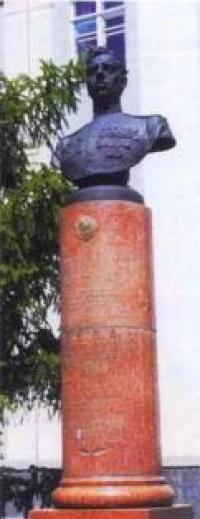
Suvorov Alexander Vasilievich.
Visit to Kostanay and Astana.
Kostanay region was formed in 1936. The region is located in the northern part of the Republic of Kazakhstan, mainly in the steppe and forest-steppe zone, within the Turgai and Trans-Ural plateau. The area of Kostanay region is 196,001 square kilometers.
Length: from north to south - about 740 kilometers, borders with the Russian Federation - 1250 kilometers, the Tobol River (within the region) - 800 kilometers. Highest point: 568 meters above sea level - Mount Kayindyshoky. Distance (Kostanay town) - 570 kilometers, north-west of Astan
Until 1997, the center of the Kostanay region in Russian was called Kostanay - after the tract on the bank of the Tobol. Neighboring countries and regions: in the north - Kurgan (RF), in the north-east - North Kazakhstan, in the south-east - Akmola, in the south - Karaganda, in the south-west - Aktobe, in the west - Orenburg and Chelyabinsk (RF).
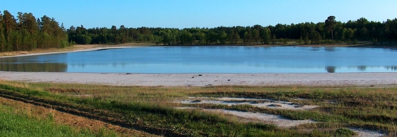
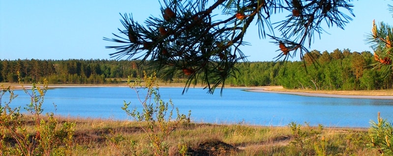
Kostanay region is the land of several thousand salt lakes. They could have turned into salt marshes long ago, if not for the peculiarities of the local nature, thanks to which they do not dry up completely. Most of the Kostanay region is occupied by the Turgai hollow and Trans-Ural plateau with heights of 200 - 300 meters above sea level.
This area is dissected throughout by ravines with steep slopes, interspersed with vast hollows and wide valleys. The largest are the Turgai Hollow with the Ubagan River and a chain of fresh and salt lakes, as well as a valley in the upper reaches of the Tobol River, the largest here.
It flows through almost the entire territory from south to north, starting from the spurs of the Southern Urals. In spring, it and its tributaries overflow strongly: this period accounts for up to 95% of the total annual runoff. But in the summer they become shallow or break into separate stretches.
In order to retain flood water and use it for irrigation, several dams and dams have been built on the rivers, completely regulating the flow. In the northwest - the foothill plains and spurs of the Urals, and in the northeast - the Predturgai plain, which descends to the north, with heights of 120 - 150 m.
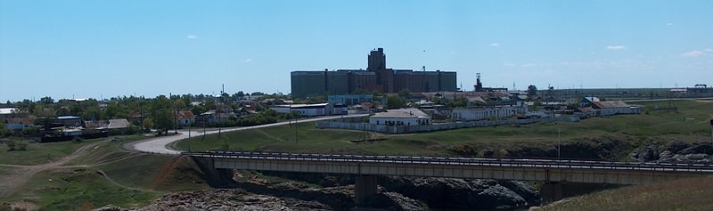
There are also a lot of small and small lakes: there are more than 5 thousand of them in the region. The Southeast occupies Kazakh melkosopochnik. The bowels of the Kostanay region are rich in minerals, especially the ore of the Sokolovsky, Sarbaisky and Kacharsky deposits, in which the iron content is 55 - 60%.
The summer is quite hot here, a strong wind often blows, causing dry winds and dust storms in summer, and snowstorms and snowstorms in winter. The nature of the north and south is noticeably different. In the south, there are semi-deserts with wormwood and saltwort vegetation.
In the north, steppes with chernozems prevail, there are birch and aspen groves, pine forests. The unique relict Naurzum forest is located on the territory of the Naurzum reserve. The existence of its largest lakes - fresh Aksuat and fresh-salty Sarimoin - is subject to long-term cyclicity: filling is replaced by drying, which prevents the salinization of lake basins.
Dozens of bird species nest on the lakes, elk, roe deer and wild boar live on the banks, and among the predators, this part of northern Kazakhstan is part of the region of steppes and lakes, included in the UNESCO World Natural Heritage List.
The most interesting ancient monument in the Kostanay region is geoglyphs, they were discovered in 2007 using a computer mapping program. Geoglyphs Kazakhstan are giant ground drawings that can only be seen from a great height; they form patterns in the form of circles, squares, and crosses.
Each has a name "Turgai swastika", Ushtogai square", "Shiiliskiy square", "Ashytasty cross", "Turgai ring". The most impressive geoglyph is “Ushtogay Square”. It consists of 101 mounds, they are folded into a geometric figure with a side of a square 287 meters and three rings 19 meters in diameter each.
All nine geoglyphs together form a single 512-meter ensemble. Such objects are the only ones in the whole of Central Asia. No less interesting is the later ritual complex of Yekidin: two spherical structures built of wild stone, presumably dating back to the early Iron Age.
These structures, which are quite rare on the territory of Kazakhstan, known as "uytas" or "dyng", were built in the form of the oldest Kazakh dwelling shoshaly and, possibly, had ritual significance. The presumable date is the early Iron Age.
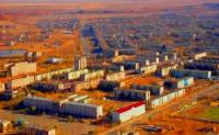
In 1879 Russian settlers founded the settlement of Nikolaevsk here, in 1893 it became a town and outwardly did not make a favorable impression. The reason for this was, in particular, the sand dust that was always in the air, and the streets were covered with sand.
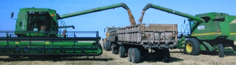
But at the beginning of the XXth century, it was already a large trade fair center in the Kazakh steppes. The town changed completely when the development of virgin lands began in the 1950s: large public and administrative buildings appeared. And today the region is a large grain center of the country.
The region borders on three regions of the Russian Federation - Orenburg, Chelyabinsk, Kurgan and four regions of Kazakhstan - Aktobe, Karaganda, Akmola and North Kazakhstan. The length of the border with the Russian Federation is 1250 kilometers.
There are many lakes and rivers in the region, mostly fresh. The main waterway of the region is the river - Tobol. The climate of the region is sharply continental, with pronounced alternations of the seasons. The average temperature in January is -18 -19 ° С, in July +19 + 22 ° С. In winter, the temperature reaches minus 25 - 30 ° С, in summer up to + 30 ° С.
Annual precipitation is 250 - 350 mm in the north of the region and up to 240 - 280 mm in the south. The territory of the region is 196,000 sq. km. (7.7% of the total area of Kazakhstan). The administrative-territorial division of the region is represented by 5 towns: Kostanay, Rudny, Lisakovsk, Zhitikara, Arkalyk, 16 rural areas, 13 urban-type settlements, 750 villages. The length of the territory from north to south - 750 and from west to east - 250 - 400 kilometers.
The region is located within the geographic structure known as the Turgai trough. It includes 16 districts: Altynsarinsky (village Ubaganskoe), Amangeldinsky (settlement Amangeldy), Auliekolsky (village Auliekol), Denisovsky (settlement Denisovka), Zhangeldinsky (settlement Turgai), Zhetikarinsky (town Zhetikara), Kamystinsky ( Kamysty village), Karabalyksky (Karabalyk settlement), Karasusky (Karasu settlement), Kostanaysky (Zatobolsk village), Mendykarinsky (Borovskaya village), Naurzumsky (Karamendy village), Sarykolsky (Sarykol settlement), Taranovsky (from Taranovskoe), Uzunkolsky (Uzunkol village), Fedorovsky (Fedorovka settlement) and four towns of regional subordination: Kostanay, Rudny, Arkalyk, Lisakovsk.
The administrative center of the region is the town of Kostanay. Located on the Tobol River, founded in 1879. The distance from Kostanay to Astana, the capital of the Republic of Kazakhstan, is 760 km. Railway and air transport, motor roads connect the region with the cities of the Republic of Kazakhstan and the CIS, direct flights - with the cities of Germany.
The network of paved roads connects all administrative centers with the regional, most of the regional centers have railway stations. The main direction of the economy is agrarian-industrial: the region is a large producer of grain, meat, milk.
The region produces 100% of the republican volume of iron ore pellets, bauxite, asbestos, 90% - iron ore. The territory of the region is characterized by a relatively flat, steppe relief. The northern part is occupied by the southeastern edge of the West Siberian Lowland, to the south of it is the Turgai Plateau; in the west of the region there is the undulating plain of the Trans-Ural plateau, and in the southwest - the spurs of the Saryarka.
The river network is sparse. There are about 310 small rivers within the region. The largest rivers are the Tobol, with tributaries of the Ayat, Ubagan, Uy and Turgai rivers with tributaries of the rivers: Saryozen, Turgai, Kara-Turgai. On the Tobol River are the Verkhnetobolskoye, Karatomarskoye and Amangeldinskoye reservoirs. There are more than 5 thousand lakes in the Kostanay region. The largest of them are located in the Turgai hollow - Kusmuryn, Sarymoin, Aksuat, Sarykopa.
The subsoil of the region is exceptionally rich in minerals, especially iron ore (deposits of magnetite ores - Sokolovskoe, Sarbayskoe, Kacharskoe and brown oolitic iron ore deposits - Ayat iron ore basin, Lisakovskoe deposit).
The total reserve of magnetite ores and brown iron ores is 15.7 billion tons, of which 5.7 billion tons are easily processed and do not require enrichment. The subsoil of the region is rich in other minerals: brown coal, asbestos, refractory and brick clays, flux and cement limestone, glass sand, building stone and others.
The region has the only jade deposit in Kazakhstan. 19 deposits of bauxite, 7 - gold, one - silver and nickel were discovered. Forested area is 217.5 thousand hectares, including 51.2 thousand hectares - natural plantations.
In connection with the development of virgin lands, almost the entire area occupied by chernozems and chestnut soils has been plowed up. In the northern part of the region, chernozems with red-grass-forbs vegetation, birch-aspen fringes and pine forests (Arakaragai, Amankaragai) prevail; in the central part - chestnut soils with red grass-grass vegetation, Naurzumkaragai pine forest, on the basis of which the Naurzum reserve was organized; in the southern half - light chestnut soils and gray soils with fescue-feathergrass and wormwood races 886.3 thousand people, including 498.4 thousand (54.9%) - urban and 409.6 thousand (45.1%) - rural residents.
National composition: the number of Kazakhs was 35.9%, Russians - 40.7%, Ukrainians - 11, 55, Germans - 3.8%, other nationalities - 8.1%. The most densely populated cities are Kostanay, Rudny, Lisakovsk, the least densely populated are the southern districts of the region, where the population density ranges from 0.4 to 0.8 people per square kilometer.
The population density is 4.7 people per 1 square kilometer. More than a hundred nationalities and ethnic groups live on the territory of the region. In recent years, there has been an increase in the population of the indigenous nationality.
On March 11, 2004, the regional emblem was solemnly presented for the first time in Kostanay. The main elements of the emblem are images of the black lark, the Naurzum tulip Schrenk and the grain field. The choice of elements is not random.
The lark and the tulip are endemic to the natural world, and thanks to high grain yields, the Kostanay region is considered the country's main granary. A small Assembly of the peoples of Kazakhstan operates in the region, uniting 14 national and cultural centers, communities and diasporas.
The state language is Kazakh, along with which Russian is used. The history, culture of ancient peoples and contemporaries of our era are presented in the exposition of the Regional Museum of Local Lore, in the fund of which there are more than 90,000 exhibits.
Resources of fauna and flora of Kostanay region (suitable for the organization and development of zones and objects of civilized fishing and hunting, lake-commercial fish farming, hunting and forestry development.
The fauna of land animals of the region includes 52 species of mammals, 267 permanently or temporarily inhabiting birds, 10 species of amphibians and reptiles, 24 fish species live in reservoirs. In the region of specially protected natural areas there is a state reserve - Naurzum.
The total area of the reserve is 191381 hectares, of which the area covered with forest - 5772 hectares, the area occupied by reservoirs - 22354 On the territory of the state reserve there are 44 species of wild animals, 280 species of birds, 10 species of fish, 687 species of plants.
The presence of 6018 heads of main and rare animals and 35892 main and rare birds. Naurzum reserve, 3 nature reserves and 12 state natural monuments with rich vegetation are the pride th area. The most popular resort-sanatorium "Sosnovy Bor" is located in the forest reserve zone "Aman Karagay" and "Ara Karagay", forty from the regional center.
Natural lakes with medicinal water and a forest rich in everything that nature can give: animals, mushrooms, berries, etc. And the air ... It gets drunk and dizzy. You will feel refreshing vigor and lightness, having visited this wonderful land.
The territory of Kostanay region covers 4 landscape zones: from forest-steppes to deserts, it is distinguished by a wide variety of flora and fauna. On the shores of Lake Kushmurun there is one of three places where black alder and other relict plant species grow in Kazakhstan.
More than 300 species of birds can be found in the region, 32 of which are included in the Red Book of Kazakhstan, and 54 species of mammals. A characteristic feature of the landscape is the mixture of natural complexes and their individual components; in one place you can see an elk and a steppe fox - corsac, black grouse and gyrfalcon, ptarmigan and little bustard.
During the period of seasonal migrations on the steppe lakes of the region, up to 1.5 million geese, as well as many waterfowl of other populations, stop annually for nesting. The most popular resort - sanatorium "Sosnovy Bor", located 40 km from the regional center, in the forest zone.
Every year up to 6,000 people undergo health improvement courses there. The medical and diagnostic complex of the sanatorium includes a mud bath and an artificial lake with a therapeutic beach, recognized as one of the best in Kazakhstan.
The presence of unique mineral springs has a beneficial effect in the treatment of diseases of the gastrointestinal tract, bronchopulmonary system, skin, gynecological, etc. Mineral water "Sosnovy Bor" is an analogue of water "Morshin", "Karlovy Vary" and "Essentuki-17", carries out complete cleansing the human body from toxins.
A powerful diagnostic base, mineral springs, forest - all this makes the sanatorium a real source of health. Kostanay region has a rich historical past. Its territory has been inhabited by people since ancient times. The sites discovered by archaeologists date back to the 6th millennium BC - the Neolithic era.
The most famous sites of the Bronze Age are Alekseevskaya and Sadchikovskaya, related to the Andronovskaya culture. A detachment of archaeologists is constantly operating in the region, during the summer you can observe their work, get acquainted with the finds of excavations of ancient settlements and burial mounds.
The Kostanay land and its heroes were sung by the famous akyns Omar Shipin, Sat Esenbayev, Nurkhan Akhmetbekov, Utemis Kalabaev.
From various information authority.
Photos by
Petrov Alexander.