


![]()
You are here
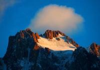
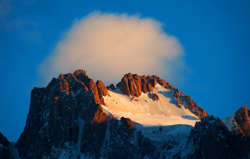
Korona Peak. Kyrgyz Ala-Too.
Peaks in Aksai horseshoe spur in Ala-Archa gorge.
“The best view from the camp, as well as from our bivouac, is the peak of Teke-Tor (4441 m). Her sparkling hat alternately burned under the sun, then glowed under the moonlight. But even in the dark, when there was no moon, this hat was able to find and absorb some kind of heavenly light and was always different, flickering among the starry sky. At times it was covered with clouds, clouds, rains. But more often it loomed clearly, to the smallest detail, and it seemed - if a person were on the snowy whiteness of Teke-Tor, we would immediately distinguish him."
V.A. Soloukhin.
Climbing to Korona peak in Kyrgyz Ala-Too mountains.
Korona Peak, 4860 meters above sea level, is located in the Kyrgyz Ala-Too ridge on the territory of the Ala-Archa Natural Park, in the Alamudun district of the Chui region. The summit is located in the northeastern part of the Aksai horseshoe spur.
From the eastern slope of the peak, the Zabirov (Dzhandy-Su) glacier begins, 5 kilometers long. From the western slopes descends the Korona glacier with a length of 1.7 kilometers. The summit ridge stretches for more than 60 meters from south to north.
The array of the Korona peaks consists of six peak towers, which resemble a crown from the northwest and west, this is the name of the peak. The slopes of the peak reach a height of 600 meters, the northern slope is more like a wall with a plumb line up to 900 meters.
The height of the first tower of Korona Peak is 4840 meters above sea level. The height of the 4th tower is 4820 meters above sea level, the height of the 6th tower is 4860 meters above sea level. The height of the 5th tower of the Korona peak is also 4860 meters above sea level, the route of V. Balezin runs along the center of the southwestern wall.
Here, the altitude difference of the route is 850 meters, the length of the route is 950 meters, the difficulty category is 5 - 6. Due to the steepness of the slopes, snow does not linger on the summit towers. The northern wall of the peak breaks off with rocks to the foot of the Uchitel glacier, 2.7 kilometers long.
2.3 kilometers southwest of Korona Peak in the spur of the Aksai Horseshoe, there is the Svobodnaya Korea Peak, 4,740 meters above sea level. 860 meters southwest of Korona is the Izyskatel peak, 4,400 meters above sea level.
1.5 kilometers northeast of Korona Peak is Semenov Tien-Shan Peak, 4895.4 meters above sea level.
Corona peak geographical coordinates: N42°30'29.49" E74°33'58.43"
Authority and photos by
Alexander Petrov.