


![]()
You are here
Karkaraly Mountains.

 resembles a yurt in shape.")
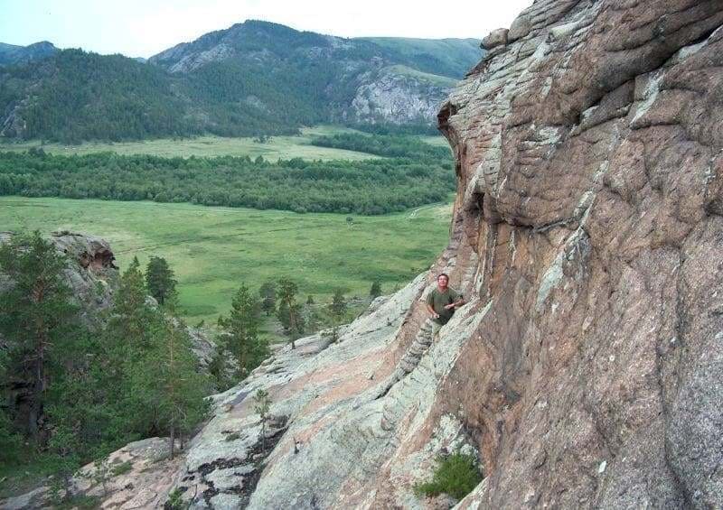
Bushwhacking in Karkaraly Mountains.
"In the family of mountains huddled on the arch,
There are wondrous mountains – the Karkaralys.
The horseman's heart, the bird, the wind
With the bubbling streams and the steep cliff
With cool foliage, with transparent silence,
They beckon. Eagles float
Over the eternal stone, covered with gray hair,
Over old Bugula…"
Sabit Mukanov. Poem "Sulushash".
Experiential tourism in Kazakhstan mountains.
Karkaraly Mountains are located in eastern part of Kazakh Uplands, 178 kilometers southeast of Karaganda, 283 kilometers northeast of Balkhash, and 264 kilometers southwest of Kurchatov. They are part of Karkaraly Nature Park, in Karkaraly district in eastern Karaganda region.
Karkaraly Mountains: the natural and historical heritage of Central Kazakhstan. The Karkaraly Mountains are one of the most picturesque and geologically interesting parts of the Kazakh Uplands. These mid-altitude granite ridges rise from the plains of Central Kazakhstan, forming a unique mountain forest oasis amidst the steppes.
The highest point of the massif is Komsomolsky Peak (Zhirensakal), 1,403 m. a. s. l., located in the southern part. The summit of Zhirensakal is crowned by three enormous stone "towers." During the Cossack era in the village of Karkaraly, this rock formation was called "Boar Shish" because wild boars roamed the area, and they are still found there today.
In 1936, the mountain was renamed Komsomolsky Peak (Zhirensakal) after 100 young men and women climbed it. The second-highest peak is Shankoz Peak, located in the northern part of the mountains at 1,360 meters above sea level. The third-highest peak is an unnamed summit, located in the central part of the massif at 1,323 m. a. s. l., which serves as a panoramic platform offering views of the Karakaraly Mountains.
The Karkaraly Mountains are a system of isolated low-altitude and steep-sided massifs, composed primarily of granite. The mountains are located in the tectonic (Caledonian) and latitudinal dry steppe zones associated with Hercynian granite intrusions; they have a different type of landscape.
Uplifted by recent tectonic movements by hundreds of meters and exposed by intense denudation, the granite intrusions have given the relief a particularly picturesque appearance.
First explorers in Karkaraly Mountains.
The discoverer of the Karkaraly oasis was the Russian writer Mikhail Prishvin, who visited here in 1909. The list of discoverers is quite extensive. Servicemen wandered past these mountains: Captain I. G. Andreyev (1785), Ataman Telyatnikov (1796), mining officials Mikhail Pospelov and Timofey Burnashov (1800), translator of the Siberian Corps Filipp Nazarov (1813), and others.
I. P. Shangin, a mine surveyor from the Altai Mining District, also traveled here. In 1816, he discovered numerous ancient lead and copper ore mining operations in the Kornetai and Beschoku valleys. Of considerable value is M. Krasovsky's three-volume work, "Materials for the Geography and Statistics of Russia," published in 1868.
Krasovsky was the first geographer to note that the Karkaraly Mountains consist of two groups, with the highest point of the granite cliffs located in the Kabany Klyuch tract (now Komsomolsky Peak). Attempts by the Karkaraly residents to sow grain directly in forest clearings proved unsuccessful. Early frosts were devastating to the seedlings.
The remaining crops were devoured by locusts.
Natural attractions in Karkaraly Mountains.
Lake Shaitankol (Devil's Lake), surrounded by high cliffs, is unique. The Basin is a large depression surrounded by granite with clear water. In the vicinity of Karkaraly, there is the "Gorge of Caves" with numerous springs; one of the caves ("Tent") resembles a yurt in shape.
Karkaraly Mountains boast a local natural attraction, an interesting natural monument: a natural tunnel 17 meters long and up to 7 meters wide. The Karkaraly Mountains are sharply dissected rocky ridges with ridge-like divides, intermontane basins, gorges, and river valleys.
Caves and rock overhangs, shallow niches and holes in the rocks, jagged towers, and solitary columnar structures are found. They extend from south to north. The mountains stretch 37 kilometers from southeast to northwest, with their greatest width in the southern part reaching 24 kilometers.
Geological structure and relief of Karkaraly Mountains.
The mountains are composed primarily of pink and gray granites, quartzites, and crystalline schists of Precambrian age. The rocks are over 1.5 billion years old. As a result of centuries of erosion and weathering, the granite boulders have taken on bizarre shapes - towers, domes, and stone walls - giving the mountains their distinctive appearance.
The terrain is dominated by rounded hills, narrow gorges, rocky outcrops, and forested valleys with small rivers and streams.
Climate and Hydrography of Karkaraly Mountains.
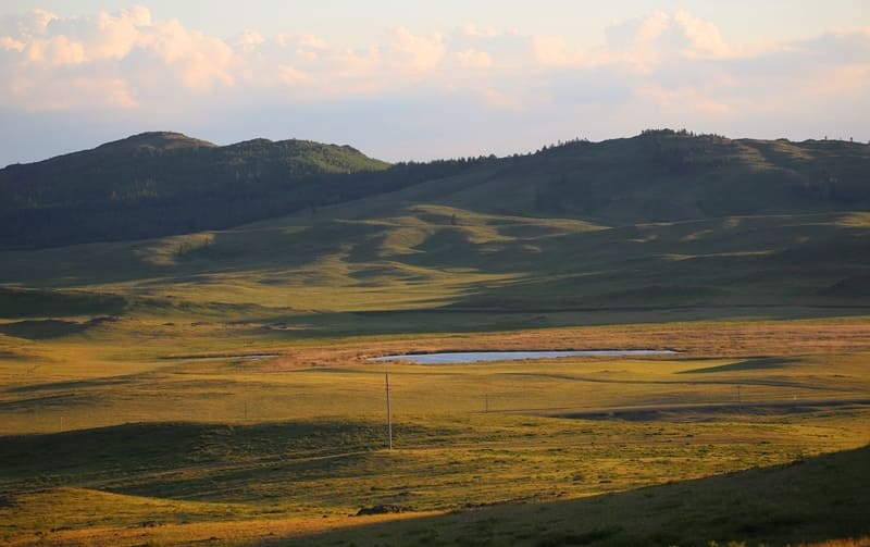
The region's climate is continental, with cold winters and warm, dry summers. Average January temperatures are around –15°C, and July temperatures are +20°C. Precipitation is relatively rare, but the mountainous terrain allows dozens of springs and small lakes to form here, such as Shaitankol, Bassein, Peschanoye, Bolshoe and Maloe, and Kimassarovskoye.
These bodies of water are fed by meltwater and groundwater, creating their own microclimate in the mountains, which is wetter and cooler than the surrounding steppe.
Minerals in Karkaraly Mountains.
Karkaraly Mountains have a noticeable landscape asymmetry: their northern slopes are steeper and richer in springs and vegetation. Situated deep in the dry steppe of Central Kazakhstan and close to major mining sites, the mountain and forest landscapes offer excellent recreation and tourism opportunities.
The Karkaraly district boasts deposits of copper and polymetallic ores. Rare metals such as molybdenum and tungsten have been discovered in the Tasbulak, Apanas, Shonai, Kuigenkystau, and Zhapak-Karagai valleys. Mineral deposits are particularly significant in the Akkezen, Kyzylshoky, Naizashoky, and Saryshoky valleys.
A large number of decorative and semiprecious stones are found in these areas. Jasper, a variety of colors, is attractive. In three caves of the Maliksai tract, one can see the crystalline facets of rock crystal and topaz, glittering in the light. Smoky and wine-yellow topazes were once found here.
This likely refers to the far left cave, renowned for its rich mineral deposits. The high mountains form a true mountain oasis amidst the Saryarka hills. Not far from Soroka Lakes are the remains of a quarry, where, just a few decades ago, various gemstones were mined - chrysoprase, amethyst, morion, quartz, and others.
The remains of the quarry are impressive caves, where, with sufficient persistence, gemstones can still be chipped from the walls or picked from the ground.
Flora and Fauna of Karkaraly Mountains.
The Karkaraly Mountains are one of the few places in Central Kazakhstan where natural pine and birch forests remain. Scots pine, silver birch, aspen, rowan, rose hips, and bird cherry grow on the slopes. The lower valleys feature mixed-grass steppes and meadows where St. John's wort, thyme, centaury, globeflower, and bluebells flourish.
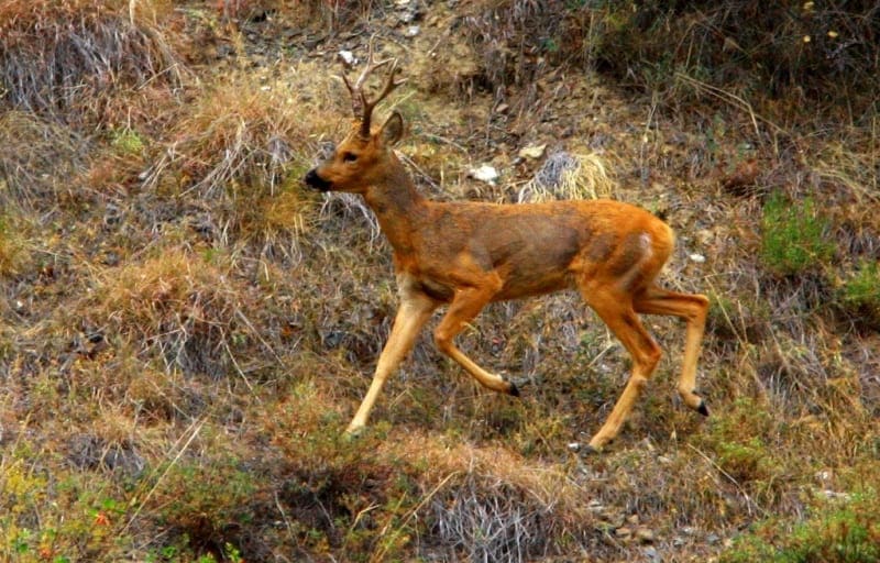
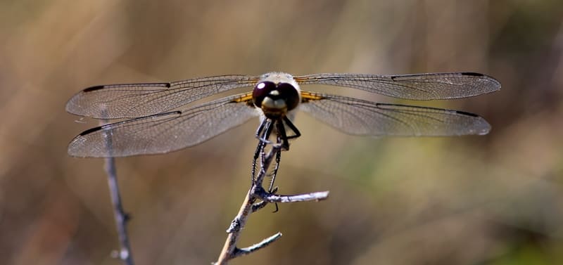
Wildlife includes roe deer, foxes, badgers, ermines, weasels, and Teleut squirrels. Rare species such as the black stork, booted eagle, eagle owl, and saker falcon are also found. More than 180 bird species and 50 mammal species have been recorded within the park.
Pine and birch forests growing directly on the mountain slopes, nestled among the steppes, are home to numerous picturesque lakes (Bolshoye, Pashino, and others), surrounded by recreation areas.
Historical and cultural significance and legends of Karkaraly Mountains.
Karkaraly Mountains have been a sacred place for nomadic peoples since ancient times. Traces of Bronze Age settlements, ancient burial mounds, and petroglyphs have been discovered here. The name "Karkaraly" is associated with the Turkic word "karkara," a decoration on a woman's headdress, symbolizing the beauty of the mountains that crown the steppe.
Many legends are associated with the mountains. One tells of a girl named Karkara, whose beauty eclipsed everything around her, and the heavens transformed her into mountains to preserve her forever. Another says that every cliff in Karkaraly holds the soul of an ancient warrior guarding these lands.
Tourism and nature conservation in Karkaraly Mountains.
Today, Karkaraly Nature Park is one of the main tourist gems of the Karaganda region. Dozens of routes are laid out here, from short walks to caves and lakes to ascents to the peaks of Kokshetau and Komsomol. The park boasts eco-trails, observation platforms, and campsites.
The best time to visit is from June to September, when the air is clear and the scenery is especially picturesque. Travelers are advised to wear comfortable shoes, plenty of water, and a hat. The Karkaraly Mountains are where the steppe meets the taiga, and ancient history merges with living nature.
Anyone who has climbed their peaks feels the breath of eternity still resonating here.
Geographical coordinates of Karkaraly Mountains: N49°23'04 E75°23'02


Authority and photos by:
Alexander Petrov.