


![]()
You are here
Karakol river. Terskey Ala-Too.

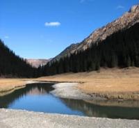
Rivers in Terskey Ala-Too mountains.
"When the last tree is cut down, when the last river is poisoned, when the last bird is caught, - only then will you understand that you cannot eat money."
Indian proverb.
Trip to Karakol River from Cholpon-Ata.
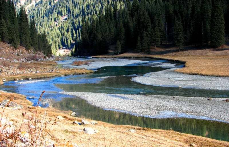
The Karakol River is located in the gorge of the same name, on the northern slope of the Terskey Ala-Too ridge in the Aksu district in the east of the Issyk-Kul region. The main channel of the river is formed at an altitude of 2598 meters above sea level from the confluence of three rivers: the right tributary of the Keltor, the middle tributary of the Uyuktor and the left Telety.
The sources of the river are located in a high-mountain glacial zone in a large glaciation knot. From the confluence of these three rivers to the mouth of the river in the southern part of the Przhevalskoe Lake Issyk-Kul Bay, Karakol is 40 kilometers long.
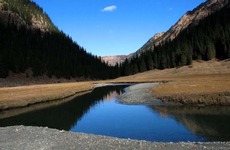
The catchment area of the river is 394 square kilometers. The average long-term water consumption is 6.6 cubic meters per second. The speed of the river in the Karakol River does not exceed 1.5 meters per second.
In its lower course, the river crosses from south to north the city of Karakol. It flows into the Przhevalsky Bay on the eastern end of Lake Issyk-Kul at an altitude of 1608 meters above sea level.
here are lakes in the river Karakol basin:
- Lake Ala-Kel, located at an altitude of 3532 meters above sea level, is located on the western slope of the Karakol gorge,
- a moraine lake, which is located in the circus between the Atjailau peak with a height of 3689.3 meters above sea level and the Aitor river valley. From the lake, the source of an unnamed river with a length of 3.5 kilometers begins, which is the left of Karakol.
Geographic coordinates of the Karakol River: N42 ° 25'19.34 "E78 ° 26'06.23"
River Keltor.
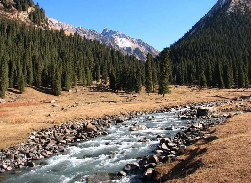
Keltor River, 14 kilometers long, is the right (eastern) tributary of the Karakol River. The river in the upper reaches is formed from two tributaries. The right tributary originates from the northwestern slopes of a small spur, in which the Ukraintsev pass is located.
The left tributary (western) originates from the Dzhigit glacier flowing down from the northern slope of the Dzhigit peak 5020 meters above sea level and from the eastern slope of the Ontor pass 3900 meters above sea level.
The Ontor pass is located in a minor, northern spur of the Terskey Ala-Too ridge, on the north side of the Dzhigit peak, the valleys of the Ontor (Uyuktor) rivers with the Ontor glacier and Keltor with the Dzhigit glacier (both are the sources of the Karakol river) will separate.
The pass is located on the northern wall of the Dzhigit peak. 900 meters before the mouth, the Keltor on the right receives an unnamed 4.2 km tributary. The sources of the tributary begin from the western slope of the summit, 4003 meters above sea level. The mouth of the river is located at an altitude of 2598 meters above sea level.
Geographic coordinates of the Keltor River: N42 ° 15'38.78 "E78 ° 32'08.57"
Uyuktor River (Ontor).
he Uyuktor (Ontor) River with a length of 13.4 kilometers is the middle tributary of the Karakol River. The river flows from the Western Karakol glacier with a length of 3.8 kilometers, flowing down from the northern slope of the Karakol peak at an altitude of 5216 meters above sea level.
There is an almost vertical wall between the Karakolsky and Elephant peaks, along which the East Karakol glacier slides 5 kilometers long. This glacier also replenishes the Uyuktor River with waters. From the western slope of the Ontor pass, the Ontor glacier descends, 1.5 kilometers long, which connects with the East Karakol glacier. In the upper reaches of the river there is the Elephant Peak, 4726 meters high above sea level. The mouth of the Uyuktor (Ontor) river is located at an altitude of 2598 meters above sea level.
Geographic coordinates of the Uyuktor River: N42 ° 13'47.87 "E78 ° 29'04.62"
Telety river.
The Telety River, 7 kilometers long, is the (left) western tributary of the Karakol River. The river is located to the west of the dividing, meridional ridge with a length of 15 kilometers, which departs from the main ridge of Terskey Ala-Too just to the west of the Karakol peak.
The river replenishes water from three small glaciers located on the northern slope of the Terskey Ala-Too ridge and partly from the northeastern slope of the Telety pass, 3801 meters above sea level. The forest zone in the valley of the Teleta river rises to 2808 meters above sea level. The mouth of the Teleta River is located at an altitude of 2598 meters above sea level.
Geographic coordinates of the Telety river: N42 ° 17'01.23 "E78 ° 27'52.48"
Rights tributaries of the Karakol River.
Ala-Kel river.
3 kilometers after the beginning of the Karakol River, the tributary Ala-Kel, 4.5 kilometers long, flows into the right. The river originates from the Ala-Kel lake located at an altitude of 3532 meters above sea level on the western slope of the Karakol gorge.
The river flows out through a natural dam blocking the lake in the northwestern part. The difference in height on the river is 1057 meters by 4.5 kilometers. The river is very rough and full of water. In some hard-to-reach places, the river forms waterfalls. The mouth of the river is located at an altitude of 2475 meters above sea level.
Geographic coordinates of the Ala-Kel River: N42 ° 19'33.50 "E78 ° 30'02.04"
Nameless stream, right tributary of the Karakol.
4.6 kilometers after the confluence of the Ala-Kel River, an unnamed stream 3.5 kilometers long flows into the right. The stream originates from the tongue of a glacier 2.3 kilometers long, located on the western slope of the Karakol gorge in the Terimtor mountain spur.
The glacier descends from the Terimtor spur into the valley of the Karakol River, from a small sub-latitudinal ridge 3900 meters above sea level. In the eastern part of the glacier, there is the Przewalski Peak 4271.9 meters above sea level.
In the moraine of the lower part of the glacier, there are two small flowing lakes. The mouth of an unnamed stream is located at an altitude of 2303 meters above sea level.
Geographic coordinates of the unnamed stream: N42 ° 21'40.02 "E78 ° 29'25.89"
Kashkasu river.
hrough 7.8 kilometers after the confluence of the unnamed stream on the right, the Kashkasu tributary with a length of 10.2 kilometers flows into Karakol. The river starts from the Kashkasu glacier with a length of 3.9 kilometers located on the northern slope of the Terimtor spur.
The sources of the Kashkasu glacier are located in the circus, in the eastern part of which is the Przewalski Peak. In the western part of the Kashkasu River there is a mountainous, remnant massif Aidyanish with a dominant height of 3228 meters above sea level.
Remnant rocks in the massif reach a height of 33 to 56 meters. In the middle course, the river flows from the eastern side of the Karakol ski base. The mouth of the Kashkasu River is located at an altitude of 1996 meters above sea level.
Geographic coordinates of the Kashkasu River: N42 ° 24'01.48 "E78 ° 28'54.84"
In the lower part, not far from Lake Issyk-Kul, the Karakol has a drying right tributary, which is filled with rainfall, and in the spring when the snow melts.
Left tributaries of the Karakol River.
Aytor River (Ayutor).
2.6 kilometers after the beginning of the Karakol River, the Aitor River, 4 kilometers long, flows into the left. The mouth of the Ayutor River is located at an altitude of 2536 meters above sea level, just above the right tributary of the Ala-Kel River.
The sources of the river originate from 5 glaciers located on the northern and northwestern slopes of the watershed ridge with the Telety river. The longest of them is the Aitor glacier, 2.5 kilometers. The origins of the glacier are located on the northern slope of Gastello Peak 4350 meters above sea level. Aitor Peak is located on the eastern ridge of the circus.
From Peak Gastello to the northeast in the ridge there are peaks: TRP (Ready for Labor and Defense), GERO, Students, Heroes of Krasnodon, Meneleevets.
Geographic coordinates of the Aytor (Ayutor) river: N42 ° 18'27.13 "E78 ° 27'04.49"
Left unnamed tributary of the Karakol River.
1.5 kilometers after the confluence of the right tributary of the Ala-Kel, a small unnamed tributary 3.5 kilometers long flows into the left. The sources of the river begin from a moraine lake located in the circus, which is the watershed of the Irdyk and Ayutor rivers.
The mouth of the unnamed tributary is located at an altitude of 2389 meters above sea level.
Geographic coordinates of the unnamed tributary: N42 ° 20'08.29 "E78 ° 27'07.32"
Zyndanbulak stream.
5.7 kilometers after the confluence of the left unnamed tributary, the spring tributary Zyndanbulak with a length of 3.8 kilometers flows into Karakol on the left. The sources of the stream are in the Atjailau tract. In its upper reaches, the Atjailau peak is located with a height of 3689.3 meters above sea level. The mouth of the Zyndanbulak stream is located at an altitude of 2205 meters above sea level.
Geographic coordinates of the Zyndanbulak stream: N42 ° 22'23.02 "E78 ° 27'16.34"
Stream Karchkiya.
3.8 kilometers after the confluence of the Zyndanbulak brook, the Karchkiya tributary with a length of 7.7 kilometers flows on the left. The spring sources of the river are located in the Atjailau tract, in its upper reaches the Atjailau peak is located with a height of 3689.3 meters above sea level.
The mouth of the Karchkiya stream is located at an altitude of 2054 meters above sea level.
Geographic coordinates of the Karchkia River: N42 ° 23'23.29 "E78 ° 25'18.34"
Authority and photos by
Alexander Petrov.