


![]()
You are here
Jetim Ridge.
Tours in Jetim mountains.
“What is still unknown to us on our planet puts some kind of oppression on the consciousness of most people. This unknown is something that man has not yet conquered, some permanent proof of our impotence, some unpleasant challenge to dominance over nature.
Amundsen Roald.
Trip to Jetim mountains.
The latitudinal Jetim ridge is located south of the Jetim-Bel and Kapkatas ridges, north of the Naryn-Tau and Borkoldoy ridges, is located in the Inner Tien-Shan in the Jety-Oguz region of the Issyk-Kul region and the Naryn region of the region of the same name.
The extended mountain range stretches in the latitudinal direction from west to east, for 106 kilometers, the maximum width of the ridge in the western part of the ridge reaches 22 kilometers. For 120 kilometers, the southern boundary of the Jetim Range is the valley of the Naryn River.
The northern border of the ridge is the rivers: Jamanechki East and Jamanechki West, the Kyzylbel River, for 45 kilometers the Archaly River, the Bolgart River and the Small Naryn. The Small Naryn River goes around the Jetim Range from the west and becomes its natural boundary.
The eastern border of the ridge is the valley of the Jamanechka rivers and the sources of the Naryn. The highest dominant height of the ridge in its eastern part is the peak of Chon-Korumdy, 4896.9 meters above sea level, located in the upper reaches of the Kyzylbel River.
The second highest peak is Moldobashi in the western part of the ridge, which rises to 4622.5 meters above sea level, located in the upper reaches of the Chon and Kichine Moldobashi rivers in the main ridge of the ridge.
The third highest peak is Tuyuairek, 4592.7 meters above sea level, located in the upper reaches of the Egiztor rivers in the main crest of the ridge. More than 17 rivers flow from the northern slopes of the ridge, which belong in the upper reaches of the Archaly river basin and in the western part of the Dzhinalach river.
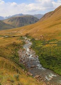
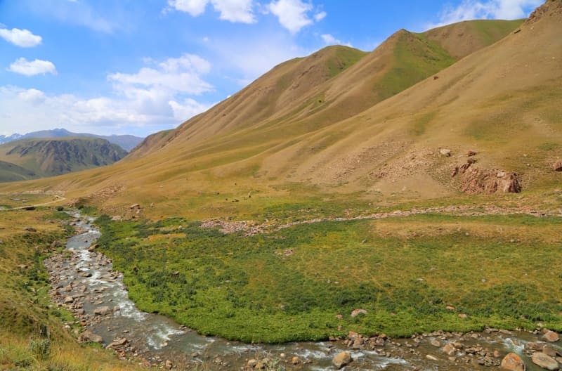
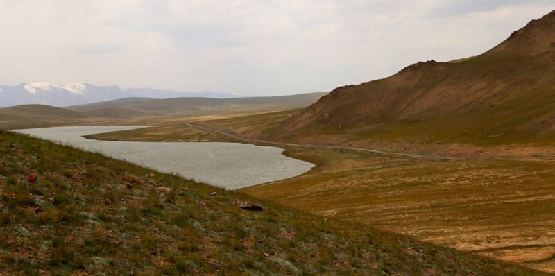
From the southern slopes of the Jetim ridge flows 20 large and small rivers, which are the right tributaries of the Naryn river basin. In the eastern part of the ridge, on the southern slope, there is a fresh, flowing lake Sary-Kol at an altitude of 3477.1 meters above sea level.
The main filling of the lake comes from small, shallow streams that flow down from the eastern slopes of the Jetim ridge. One of the tributaries of the Aigyrbulak River, 11.5 kilometers long, flows out of the southeastern part of the lake.
The main part of the branched sources of Aigyrbulak are located on the southern slope of the Jetim ridge. The length of Lake Sary-Kol from southwest to northeast is 2.5 kilometers, the largest width in the southern part of the lake is 907 meters.
The area of the lake is 1.59 square kilometers, the perimeter is 5.86 kilometers. The main glaciation of the range is located in the central and eastern parts of the range. Glaciers cover mainly the northern slopes of the range, while there are no glaciers on the southern slopes of the gorges.
From the peak of Moldobashi to the east on the northern slopes there are glaciers: the Egiztor West glacier with a length of 4.3 kilometers, the Egiztor East glacier with a length of 4 kilometers, the Archaly glacier with a length of 4 kilometers, the Kyzylbel West glacier with a length of 4.1 kilometers, the Kyzylbel East glacier with a length of 3.9 kilometers , West Jamanechki Glacier with a length of 4.6 kilometers, Central Jamanechki Glacier with a length of 3.7 kilometers, East Jamanechki Glacier with a length of 2.8 kilometers, Shorgosu Glacier with a length of 1 km. In the upper reaches of the Shorgosu River, the glaciers of the eastern part of the Jetim Range end.
The administrative border between the Naryn and Issyk-Kul regions passes along the Naryn River in the southern part of the ridge. Steppe, meadow and meadow-steppe vegetation grows on the slopes of the Jetim ridge.
Geographic coordinates of Jetim Range: N41°34'27.81" E76°58'15.00"
Author and photos
Alexander Petrov.