You are here
History of study of Pamir firn plateau.


Travels to Pamir mountains.
“ - Does the peak know that it is conquered?”
А. Kulich.
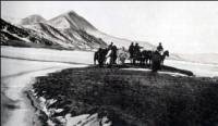
Trip from Dushanbe to Jirgital.
The first information about the plateau is provided in the materials of the Tajik-Pamir expedition of 1932 (TPE, 1934). K.K. Markov (1935), when analyzing the vertical profile of the Pamirs, points to the existence of this leveled surface, A.V. Moskvin (1936) drew attention to two high-mountain platforms as unique relief forms. E.A. Beletsky, while climbing the peak of Communism (Stalin) in 1937, noticed the snow fields of a huge plateau lying to the west of the peak. Pamir firn plateau, according to E.V. Timashiev (1954), is a high-mountain horizontal surface of a significant area, preserved among sharp ridges and deep gorges.
It is located at an altitude of about 6 kilometers above sea level and is limited by steep slopes with a relative height of up to 2 kilometers. The surface of the plateau is covered with snow and firn covers, the thickness of which is measured in many tens of meters.
The plateau extends from the crest of the Academy of Sciences ridge to the west, along the main watershed of the Peter the Great ridge, on its northern side. It has the following largest dimensions: length along the axial line (from east, northeast to west, southwest) about 12 kilometers, width (from south, southeast to north, northwest) about 3 kilometers, area - 20 square kilometers, framing slopes - about 31 square kilometers.
Photographs of the plateau taken in (1932, 1933), as well as in 1937, could not provide significant information about it, since in Prokudaev’s photograph from the slopes of Evgenia Korzhenevskaya peak the plateau is obscured by the massif of Kirov Peak, and the rest of the photographs made from very low points.
For the first time, the plateau in all its glory appeared in a photo panorama made by S. Popov from the climbing expedition of the Nauka sports society, which explored the area of the Sugran glacier in 1939. The expedition was led by a professor, an enthusiast for exploring the high mountainous regions of Central Asia.
A small group climbed to the Shini-Bini pass, from where a photograph of the plateau was taken. During the first ascent to the peak of the 30th anniversary of the Soviet state, there was a young scientist and geographer in the group of climbers.
From the snow-covered slopes of the six-thousandth peak, climbers looked into the Fortambek valley, surrounded by the majesty of ice ridges. The plateau stretching in the eastern side was magnificent - its slightly wavy surface, shaded by the blue of the peaks, was mesmerizing.
Evgeny Timashev took an excellent photograph of the plateau and later published a detailed description of the plateau in the collection “Defeated Peaks”. The next year, Timashev examined the Gando glacier, organizing a small expedition from the Institute of Geography of the USSR Academy of Sciences - only two people.
With Gando, the plateau was out of reach. The researcher's further aspirations were interrupted by his tragic death while climbing in the Caucasus mountains.
History of ascents to Pamir firn plateau.
For the first time people climbed the Pamir firn plateau only in 1957. These were the Burevestnik climbers who reached it along the ridge of Kuibyshev Peak from the upper reaches of the Belyaev Glacier, then storming Communism Peak from the plateau.
Burevestnik climbers mastered the first routes to the plateau from the Fortambek valley. The rock-snow ridge “Burevestnik” is now the path of climbers, glaciologists, and medical biologists. With the direct assistance of Burevestnik climbers, in 1967, a high-altitude parachute jump was made for the first time in world practice on the Pamir firn plateau.
Parachutists A. Petrichenko, V. Tomarovich, V. Prokopov, E. Sevostyanov, V. Glagolev and V. Chizhik left the plane and landed safely on a 6000-meter plateau. Since 1971, every year, during the summer months, the Medical-Biological Expedition of the Academy of Sciences of Tajikistan is based in the “Suloev Glade”, conducting a significant part of the work on the Pamir firn plateau.
In collaboration with the expedition to the plateau, work has begun in recent years by the glaciological group of Moscow State University.
Geographic coordinates of Pamir firn plateau: N38°57'23 E71°57'33
Authority and photos by:
Vladimir Iosifovich Racek, “The Five Highest Peaks of the USSR”, Uzbekistan Publishing House, Tashkent, 1975.
"Fortambek and its peaks." G. Kalinin. Tashkent, Uzbekistan, 1983.


