


![]()
You are here
History of Sauran.
Tour from Uzbekistan to Sauran fortress.
"This is established that the medieval city of Sauran was located in the lower delta zone of three former mountain streams – the Tastaksay, the Aksay and the Maidantal, flowed from the southern slopes of the Karatau mountains in the direction of the Syrdarya river"
Tour Historic Monuments of Kazakhstan and Uzbekistan.
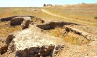
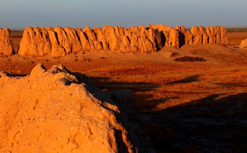
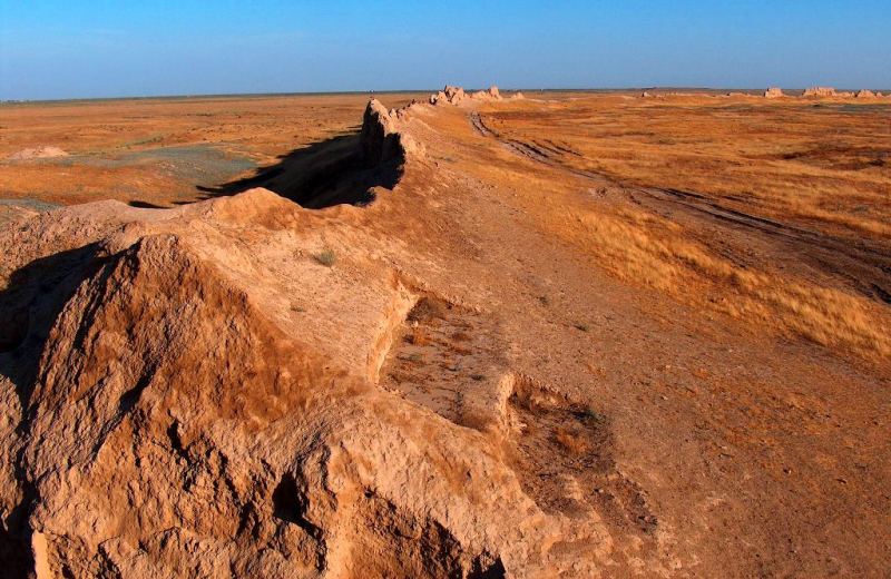
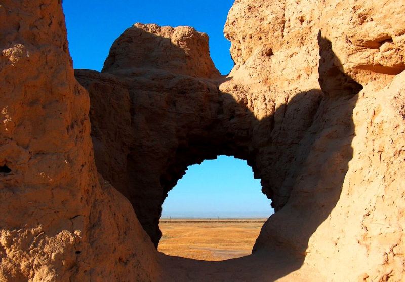
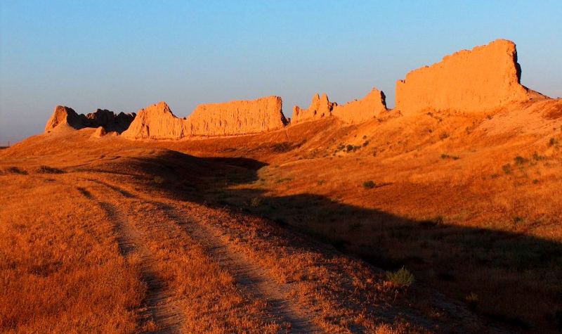
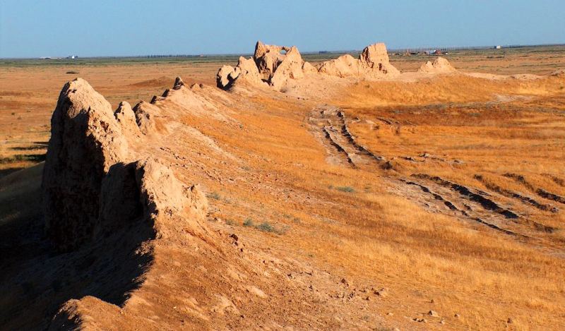
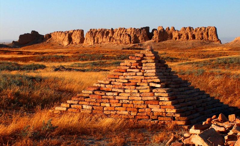
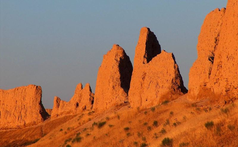
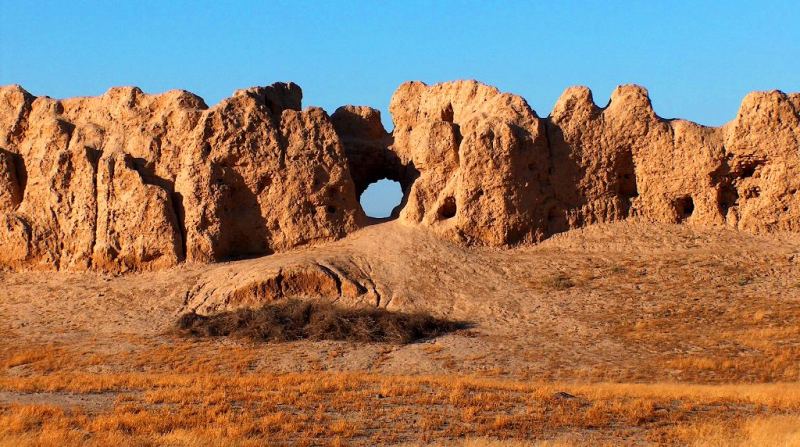
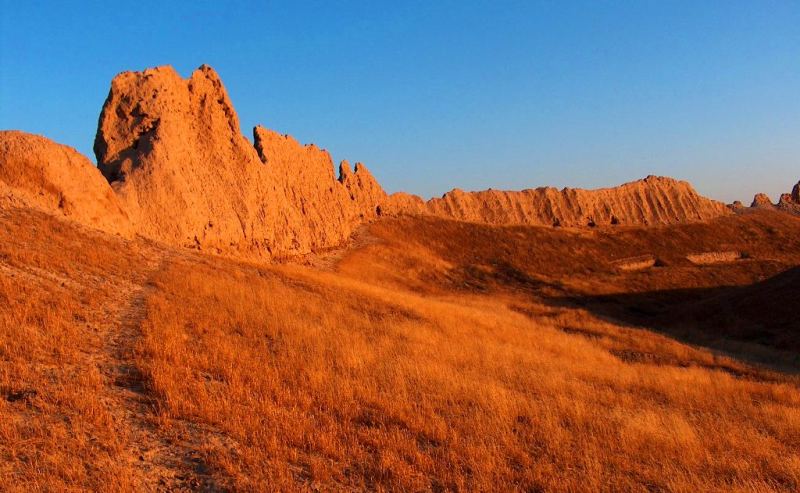
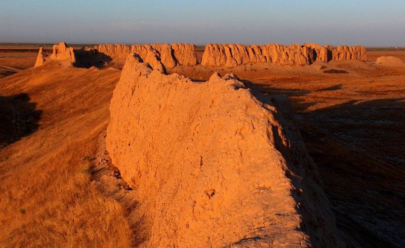
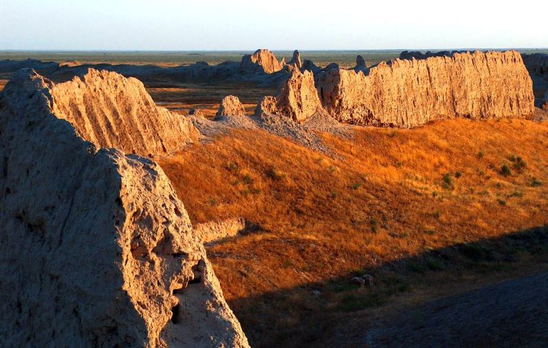
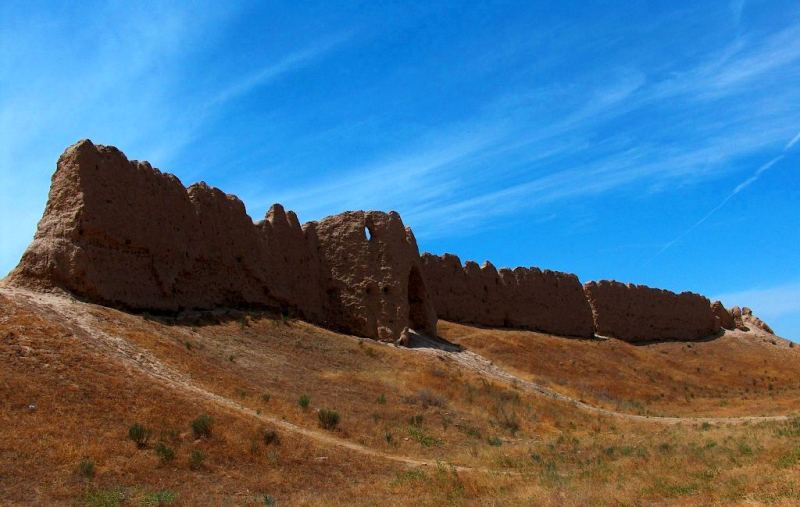
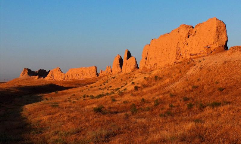
Ruins of Sauran medieval fortress are situated in desert, 40 km to the north-west from Turkestan city (before the XVII c. – Yasy) (Kyzylorda region, Kazakhstan Republic). There are the most spectacular and well-preserved medieval ruins in Kazakhstan.
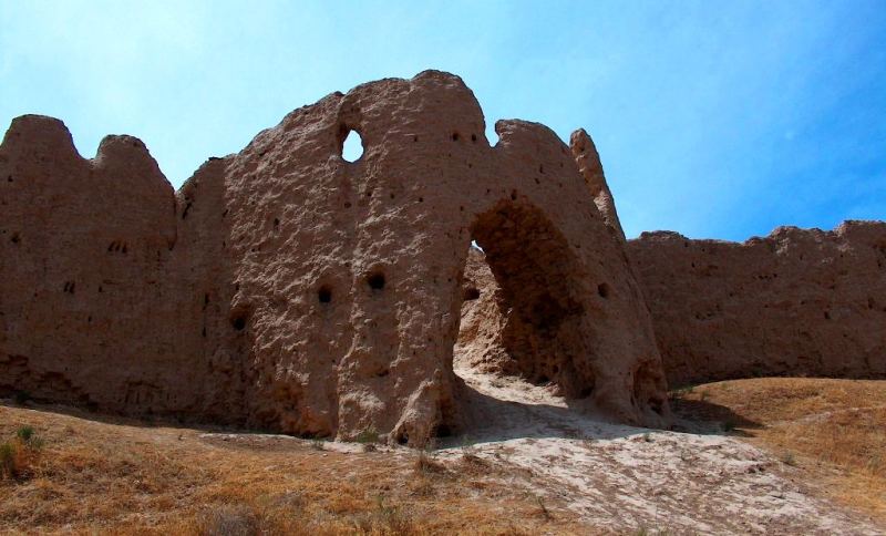
Medieval Sauran city is regarded and described as a standalone city oval in shape and surrounded by fortified walls in a comparatively good state of preservation in the literature on the subject from the time of its first archaeological survey.
Historians from the IX Century reported that the city of Sauran had seven protective walls, a mosque and a marketplace. The discovery of underground water canals bears witness to the technological skill and craftsmanship of its inhabitants.
The Mongols could not take Sauran by force of arms for many months, and only stormed the walls after they had starved the population. Because of its strategic location not far from the Syr Darya and its significance as a trade centre on a crossroads along the Silk Road, Sauran rebounded from its sacking in the XIIIth Century, to become the capital of the White Horde.
Tamerlane turned the city military stronghold - and again Sauran stood firm. Even the much-feared Zhungars failed to take control of the fortress. At some stage during the XVIII Century, the city fell into oblivion - in the long run, the sea route to the Indies had a more devastating impact on the Silk Road than all the hostile invasions put together.
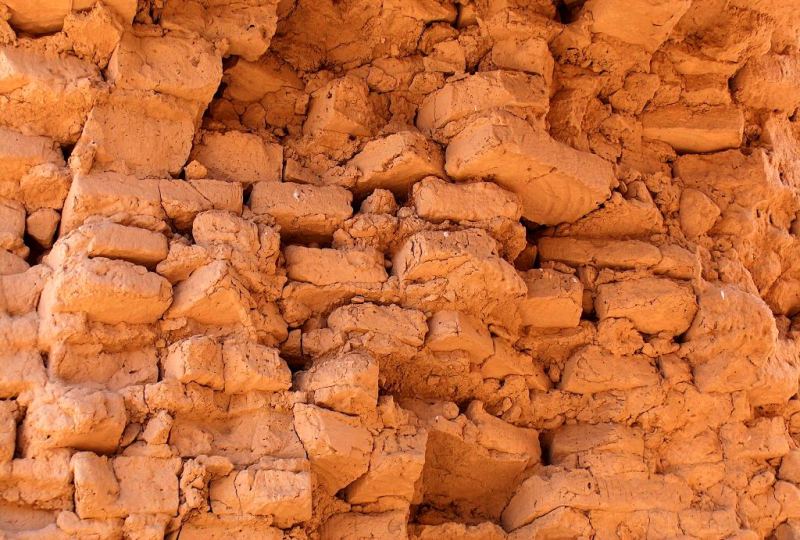
Today, the ravages of time gnaw into the remains of the circular wall that, with a diameter of just over one kilometre, sticks up out of the steppe. It is only thanks to the dry climate that the fortress, built of limestone bricks, has not disappeared altogether.
Though a sign indicates that this site is protected by the state, the lack of proper road signs and the bumpy road towards its location speak a different language. The fortress of Sauran, to the northwest of Turkistan along the road to Kyzylorda, is not easy to find.
Twice, signs with the word Sauran on them send the ignorant off in the wrong direction - it seems there are two villages in the area that bear the name Sauran as well. The actual site of the ancient city ruins is situated beyond those villages, some 1.5 kilometres off the road to the left (if coming from Turkistan).
You must follow a dirt road that starts opposite a big copper image of an eagle. After one kilometre, you cross the Shymkent - Kyzylorda railtrack, from where the remains of renowned Sauran can already be seen.
Near neighborhood with remnants of mediaeval agricultural and irrigation layout planning is supposed to be a vast farm district, the area of which is variously and approximately estimated.
Until now in visual examination and particularly on the air photos we can clearly distinguish some household plots with enclosed rectangular gardens and vineyards, and a network of irrigation ditches and canals.
As far back as the end of the 60-s as a result of decoding air photos of the city neighborhood, the traces of the kariz/kahrez, underground drainage galleries to supply ground water to the city.
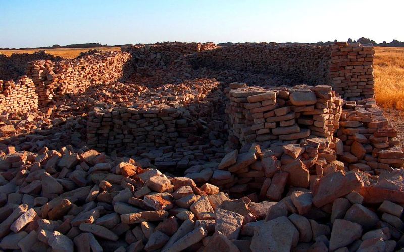
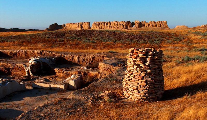
Major structural elements of Sauran archaeological complex have already been surveyed, described, and localized on the ground. Primarily Sauran is a city - fortress with an adjacent suburban zone and necropolis.
The preliminary archaeological investigation of this monument has been conducted under the State program “Cultural heritage” involving a broad-scale examination of a number of remarkable architectural and archaeological monuments (mosques, madrasahs, khankahs, mansion houses, city gates).
As far as charbag (a landscaped garden-park) is concerned, it may correspond to the walled-in territory around the fortress (at the first stage) or most likely the other layout design fenced about with straight walls and towers at a regular distance.
The area of the enclosure is approximately 300 х 1200 m. The traces of this layout design are clearly seen on the aerial photos taken at a distance of 150 m to north-east from the fortress.
This layout design was actually built on the kariz lines and in some way (so far not clear how) connected with them. Inside its walls there was a pool, as well as ruins of some construction, which corresponds to the service space described by Wasifi.
This is established that the medieval city of Sauran was located in the lower delta zone of three former mountain streams – the Tastaksay, the Aksay and the Maidantal, flowed from the southern slopes of the Karatau mountains in the direction of the Syrdarya river.
In the middle and lower reaches they had multiple parallel, deviating and converging streamflow separations. Combined they constitute three talus trains converging all together in desert, in the area of the antique cities of Karatobe and Sauran, where their surface and underground waters mingle (Deom, Sala 2005).
The Maidantal river consists of the largest surface and underground water flows and actually the area where it runs is the major hydrologic basin; the Aksay river flow is not so strong, but since it runs in the central lower-lying ground, it has middle and lower reaches of the river bed, which is fed by water in the place of junction of underground waters of other 2 streams.
Except for the principal canyon of the rivers Tastaksay and Maidantal and lower reaches of the river Aksay, which have although poor but year round perennial streams, all the others are intermittent streams flowing only in spring.
The unique character of Sauran monument is that all the principal elements of its archaeological complex still remain in a satisfactory undamaged condition and easily accessible for investigation.
These adjacent elements (of the structure) were located in the same area and more often overlapped each other.

Authority:
« Religious and spiritual monuments of the Central Asia ». The author of M. Khahsimov. Publishing house, Saga, 2001. Samarkand. «Masterpieces of the Central Asia», Tashkent, Publishing house Sanat, 2004. www.farsah.kz. «Ancient Kazakhstan» Arias, Saki, Hun, Turkis. The children's encyclopedia of Kazakhstan. Almaty, 2007, publishing house Aruna. Medoev A.G., «Engravings on rocks.Sary-Arka, Mangyshlak», Almaty, Zhalyn, 1979. Marikovskij P.I. «Figures on rocks of Southern and Central areas of Kazakhstan», Almaty, Tuganolke, 2004. The guidebook across Kazakhstan. Authors Dagmar Schreiber and Jeremy Tredinnick. Publishing house "Odyssey".2010.
Photos
Alexander Petrov.