


![]()
You are here
History of Akbaital pass.

Combined tour in Tajikistan.
“We leave something of ourselves behind when we leave a place, we stay there, even though we go away. And there are things in us that we can find again only by going back there”
Pascal Mercier. «Night Train to Lisbon».
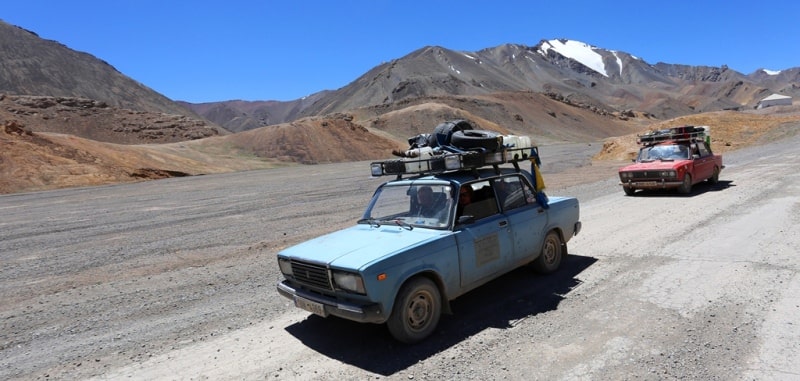
Horse tours and campaigns in Tajikistan.
From the Suok-Chubyr tract, the tract imperceptibly enters the wide valley of the small Akbaital River, which flows perpendicularly into the Kizil-Dzhiik. giving the main share to the Muzkol. The auxiliary role of Akbaytal relative to the Muzkol river was, apparently, the reason that even on the pre-revolutionary maps it was called "Chan-Su" ("side river").
Later, in connection with the Akbaytal pass, located in its share, the river on the maps was also called “Akbaytal”, sometimes adding the word “northern”. It is possible that the river had two names in parallel, as is often the case, but with the increased priority of the Pamir Highway and its main pass, the latter prevailed.
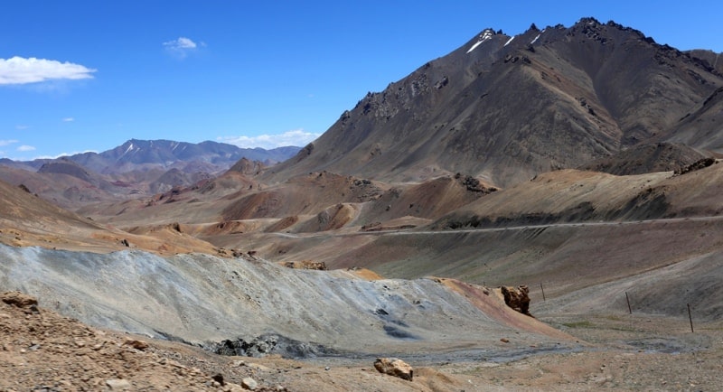
Akbaital slowly flows along its valley in a narrow strip, forming small floods in places.Gradually, the height increases, and the still rounded side slopes also slowly converge. The valley with a hollow river goes up, and nothing seems to portend the proximity of the highest pass of the tract.
But the impression, based on the idea that the pass should be in the upper reaches of the valley, turns out to be wrong here. At a small lagoon, the road steeply crosses the river, and then an ascent to the pass suddenly opens.
It begins immediately from the river and stretches upward along a small cleft of the eastern slope of the valley towards a stream running alongside. From this place and higher, the river itself is called in the old Chan-Su way.
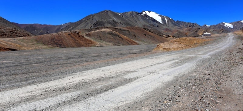
Having risen to its highest mark, the road runs quite smoothly for a couple of kilometers, then a view opens onto the wide valley of the South Akbaital River, where a more extended and steep descent leads. Taking a closer look, it is easy to notice that the saddle-pass is a long hollow that runs between two parallel ridges of mountains.
The pass is relatively uncomplicated apart from its height. There are no complicating glaciers and snowfields on the way, no overhanging slopes and no sharp ridge. There is space, only stones around, solitary rocks and calm slopes.
Still, the pass cannot be considered completely safe, sometimes there are accidents here too. But for many years Akbaytal did not have a bad reputation, which, apparently, determined the popularity of the pass since ancient times.
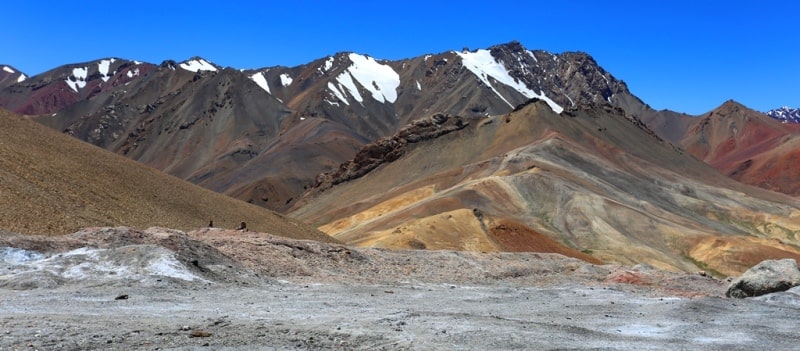
However, despite the old acquaintance with the pass, the meaning of its name and the rivers that flow from it remains unclear. The fact is that the current literal translation of the name from the Kyrgyz language "White mare" ("ak" - "white", "baital" - "mare") is unacceptable, since there is nothing like a white mare in the shape of the pass.
It is dominated by gray and dark colors. Nor does the sight of the rivers and their valleys flowing down from the pass remind of the white mare. Researchers suspected that the word "baital" has some other meaning here.
Some people ask the question: is it possible to see the word “tal” (“willow”, “talnik”) in “baital”. Unfortunately, you can't. Both rivers flow from the pass at an altitude of more than 4000 meters above sea level to spacious valleys with a typical alpine steppe landscape.
On the lifeless squabbles and bottoms of the valleys, grass grows only in places, and in summer a narrow strip of greenery breaks through here and there at the water's edge. In the valleys of both rivers, not to mention the pass, no willow or shrub grows.
Meanwhile, the word "baital" is often used in geographical names. It is, for example, marked in the name of the Alibaytal River, flowing in the watershed of the Ural and Ilek rivers. Yes, and not far from our places - the Bozbaital River, flowing through a wide valley, again with a steppe landscape, flows into the Kokuybel River from the Muzkol ridge.
There is even more sparse vegetation, lifeless slopes in gray tones. And this feature of the valley is emphasized in the name by the Kyrgyz word “boz” (“light gray”), which also denotes a dry area devoid of lush vegetation.
In addition, the geologist P.P. Chuenko noted in 1935 that the caravan path from Kokuybel to the Ail-Utek pass leading to the upper reaches of the Tanymas, passed through a wide, flat valley (now there is a road), called "Baital Yuli", then there is a "road along Baytal".
It turns out that the word "baital" reflects some features of the river valley, not the pass. It seems that it refers to the steppe nature of the valley and means "wide, large steppe valley", which satisfies the types of all the mentioned valleys, in whose name it is used.
Then it turns out that "Akbaital" is a "wide white steppe valley". This characteristic cannot be attributed to the valley of the northern river: there is no prominent white color there. In addition, the river itself, as we remember, changed its name.
But in the valley of the southern river, white rocks are clearly visible in the side slope. The channels of the river and its small tributaries are dotted with rubble of white stone, in some places there are blocks of the same rock.
And, probably, it is no coincidence that the old burial ground at the right side of the valley, near the mouth, made of the same material, is called "Ak-Gur" ("white grave"). There is reason to believe that this valley of the steppe type with a noticeable white color of rocks reliably guided travelers going to the pass, which can be considered an important reason why the characteristic feature of the valley became the name of the pass.
The southern valley widens more and more towards its mouth and converges with the valley from Lake Rangkul. At the place of their confluence, a rounded Tongelek-Batyku depression ("round pit") appeared, which served as a fork in the former caravans.
Here the road is already covered with asphalt. Without repeating the old path, he takes the shortest path with a barely noticeable slope to the south. Signs of civilization appear - the highest city in the Pamirs, Murghab, is approaching.
Nowadays, few people remember that the city arose on the site of the former fortification of Pamir Post, built by Russian soldiers in 1893 near the small camp of Sha-Jan. The town itself took over the name of the Murghab River, which flows here in a swampy spacious grassy floodplain.
This picture of a river with green banks, unusual for an altitude of 3,600 meters above sea level, is captured in its name - "grassy river" or "meadow river".
Geographic coordinates of the Akbaytal pass: N38 ° 33'40.13 "E73 ° 35'53.12"
Authority:
S. Alimov. "Pamir Highway: a journey into the world of names." Almanac "Wind of wanderings", №23
Photos by
Alexander Petrov.