


![]()
You are here
Hiking tour on Lineysky columns and lake Kedrovoe.


Observation excursion in West-Altay reserve.
"The mountains call to those whose souls are their height and shape the character of those who live at their foot."
Short description of a route of a tour from town of Ridder in West Altai Nature Reserve:
Ust-Kamenogorsk – settlements of Tarhanka - of Cheremshanka – city of Ridder – West Altai Nature Reserve – Koksinsky cordon – Lineyskie Pillars – Lake Kedrovoe – village of Poperechnoye – city of Ridder – Ust-Kamenogorsk.
Distance of route: 458 km.
Distance of an active part of a tour: 47 km.
Season: June - September.
Best time for an tour: June, July, August.
Duration of tour: 7 days, 6 nights.
Detailed program of a tour day after day on natural sights of West Altai Nature Reserve:
Guided tour from Kazakhstan to Russia.
Day 1. Ust-Kamenogorsk - city of Ridder (146 km, 3.5 hours).
Transfer to Ridder, arrival, transfer to hotel, accommodation, a lunch.
Town history Ridder begins since 1786. At the time of Catherine II reign, in May, 1786 9 search expeditions, one of which was headed by the 27-year-old mountain officer Philip Ridder, were sent to Altai. On May 31, 1786 he finds the richest field containing gold, silver, polymetals.
On February 6, 1941 the town Ridder was renamed into Leninogorsk. On June 28, 2002 the historical name - Ridder was returned to the town of Leninogorsk. After a lunch visit of the local history museum, in the local museum it is collected rich quantity of exhibit about city stories, in funds of the museum there are more than 28 thousand exhibits.
Visit of the museum of zinc plant, there are very interesting exhibits and materials about history of the zinc mine here.
Visit of the Altai botanical garden which began the work in 1935.
The founder of a botanical garden Pyotr Aleksandrovich Ermakov is buried in the territory of a garden. The unique collection fund of live plants Altai a botanical garden is presented by 3745 types, forms, grades, samples, the collection of fruit and berry cultures consists of 342 types.
A sightseeing tour on the town, visit of the central square of the town. Dinner and overnight.
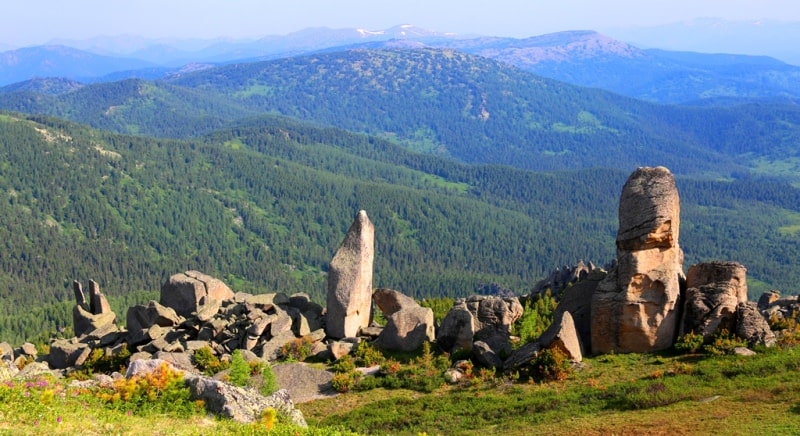
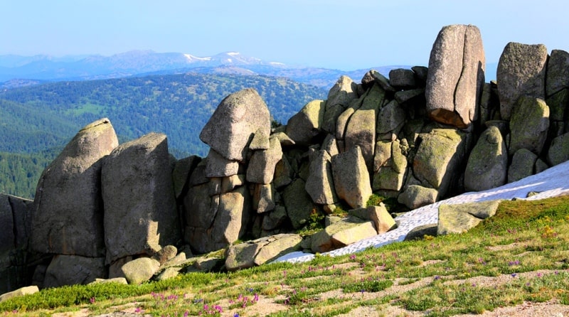
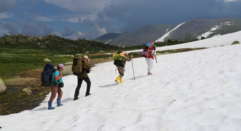
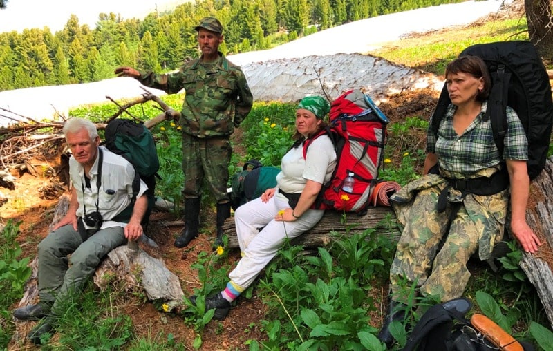
Day 2. Ridder - Lineysky pass - river Black Uba - Koksa cordon - Gulbiche watershed moor - Lineysky columns (Stone fairy tale) (68 + 8 = 76 km, 3,5 hours).
Breakfast. Transfer: Ridder - the pass Lineysky - Koksa cordon (68 km).
Our way from Ridder conducts on the automobile grader on the East to border with the Russian Federation. We pass turn on the village Poperechnoe to which there are only 4 kilometers from here. We pass tourist centers the Grey meadow, Klimovka which are to the right of the road, also we pass two cordons of huntsmen of West Altai Nature Reserve White and Black Uba.
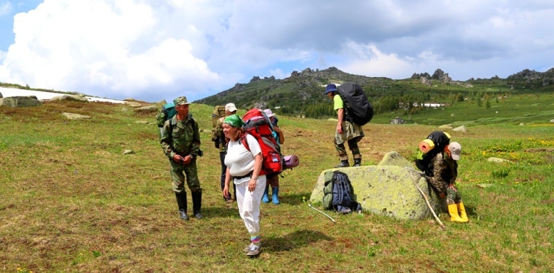
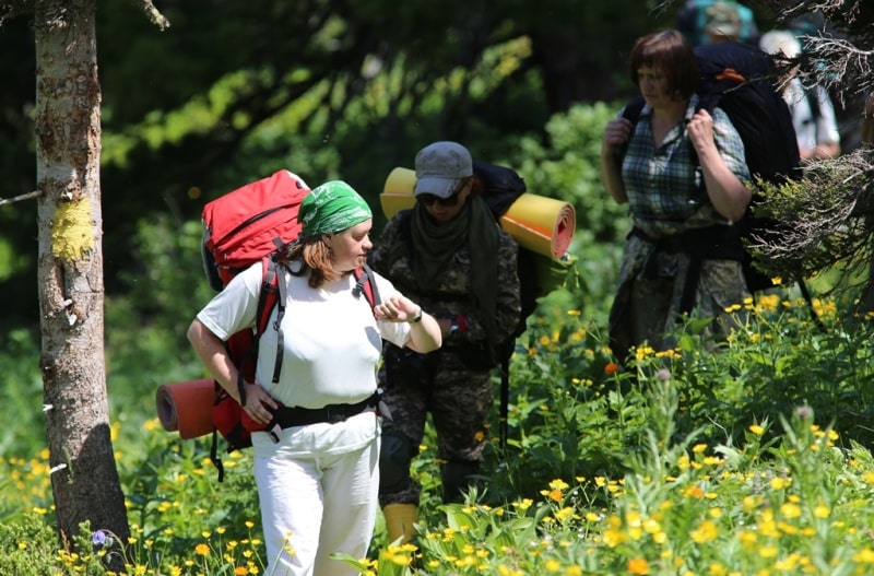
Arrival in vicinities of a cordon of Koksa, preparation for trekking.
Hiking: vicinities of a cordon White Uba - a stream of Sikhoi 1710 m. a. s. l. (2 km, 1 hour).
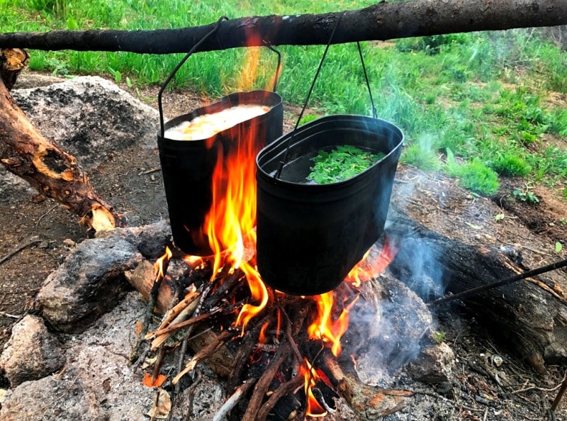
A lunch in way. Rest at a stream. Slightly below than the ford through a stream Dry there are small picturesque falls.
Further transition: a stream Sukhoi - a stream of Shwamp 1765 m. a. s. l. (2 km, 1 hour).
Rest, small lunch.
Hiking: a stream Shwamp - the watershed moor of Gulbiche of 1870 m. a. s. l. - the natural landmark Lineysky columns (4 km).
Arrival in the natural boundary Lineysky columns, pitch up a tent, dinner and overnight.
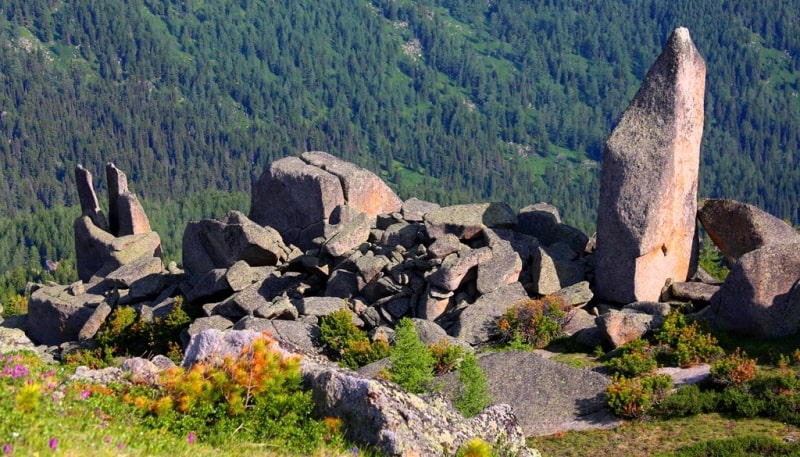
Day 3. Lineysky columns (10 km).
Breakfast. Hiking around Lineusky columnus.
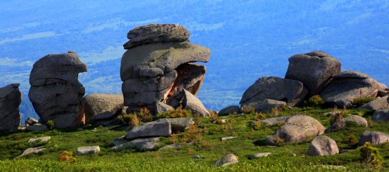
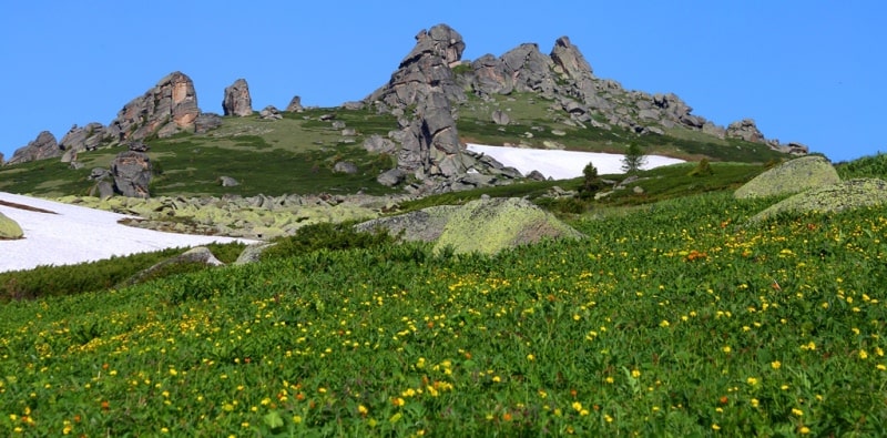
In the central part of the natural landmark Lineysky columns are concentrated the highest stack on 35 meters. It is the most unique and attractive a sight not only West Altai Nature Reserve and all Kazakhstan Altai, widely known outside Kazakhstan.
Natural landmark extent from the North on the South 2 kilometers 500 meters and from the East on the West the natural landmark was stretched on 3 kilometers. The area the natural landmark Lineysky columns makes 750 hectares. Walks in the environs of Lineysky columns.
Lunch, dinner, overnight in tents.
Day 4. Lineisky columns - Lake Kedrovoye 1845 m. a. s. l. (7 km).
Breakfast. Hiking: the valley of the Lineisky Poles - the pass between the valleys of the rivers Belaya Uba and Barsuk 1830 m. a. s. l. - Lake Kedrovoe.
After we leave the tourist camp “Barsuk”, we will wade into a small river of the right tributary of the Barsuk river and begin to climb a low pass, which is the watershed between the Belaya Uba and Barsuk rivers. From the pass you can see a fascinating view of the northern part of the natural landmark Lineisky Poles.
On the ridges rise granite whimsical remnants. Lunch on the way. From the pass we descend on the right side of one of the tributaries of the Belaya Uba river on the left side of this river there is a moraine, stone river with a length of 1 kilometer 600 meters, which accompanies us to the point of ascent to Kedrovoye Lake.
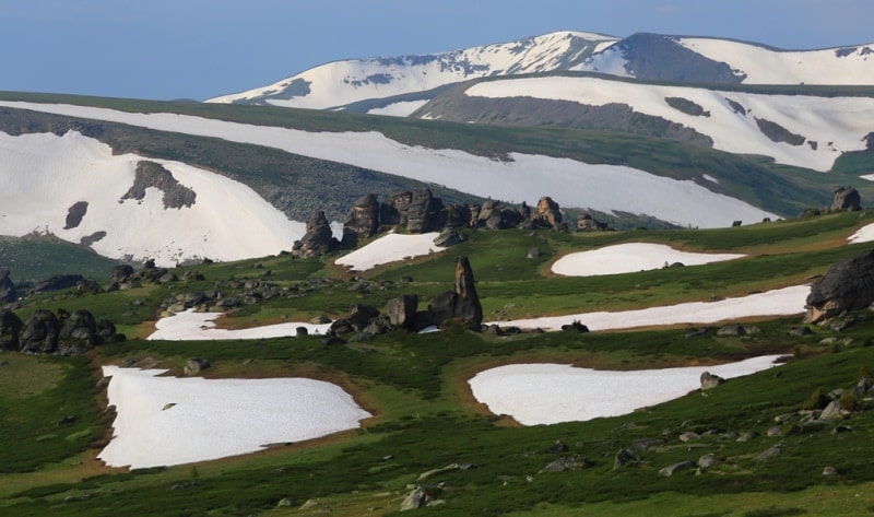
Soon we cross the ford of several left tributaries of the river Belaya Uba and begin the ascent to the lake. Arrival at the tourist parking at the lake Kedrovoye. Moraine-Dam Lake Kedrovoye is located on the eastern slope of the Ivanovsky Range, at an altitude of 1845 m. a. s. l.
Lake Kedrovoye is located on the territory of the West Altai Natural Reserve, in the Ridder district of the East Kazakhstan region. The width of the Kedrovoye Lake is 225 meters, the length of the lake is 309 meters. The lake is filled with snowfields, which are concentrated on the southern steep slope.
Snowfields periodically break away from the boundary of the snow and noisily break down into the lake. The eastern shores of the lake are steep, while the northern and western shores are gently sloping and easily accessible. With the exception of the southern slope, the rest of the lake is in the thickets of old cedars, some of which are more than 400 years old.
The lake is drainless, filtration from the lake is carried out by groundwater. The lake is a local natural attraction.
Walk around the lake.
Pitch up a tent, dinner and overnight in the tent.
Day 5. Lake Kedrovoye - Lake Shcherbakov (Listvyazhnoye) - Beloubinsky lakes (8 km).
Breakfast. Walk on the lake Shcherbakov 1775 m. a. s. l. (1.5 km).
Lake Shcherbakov is located in the northwestern part of Lake Kedrovoye. In 2002, Listvyazhnoye Lake was renamed Shcherbakov Lake. In honor of the scientist and naturalist Boris Shcherbakov. This was done by decision of the Institute of Geography of the Academy of Sciences of the Republic of Kazakhstan during the compilation of a map of reserves.
Lake Shcherbakov is located on the territory of the Western Altai Reserve, which was created on the initiative of B. Scherbakov. The path to the lake is very picturesque and passes along the northern slope of the Ulbinsky Range. The length of the lake Shcherbakov is 306 meters and the maximum width of 154 meters.
The shores of the lake are steep, inaccessible, and only in the western part of the place where a small river flows into the lake, one can get to the shore of the lake without difficulty. From the south to the lake abuts the steep slopes of the Ulbinsky ridge.
From the eastern, northern and western sides of the lake is in the coniferous framing of trees mainly consisting of cedar. The lake is drainless, filtration from the lake is carried out by groundwater.
Return to the tent camp on Lake Kedrovoye (1.5 km). Lunch.
After lunch, walk to the First Beloubinsky Lake, 2,035 m. a. s. l. (2 km).
The width of the lake is 314 meters, the length of the lake is 288 meters. The lake is filled with snowfields, which are concentrated on the southern steep slope. A small river flows out of the northern part of the lake and here, close to each other, there are three small lakes.
The southern slope of the lake is steep and snowy, the banks of the northern, western and eastern parts of the lake are gently sloping with thickets of dwarf birch trees. Walk in vicinities of the First Beloubinsky lake.
A walk to the Second Beloubinsky lake is 2055 m. a. s. l. (500 meters).
The length of the Second Belubinsky lake is 195 meters, width 156 meters. The southern slope of the lake is steep and snowy, the banks of the northern, western and eastern parts of the lake are gently sloping with thickets of dwarf birch trees. The lake is filled with snowfields, which are concentrated on the southern steep slope.
Walk in vicinities of the Second Belubinsky lake.
A walk to the Third Beloubinsky lake is 2135 m. a. s. l. (1 km).
From the Third Lake we leave to the Second Lake and along a steep slope we begin the ascent to the terrace of the Third Belousinsky Lake. The length of the lake is 278 meters, the greatest width is 184 meters. Moraine Third Belubinsky Lake is located on the eastern slope of the Ivanovsky Range in an intermountain circus with steep and steep slopes.
The northern shore of the lake is flatter and more easily accessible.
Walk around the lake. Return to Kedrovoye Lake (1.5 km).
Dinner and overnight in tents.
Day 6. Lakes Cedar - a cordon Palevsky (15 km).
Breakfast. Hiking: the lake Cedar - the Ivanovskiy ridge - a cordon Palevsky (15 km).
From the lake Cedar we rise by a crest of the Ivanovskiy ridge. From a crest of the ridge majestic views of the Altai taiga, of the valley of Belaya Uba open. In good weather in the West it is visible top the Vysheivanovskiy 2778 meters high above sea level.
On our way the taiga reminds the Alpine tundra with a cedar Siberian dwarf pine gradually more vegetation changes. A lunch in way. Further our way goes along the river Palevskaya Razlivanka among a dense Altai taiga, gradually the track passes into the road and we come to an forest cordon.
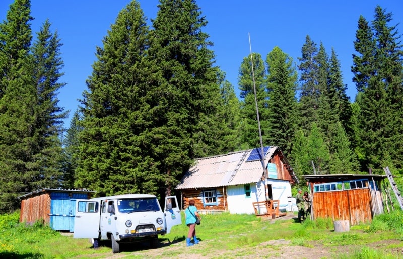
Accommodation in the guest house on the Palevsky cordon, a dinner and overnight.
Day 7. Cordon Palevsky - settlement Poperechnoe - Ridder - Ust-Kamenogorsk (197 km).
Breakfast. Transfer: The Palevsky cordon - the village Poperechnoe (20 km).
On the way visit of the village Poperechnoe. The ancient village Poperechnoe, is the taiga village with the rich, interesting, unique customs and traditions which remain locals for more than 250 years. The cozy village consists of one street and it rests against the river bank White Uba, from here and there was a name of the village - Poperechnoe.
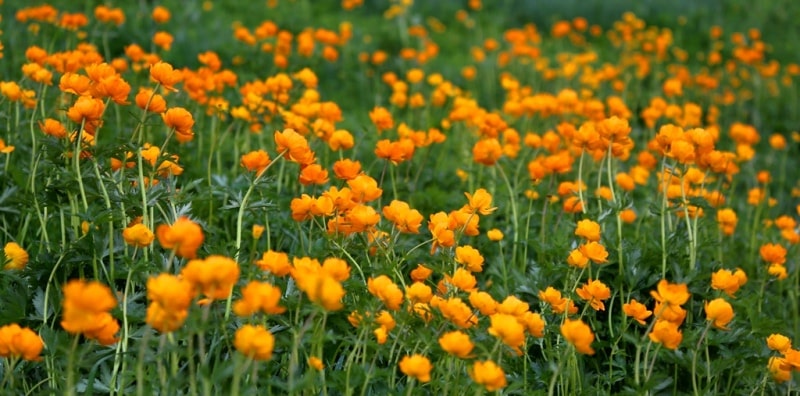
Around the village there are picturesque natural sights - the mountains which overgrew the century wood hills overgrown with dense deciduous and coniferous trees, abundance fragrant разнотравья and flowers. It is a lot of around the village of the small marvelous rivers which bear the waters in White Ubu.
Walk on the settlement and its vicinities.
Transfer: the village Poperechnoe - Ridder (31 km).
A lunch in cafe.
After a lunch transfer: Ridder - settlements of Ulba - of Cheremshanka (41 km).
A stop in the settlement of Cheremshanka. The village is in Glubokovsky district, is the administrative center Cheremshansky of the district. Through the village the river Cheremshanka - the right inflow of the river Ulba flows. It is founded in 1799 in the Ridder district of the Zmeinogors district by conservatives Poles.
In the central part of the village there is a local market on which it is possible to see taiga gifts. On a market it is possible to buy birch brooms, officinal herbs, pine nuts, salty mushrooms including legendary local milk mushrooms, different wild berries jam, medical tinctures - pantocrine ((medicament prepared from antlers of young Siberian stag) and others.
Also on a market in various quantity local souvenirs of a product of local handymen from birch bark, woodcarvings are presented.
Further transfer: the settlement of Cheremshanka - Ust-Kamenogorsk (105 km).
Arrival in Ust-Kamenogorsk, end of a tour.


Note:
Author program of Alexander Petrov. Copying and introduction - from the sanction of the author.
Photos by:
Alexander Petrov