You are here
Gorge Dzhety-Oguz.
Tours to gorge Dzhety-Oguz.
“The view from our overnight stop to the south through the Jety-oguz gorge to the Tien Shan was magnificent. The snow-white, two-horned Oguz-bash closed the valley in the south and resembled the Jungfrau mountain of the Bernese Alps, but was even more original and magnificent both in its form and in its whiteness.”
P. P. Semenov-Tyan-Shansky. “Journey to the Tien Shan”. 1856-1857.
Tours from Bishkek to Dzhety-Oguz gorge.
Upper boundary of Jety-Oguz gorge is located at an altitude of 3160 meters above sea level, lower boundary is located on southern side of village of same name at an altitude begins at an altitude - second mountain section of Issyk-Kul Nature Reserve. Jety-Oguz gorge is located on northern slope of Terskey Ala-Too mountain range in Jety-Oguz district of Issyk-Kul region.
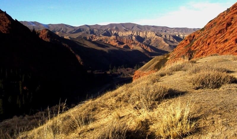
The gorge cuts through the northern slope of the Terskey Ala-Too ridge in the submeridional direction. The gorge extends for 39 kilometers from the upper boundary of the glaciers Ailanysh Central located at an altitude of 4679 meters above sea level, Ailanysh North located at an altitude of 5126 meters above sea level (northern slopes of Karakol peak) and Ailanysh South located at an altitude of 4323 meters above sea level.
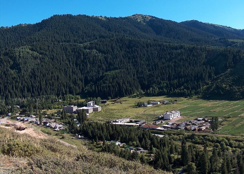
The gorge itself begins immediately behind the village of Jety-Oguz at an altitude of 1792 meters above sea level. In the middle reaches of the Jety-Oguz River there is an intermountain depression Kek-Dzhayik, which has the shape of an asymmetrical basin.
The bottom is inclined towards the floodplain of the Jety-Oguz River, weakly dissected, the height above sea level is 2300 - 2500 meters. The slopes are steep, dissected by deep river valleys. From the north, the depression is bordered by the mid-mountain ridge Kek-Dzhon.
From the Kek-Dzhayik depression to the watershed strip - a high-mountain section of the gorge (4200 - 4900 meters above sea level and higher). elief: narrow ridges, cirques, trough valleys, moraines, 25 modern glaciers with a total area of 33.1 square kilometers, traces of Pleistocene glaciers.
From the northern foot of the Kek-Dzhon ridge to the piedmont plain - a low-mountain section of the gorge (up to 2500 meters). The slopes are gentle, dissected by numerous dry gorges and gullies. The bottom is wide up to 300 - 400 meters with a well-defined floodplain.
The gorge is of erosional origin, individual sections arose at different times. The Kek-Dzhayik depression arose before the Quaternary. In the gorge, work is carried out to protect and plant forests. In the gorge is the Jeti-Oguz resort, located 31.5 kilometers southwest of the town of Karakol in the middle part of the Jeti-Oguz gorge at an altitude of 2037 meters above sea level.
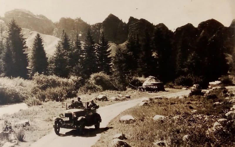
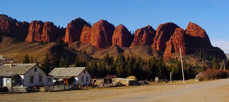
Right in front of the resort, among the forest slopes on both banks of the river, there are spectacular outcrops of high, bright crimson and massive red rocks made of layered, red sandstone, which the Kyrgyz called Jety-Oguz ("Seven Bulls").
Since those ancient times, as a result of weathering processes, the number of rocks has increased significantly. The red rocks are so unique and beautiful that in 1968 they were depicted on Soviet postage stamps dedicated to Kyrgyzstan.
Along the zone of deep tectonic disturbances in the Terskey Ala-Too ridge, there are outlets of hot mineral springs in the Jety-Oguz gorge. The main therapeutic factors of the resort are the mountain climate and thermal (temperature 33 - 43 °) springs with high radioactivity.
Here they treat diseases of the joints, spine (rheumatic, gouty arthritis, etc.) and peripheral nerves, mainly of metabolic origin, as well as some gynecological and skin diseases. Radon decay products are adsorbed on the skin and form the so-called active plaque, during the decay of which the patient is exposed to radioactive irradiation for about 3 hours.
Jety-Oguz Gorge is the second mountainous section of the Issyk-Kul Nature Reserve.
Zonal areas of Jety-Oguz Gorge.
- plain-foothill semi-desert located at an altitude of 1630 to 1850 meters above sea level, mountain-valley soils, light brown and light chestnut, wormwood-cereal steppe with shrubs,
- foothill-mid-mountain steppe zone located at an altitude of 1850 to 2100 meters above sea level, mountain chestnut soils and chernozems, cereal-wormwood dry steppe, tall-grass meadow steppes,
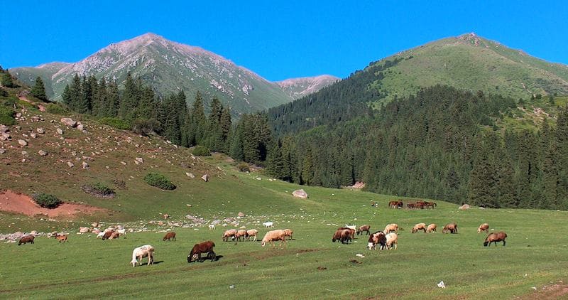
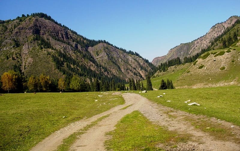
- mid-mountain forest, meadow and steppe zones located at an altitude of 2100 to 3000 meters above sea level, mountain forest and mountain and meadow soils, Tien Shan spruce with rich shrub undergrowth, forb-grass lawns,
- high-mountain subalpine meadow-steppe zone located at an altitude of 3000 to 3400 meters above sea level, mountain, meadow and steppe subalpine soils, forb, geranium, alchemilla and other meadows,
- high-mountain alpine meadows located at an altitude of 3400 to 3700 meters above sea level, mountain and meadow sod and semi-peat soils, forb and kobresia meadows, rocks, screes, glaciers and moraines,
- glacial-nival zone located above 3500 - 3700 meters above sea level, patches of alpine meadows, individual plants of chickweed, edelweiss, anemones, mosses and lichens, snowfields, glaciers.
In the gorge at an altitude of 2100 to 3100 meters above sea level, forests grow on the more humid northern slopes and in deep shaded areas. Light spruce forests of the park type are very colorful against the background of the eternal snows of the ridge.
The trees are mostly rare, bright flowers are colorful on the lawns. Among them, tall aconite stands out. Its characteristic palmate leaves are deeply incised, helmet-shaped purple, less often white, flowers, collected in long inflorescences, are very unusual.
Aconite contains a strong alkaloid aconitine and is extremely poisonous. Tourists should take this into account on walks and excursions. In the gorge grows the Tien-Shan spruce - a rare in beauty relict tree species preserved from the Miocene period.
Slender spruce trees stand rarely, their drooping branches form a narrow cone of the crown and are somewhat remotely reminiscent of cypresses. On steep mountain slopes facing north and northeast, on coarse rubble soils, dense mossy spruce forests are found.
On such steep slopes, you can find individual mighty trees 40 - 60 meters high, the trunks of which exceed 2 meters in diameter, and their age reaches 400 years. The undergrowth is made up of shrubs: rose hips, honeysuckle, black chokeberry, rowan and currant.
Mountain and forest dark soils, including mountain chernozems, are rich in humus. Spruce forests of the Jety-Oguz gorge alternate with tall-grass subalpine meadows. Above the forest zone on the slopes of the northern exposure there is a subalpine meadow-shrub landscape, representing the transition to the zone of alpine meadows.
In the subalpine zone, along with forb meadows, dense shrubs are common - most often creeping juniper and caragana. In forb meadows, Phlemis montanum dominates, among other plants, primroses, geraniums, forget-me-nots are most common, somewhat less often onions, alchemilla, ligularia and cobresia, very few cereals.
The uppermost belt of mountain vegetation from 3000 to 3800 meters above sea level on the slopes of the northern exposure, in trough valleys and on the southern slopes of syrts is represented by low-grass, but dense alpine forb meadows and alpine lawns on mountain and meadow, to some extent peaty, soils.
Perennial plants predominate: sedge, cobresia, meadows are decorated with bright and large flowers of poppies, tulips, asters, gentians, edelweiss, saxifrage, forget-me-nots, etc. Lawns of alpine vegetation alternate with rocks and wide trains of stone scree.
A typical representative of the alpine flora is the Siberian edelweiss. This herbaceous plant from the Asteraceae family, densely covered with white hairs, has an inflorescence in the form of a fluffy white star. Unlike the closely related species of alpine edelweiss, which has become a rarity in the Alps, the Siberian edelweiss is widespread in the highlands of Terskey Ala-Too, especially in more humid places. In the foothill-mid-mountain steppe zone on the northern slopes of Terskey Ala-Too, rodents (hamsters, voles, red pikas, house mice, mole voles, tolai hares) and predators living at their expense predominate: foxes, wolves, steppe ferrets, steppe cats, porcupines.
Fauna of Jety-Oguz Gorge.
In the mid-mountain zone at an altitude of 2800 to 3000 meters above sea level, there are many predators in the forest zone (brown and Himalayan bears, wolves, foxes, badgers, and, less often, lynxes), as well as roe deer and tolai hares.
The screes are inhabited by the now rare white-bellied marten, weasels, ermines, and the red solongai, which is close to the ermine. The ermine and weasel are agile, bold predators, they feed on mouse-like rodents, but sometimes they attack birds, jumping on their backs and biting off their heads or necks.
The nimble red weasel is fearless and sometimes runs and bustles about its business right at the feet of a person.Wild boars live in the forest zone of the gorge, according to the latest research Its forests are inhabited by about 150 wild boars.
Geographical coordinates of Jety-Oguz gorge: N42°19'13 E78°15'02

Authority:
B.I. Rukavishnikov. "Lake Issyk-Kul and the Terskey-Alatau Ridge". Moscow, "Physical Education and Sport", 1970.
Photos by:
Alexander Petrov.


