You are here
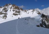
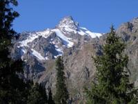
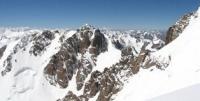
Glaciers of Gissar-Alai ridges.


SIT - Special Interest Tour to Uzbekistan.
"In the Gissar Range system we managed to discover several new glaciers and travel along them along unexplored routes. The road is unpleasant for nervous people. Gradually the cornices turn into "balconies" that hang over the river at a height of 50-70 fathoms and, due to their amazingly light construction, require the full attention of both the horse and the rider. They are made of poles resting on random rock ledges and stakes that are driven into cracks or just placed against the rocks, and it is unknown by what miracle they serve as a support for the balcony. On top of the poles are laid slabs of stone and brushwood with a layer of earth poured on them. The entire structure is no more than a foot wide, due to which the rider must constantly lean toward the abyss so as not to hit his shoulder on some ledge and not throw himself and his horse into the river."
N. L. Korzhenevsky. "A brief report on a trip to the Pamirs in the summer of 1923."
Relevant information in Uzbekistan.
The system of the Gissar-Alai ridges stretches from west to east for 900 kilometers with a width of about 150 kilometers in the western part and up to 80 kilometers in the eastern. This is a fold structure of the Hercynian age, composed of sedimentary and metamorphic rocks with inclusions of granites and diorites.
The eastern part of the Gissar-Alai is the Alai Range, which extends from the connection with the Ferghana Range in the east to the Matchinsky mountain junction in the west. In the region of this node, at the Igla peak 4730 meters above sea level, the Turkestan and Zeravshan ranges extend to the west from the Alai ridge, separated by the longitudinal valley of the Matcha-Zeravshan river, and the Gissar range from the Zeravshan ridge in a southwestern direction.
Ranges reach their greatest heights in the area of the Matchinsky Knot, up to 5500 meters above sea level, and there is significant glaciation with the largest in Gissaro-Alai Zerafshan glacier. The climate of Gissar-Alai is formed by the general circulation of air masses for Central Asia with the predominance of west-east transport and is distinguished by continentality with sharp seasonal and daily fluctuations in meteorological elements.
The main precipitation is brought by southwestern air currents from the Atlantic Ocean in the winter-spring period. Most precipitation falls on the southern slopes of the Gissar Range (about 2000 mm per year). To the northeast, the amount of precipitation decreases, and on the northern slope of the Turkestan ridge, about 1000 - 1200 mm falls in the crest part, and to the east, in the basins of the Isfayramsay, Aravansay and Ak-Bura rivers, 500 - 600 mm.
In the upper reaches of the Karadarya River, where the Alai Ridge merges with the Fergana Range, the amount of precipitation again increases to 800 - 900 mm due to favorable orographic conditions. The height of the firn line as a whole increases from 3400 meters above sea level on the southern slope of the Gissar ridge to 4540 meters above sea level on the southern slope of the Alai ridge in the Kyzyl-Suu river basin.
Within the region, significant fluctuations in precipitation and firn line height are observed depending on the height of the ridges and their orientation relative to winds carrying moisture, which has a significant impact on the nature and size of glaciation.
According to the Catalog of Glaciers of Tajikistan, in Gissar-Alai there are 3890 glaciers with a total area of 2327.8 square kilometers *. Of these, glaciers of the northern slopes of Turkestan and The Alaiski ranges, which give runoff to the rivers of the Ferghana Valley, the Syr Darya basin, have an area of 888.5 square kilometers, which is 38.2% of the total area of glaciation; 60.5% of the area of glaciation (1408.0 square kilometers) belongs to the Amu Darya river basin and 1.3% (31.3 square kilometers) is located in the upper reaches of the East Kyzyl-Suu river of the Tarim river basin.
The most numerous are small glaciers. In Gissaro-Alai, almost all morphological types of mountain glaciers are represented - from small caravan and hanging glaciers to large valley, complex valley and dendritic glaciers.
Glaciers of different sizes and types are very unevenly distributed across the Gissar-Alai territory. In the western part of the region, on the slopes of the Gissar Range and its spurs, having heights from 3000 to 4000 meters above sea level, despite abundant moisture, there are only small glaciers located in the highest parts of the mountains in the Karas, which create favorable conditions for snow accumulation and protect it from melting.
Further east and northeast, as the height of the mountains increases, an increasing proportion of the number and area falls on the valley, and then on the complex valley glaciers, which are becoming larger and reach maximum development in the Matcha mountain node.
The slopes of the ranges here are dissected by deep transverse valleys, and along open to the west longitudinal valleys of the Matcha and Yagnob rivers, as well as from the south along the Sorbo river valley, moist western and southwestern air flows penetrate into this area and through the pass.
The match falls into the upper reaches of the Sokh and Isfara rivers on the northern slope of the Alai Range. Here, up to 2500 mm of precipitation falls annually, which, together with the high height of the mountains and their strong dissection, contributes to the development of powerful modern glaciation, represented by large dendritic and complex valley glaciers, which account for up to 70% of the total glaciation area in this region.
In addition to the Zeravshan glacier, flowing along a longitudinal valley between the Turkestan and Zeravshan ridges, in the area of the Matcha mountain junction there are large complex valley glaciers: Preobrazhensky-Rama and Rossinch on the southern slope of the Turkestan ridge, glaciers Darapioz, Shahisafed and Rog on the northern slope Zeravshan ridge, glaciers Parakh, Tamdykul, Ishtansaldy and others on the southern slope of the Alaisky Range and glaciers of Shchurovsky, Archabashi and others on the northern slope of Alaisky and Turkestan ranges.
This constellation of large glaciers is called the Matchinsky glaciation site. To the east, due to a decrease in the Alai Range and a decrease in the amount of precipitation in the same direction, the area of glaciation decreases, glaciers become smaller, and caravan glaciers begin to prevail again.
Authority:
"Glaciers." L.D. Dolgushin, G.B. Osipova. Series "Nature of the world." Moscow, the publishing house "Thought". 1989.
Photos by:
Alexander Petrov.


