


![]()
You are here
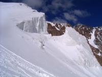
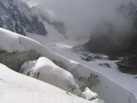
Glaciers of Alai Range.
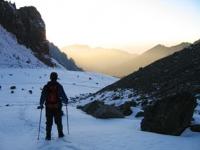
Features of a travel across Kyrgyzstan.
“Travel far enough, you meet yourself”
David Mitchel. “Cloud Atlas”.
Big travel over four countries of Central Asia.
Alai Range - the most significant range of the region both in length and in height. The length of the ridge is 580 kilometers, the average height is 4440 m. a. s. l., the highest point - Tamdykul peak, 5539 m. a. s. l.
Its western extension is the Turkestan ridge with a maximum height of 5621 m. a. s. l.
To the north of the Alai and Turkestan ranges, several advanced second-order ridges extend parallel to the main and separated from them by latitudinally elongated river valleys and intermontane basins. The chain of these mountains closest to the main ridges is not inferior to them in height.
The most significant of the advanced ranges is the Kichik-Alai ridge. Its length is about 100 kilometers, the average height is 4400 m. a. s. l. The relief of the high mountain zone of the Alai and Turkestan ridges and the chain of leading ridges closest to them is characterized by a sharp dissection and an abundance of glacial relief forms in the form of trogs, many of which are occupied by modern glaciers.
The southern slopes of these ridges are short and steep. There are 1366 glaciers on the Alai ridge with a total area of 956.3 square kilometers, on the Turkestan ridge 581 glaciers with a total area of 648.9 square kilometers. There are 477 glaciers on the southern slope of the Alai Range, their total area is 366.9 square kilometers.
Glaciers in the western part of the southern slope give runoff to the right tributaries of the KyzylSuu-Surkhob river (389 glaciers with an area of 335.6 sq. km., the eastern part - in the East Kyzyl-Suu river belonging to the Tarim river basin (88 glaciers with an area of 31.3 square kilometers).
The height of the firn line on the southern slope of the Alai Range. increases with west to east from 3800 to 4290 meters above sea level, the height of the ends of glaciers from 3700-3800 m. a. s. l. in the Surkhob basin to 4230 meters above sea level in the Kyzyl-Suu river basin.
More than 70% of the total area of glaciation on the southern slope of the Alaisky Range falls on simple and complex valley glaciers, and half of this area make up 9 dendritic and complex valley glaciers. Most long glaciers have well-developed firn basins located both in single-chamber and in multi-chamber valleys.
Parts of glaciers descend low and have slight slopes. Often they are bordered by terminal moraines. Glacial tongues are characterized by a small moraine of their surface and a significant development of ablation and the forms of meso and microrelief.
Many asymmetric glaciers receiving more abundant food from the slopes of the northern exposure. Hanging valley glaciers that do not reach the bottom of the main valley are characterized by steep glaciers, broken by cracks. Icefalls occur from them.
Caravan and valley glaciers (about 40% of the number and 18% of the area of glaciation) are found everywhere and are located in the upper reaches of narrow lateral valleys. Small slope glaciers occupy gentle mountain slopes.
Darapioz Glacier in Alay Range.
(11.4 kilometers long, 21.5 kilometers square) is a complex valley glacier in the Yarkhich River basin, at the junction of the Alai and Zeravshan ranges. Its broad tongue flows to the south, and the basins of food of the main stream and large tributary occupy deep canyons of northern exposure. The lower 7 kilometers of the glacier are covered by moraine.
Ishtansaldy Glacier in Alay Range.
The dendritic glacier Ishtansaldy is located in the Rasht region of the Jirgital region of Tajikistan on the eastern slope of the Alai ridge and belongs to the Tandykul river basin. The length of the glacier is 9.8 kilometers, an area of 15.7 kilometers square, in the place where it makes a turn to the north, around the headwaters of the Koksu River.
Steep streams of firn and ice descend from the Talbe Pass at a height of 4052 m. a. s. l. The lower 3.2 kilometers of the glacier are covered by moraine. Avalanches and firn landslides from the slopes take a large part in the nutrition of the glacier.
Jamarkyrchin Glacier in Alay Range.
Is located in the Rasht region of the Jirgital district of Tajikistan on the southern slope of the Alai Range, and belongs to the Ptovkul River Basin. In the vast multi-chamber glaciers in the upper reaches of the Pitaukul River there are firn areas of the Jamarkyrchin hollow glacier, which is now practically divided into two glaciers.
The larger left has an area of 13.4 square kilometers, the right - 8.5 square kilometers. Their short parts descend to heights of 3740 and 3780 meters above sea level, closely clinging to each other with their end parts. The total area of firn basins feeding them is 18.8 square kilometers, the area of the ends of the glacier is only 3.1 square kilometers.
Abramova Glacier in Alay Range.
Is located in the Chon-Alai region of the Osh region in the Alai Range. The length of the glacier is 9.0 kilometers, with an area of 25.2 kilometers square) located at the headwaters of the Kek-Suu River (Kyzyl-Suu River). Since 1967, observations on the MHD program began on this glacier.
The glacier's feeding area lies in a vast circus framed by steep snow-covered ridges. A wide, relatively clear glacier with one middle moraine descends to an altitude of 3620 m. a. s. l. Power of ice 2 kilometers from end of 160-170 meters.
Between 1967 and 1976, the mass balance of the glacier fluctuated from + 82.2 to - 100.0 g / cm square, averaged -31.6 g / cm square per year.
The average annual accumulation was 161.6 g / cm2 square, ablation -193.2 g / cm2 square. The duration of the ablation period is from 100 to 160 days. Up to 90% of the melting of snow and ice occurred due to solar radiation. In the next 5 years (1967-1980), the average mass balance was also negative (-104.8 g / cm2 per year).
The speed of ice movement on the Abramov glacier usually does not exceed 20-30 centimeters per day. However, on this glacier, once every 10 to 11 years, ice is accelerated to 2 meters per day and the end of the glacier is advanced.
So, during the movement of the glacier in 1972 - 1973. the end of the glacier advanced 625 meters (Abramova Glacier. 1980; Fluctuations. 1985).
Glaciers of northern slopes of Alai and Turkestan ranges.
Give runoff to the rivers of the Syr Darya basin, many of which do not reach this river, but are completely disassembled for irrigation within the Ferghana Valley. The share of glacial runoff in the annual runoff of these rivers is 12–17%, and in the summer, when water is especially necessary for irrigation, this share increases to 35-40%.
On the northern slope of the Alai ridge, there are 889 glaciers with a total area of 589.4 square kilometers, on the northern slope of the Turkestan ridge 306 glaciers, their area is 299.1 square kilometers. 83% of all glaciers on the northern slopes of these ranges are smaller than 1.1 square kilometers, and they account for about 37% of the glaciation area.
Glaciers with sizes from 1.1 to 5 square kilometers occupy more than 40%, and glaciers larger than 5 square kilometers - 22% of the total area of glaciation. 4 glaciers have an area of more than 10 square kilometers each. Almost 70% of the total area of glaciation falls on simple and complex valley glaciers (32% of the total number of glaciers).
The food areas of the valley glaciers occupy steep snow-covered slopes. In the western part of the region, their surface is quite calm, with almost no cracks. In the central part, in the basins of the Shakhimardan and especially Sokh rivers, the surface of most glaciers is covered with cracks, impassable.
Many glaciers have ice falls several hundred meters long. Large valley glaciers are characterized by a wide variety of forms of glacial relief. On them surface moraines, erosion furrows, wells, ice tables and other forms of meso - and microrelief due to their formation by selective melting of clean and contaminated ice.
Large glaciers are covered with moraines. Overall downhill surface moraine covered 13-15% of the area of glaciers. The highest moraine coverage in the Akbura River basin, where it reaches 18.3% of the total area, or 43.5% of the area of ablation of all glaciers of the basin.
The ends of the valley glaciers descend to 3100 - 3300 m. a. s. l. Below all to 2750 meters above sea level, the Raygorodsky glacier (6.4 kilometers long, 6.0 square kilometers) descends in the Sokh river basin. The power of the glaciers is relatively small, not exceeding several tens of meters.
The maximum power of ice measured on the Bakalak glacier (length 4.2 kilometers, area 6.9 kilometers square) in the Aravan river basin was 100 meters. The ablation period on the glaciers lasts 90 - 110 days (from June to September). Melting intensity varies widely depending on weather, glacier height, thickness of the moraine cover, etc.
According to observations on the Bakalak glacier, the average melting intensity decreases from 7.0 centimeters per day at an altitude of 3900 meters above sea level to 1.0 centimeters per day at 4100 m. a. s. l. The maximum melting reaches 10 centimeters per day.
The glacier speeds of the northern slope are negligible. So, on the Bakalak glacier in 1963, the speed of ice ranged from 2.8 to 9.6 centimeters per day, on the Kugandy glacier (Isfayram-sai river basin) - from 8 to 17 centimeters per day, under the ice of the Raygorodsky glacier - 19 - 20 centimeters per day.
In the 1960s and 1970s, large glaciers retreated at a speed of 25 to 70 meters per year. Small Karov and hanging glaciers (68% of the number of glaciers and 33% of the area of glaciation) are located on the slopes of valleys above large glaciers, in the upper valleys of the second order and on the slopes of lateral spurs and forward ranges.
Glaciers located on the front ranges are included in the general assessment of the glaciation of the northern slopes of the Alai and Turkestan ranges. The most significant is the glaciation of the Kichik-Alai ridge (162 glaciers with an area of 133.2 square kilometers).
There are several large valley glaciers (for example, the Gezart glacier with an area of 9.8 square kilometers), as well as medium and small glaciers of valley and caravan types. On the northern slope, glaciation is more significant than on the southern.
Large glaciers of Dugova and Egorova are located at Kollek. The most significant is the glaciation of the Kichik-Alai ridge (162 glaciers with an area of 133.2 square kilometers). There are several large valley glaciers (for example, the Gezart glacier with an area of 9.8 square kilometers), as well as medium and small glaciers of valley and caravan types.
On the northern slope, glaciation is more significant than on the southern. Large glaciers of Dugova and Egorova are located on the Collector ridge, in the Isfayramsai river basin, at the junction of this ridge with Alaysky. In the Karabel mountains are the glaciers of Utren and Raygorodsky.
A compact group of glaciers located in at the junction of the Kuldyntau and Kuruksai ranges on both the northern and southern slopes. On the southern slope of the Turkestan ridge, entirely belonging to the Zeravshan river basin, there are 275 glaciers with a total area of 349.8 square kilometers.
There are glaciers on a stretch of a ridge about 250 kilometers long from the Shakhristan pass in the west to Igla peak in the east. The western part of this section up to the Yakhrut pass has an average height of 4070 meters above sea level.
There are few glaciers, these are small hanging and caravans that are not found in every valley.
To east of the Yakhrut pass, the height of the ridge increases, the relief becomes more complex, the upper valleys are deeply cut into the slopes, the rear walls of the firn areas of the glaciers cool. Here, in the upper reaches of the short valleys, the right tributaries of the Zeravshan River, there are valley glaciers with an area of up to 6 - 7 square kilometers each.
There are many Turkestan-type glaciers, which are characterized by insignificant sizes of firn regions and avalanche feeding. Their glaciers are armored with a powerful moraine cover. The largest glaciers are in the highest eastern part of the ridge.
Preobrazhensky Glacier in Turkestan Range.
is located in the Sogd region of Tajikistan on the southern slope of the Turkestan Range, and belongs to the Zarafshan River Basin. Among them is the Preobrazhenskiy dendritic glacier (12.8 kilometers long, 17.8 square kilometers in area, ice volume is over 9 kilometers cubic).
This glacier merges from two roughly equivalent streams - the Preobrazhensky and Rama glaciers, which have well-defined multi-chamber feeding areas and long glaciers that first flow through their valleys and then merge into a common glacier about 4 kilometers long.
At the end of the glacier at an altitude of 2960 Preobrazhensky-Rama are large areas of dead ice buried under a moraine.
Zeravshan glacier in Turkestan ridge.
is located in the Sogd region of Tajikistan on the southern slope of the Turkestan ridge, and belongs to the Zarafshan river basin. In the headwaters of the Matcha river is the largest Gissar-Alai glacier - Zeravshan (27.8 kilometers long, 132.6 kilometers square, ice volume about 15 kilometers cubic).
This is a dendritic glacier consisting of a main stream and 20 tributary glaciers. Main The source of the Zeravshan glacier begins at the junction of the ranges of Turkestan, Alai and Zeravshan. It flows first to the south, and then near the Matcha pass 4008 meters above sea level, it turns west.
The firn area of this stream is relatively small, and the glacier receives the main food through tributaries originating on the southern slope of the Turkestan ridge. These are complex valley glaciers occurring in well-developed transverse valleys - the Farakhnau, Tolstov, Skachkova, Miramin and other glaciers.
The left tributaries descending from the northern slope of the Zerafshan ridge are not large and steep. The relatively narrow (1.5 kilometers) and long part of the Zeravshan glacier with an average surface slope of about 8 ° descends along a longitudinal valley between the Turkestan and Zeravshan ranges to an altitude of 2810 meters above sea level and ends with a cliff, from which the Matcha River bursts out from a grotto.
The surface of the glacier is characterized by median moraines and numerous ablative relief forms. Gradually, the middle moraines merge with each other, and the lower part of the glacier for 10 kilometers is completely covered with a moraine cover.
There are often icy hills covered by moraine, at the foot of which lie small lakes. The speed of the Zeravshan glacier decreases from 20 - 25 centimeters per day in the upper part of the tongue to 0 centimeters per day at its end. The average thickness of the glacier is 200 meters.
Since the end of the last century, the glacier has receded, and its the right side, which receives more powerful tributaries, recedes more slowly than the left. The long-term negative balance of the glacier is also indicated by the separation of some tributaries from it and a general decrease in the surface, which is equal to an average of 60 centimeters a year (Largest Glaciers. 1967).
The two largest glaciers - Zerafshansky and Preobrazhensky-Rama - occupy 53% of the total glaciation area of the southern slope of the Turkestan Range, and in general, valley glaciers, which make up about 40% of the total number of glaciers, account for more than 80% of the total area.
Another 2 glaciers have an area of more than 5 square kilometers each, but mostly glaciers small: 85% of all glaciers on the southern slope of the Turkestan ridge are less than 1.1 square kilometers, their area is about 20% of the total.
Most significant sections of Alai Range.
Kichik Alai.
With a length of 100 kilometers, is located at an altitude of 2000 to 4800 and has a direction to the west and east.
Ishtansaldy-Abramov.
With a length of 70 kilometers, is located at an altitude of 3000 to 5000.
The Dugoba.
50 km long arc is located at an altitude of 3,000 to 4,900 m. a. s. l.
Tutek–Archa-Bashi.
is 50 kilometers long and is located at an altitude of 3900 to 4700 m. a. s. l.
The total area of glaciation of the Alai Range, about 811 square kilometers.
Largest glaciers of Alai Range.
The Archa-Bashi Glacier.
With a length of 12.3 kilometers, an area of 25.4 square kilometers, located at an altitude of 3190 to 4900 m. a. s. l., belongs to the Sokh river basin.
The Abramov Glacier.
With a length of 10.5 kilometers, an area of 25 square kilometers, located at an altitude of 3700 to 4800 m. a. s. l., belongs to the Surkhob river basin.
The Tandy-Kel glacier.
With a length of 10.1 kilometers, an area of 9.5 square kilometers, is located at an altitude of 3200 to 5200 m. a. s. l., belongs to the Surkhob river basin.
The Ishtansaldy Glacier.
With a length of 9.8 kilometers, an area of 15.7 square kilometers, located at an altitude of 2820 to 4500 m. a. s. l., belongs to the Surkhob river basin
The Yangidavan Glacier.
With a length of 7.8 kilometers, an area of 12.4 square kilometers, located at an altitude of 3520 to 4500 m. a. s. l., belongs to the Surkhob River Basin.
The Jaman-Kirchyn glacier.
With a length of 6.8 kilometers, an area of 22 square kilometers, located at an altitude of 3740 to 4800 m. a. s. l., belongs to the Surkhob river basin.
The Tlbe Glacier.
With a length of 6.2 kilometers, an area of 5.8 square kilometers, located at an altitude of 3400 to 4720 m. a. s. l., belongs to the Kojo-Ashkan-Sokh river basin.
5.7 kilometers long Jiluu-Suu glacier.
an area of 6.4 square kilometers, located at an altitude of 3920 to 4700 m. a. s. l., belongs to the Kodzh-Ashkan-Sokh river basin.
The 5.5 km long Jashyl-Kel glacier.
An area of 4.4 square kilometers, is located at an altitude of 3200 to 4650 m. a. s. l.l, belongs to the Ak-Terek-Sokh river basin.
Authority:
"Glaciers." L.D. Dolgushin, G.B. Osipova. Series "Nature of the world." Moscow, the publishing house "Thought". 1989.
Photos by:
Sergei Mokhalkov.