


![]()
You are here
Geology and relief of Ala-Archa park.
Tours to Ala-Archa park.
“We are in the silence of the cities
Have lived a long winter
We dreamed of a sea of flowers
The camp where we became friends
Spring is over the world again
Route and space again
The moon is on the right half of the sky,
Teke-Tor shines on the left."
A. Shumeiko.
Climbing Ala-Archa gorge.
The main role in the creation of the modern relief of the Kyrgyz ridge belongs to the alpine mountain-building cycle (alpine orogeny is the newest folding of the earth's crust, the main phase of which took place in the Neogene (the Neogene lasted 25 million years and ended about 1 million years ago).
Its powerful tectonic movements were expressed in a vaulted uplift and in a gentle trough of large parts of the Mesozoic platform, as a result of which there was a separation of two main elements - ridges and depressions.
Alpine mountain building reaches its highest intensity in the second half of the Neogene and especially at the beginning of the Quaternary period. During this time, the rising mountain ranges underwent further tectonic transformation.
Various faults and faults occurred. And in the sagging depressions, a thick stratum of clastic rocks was deposited, subject to crushing. The raising of the vaults contributed to the rise of the mountains. As a result, a cooling of the climate began, which created a large glaciation of the mountains.
The ancient glaciation, especially the second phase, the probable advance, which belongs to the upper pleistocep, left bright traces in the modern appearance of the Northern Tien-Shan. In the Ala-Archi basin, ancient Paleozoic biotite and amphibole granites are developed, breaking through the formations of the Lower Paleozoic sandstones, phyllites and conglomerates.
In the lower reaches of the Ala-Archi, at the exit from the mountains, a suite of Hercynian effusive rocks is developed (effusive rocks are igneous rocks that poured out from volcanoes or cracks in the earth's crust and froze on its surface), represented mainly by diabases and quartz porphyries.
This formation is overlain by the only Tertiary red-colored stratum within the region of oblique crushed stone conglomerates with subordinate interlayers of sandstones and siltstones, sometimes with gypsum. Higher along the gorge, a narrow strip of Lower Paleozoic sediments occurs, represented mainly by sandstones and clay shales (phyllites).
The southern border of these deposits is rather uneven, the northern border in this area runs almost parallel to the Kataberdy gorge and crosses it diagonally. The strip of granites is narrow here; further south, the Lower Paleozoic deposits are again widespread, but they are already represented mainly by conglomerates of red clay shales and pieces of chalcedony and quartz.
To the south of the rivers Adygene and Aksai, up the Ala-Archi valley, only granites are developed, which also compose the watershed ridge of the Kyrgyz Ala-Too in the area of the Ala-Archa pass. Only in the southeast of Ala-Archa does a suite of dark thin-layered quartz sandstones develop, in places with the presence of pyrite.
When at the beginning of the Quaternary period the territory of the region was raised to a sufficiently significant height and as a result it underwent glaciation, the powerful tongues of ancient glaciers, flowing down, first laid, and then significantly deepened three main negative forms of relief - the valleys of the Ala-Archi rivers, Aksai and Adygene.
These valleys are typical troughs with bright traces of ancient glaciation in the form of curly rocks, sheep's foreheads, moraine deposits, etc. The upper reaches of the valleys merge with huge cirques of ancient glaciers, which left here powerful deposits of terminal, lateral and bottom moraines.
Moraines of the ancient Tuyuk glacier, for example, seem gigantic in comparison with the ancient moraines of the Caucasian glaciers. These moraine heaps completely fill the upper reaches of the spurs, sometimes reaching a length of one and a half kilometers, rising above the bottom of the valleys by 30 - 50 meters.
After the retreat of the glaciers, due to the intense erosion of the Ala-Archa River and the two main tributaries - Aksai and Adygen, the basin's territory turned out to be dissected into a number of mountain massifs, divided by river valleys.
This is how the Dzhilysh and Aksai spur became isolated, which are separated from each other by the Ala-Archi valley, and from the Ala-Archi and Dzhilysh watersheds by the valleys of the Aksai and Adygen rivers.
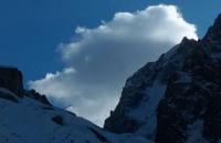
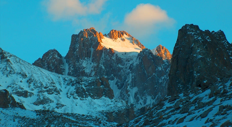
Glaciation, widespread within the Ala-Archi basin, also left an imprint on the modern appearance of the study area. Its impact is witnessed by pointed alpine forms of peaks in the crest of the ridges, numerous kars, bedrock deposits of active glaciers.
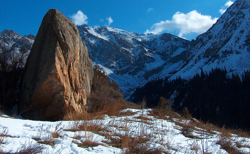
Along with erosion processes that develop and deepen negative landforms ultimately lead to further dismemberment of the area, the flowing waters of the basin also create some positive landforms. This is especially noticeable in the valley of the Ala-Archa River, which, along its entire length, either from the right or from the left banks, is cluttered with the outflow cones of its tributaries.
Several outrigger cones in the Ala-Archi valley are formed by mudflows. Mudflows are piles of unsorted material and, as a rule, are not very powerful. In the middle part of the basin, a mudflow fan is clearly visible, which passed in 1953 along the Adygene gorge.
This mudflow destroyed the Tien-Shan spruce forest at the mouth of the Adygen and blocked the entire gorge here. The processes of physical weathering also play an important role in the formation of the modern relief. His traces can be seen everywhere.
They are especially noticeable in the high-mountainous part of the region, where rocky outcrops are widespread. Collapsing, bare rocky ledges give a huge amount of rocky material. Under the influence of gravity and erosion, the bulk of this material is transferred to the lower parts of the mountain slopes, where it is deposited in the form of stony taluses, sometimes reaching significant thickness.
These large taluses are quite typical for the entire Ala-Archi, and distinguish the Western Tien-Shan, for example, from the Caucasus. Fieic weathering also occurs on the slopes of ridges and produces numerous stony placers or forms numerous stony taluses at the foot of the slopes and in the margins.
Finally, part of the weathering products are carried out by glaciers and flowing waters into mountain valleys and deposited there either in the water of the moraine, or, below, in the form of a vast pebble floodplain along the river beds.
As the main structural elements of the basin - ridges and deep valleys separating them, - and smaller forms of relief - peaked peaks and ridges of high mountains, curly rocks and sheep's foreheads in the troughs - are largely determined by the composition of the rocks that make up the region.
It is very important for climbers to know that in the high-mountainous part of the Ala-Archi basin, alpine landforms are widely developed and are composed mainly of granites.
Authority:
A. Kuznetsov "Alaarcha". “Defeated peaks. 1973 - 1974 ". “Mysl”. Publishing House, 1976.
Photos by
Alexander Petrov.