


![]()
You are here
Geological of Kopetdag ridge.


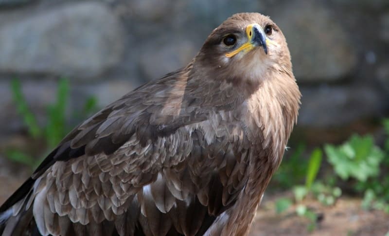
Wildlife Tours in Turkmenistan.
“The creation of a thousand forests is in one acorn”
Ralph Waldo Emerson.
Flower Tours in Turkmenistan.
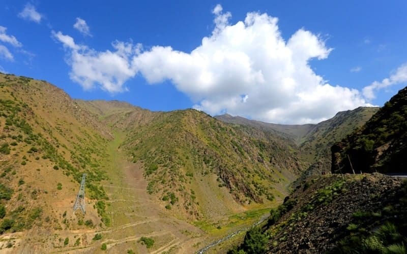
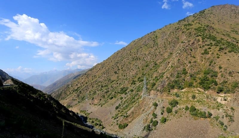
Kopetdag ridge (Turkic "multi-mountain", Turkm. Köpetdag) is located in the eastern part of the Balkan velayat, in the southern and southwestern parts of the Akhal velayat. The highest peak in the Turkmen part of the Kopetdag is Mount Chapan with a height of 2889, 2 meters above sea level, located in the main ridge of the Kopetdag on the border with Iran.
The northern slopes of the mountain are located on the territory of Turkmenistan, the southern slopes are on the territory of Iran. The second highest mountain of the Kopetdag ridge is Mount Shah-Shah with a height of 2863.7 meters above sea level, located 2.9 kilometers east of Mount Chapan in the main ridge of the Kopetdag.
The third highest mountain is Mount Bozy-Yamo with a height of 2690.7 meters above sea level, located 14.4 kilometers southeast of Mount Chapan, located in the Saandak border range on the border with Iran. The highest mountain of the Kopetdag ridge - Riza is located on the territory of Iran with a height of 2942.1 meters above sea level in the southeast of Mount Chapan.
Kopetdag is not a single ridge, but a system of frontier ridges and mountain elevations. In the region of Bakharden - Ashkhabad, the mountains have the appearance of a relatively monolithic border ridge; eastern to the Turkmen territory there are only foothills and certain sections of the forward chains.
And in the Turkmen part of the Western Kopetdag the space with a complex dissected mountainous relief reaches a width of 110 km. Here, from the east-southeast to the west-north-west, numerous short ridges stretch.
In the westernmost region, they change their direction to the latitudinal and then to the south-west, and only the clearly distinguished Front Chain (or Front Range) retains the main west-north-west strike almost until its end.
These rocky ridges correspond to anticlines, which are often upturned to the north and complicated by stuffing, which makes them a sharply asymmetrical profile. While the southern slopes are gently sloping, the northern slopes are almost sheer precipices cut by short deep gorges.
In the western low-mountain extremity of Kopetdag, the ravine dismemberment is large and the relief becomes a badland. The ridges of the western part of the Kopetdag are grouped into rows of the main mountain ranges, separated by longitudinal valleys several kilometers wide (Khodzhakalinskaya, Sumbarskaya, Chandyrskaya), into which narrow transverse valleys open.
Both the northern Advanced Chain of the Western Kopetdag and the more southern chains have heights mainly in the range of 1000 - 2000 m. A characteristic common feature of the Kopetdag ridges is the flat shape of their peaks.
“Before the gaze of the observer, inspecting the Kopetdag from any dominant summit, a vast flat or slightly wavy space spreads out, extending far into Iran. Here, upstairs, the impression of a mountainous country, of deep, almost impassable gorges of the species composition and other ridges, almost completely disappears.”
In front of the steep, often impregnable northern slopes of the Forward Chain, towering 500 – 1500 m above the piedmont plain, there is a strip of foothills. The foothills accompany the main chain to the east of Ashgabat.
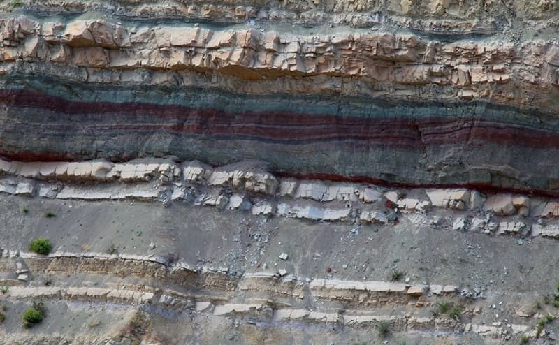
Most often they are formed by hills of 100 - 300 m relative height, with gentle peaks and heavily dissected slopes. The foothills are composed of Paleogene and Neogene sediments, which are relatively easy to wash out.
Chains of ridges are formed mainly by dense lower Cretaceous rocks (limestone, sandstone, partly marl, siltstone and clay). The slopes of the ridges are often armored with hard-washed sandstones. Upper Cretaceous sediments occupy smaller spaces and are developed mainly in the western part of the Kopetdag.
They are predominantly clayey marly composition. In the areas of the Upper Cretaceous and Paleogene sediments, the relief often becomes a badland. In Kopetdag there is a clear connection between the relief forms and the tectonic structure.
The longitudinal valleys of the Western Kopetdag mainly correspond to the axes of the synclinal structures, and the chains of ridges correspond to the systems of anticlinal uplifts. Due to local diving and raising of the hinges of large folded structures, the latter were divided into a number of second-order folds.
The main ridges are anticlinal or anticlinal folds, less often - their wings. The folded structure of the Kopetdag is complicated by a large elevation in the zone of its northern Forward Ridge and a number of other faults.
All structural elements are combined in the Kopetdag mega-anticlinorium. Kopetdag belongs to the Alpine geosynclinal region. In place of the mountains, a geosyncline was located, in which powerful strata of Jurassic and especially Cretaceous sediments accumulated during the Mesozoic.
The geosynclinal regime with deposition of marine sediments continued in the Paleogene. On the verge of the Paleogene and Neogene occurred uplifts. Neogene is characterized by the further development of tectonic movements and uplifts, the erosion of the growing elevations and accumulation of continental sediments, and marine transgressions in the western part of the Kopetdag.
The formation of relief with the leading value of tectonic movements and erosion accumulative processes developing on their background occurred during the entire Neogene and the Quaternary period. The creation of the mountain relief began in the lower half of the Neogene.
Arising mountain ranges at first strongly inferior in height to the modern ones. The epochs of intensive uplifts were replaced by epochs of relative subsidence and general slowing down of tectonic movements, during which the alignment surfaces were formed.
I. A. Rezanov notes three tiers of such surfaces: the topmost one is of Miocene age, the middle one is Pliocene and the bottom one is early Quaternary. The current appearance of the Kopetdag was obtained as a result of Quaternary tectonic uplifts and the erosion division that accompanied it.
In the Quaternary, the formation of folded structures continued. The active tectonic life of the Kopetdag is still ongoing. The development of anticlinal structures continues in the foothill zone as a result of movements along the deep faults in the surface strata.
The seismicity of the region is associated with these advances. The epicenter of the devastating Ashgabat earthquake of 1948 was located 25 km south-east of Ashgabat, in the area of the Khalits hill, where the strength of the earthquake reached 10 points.
Ashgabat was almost completely destroyed. From horizontal shocks, the walls of small houses, made of mud brick, fastened with a clay mortar, scattered onto the pile of brick and the roof collapsed. Single large buildings, built according to modern rules of anti-seismic construction, were almost not damaged (textile factory, power plant, etc.).
Authority:
N. A. Gvozdetsky, N. I. Mikhaylov. "Physical geography of the USSR. Asian part. The edition third corrected and added. Moscow "Thought" of 1978. http://tapemark.narod.ru/geograf/1_5_5.html
Photos by
Alexander Petrov.