


![]()
You are here
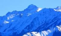
Geography Almaty reserve.
Excursions in Almaty reserve.
“At his best, man is the noblest of all animals; separated from law and justice he is the worst”
Aristotle.
Nature of reserves of Kazakhstan.
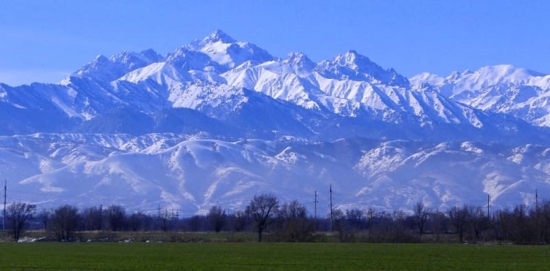
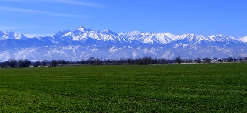
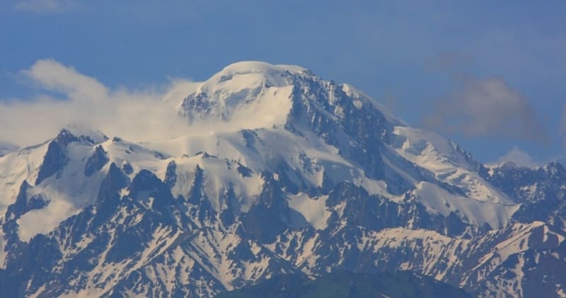
In foothills in first ten days of March, and at high altitudes in May, snow cover in Almaty Nature Reserve lasts from 3 (low mountains) to 7 months and more than 9 (high mountains). Period of its establishment varies: from early December under mountains to mid-October at high altitudes.
The thickness of the cover reaches 60 - 80 cm. In low mountains, snow usually begins to melt at the end of the first ten days of March, in high mountains - only at the end of May. In conditions of little cloudiness and long daylight hours, the radiation factor has a significant influence on the climate.
In the mountains, direct and total radiation is greater in winter and less in summer than on the plains. The duration of sunshine throughout the year at an altitude of 2500 m exceeds 2000 hours. The determining factor of climate, in addition to solar radiation, is atmospheric circulation.
In the area of the reserve, the prevailing winds are southern directions, with northern winds taking second place in directions. Strong winds especially affect temperature and humidity indicators.
Climate of Almaty Nature Reserve.
The territory of the reserve belongs to the Trans-Ili mountain climatic subregion. The climate is continental with a late spring-summer maximum precipitation and it is typical for the Northern Tien Shan. Its main features are high solar radiation and the complex nature of atmospheric circulation.
The average annual air temperature ranges from 6.8 in the lowlands to 0.8 at the upper limit. The minimum average monthly temperatures were noted in January (- 4.3 in the lower part to - 9.7 in the upper part), the maximum in July (from 18.1 to 10.6 ).
In summer, there is a noticeable decrease in temperature with increasing altitude; this pattern is expressed by a gradient of 0.5 - 0.7 for every 100 meters. In winter, the increase in air temperature reaches 0.6 per 100 meters up to an altitude of 1600 - 1800 meters above sea level, after which there is a consistent drop of 0.3 per 100 meters.
The duration of the cold period in the foothills is more than 4 months, and at an altitude of 3000 meters above sea level - more than 7 months. Winter is characterized by frequent daytime radiation thaws. The transition from winter to summer in thermal terms occurs in the foothills in the first ten days of March, and at high altitudes in May.
An important climatic factor is the amount of precipitation and air humidity. Their maximum occurs in the middle part of the mountains, at altitudes from 1500 to 2300 m. a. s. l. Thus, in the foothills the average annual precipitation is 555 mm, at altitudes of 1600 - 2200 m. a. s. l. 840 - 880 mm falls, and at altitudes of 2500 - 3000 m. a. s. l. - 735 - 750 mm.
Climate indicators naturally change with changes in absolute altitude.
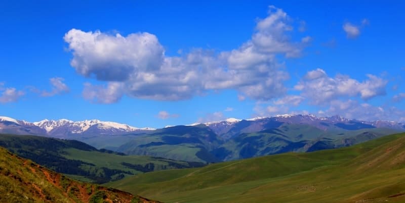
In this regard, 4 altitudinal climatic zones are distinguished in Northern Tien Shan:
- low-mountain (grass-mixed-grass steppe),
- mid-mountain forest-meadow-steppe
- mid-mountain coniferous-forest,
- alpine (subalpine alpine meadow-steppe) and nival-glacial.
All belts are represented in the reserve, except for the mountain belt. The climate of the middle mountains is temperate continental, the highlands are cold, sharply continental. The climate in the glacier-nival zone is the harshest. The average annual temperature is minus 10 - minus 12; there is no usual division into 4 seasons.
Even in July, the average monthly air temperature is negative, and snow falls all year round. Orography and geology. The modern relief of the reserve began to form at the end Paleogene - early Neogene. The Alpine orogeny caused further uplift of the mountains.
Movements of maximum amplitude occurred precisely in the area of the Talgar mountain cluster. Active tectonic movements continue today, and earthquakes are quite common here. In the Pleistocene, the first glaciation of the most elevated part of the reserve occurred.
The second glaciation was less significant and ended approximately 10,000 years ago (Murzaev, 1958; Zhiryakov et al., 1990). The main orographic pattern of the northern part of the reserve is created by the Talgar massif and three spurs extending from it with rocky ridges, firn fields and glaciers.
This belt (glacial-nival) is clearly limited by the lower parts of the glaciers (3200 - 3400 m. a. s. l.) and the firn line, which lies in the range of 3700 - 3900 m. a. s. l. Below it, to an altitude of 2700 - 2800 m, there is a belt of highlands, the relief of which is steep.
Significant areas of the ridges and slopes are rocky cliffs, and there are also numerous large rock fragments and scree. The rest of the northern part of the reserve belongs to the middle mountains, which also have steep slopes and highly dissected terrain.
In the southern part of the reserve, glacial-nival landforms predominate, especially in the basins of the South-Eastern Talgar and South Issyk rivers. This is where the Bogatyr and Korzhenevsky glaciers are located. Most of the territory (medium mountains) is covered with rock fragments, crushed stone, sandy-clayey conglomerates and gravel.
The underlying rocks are granites, granodiorites and syenites. Gneisses, crystalline schists and quartzites are found.
Soils of Almaty Nature Reserve.
The soil cover is determined by vertical zoning. Its diversity developed under the influence of relief, dynamic processes, composition and properties of soil-forming rocks (Assing, Kurmangaliev, 1958; Glazovskaya, 1966; Sokolov A.A., 1977; Sokolov et al., 1962).
Following soil-climatic zones in Almaty Nature Reserve are distinguished sequentially from top to bottom:
– high-mountain nival-rock zone (3200 – 3400 m. a. s. l. and higher). There is practically no soil cover. This zone is an area of accumulation of solid moisture and feeding of rivers;
– high-mountain meadow and meadow-steppe zone (2400 - 3400 m. a. s. l.) with mountain-meadow alpine and subalpine soils on the northern slopes, high-mountain meadow-steppe and steppe soils on the southern slopes, high-mountain dark-colored soils of dwarf juniper trees;
– mountain forest-meadow-steppe zone (1200 - 2400 - 2500 m. a. s. l.).
With mountain-forest dark-colored, mountain-forest chernozem-like, mountain forest-meadow, mountain leached and ordinary chernozems (on the northern slopes) and mountain meadow-steppe and mountain-steppe thermoxeromorphic soils on the southern slopes, the soil cover in the reserve is represented by mountain soils, or rather soils mountain slopes are easily susceptible to erosion, in particular landslide processes.
Therefore, there is a danger of mudflows on the territory of the reserve.
Hydrology and rivers of Almaty Nature Reserve.
In the protected area, several powerful spurs branch off from the main ridge of the Trans-Ili Alatau, which are river watersheds. The most abundant rivers in the territory are the South-Eastern, Left, Middle and Right Talgars, as well as the Issyk and Southern Issyk.
With a relatively small depth (up to 1 meter) and width (from 5 to 10 meters), their rapid flow is due to a large difference in heights. The energy of the water is so great that monolithic rocks are ground down, crushed and ground into sand, giving way to the powerful onslaught.
The raging mass rushes down with a roar, dragging along huge stone boulders, and sometimes demolishes concrete human engineering structures (Dzhanyspaev, 2006). All major rivers are fed by snow and glacier with spring and summer floods. Both rivers and most tributaries are prone to mudflows.
The water in the rivers is clean most of the year, but during periods of floods and precipitation it is cloudy with a large amount of bottom sediments. The water is fresh and ultra-fresh (salt content from 100 to 150 mg/l), soft and very soft, calcium bicarbonate.
Lakes of Almaty Nature Reserve.
The upper reaches of large rivers flowing from glaciers enliven moraine and dam lakes. The largest lake Muzkol is located in the upper reaches of the river. Issyk (3600 meters above sea level), its area is 46,300 square meters, and its depth reaches 25.5 meters.
In the basin of this river there are two more lakes of landslide-tectonic origin, Issyk and Akkol. The beautiful Lake Issyk existed in its original form until 1963. On a hot July day, a destructive mudflow broke through a natural dam in a matter of minutes and wiped out the picturesque mountain wonder from the face of the earth.
The preserved eastern bay of the lake is currently slowly replenishing with water and gradually increasing in area.
Glaciers of Almaty Nature Reserve.
All large rivers and lakes receive their main supply from the melting of glaciers, of which there are a lot in the reserve. There are 113 of them on the northern side of the ridge alone. The largest is the Shokalsky glacier located in the Sredny Talgar River basin, almost 5 km long. It pulsates with a periodicity of 20 – 24 years.
The glacier's tongue cracks into numerous blocks and quickly moves down. On the southern side of the ridge, at the sources of the Chilik River, there is a powerful site of modern glaciation, which includes 86 glaciers. The largest of them are the Korzhenevsky glacier, about 12 kilometers long, and the Bogatyr glacier, more than 8 kilometers long.
Mineral water sources of Almaty Nature Reserve.
Located in the Talgar River basin at an altitude of 1850 meters above sea level. The waters are radon, hydrocarbonate sulfate sodium-calcium with a total mineralization of 0.1 – 0.3 g/l. According to the conclusion of the Institute of Regional Pathology of the Ministry of Health, these waters can be used for medicinal purposes.
There are many other unique creations of nature on the territory of the reserve. In the upper reaches of the Straight Slit tract there is the largest glacier in the Northern Tien Shan, about 3.5 kilometers long. It moves at a speed of several tens of centimeters per year, and has the lowest location (2400 m. a. s. l.) among the active glaciers in the region.

Authority:
Ishkov E. Reserves of Central Asia and Kazakhstan. Almaty, Kazakhstan, 2006. Under the general edition of Roman Yashchenko. The international union of conservation of IUCN - The World Conservation Union. Physiographic features (across Kerteshev, Vagapov, Yashchenko, 2001).
Photos by:
Alexander Petrov.