


![]()
You are here
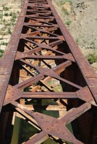
English Bridge in Karsakpai.
Sights in village of Karsakpai.
“In the second half of the 2nd millennium BC. Central Kazakhstan has become one of the important centers of metallurgy on the Eurasian continent.”
A. H. Margulan.
Trip to village of Karsakpai.
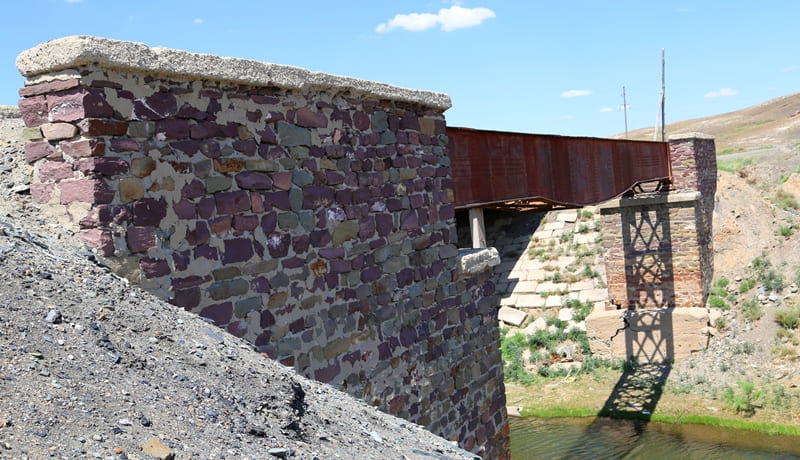
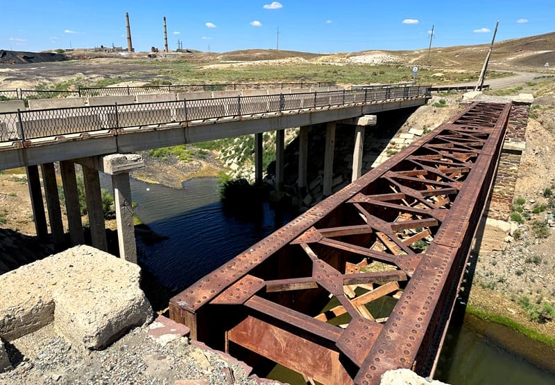
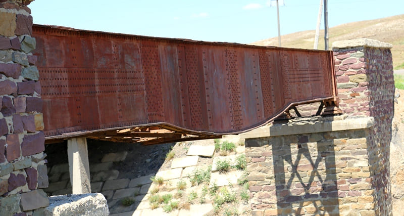
Bridge on Kumola River, built by English Joint Stock Company Atbasar Copper Ores, is located at an altitude of 480 meters above sea level, located in eastern part of village of Karsakpai in Ulytau district of region of same name.
The construction of the bridge on the Kumola River dates back to 1914, when the foundation of the Karsakpai concentrating plant for the future copper smelter was laid. The necessary material for the construction of the plant was delivered from Zhusaly station on camels and along a 13-kilometer-long narrow-gauge railway track.
The train arrived in Karsakpai three years later on the day of the revolution in October 1917. By this time, a bridge was built on the Kumola River. The revolution in October 1917 forced the management of Atbasar Copper Ores to leave Karsakpai.
Thus, the British never used the railway bridge. By this time, the English Joint Stock Company had laid 18 small mines with a depth of 6 to 80 meters. The total depth of all mines was about 400 meters. Copper reserves were first registered as the Zhezkazgan copper deposit in 1847 by the Russian merchant Nikolai Ushakov, but he, having no capital reserves, resold the copper deposits along the banks of the Kengir and Zhezda rivers to the merchant Anikiya Ryazanov, who in turn resold the deposit to an English joint-stock company.
In London, Anikei Ryazanov finds interested parties and organizes the Atbasar Copper Ores Joint Stock Company. It carried out reconnaissance work for the construction of a narrow-gauge railway Zhezkazgan - Karsakpai - Baikonur with a length of 120 kilometers.
For this road, a bridge across the Kumola River was needed. There is a road bridge 20 meters from the railway bridge in the western part. Nowadays the Saksaulskaya – Zhezkazgan railway makes a loop 2.1 kilometers south of the village of Karsakpai.
Geographic coordinates of English bridge in Karsakpai: N47°50'13.03" E66°44'44.06"
Note:
If you are using geographic coordinates for Google Earth or Google Maps navigation systems, you must remove the last two digits from geographic coordinates and " (hundredths of a second) and enter the result in the input line. Example: N51°44'09.67" E72°39'40.81" = N51°44'09 E72°39'40
Authority:
Mukanov U.M. M90 “The City of Satpayev and the Satpayevites.” City of Zhezkazgan, JSC "Poligraphy", 2003, 190 pages.
Alexander Petrov.
Photos by:
Alexander Petrov.