


![]()
You are here
Deserts of Central Asia.


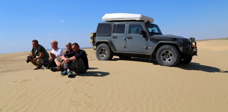
Special excursion in deserts of Central Asia.
“All art is but imitation of nature”
Lucius Annaeus Seneca.
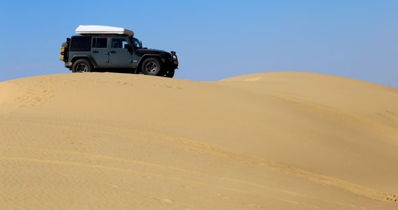
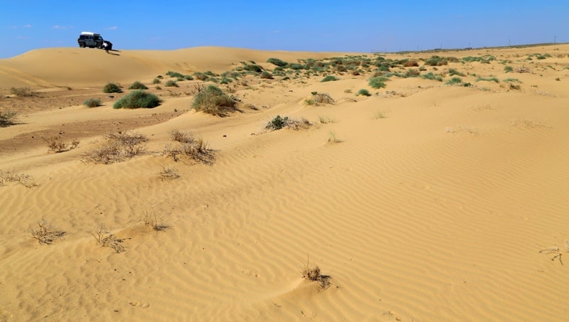
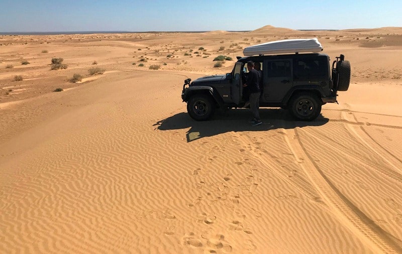
Side tour in Karakum desert.
Most of the sands in the deserts of Central Asia were formed as a result of the movement of ancient alluvial quaternary sandy and sandy clay deposits. In the southern zone (subtropical deserts) these are the sands of the Central and South Karakum, the sand of the northeastern, Syrdarya, part of the Kyzylkum desert.
A relatively small part of the sands arose as a result of weathering and further movement of sandstones (the western part of the Zaunguz Karakum, the central and south-western parts of the Kyzylkum desert). There are sands, which are inoculated lake sediments.
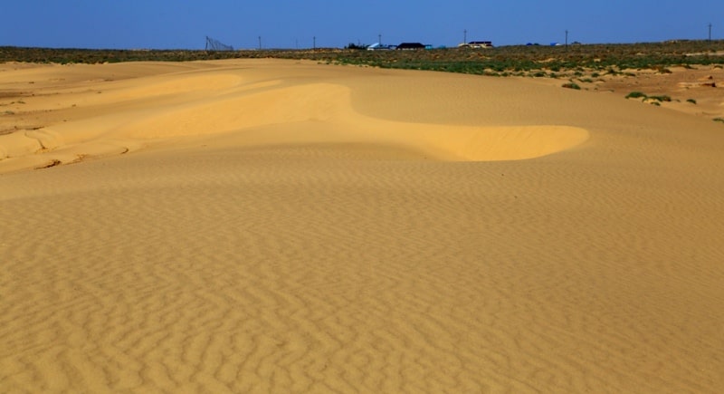
Thanks to the aeolian processing, the sands of the Central Asian deserts are well sorted. These are fine-grained sands, 90 - 99% consisting of a fraction of 0.05 - 0.25 mm. The color of sands depends on the age of movement, the duration of their processing by atmospheric phenomena.
Ancient alluvial sands in the deserts of Central Asia are usually gray, but when they fall into the sphere of soil formation, they acquire a yellowish-brown shade due to iron oxides. The longer the sands are on the surface, the more they turn yellow.
The sands of the Zaunguz Karakum, for example, that are subject to movement and the action of soil processes from the Pliocene, are more yellow than the upper Quaternary sands of the Central Karakum. The origin of sands and the origin of sandy forms in deserts should be clearly distinguished.
In relation to the deserts of Central Asia, the question of the origin of the relief of the sands was subject to discussion in the prewar years. Many researchers have denied the specificity of the relief of sandy deserts and the role of the wind in the formation of the relief of overgrown sands.
The Karakum sandy overgrown sands were attributed to a different origin: they were considered as erosion accumulative formations of meridional water flows, they wrote about karst origin between the ridge basins. It was even suggested (P. S. Makeev) about the tectonic origin of the Karakum meridional ranges.
The use of aviation contributed to clarifying the question of the origin of the relief forms of sandy deserts. With the help of observations from the aircraft and aerial photography, large areas of sandy deserts were identified and with certainty the specificity of the relief of sands was established, associated with their flowability and aeolian transportation.
With the help of aerial photography and visual observations from an airplane, widespread development in the sandy deserts of Central Asia of ridged relief forms parallel to the prevailing winds has been observed, and a tendency to rearrange the forms perpendicular to the prevailing wind into parallel ones has been observed.
According to B. A. Fedorovich, the formation of the ridge relief of the sands, which is the main type, and its features are associated with eddy air flows and dynamic phenomena that occur at the border of two moving dunes, in this case air and sand.
Visual evidence of the aeolian nature of the ridge forms of relief is the rounding of the ridges of hills in the desert (for example, in the Kyzylkum sands), just as these hills are surrounded by air currents. The nature of the relief forms depends mainly on the wind regime, as well as on the age of the relief, the amount of sand, the presence of vegetation.
If the desert plain of sandy clay alluvium is in the early stages of migration, then only small clusters of sand lie on its surface. Under these conditions, solitary dunes may form. With a duration of movement and large accumulations of loose sand, instead of single sand dunes, barchan chains appear, which are perpendicular to the prevailing winds.
Barchans and barchan chains are characteristic only for loose sand fixed by vegetation. For overgrown sands, which occupy much larger spaces than free-flowing, is characterized by ridged and hilly, or cellular, relief. For a long time, the sands fixed by vegetation were regarded as fixed, the relief of which ceased to develop.
This view is refuted by direct observations in nature. In the Karakum desert, near Repetek, film drip overgrown sand ridges (in the enclosed area) were conducted. After some time, it turned out that in some places the bitumen film was dispelled and the sand moved, in some places the film was buried under the blown sand.
It became clear that the overgrown sands are not fixed, the development continues, albeit slowly. Ridge sands are formed in cases when a dominant direction or a clearly expressed resultant sum of active winds is clearly felt in the wind system.
If one dominant direction is not observed in the wind system, then hilly, or cellular, sands are formed. L. S. Berg argued that the increase in free-flowing sands was not associated with the drying out of the climate of Central Asia, as some researchers had suggested, but was due to economic activity - excessive grazing of livestock and trampling of vegetation at wells and watering places, cutting for saxaul fuel, etc.
According to L. S. Berg and V. A. Paletsky, in modern climatic conditions, the sands, being isolated from the influence of economic activity, are subject to overgrowth, that is, they are naturally covered by vegetation. This provision as a general rule can be made now, but with exceptions, since in places of increased atmospheric circulation, natural conditions are created for the development and existence of free-flowing sand dunes.
The soils of the sandy deserts on the former soil maps were designated simply as clusters of sands. E. V. Lobova (1960) southern sandy deserts include carbonate (typical) gray brown soils in the Turan province. Humus in the soils of sandy deserts is found in insignificant amounts (about 0.5% or less).
The maximum amount of humus is often confined to the middle part of the profile, since the upper horizons can be fresh, displaced sand, which has just entered the fixing phase with vegetation. Growing conditions of plants in a natural setting (i.e., without irrigation) in sandy deserts are more favorable than in stony, and especially stony and saline.
The point here is primarily in the hydrological regime of the sands, since the possibility of organic life in the desert is determined primarily by moisture. In winter and spring, when the snow cover is melting and from rains, the sands become saturated with moisture.
The depth of winter spring moisture saturation with sand reaches 1-1.5 m. The capillarity of pure sands is weak, there are no upward flows of moisture, and the moisture stored in the sands is almost completely spent on plants. It should also be borne in mind that when the sand is saturated with moisture, almost all of the moisture is available to plants: in comparison with clay soils in the sand there is less dead moisture.
In addition, sands have the ability to absorb (condense) moisture from the air. From the moisture absorbed from the surface and absorbed from the air, so-called hanging horizon is formed. In different seasons, it is at different depths: in the spring at the very surface, and at the beginning of summer it drops to 20 cm and soon disappears completely, sometimes merging with a wet horizon located deeper.
This upper intermittent spring horizon of moisture feeds ephemeral vegetation. In addition, at a depth of 100 - 140 cm, there is a second wet layer that does not disappear throughout the year, the moisture of which is used by shrub vegetation.
Thus, in the sandy desert, in contrast to other types of deserts, there is a comparatively good constant soil moisture, which creates conditions for the existence of shrubs and even trees in it, that is, life forms that are generally alien to the desert.
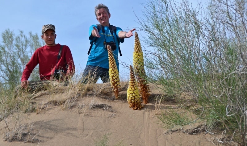
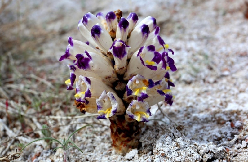
The vegetation of sandy deserts is richest in comparison with other types of deserts, but at the same time it is extremely specific due to the mobility of the flowing substrate. The plants of the sandy desert have special adaptations for existence in these conditions and form a special group.
An ordinary plant in a loose sandy substrate would have been covered with sand and died. With the accumulation of new portions of sand and the raising of the surface of sand accumulation, the hanging horizon of humidity rises, more precisely, a new horizon is formed, at a higher level.
The former horizon is not replenished any more by moisture, the water contained in it is quickly consumed by plants, and the roots in this horizon cease to receive moisture. These are large shrubs, up to 3 m in height, with cylindrical green sprigs instead of leaves, characterized by rapid growth and easily forming adventitious roots.
The trunk sometimes reaches 40 cm thick. Acacia (Ammodendron conollyi) - shrub from the legume family, up to 3 m in height, with silver leaves. White or sandy saksaul (Haloxylon persicum) is typical for sands - a tree is up to 4 – 5 m in height, with a trunk diameter of up to 35 cm.
The wood of a sandy saxaul is light, the leaves have the appearance of short, sharp scales. The main habitats of white saxaul are half-overgrown or overgrown hilly and ridge hilly sands with deep groundwater. Also characteristic of the sandy desert (Salsola richteri), astragalus, ephedra.
The fixed sands in spring are covered with rather dense grassy vegetation. Mostly sandy (Carex physodes, in Turkmen - Ilak), fade in mid-May. Sandy deserts are used as pastures: here the best conditions for grazing Karakul sheep. An important feature of sandy deserts as pastures is the ability to use them throughout the year.
In spring and summer, sand sedge is the main fodder plant. In autumn, the main fodder is semi-shrubs and shrubs, mainly eaten by sheep and camels; Astragalus, saltwort, ephedra, juzgun, saxaul, etc. have fodder value. Saltwort and various subshrubs serve as winter food; shrubs lose leaves for winter and are eaten only by camels.
All year round, the cereal Seleu (Selin) is of great feeding value. So, pastures of sandy deserts in comparison with other types of deserts are distinguished by high productivity, good quality of forage plants, availability of fodder in winter, critical for cattle breeding, and relatively low dependence on weather conditions.
Even in the most arid years, sandy pastures have enough fodder. In such years, annual grasses do not appear, which, of course, affects the pasture productivity. Moderate regulated grazing of livestock not only does not harm the vegetation of the sandy deserts, but is even useful, as the cattle loosens the upper layer of sand and destroys the crust formed in the dusty sands, which improves the hydrological regime of the sands.
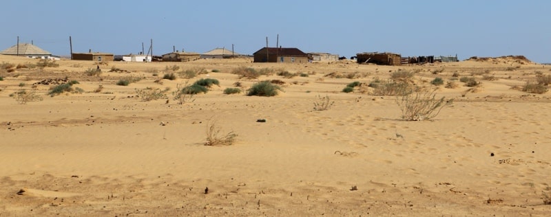
In the Karakum desert, in areas of excessively poor grazing, mosses develop (Turkmen call them "Kharakharsang"), which oppress grassy vegetation. Many plants of sandy deserts are used to fix mobile sands that move in oases, fill fields, gardens and buildings, enter roads, etc.
The plants that strengthen sand are juzguns, saxaul, astragalus, combesters (Tamarix), etc. (M.P. Petrov, 1950). Loose sand represents some comfort for animals in the desert, allowing them to easily dig in the sand, but at the same time moving along loose sand requires special adaptations.
Driving along the Transcaspian railway through the Kara-Kum, you can see larks sitting in the shadow of the telegraph poles. As the shadow moves, the birds also move. There are also desert (Lanius excubitor pallidirostris), desert (Oenanthe deserti), imitating the voices of various animals and birds, desert crow (Corvus ruficollis), a large predator, the Buzzard Buzzard (Buteo rufinus).
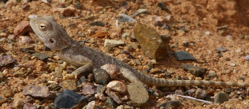
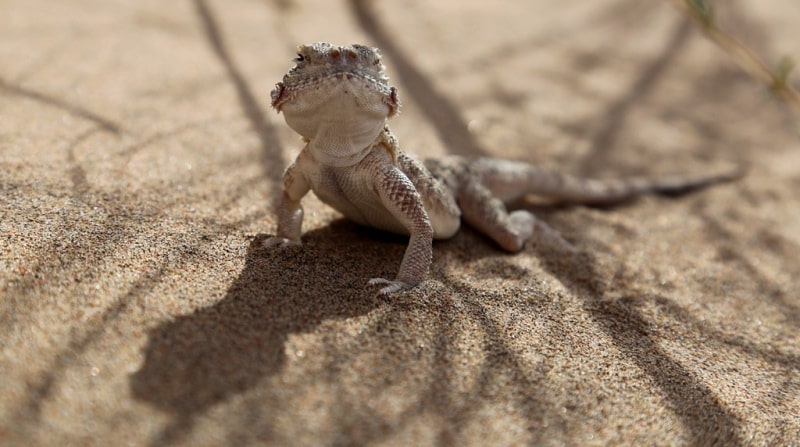
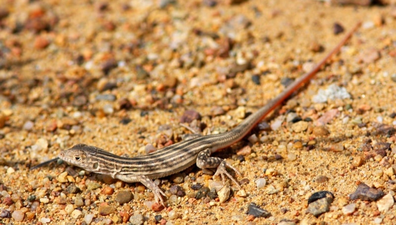
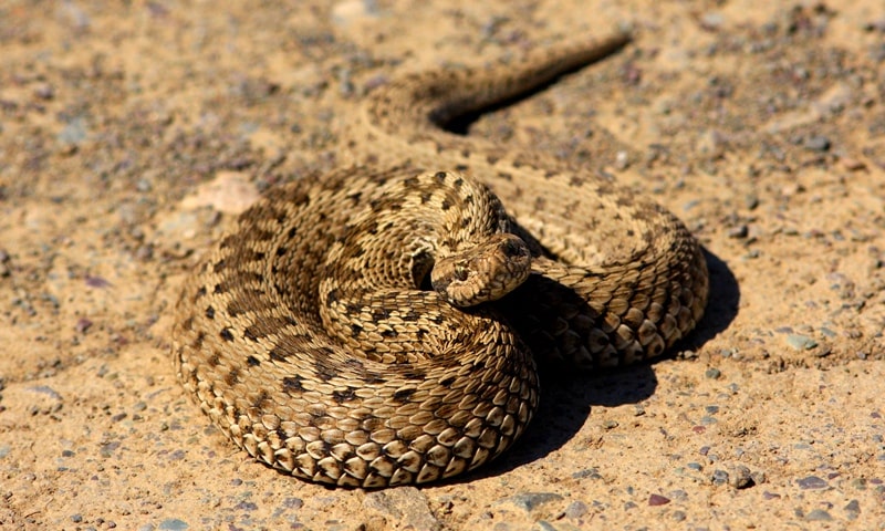
For sandy deserts is characterized by an abundance of reptiles. Of the lizards here are found: a small sandy (Phrynocephalus interscapularis), a larger eared (Ph. Mystaceus), which can be seen on the top of a sand dune or a mound, where it usually stands on elongated legs with a bent upward tail, blown by the breeze, the Turkestan agama (Agama sangulenta ), which is saved from the hot sand on the tops of bushes.
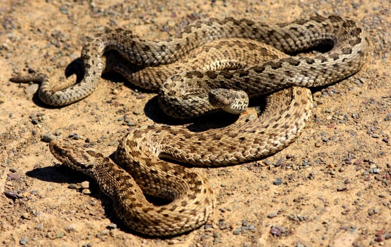
There is a giant gray lizard (Varanus griseus) up to 1.5 m long. Of the snakes, an interesting sand boa (Eryx miliaris) is of small size (up to 75 cm). He embraces his prey (gerbils and other animals) with strong rings, choking and swallowing entirely.
The poisonous snake arrow (Taphrometopon lineolatum), imperceptible among shrubs, acts quickly and adroitly, harmless to human life. There is a poisonous sand ef (Echis carinatus). Of insects in the sandy desert live beetles (Sternodes caspica, etc.), beetles, etc.
Of the arachnids, phalanx and scorpions are numerous. Even from a brief overview of the nature of the sandy deserts, it can be concluded that these deserts, which have peculiar forms of aeolian relief, sandy soils, adapted to live on loose sand with vegetation and unique fauna adapted to life in sands, represent a very special geographical complex .
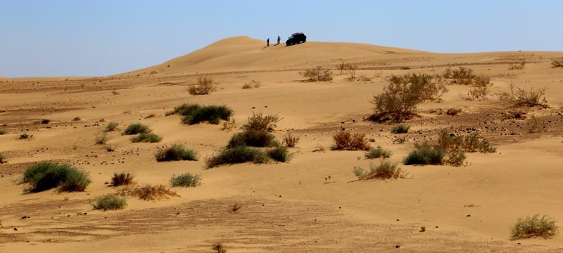
Its specificity and differences from other subtypes of the desert landscape are determined by the sandy substrate. The sandy deserts of the southern zone include the largest Karakum and Kyzylkum deserts (each with an area of about 300,000 square kilometers, sands of the Caspian Plain of Turkmenistan.
Karakum Desert.
"Karakum" in translation from Turkic means, in the opinion of E.M. Murzaev, "earthen sands". By relief, the desert is divided into two parts. The smaller, northern part is occupied by the Zaunguz Karakum, or Zaunguz plateau, which in the south is bounded by a steep ledge of 60 – 80 m divided into flat ridges.
Treated with desert continental phenomena. A much more recent channel of the ancient river channel of the Amudarya is limiting the Karakums from the north-west of Uzba, which dried up, but retained all the morphological features of the river valley.
To the south of the Unguz, the spaces of the Central, Southeastern, and Southern Karakums extend, forming in aggregate the second, most of the desert. The central Karakum in relation to the Zaunguz Karakum represent a lower plane, which is why they are often called the Low Karakum.
To the south and southeast, the surface gradually rises, and the plains of the South and South-East Karakum lie at higher altitudes than the Zaunguz plateau. The surfaces of both planes that form a step are slightly inclined to the west.
In the South-Eastern Karakum there is a dry bed of the ancient river channel - Kelifsky Uzboy, much of which is now occupied by the Karakum Canal.
The Zaunguz plateau is formed in the upper part by sandstones and clay-sandy sediments of the Paleo Amudarya, which flowed here in the Miocene - Pliocene. The waters of the ancient Amu Darya flowed from the east to the west between the ledge of the Zaunguz plateau and the Kopetdag in the lower Quaternary time, the spaces of the Central and South-Eastern Karakum are lined with its alluvium.
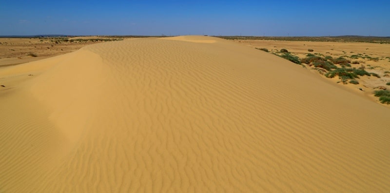
In the southern part of the Karakum desert, delta deposits of the Tedzhen and Murgab rivers are laid on it. In the eolian desert relief, ridge sands dominate, turning into hilly (small-row) sands in the south, among which there are flat clay areas - takyr soil.
Most of the sands are fixed with vegetation. Bulk sands occupy about 5% of the area, mainly in the South-Eastern Karakum. Groundwater in the central parts of the desert is highly mineralized, but where the waters of the Amu Darya, Murghab, Tejen and Kopetdag rivers flow into the sands, weak saline groundwater is widespread.
As a result of hydrogeological studies of recent years, large reserves of fresh groundwater have been discovered in the east and southeast of the desert, freshwater lenses in the Zaunguz Karakum. There are many wells in the desert (more than 10 thousand), and in areas devoid of fresh groundwater, bulk wells (Chirle) are organized in which fresh rainwater is collected with takyr soil.
It saturates the thickness of the sand, forming lenses on top of the more dense saline groundwater. The soil vegetation cover and animal world of the Kara-Kum is essentially already described above, with a general characteristic of the southern sandy deserts.
For Kara-Kum in comparison with other sandy deserts especially intensive development of spring ephemeral vegetation is typical. Almost all of their territory, with the exception of sand dunes, is covered in spring with a green carpet of ephemera and ephemeroids, among which sandy sedge is dominated by a valuable forage plant.
On overgrown sands, white and black saxaul are found. Shrubs are characteristic of the overgrown sand dunes: sand acacia, juzguns. The Karakums are vast pastures where karakul sheep, goats and camels are grazed. Most of these pastures are used year round.
In places of grazing the main flocks of sheep create reserve fodder funds, construct new wells. To expand the area of agricultural oases and irrigate the southern part of the desert, the Karakum Canal was created. Topical issues are the introduction of pasture rotation, improvement of pastures, the prohibition of logging of saxaul and shrubs.
There are deposits of various mineral waters in the Karakum desert, large reserves of potash and salt have been discovered. Since 1929, high-grade sulfur deposits have been developed in the center of the desert, in the Ungus region. Gas and oil are found in some places. Large gas fields Darvaza-Zeagli finding in the Central Karakum.
The Ochak gas field is located in the Zaunguzskiy Karakum, the Bayram-Aliyskoye field is located in the South-East Karakum (there is also oil here). Adjacent to the western part of the Karakum desert, in the coastal desert regions of western Turkmenistan, a number of oil and gas fields are being exploited - in Nebit-Dag, Kum-Dag, Koturdepe, on the Cheleken Peninsula, etc.
Kyzyl-Kum desert.
The name "Kyzyl Kum" in translation from the Turkic language means "red sands". The sands formed here by the weathering of bedrock sand deposits have a reddish color. In the northern Syr Darya strip, which, like the Central Karakum, is an ancient alluvial plain with sand accumulations resulting from the movement of alluvium, the sands are grayish yellow.
The desert surface has a gentle general slope from the south-east to north-west, to the coast of the Aral Sea. A characteristic feature of the Kyzyl-Kum desert - the existence of isolated low mountains in its central and southwestern parts - lost mountain ridges, these are Bukantau, Dzhetymtau, Tamdytau, Guldzhuktau and others, in the west - Sultanuizdag.
All of them are the lost mountain of the Paleozoic (Hercynian) folded ranges, located on the continuation of the structures of the northern ranges of the Pamir-Alay (Turkestan Range and the Nuratau Range) and elevated by the latest tectonic movements.
The ridges are composed of highly stationed and metamorphosis of Paleozoic schists, limestones, granites, etc. On the tops and ridges of many lost mountain, there are developed leveling surfaces used for rainfed crops. The slopes of the lost mountain are strongly dissected, at the foot there are plumes of rubble of sand accumulations, which are often the reservoirs of fresh groundwater, which in some places feed the springs supplying the mining settlements.
In the area of lost mountain there are flat hilly elevations and plateaus composed of weak disturbed Cretaceous and Paleogene sedimentary rocks (marls, sands, clays). The presence in the central and southwestern parts of the desert of extensive closed depressions (the valleys of the Karakat and Ayakagytma) is also characteristic.
Most of the Kyzyl-Kum desert is occupied by sand massifs formed by half-fixed sands. The most common sand ridges of the meridional orientation. At settlements and around wells there are flowing, dune sands. A significant array of sand dunes stretched along the Amu Darya.
In most cases, the exposure of the sands is the result of immoderate grazing of vegetation by cattle at watering places, as well as the use of shrubs and saxaul for fuel. In a number of areas, work is being done to strengthen the sands by planting shrubs - dzhuzguna, saxaul, and others.
Barkhan sands in the south of the desert, advancing on the Bukhara and Karakul oases and falling asleep, are now fixed. It created a powerful barrier of greenery (from saxaul and large black saxaul trees) 120 km long. In the Kyzylkum desert, small cattle (mainly karakul sheep) are grazed, as well as camels, horses, and in a smaller quantity - cattle.
The organization of pasture use and the creation of new wells have greatly increased the livestock population. Large artesian basins are found in the central and southwestern parts of the desert. Near the artesian wells in the depressions there are pockets of agriculture, melons and gourds are cultivated, experimental stations have been created, whose work is aimed at providing livestock with additional feed.
The channel from the Chardara reservoir on the Syr Darya, carried out into the depths of the desert, made it possible to master part of the desert lands for rice fields, orchards and vineyards. In the lost mountain mountains of the desert there are a variety of mineral wealth (marble, graphite, turquoise, asbestos, coal, etc.), mines work.
Not so long ago, the Muruntau gold deposit was discovered, where the village of Zarafshan has already grown (“gold-bearing” - in Uzbek). In the south there is a large gas field Gazley. Gas was also found on the southwestern margin of the desert on the right bank of the Amu Darya, near the Farab station.
Authority:
N. A. Gvozdetsky, N. I. Mikhaylov. "Physical geography of the USSR. Asian part. The edition third corrected and added. Moscow "Thought" of 1978.
http://tapemark.narod.ru/geograf/1_5_5.html
Photos by:
Alexander Petrov.