


![]()
You are here
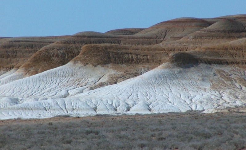
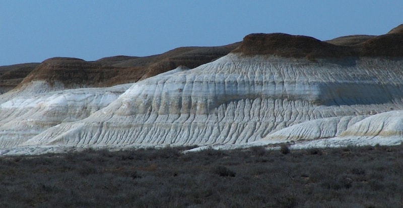
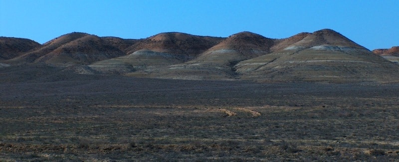
Achysor depression.
Small Group Tours on Mangyshlak.
“The creation of a thousand forests is in one acorn”
Ralph Waldo Emerson.
City Tours on Mangyshlak.
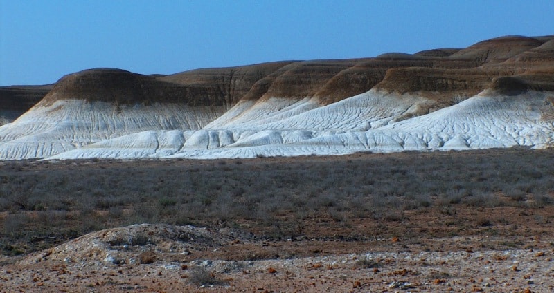
The Ashchysor depression, a former bay of the eastern coast of the Caspian Sea, now a depression, is located 4.5 kilometers north of Aleksandrbai Bay and 14.8 kilometers north-east of Cape Peschaniy in the Mangistau region in the southeast of the Mangistau region.
Aschysor has a Turkic name, it comes from the merger of two words: aschy - "bitter" and sor - "dry lake". At the beginning of the XVIIIth century, Ashhysor was connected to the Caspian Sea. In 1715 A. Bekovich-Cherkassky first mapped it and named it Oseter Bay.
On the map of G.S. Karelin Bay is named after Kankrin, the Minister of Finance of Russia. However, this name did not catch on. On the maps of the late XIXth century, the name Benturli-Ishan is found, which means "the main spiritual person of the Mangyshlak Turkmens". In 1764 it was connected to the Aleksandrbai Bay.
At the end of the XIXth century, it separated from the Gulf of Alexanderbay by a sandy ridge, turning into Lake Benturli-Ishan. Then, for a considerable time, depending on the fluctuations in the level of the Caspian, it either connected with it or lost its connection.
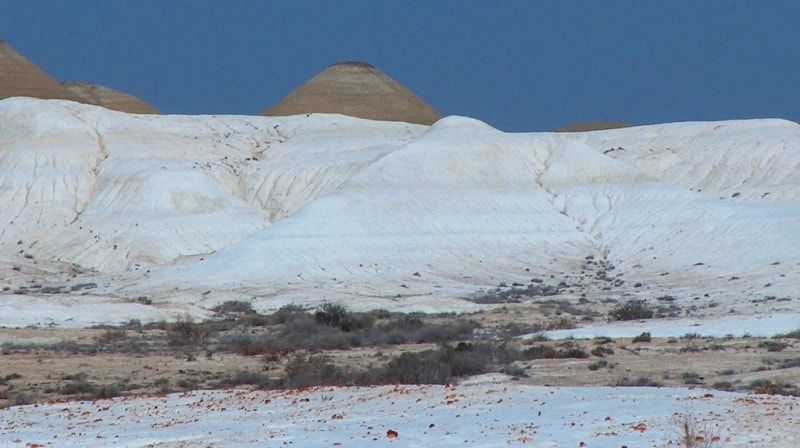
Now Ashhysor and the Caspian are connected by a watershed (sandy embankment) 40 meters high, 7 kilometers long and 4 to 15 kilometers wide. In the relief of Ashhysor, there are 2 depressions of various sizes, dissected from west-south-west to east-north-east by a stone ridge.
The smaller one is conventionally named Upper Ashysor. An insignificant amount of water seeping through the sandy barrage from the A. Bekovich-Cherkassky bay leads to the formation of small lakes that dry up in summer.
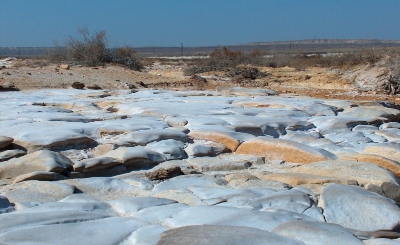
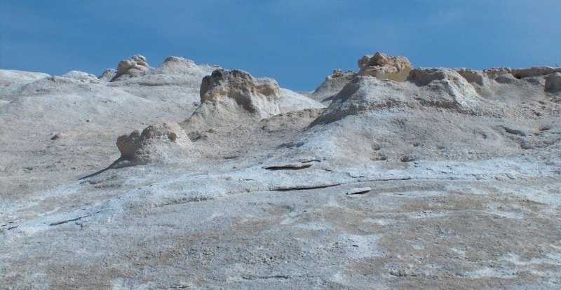
The Lower Ashysor salt marsh occupies an area of 170 square kilometers, in the southwestern part it drops to a mark of 38.5 meters. Bottom salt deposits are similar to the salts of Kara-Bogaz-Gol. A project by the famous geographer S.Yu. Geller (1954) on its chemical and energy use.
The project provided for the possibility of replacing Kara-Bogaz-Gol with a new sulfate base. The passage of water from the sea into the depression can be carried out relatively easily along the natural slope with the subsequent supply of these waters by short channels to the steep precipice of the Karagiye depression.
This makes it possible to create a hydroelectric power station with a capacity of 35,000 kW without building a dam. It was assumed that the constancy of the pressure would be maintained due to evaporation from the Karagiye depression.
The creation of a concentrated brine in Ashhysor can provide not only sodium sulfate, but also other salts dissolved in the water of the Caspian Sea. A significant part of the coastal lowland in the northwest of the Mangyshlak Peninsula is occupied by the Ashhysor salt marsh depression, which is impassable in its central part.
The bottom of the depression is almost 10 meters below the level of the Caspian Sea. In the north-west of the territory, around the Ashchysor salt marsh depression and along the sea coast, hilly and flat sands stretch in a narrow strip.
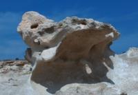
On the sands along the coast of the Caspian Sea and around the Aschysor depression, the Dzhuzgun and Duzgen shrubs rarely grow, with a height of 1 to 2 meters. On the gentle slopes of the Ashchysor depression, saxaul up to 2 meters high is found in separate groups.
Geographic coordinates of the Ashisor depression: N43 ° 16'00.22 "E51 ° 29'54.94"
Authority:
http://www.caspianmonitoring.ru/
Photos by:
Alexander Petrov.