


![]()
You are here
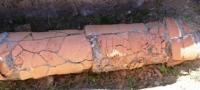
Dekhistan water canals.
Turkmenistan – Silk Road Travellers.
“Finally, the channel known as Asadi al-Khorasani (the Asadi channel, or Asadi al-Khorasani, apparently flowed past the walls of Gyaur-kala on the east side.) Delivering water to the Bab Sanjan, Beni-Makhan and others; on this channel were the houses of the Merv marzban. These are the canals on which city blocks and buildings are located. These buildings and these (the Asadi Canal, or Asadi al-Khorasani, apparently flowed past the walls of the Gyaur-kala on the east side.) The channel is surrounded by a wall; another wall surrounds (the whole) this city and volosts (rustak) it; it covers all urban settlements and is called ar-Rai, - traces of this wall are visible to this day"
Kitam Mesalik Al-Memalik.Merv »Al-Istarhi.
One day tour in Turkmenistan.
Before us in the morning light stretches the flat, shadowless desert Dakhistan - the land of the disappeared Dakhs. When was it inhabited by people, when fragrant gardens appeared and cities and irrigated fields arose in this vast seaside oasis? Where did people get the water and how was it used?
Dakhistan (or Dekhistan) can really be called an "abandoned land", because on the Meshedi-Misrian plain, on an area of 300 thousand hectares, there are currently only two or three small auls, whose life is based on collected on takyrs - compacted low areas of clay deserts - rainwater and partly on imported water.
The largest of these villages is Madau, or Madav. Twenty-five kilometers from it, to the south - southeast, the Depe hill rises - the remains of a large city with a rectangular citadel, with walls two meters thick, with a shakhristan and a rabad suburb, with traces of several reservoirs - hauz, multi-room rich houses, madrasah with hex towers, with a rampart.
And how many here, right on the surface of the earth, fragments of fine art products made of ceramics and glass! It is believed that this very city of Madav was mentioned in the Middle Ages under the name Akhur, and from it came one of the famous Muslim lawyers of the XIIth century, Fakih, who later moved to Merv.
The city of Akhur-Madav was a cultural center, although it probably was not at that time the capital of the country, which was inhabited in the Middle Ages, according to modern estimates, up to 180 thousand people.
We are driving north, and I am convinced that I was wrong in calling Dakhistan "a country without shadows." The oblique rays of the sun mercilessly reveal the wrinkles of the earth. And these wrinkles, like the wrinkles of a human face, are a significant trace of the time lived.
Low, poorly visible, earthen ramparts stretch across the plain from east to west, to the sea. To the left of the road, a flat-topped hill grows, light and imperceptible from afar, but close up it turns out to be rather high, steep, and the dense shadow on its northern side emphasizes the severe loneliness of this depot. Its contours unmistakably betrayed a silenced medieval fortress.
But it soon became obvious that the fortress was not alone, and a new depot, not so far from the first, also unexpectedly appeared on our way. Looking closely at the sun-drenched distance, we soon began to notice in advance the "oncoming cities".
There were a lot of them. There are about fifteen disappeared cities on the Meshedi-Misrian Plain, and counting rural settlements, individual estates and traces of ancient sites from the Bronze Age (II millennium BC), antiquity to the Middle Ages - more than a hundred settlements.
Earthen shafts are encountered all the time. They are different: sometimes they are wide - up to 8 m and even 10 m, sometimes they are narrow - only 0.8 - 1.5 m wide, sometimes they are rather high, clearly visible in the terrain, sometimes they are barely noticeable.
Some experts considered these embankments to be bulk, intended for the collection and retention of flood waters that escaped in the spring from the western ridges of the Kopet-Dag, from the Kuren-Dag and its spurs. Maybe some of the shafts actually served this purpose.
After all, to this day, the rainwater retained and directed to the lowlands serves to supply water to auls, for watering sheep flocks and for watering melons. And in the Bugdayli tract (“bugday” - in Turkmen “wheat”) there is enough rainwater on the takyrs to grow wheat.
On the outskirts of the Meshed Sands, the population makes filling wells - chirle. Of course, a thousand years ago there was much more water, and this is reflected in the name of the perished city of Madav that I mentioned (“mad” is Persian for “tide”, and “ab” is water or stream). Indeed, after rains near the settlement there is an invasion of water and on the surrounding takyrs they are formed on time whole lakes.
But nevertheless, most of the shafts turned out to be really canals or ditches, the channels of which were filled with silt and were covered with sand, and their river-bed elevations - dumps - collapsed, swam and, having undergone erosion, were partially leveled.
The ancient Atrek delta was the main source of water for the vast and complex irrigation system in the Misrian Plain. The emergence of a land irrigation system here dates back to the II millennium BC. e. Some of the low but wide swells turned out to be traces of the natural channels of the bygone delta.
As for the age of the canals, its determination was not easy, because medieval and ancient canals were sometimes superimposed on the remains of the oldest irrigation structures of the Late Bronze Age and Early Iron Age (late II - early I millennium BC).
And I must say that irrigation technology in the Late Bronze Age was already quite high in the East. Younger canals from ancient times and especially from the Middle Ages extend far to the north from the Atrek River and reach the ruins of the large, probably capital city of Meshed-i-Misrian (or Messerian), which gave the name to the entire plain.
The main channel of medieval Dakhistan Shah-Duz - the King of the Plain - was surrounded by a whole retinue of the ruins of settlements, mills, aqueducts and traces of fields, which can be found today, several hundred years after their disappearance.
You will be surprised - how can we talk about fields, if for five hundred years there has been neither river water nor farmers. It turns out - it can. We were incredibly lucky. A little rain that started at night made us climb into the tents, while the morning landscape took us by surprise.
It might seem that some mighty gin carefully moved the sleeping tents to another place and lowered them, without waking us, right in the middle of the fields, and even some kind of rice! In the slanting rays of the sun, water glittered from the night rain, filling squares of fields, measuring 20 x 20 and 30 x 30 m, separated by earthen rollers, just as the rice farmers of Central Asia do now. Here it is - the memory of the earth!
Throughout our journey, we have seen many times how carefully the desert preserves the traces of life, work, art, and even the thoughts and feelings of people of different times. A person cut off from his land sometimes quickly forgets even his own language.
The languages of the great Sumer, Parthia and, relatively recently, about a thousand years ago, Sogd, were forgotten and lost. But human thoughts and feelings, having merged into work and into works of art, leave the memory of peoples and tribes with their eternal autograph on the palms of the earth.
Now we are convinced with our own eyes that the Arab chroniclers were accurate, asserting that rice was grown in Dakhistan along with wheat and barley. And their words about the abundance of orchards and vineyards in the land of the Dakhs no longer cause any doubts in us.
Authority:
"Ancient and new roads of Turkmenistan". V.S. Zaletaev. 2009. http://etnolingvistika.ru