


![]()
You are here
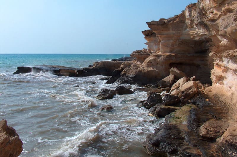
Cape Tyub-Karagan.
Westernmost cape of Mngyshlak.
“On July 5, around midday, the pilot, having climbed the mast, was the first to notice the Mangyshlak coast and announced that he could see “lbishche” - that is what the local sailors call the Karagansky cape. This is the elevation of Mangyshlak - 60 fathoms above the surface of the sea, which is visible for 50 miles and serves as a harbour for those sailing from Guryev and Astrakhan. As we approached the coast, it became more clearly visible, seemed higher and higher and stretched on one side far to the east to the Sarytash Bay, disappearing in the misty distance, and on the other - headed south to the Novopetrovsk fortification. In the west, the long island of Kulaly appeared in places. Having drawn level with the Tyub-Karagan cape, about ten miles from the harbor, our vessel, changing course to the south, sailed along the high, wild coast... on the hill the buildings of the Novopetrovsk fortification under construction were visible. A fresh north wind quickly carried us to the fortification, past the huge stones of the Karagan coast and the gorges overgrown here and there with mulberry trees. Finally, the entire Karagan Bay opened up in the form of a semicircle, surrounded by steep cliffs to the east, and having a sandy lowland plain to the south, which passes to the west into a spit jutting out into the sea. This spit let a special slope into the bay, called Aylyak by the natives... behind which a quiet, deep harbor was formed, protected from all winds."
"Notes of Russian Geographical Society". Section 2 "Trip to Mangyshlak Peninsula in 1846 by M. Ivanina". St. Petersburg, 1847.
Sea coast of Mangyshlak.
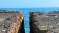
Cape Tyub-Karagan (Kazakh: Түпқараган) is located at an altitude of 29 meters below sea level, is located on eastern coast of Caspian Sea, on Tyub-Karagan Peninsula, is westernmost end of peninsula of same name and Magyshlak Peninsula, in Tyub-Karagan district of Mangistau region.
Cape Tyub-Karagan is an outstanding geographical and historical object on the western coast of the Mangyshlak Peninsula. It is a narrow and elongated piece of land jutting into the Caspian Sea and forming the northern continuation of the Mangyshlak Peninsula. Cape Tyub-Karagan is washed by the waters of the bays in the north of Mangyshlak and in the west of Tyub-Karagan Bay.
Historical significance of Cape Tyub-Karagan.
In ancient times, the cape was used as a link "from Khiva to Rus": from the cape to Khiva there was land communication on camels, and from the cape to the mouth of the Volga there was sea communication. In 1716, a Russian fortress of the same name was built on the cape, which was evacuated in 1717 due to the plague, the threat from the nomadic Turkmen and the news of the death of the Khiva expedition.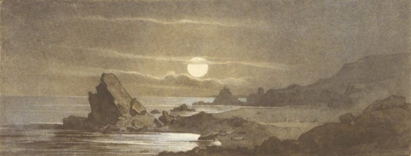
Paleolithic monuments have been found on the Tyub-Karagan peninsula. Aleksandrovsky Fort (Fort-Aleksandrovsky) is the oldest Russian settlement in the Trans-Caspian region, founded in 1846, in the form of the Novo-Petrovsky fortification, on Mangyshlak, near the Tyub-Karagan cape and the Caspian Sea bay, and renamed Fort-Aleksandrovsky in 1857.
It was the administrative center of the Mangyshlak district. Near the cape there is a garden laid out in the 1840s by the famous writer Taras Shevchenko, who was here in exile. With the construction of the Trans-Caspian railway, the commercial importance of the Aleksandrovsky fort, where the caravan route from Khiva ended, fell. Its few inhabitants were engaged almost exclusively in buying up fish products and sending them to the city of Astrakhan.
4.6 kilometers to the south and slightly to the west is the Upper Tyub-Karagan lighthouse, one of the oldest in Mangistau. The lighthouse is located on the elevation of the Tyub-Karagan cape, 8 kilometers northeast of the village and port of Bautino and 11 kilometers northeast of the city of Fort Shevchenko.
The first lighthouse was built in 1851, unfortunately, its fate was sad - it collapsed from the cliff on which it stood onto the coastal rocks. The second lighthouse began in 1863. In April 1870, the lighthouse was burned by privateers of the Adayev rebellion in Mangyshlak, and in 1929 it was attacked and fired upon by Basmachi.
Natural features of Cape Tyub-Karagan.
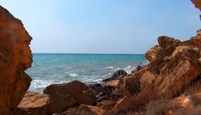
Tyub-Karagan is characterized by picturesque landscapes with limestone and sandstone blocks, powerful cracks, canyons and piles of stones. The cliffs of the Zhygylgan failure rise above sea level by 180 - 200 meters, providing excellent observation points. The climate of the region is sharply continental and extremely dry, with an annual rainfall of about 100 - 150 mm. The vegetation is mainly represented by wormwood, saltwort and rare shrubs.
Tourist attractiveness of Cape Tyub-Karagan.
Today Cape Tyub-Karagan attracts tourists with its unique nature, historical monuments and opportunities for active recreation. It is recommended to visit the cape on SUVs, as the roads in the region are mostly dirt and dusty. Cape Tyub-Karagan is a place where rich history, unique nature and cultural heritage are combined, making it one of the most interesting places to study and visit in Kazakhstan.
Geographical coordinates of Cape Tyub-Karagan: N44°38'45 E50°18'41
Authority and photos by:
Alexander Petrov.