


![]()
You are here
At-Bashi Range.

Tours to At-Bashi mountains.
"Atbash ridge on the northern slope is covered from below with a spruce forest, descending quite low, in the eastern part almost reaching the plain. The mountain slopes are not rocky, green, the slopes are quite soft. The upper part of the mountains is covered with snow. The mountains did not give the impression of being particularly high, which was already due to the fact that the Atbash valley itself lies at a decent altitude."
"Across the mountainous regions of Russian Turkestan." V. I. Lipsky. 1906.
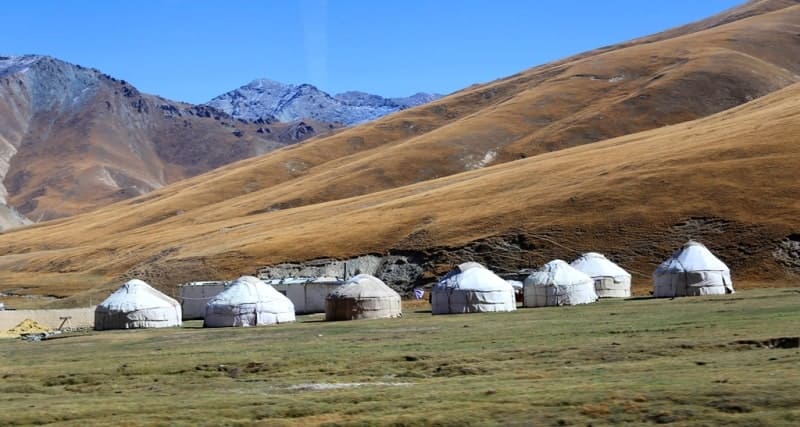
Trip to Tash-Rabat caravanserai in At-Bashi mountains.
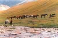
At-Bashi mountain range is located in southern part of Inner Tien-Shan, is located in southern part of Western Tien-Shan, in south of Naryn region in At-Bashi district.
The ridge separates the At-Bashi basin in the north from the Chatyr-Kol basin and the Aksai syrts in the south. The length of the At-Bashi ridge from southwest to northeast is 140 kilometers, the maximum width in the central part reaches 48 kilometers.
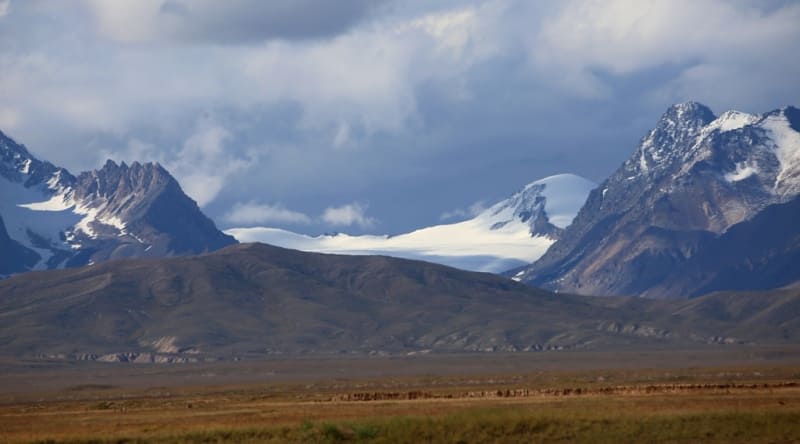
The average height of the ridge reaches 4280 m. a. s. l., the maximum height is 4786 m. a. s. l. The dominant peak of the ridge is the Koshkar-Ata peak, 4788.9 m. a. s. l., located in the central part of the glaciation. The second highest peak is Mount Kensu with a height of 4757.4 m. a. s. l., located 16 kilometers southwest of Koshkar-Ata.
The third highest peak is Oshayryk, 4751 m. a. s. l.l, located 9.4 kilometers southwest of Koshkar-Ata peak. In the eastern part of the ridge, the dominant peak is the Karangy-Ter peak, 4410.2 m. a. s. l., located in the upper reaches of the Karangy-Ter River, which is the left tributary of the Aksai West River.
In the eastern part, on the southern slope of the ridge, there is Lake Uyurme-Kel, located at an altitude of 3746.4 m. a. s. l. In the western part of the ridge is the peak of Kichi-Kurumdu, located at an altitude of 4516 m. a. s. l. In the southwestern part of the At-Bashi ridge there is Chatyr-Kol Lake, located at an altitude 3530.2 m. a. s. l., located between the southwestern part of the At-Bashi ridge and the northeastern part of the Torugart-Too ridge in the Atbashinsky district of the Naryn region.
The length of the lake from southwest to northeast is 22.5 kilometers, the largest width in the central part is 10.8 kilometers. The area of the water mirror is 160.1 square kilometers, the perimeter of the lake reaches 57.37 kilometers, the average volume of water is 8.5 cubic kilometers.
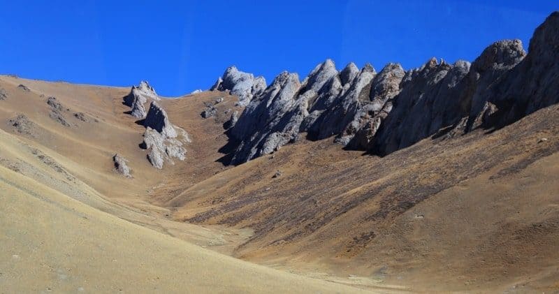
The slopes of the ridge are cut by river valleys and ravines. In the upper reaches there are small glaciers, trough valleys, cirques. The ridge is composed of Paleozoic metamorphic schists, limestones, sandstones, gneisses, shales, conglomerates, marbles, tuffs, porphyrites, and partly igneous rocks (granites, syenites).
Glaciers in At-Bashi Range.
On the crest of the Atbashi Ridge there are glacial forms, modern glaciation (the total area is about 150 square kilometers). There are 149 glaciers on the At-Bashy ridge with an area of 106.2 square kilometers. The area of glaciation is approximately equally divided between the northern and southern slopes, but small cirque and hanging glaciers predominate on the north, and on the south, gently descending to the Chatyr-Kol and Ak-Sai syrts, mainly valley glaciers ending at an altitude of 3900 - 4100 m. a. s. l.
The largest glacier, with an area of 6.9 square kilometers, lies at the head of the Mustavas River. Large glaciers: Kosh-Kara-Tash, Muzdabas, Acha-Kaiyndy, Tuyuk-Bogoshtu. Passes: Jol-Bogoshtu, Uyurme, Tash-Rabat, Ichke. The ridge is dominated by mountain-meadow and subnival landscapes.
Mineral deposits in At-Bashi ridge.
There are deposits of mercury, lead, nickel, marble, building materials, etc.
Landscapes in At-Bashi Range.
Landscapes: on the southern slopes alpine, subalpine at an altitude of 3600 to 3900 m. a. s. l., alpine tundra, nival belt at an altitude of 3900 to 4300 m. a. s. l., on the northern slopes mountain steppes at an altitude of 2400 to 2700 m. a. s. l., mountain meadows at an altitude of 2700 to 3000 m. a. s. l., subalpine, alpine at an altitude of 3400 to 3800 meters above sea level and tundra at an altitude of 3800 to 4300 m. a. s. l., western - rocky, steppe, subalpine and tundra.
Geographical coordinates of At-Bashi ridge: N40°56'30 E75°43'18

Authority:
Alexander Petrov.
"Glaciers." L.D. Dolgushin, G.B. Osipova. Series "Nature of the world." Moscow, the publishing house "Thought". 1989.
Photos by:
Alexander Petrov.